mail_outline sales@mediastorehouse.com
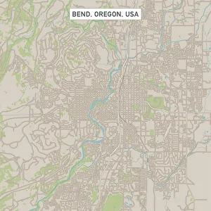
Bend Oregon US City Street MapVector Illustration of a City Street Map of Bend, Oregon, USA. Scale 1:60, 000. All source data is in the public domain. U.S
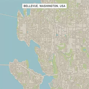
Bellevue Washington US City Street MapVector Illustration of a City Street Map of Bellevue, Washington, USA. Scale 1:60, 000. All source data is in the public domain. U.S
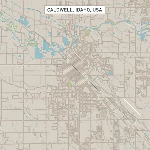
Caldwell Idaho US City Street MapVector Illustration of a City Street Map of Caldwell, Idaho, USA. Scale 1:60, 000. All source data is in the public domain. U.S
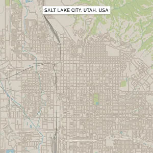
Salt Lake City Utah US City Street MapVector Illustration of a City Street Map of Salt Lake City, Utah, USA. Scale 1:60, 000. All source data is in the public domain. U.S
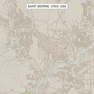
Saint George Utah US City Street MapVector Illustration of a City Street Map of Saint George, Utah, USA. Scale 1:60, 000. All source data is in the public domain. U.S
Laramie Wyoming US City Street MapVector Illustration of a City Street Map of Laramie, Wyoming, USA. Scale 1:60, 000. All source data is in the public domain. U.S
Gillette Wyoming US City Street MapVector Illustration of a City Street Map of Gillette, Wyoming, USA. Scale 1:60, 000. All source data is in the public domain. U.S
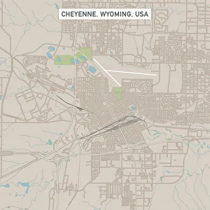
Cheyenne Wyoming US City Street MapVector Illustration of a City Street Map of Cheyenne, Wyoming, USA. Scale 1:60, 000. All source data is in the public domain. U.S
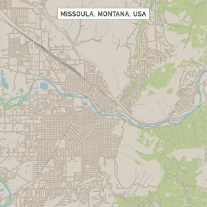
Missoula Montana US City Street MapVector Illustration of a City Street Map of Missoula, Montana, USA. Scale 1:60, 000. All source data is in the public domain. U.S
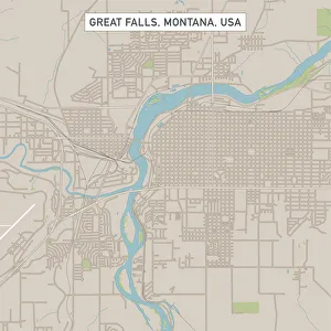
Great Falls Montana US City Street MapVector Illustration of a City Street Map of Great Falls, Montana, USA. Scale 1:60, 000. All source data is in the public domain. U.S
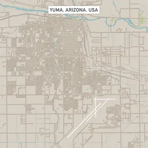
Yuma Arizona US City Street MapVector Illustration of a City Street Map of Yuma, Arizona, USA. Scale 1:60, 000. All source data is in the public domain. U.S
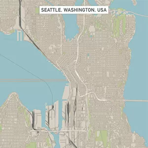
Seattle Washington US City Street MapVector Illustration of a City Street Map of Seattle, Washington, USA. Scale 1:60, 000. All source data is in the public domain. U.S
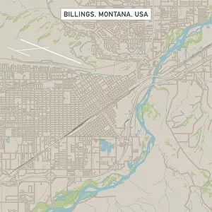
Billings Montana US City Street MapVector Illustration of a City Street Map of Billings, Montana, USA. Scale 1:60, 000. All source data is in the public domain. U.S
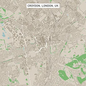
Croydon London UK City Street MapVector Illustration of a City Street Map of Croydon, London, UK. Included files are EPS (v10) and Hi-Res JPG. Data courtesy from Ordnance Survey: VectorMap District https
Maui Aerial View #3A wonderful aerial view of the Maui - Hawaii coastline as scene from a small airplane flying at low altitude. The beautiful lush landscape contrasts the scenic beaches and wonderful turquoise waters
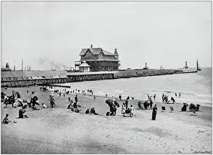
Antique black and white photograph of England and Wales: Lowestoft Pier
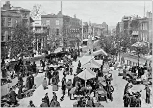
Antique black and white photograph of England and Wales: Market Square, Taunton
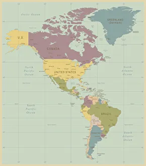
Vintage Map of North and South America534055040
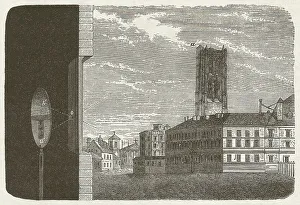
Principle of the camera obscura, wood engraving, published in 1877Principle of the camera obscura. Woodcut engraving, published in 1877
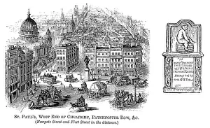
St Paul's, Cheapside, Paternoster Row, London (1871 engraving)St Paul's Cathedral, the west end of Cheapside, Paternoster Row, Newgate Street and Fleet Street, with an old stone inscription once to be found in Panyer Alley, EC4
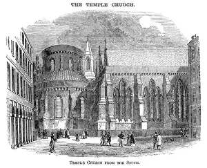
Temple Church, London, from the south (Victorian woodcut)The Temple Church, London, seen from the south. Woodcut from "Pleasant Hours: A Monthly Journal of Home Reading and Sunday Teaching; Volume III" published by the Church of England's
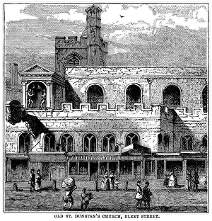
Old St Dunstan's Church, Fleet Street, LondonOutside the old Guild Church of St Dunstan-in-the-West in Fleet Street, London. From "Wycliffe to Wesley; Heroes and Martyrs of the Church in Britain" published in 1885 by T
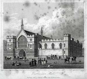
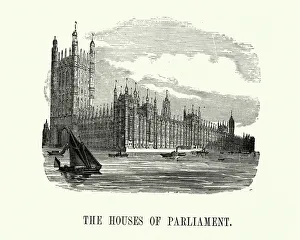
Westminster Hall" Vintage engraving from 1831 of Westminster Hall, London, England the oldest existing part of the Palace of Westminster, was erected in 1097
Victorian London - Houses of ParliamentVintage engraving of Houses of Parliament, London, England. 1893. The Palace of Westminster is the meeting place of the House of Commons and the House of Lords
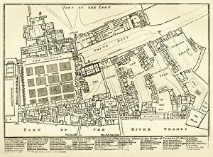
Plan of the old Royal Palace of WhitehallA ground plan of the old Royal Palace of Whitehall beside the River Thames in London. The Palace was an enormous collection of buildings
Sky TriadA color photo of a sunlight box on the roof of a commercial building in Portland, Oregon
Pipe and StripesA color photo of a commercial building in southeast Portland, Oregon
HopperA color photo of an industrial ventilation turbine on the roof of a commercial building in southeast Portland, Oregon
Blue On TopA color photo of a natural light box on a commercial building in downtown Portland, Oregon
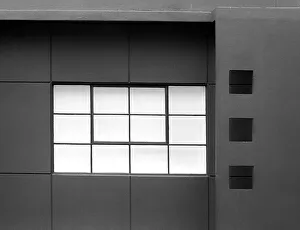
Black WindowsA black and white photo of a commercial building in downtown Portland, Oregon
Sky WheelA color photo of a wind turbine on the roof of a skyscraper in downtown Portland, Oregon
ColumnA color photo of a right angled column on a commercial building in downtown Portland, Oregon
RookeryA commercial building in downtown Portland, Oregon with a group of birds perched upon the roof
ForgottenA color photo of an abandoned industrial building in southeast Portland, Oregon
Church SpireA color photo of a church spire in Milwaukee. Oregon
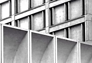
Concrete CubismA black and white photo of a commercial building in downtown Portland, Oregon
Cubismo ConcretoA black and white photo of a commercial building in downtown Portland, Oregon
Brick PhysicsA color photo of the brick facade of the Milwaukee city hall in Oregon
Vent on RoofA color photo of an aging air vent on a stone restaurant in Madras, Oregon
Red MarketA color photo of the display on the roof of an abandoned grocery store in Madras, Oregon
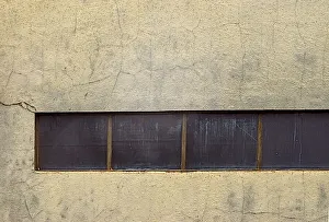
Concrete WindowA color photo of a wall on a warehouse in southeast Portland, Oregon
Red BridgeA color photo taken in September of 2018 of a pedestrian bridge that is part of the Springwater Corridor Trail that runs through the cityin southeast Portland, Oregon
Cloud VigilA color photo taken in February 2019 of an older southeast Portland commercial building. Many of the aging buildings in this area have been demolished in order to build more lucerative condos
Sky SquaresA color photo of a newer commercial building in southeast Portland, Oregon taken in February 2019
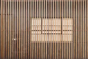
Wooden StripesA color photo of a commercial building in Southeast Portland, Oregon showing the wooden veneer near the entrance taken in February 2019
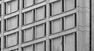
Window to GeometryA black and white photo of the facade of a commercial building in southeast Portland, Oregon taken in February of 2019
Parede VermelhaA color photo taken in February 2019 of the red, wooden wall of a commercial building in Southeast Portland, Oregon
Blue Windowed WallA color photo taken in February 2019 of the wall of a commercial building in downtown Portland, Oregon displaying the sparse use of windows on it