mail_outline sales@mediastorehouse.com
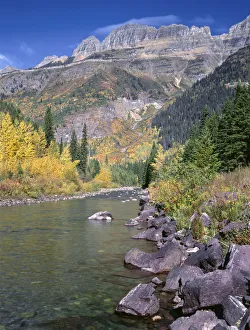
Autumn colored trees along stream with rocky mountains in background, McDonald Creek, Glacier National Park, MontanaGlacier National Park is a national park located in the U.S. state of Montana, on the Canada-United States border with the Canadian provinces of Alberta and British Columbia
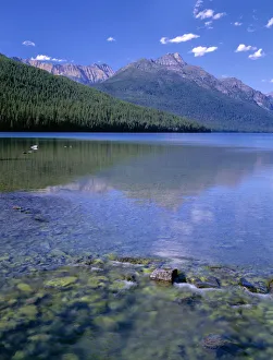
Lake reflecting rocky and forest covered mountains, Bowman Lake, Glacier National Park, Montana, USABowman Lake is in the northwestern portion of Glacier National Park in Montana. It is not commonly visited by most visitors to Glacier National Park
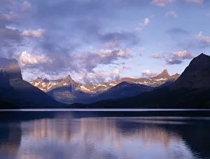
Clouds over lake surrounded by rocky mountains, Saint Mary Lake, Glacier National Park, Montana, USASaint Mary Lake is the second largest lake in Glacier National Park, in the U. S. state of Montana. The lake is 9.9 miles (15.9 km) long and 300 feet (91 m) deep with a surface area of 3
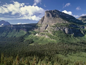
Rocky mountain towering over coniferous forests in valley, Heavy Runner Mountain, Glacier National Park, Montana, USAHeavy Runner Mountain is located in Glacier National Park in northwest Montana. Part of the Lewis Range, Heavy Runner is situated along the east side of the Continental Divide immediately east of
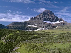
Rocky mountain towering over meadows and coniferous forests, Reynolds Mountain, Lewis Range, Glacier National ParkReynolds Mountain (9, 125 feet (2, 781 m)) is located in the Lewis Range, Glacier National Park in the U.S. state of Montana
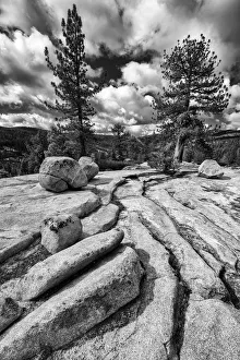
Black and white image of granite outcropping with boulders, Yosemite National Park, California, USAYosemite National Park is a United States National Park spanning eastern portions of Tuolumne, Mariposa and Madera counties in the central eastern portion of the U.S. state of California
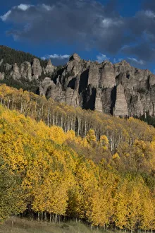
Autumn aspen trees (Populus tremuloides) in Uncompahgre National Forest, Owl Creek Pass, Colorado, USAAspen tree (Populus tremuloides) is a deciduous tree native to cooler areas of North America, one of several species referred to by the common name Aspen
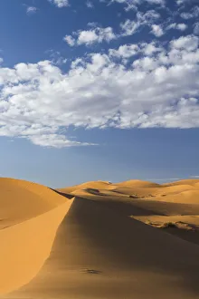
Landscape of dunes in Erg Chebbi, Sahara, MoroccoThe dunes of Erg Chebbi reach a height of up to 150 meters in places and altogether spans an area of 50 kilometers from north to south
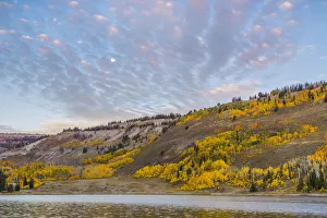
Beautiful sky over hill in Manti-La Sal National Forest, Utah, USAThe Manti-La Sal National Forest covers more than 1.2 million acres (4, 900 km2) and is located in the central and southeastern parts of the U.S
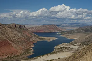
Landscape with mountains and winding river in Flaming Gorge National Recreation Area, Sheep creek canyon, Utah, USAFlaming Gorge National Recreation Area is a United States National Recreation Area located in the states of Wyoming and Utah
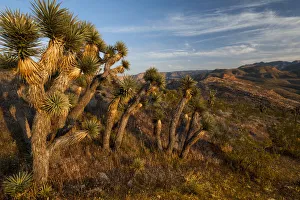
Landscape with Joshua trees (Yucca brevifolia) in Mojave Wilderness Area, Utah, USAThis monocotyledonous tree is native to arid southwestern North America in the states of California, Arizona, Utah, and Nevada, where it is confined mostly to the Mojave Desert between 400 and 1
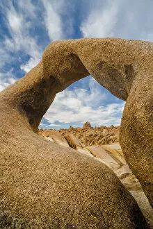
Mobius Arch with clouds, Alabama Hills Recreation Area, California, USAThe Alabama Hills are a range of hills and rock formations near the eastern slope of the Sierra Nevada in the Owens Valley, west of Lone Pine in Inyo County, California, United States
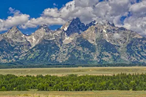
Early Morning Clouds, Grand Teton Mountains, Grand Teton National Park, Wyoming, USAGrand Teton National Park is a United States National Park in northwestern Wyoming. The park includes the major peaks of the Teton Range
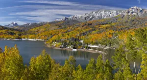
Sunny landscape with Silver Jack Reservoir and forest in autumn, Colorado, USASilver Jack Dam is a dam in Gunnison County, Colorado. The earthen dam was constructed between 1966 and 1971 by the United States Bureau of Reclamation, with a height of 173 feet
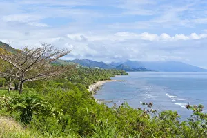
East coast of Grande Terre, New Caledonia, South PacificGrande Terre is the largest and principal island of New Caledonia. British explorer James Cook sighted Grande Terre in 1774 and named it New Caledonia
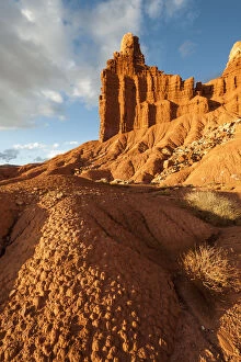
Landscape with eroded rocks in Capital Reef National Park, Utah, USACapitol Reef National Park is a United States National Park, in south-central Utah. The park is approximately 60 miles (97 km) long on its north-south axis but an average of just 6 miles (9.7 km)
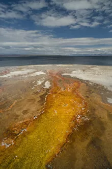
Detail of West Thumb Geyser Basin emptying into Yellowstone Lake, Wyoming, USAThe West Thumb Geyser Basin, including Potts Basin to the north, is the largest geyser basin on the shores of Yellowstone Lake
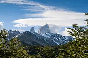
Trek up to Mount Fitzroy, ArgentinaMonte Fitz Roy (also known as Cerro Chalten, Cerro Fitz Roy, or simply Mount Fitz Roy) is a mountain located near El Chalten village, in the Southern Patagonian Ice Field in Patagonia
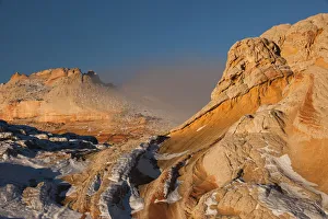
Winter fog and geological formations found at Vermillion Cliffs National Monument, Arizona, USAVermilion Cliffs National Monument is located in Arizona, immediately south of the Utah state line. This National Monument, 293, 689 acres (118, 852 ha) in area, protects the Paria Plateau
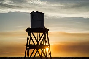
Old wooden water tower at La Delta during Drought Spotlight number 3, Route 66, Victorville, Southern California, USAA water tower is an elevated structure supporting a water tank constructed at a height sufficient to pressurize a water supply system for the distribution of potable water
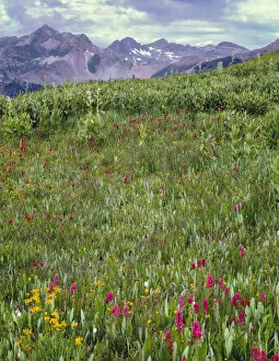
Bistort (Persicaria bistorta) and fleabane blooming beneath distant peaks of La Plata MountainsPersicaria bistorta (bistort, common bistort, or meadow bistort) is a species of flowering plant native to Europe and north and west Asia. The generic placement of this species is in flux
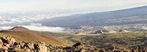
Sunny Panorama with Mauna Kea, Hawaii, USAMauna Kea is a dormant volcano on the island of Hawaii. Standing 4, 207 m (13, 802 ft) above sea level, its peak is the highest point in the state of Hawaii. Much of the mountain is under water
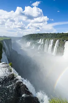
Largest waterfalls of Iguazu Falls, ArgentinaIguazu Falls, Iguazu Falls, Iguassu Falls, or Iguau Falls are waterfalls of the Iguazu River on the border of the Argentine province of Misiones and the Brazilian state of Paran
Eroded rock formations at sunset in Arches National Park with clouds, Utah, USAArches National Park is a US National Park in eastern Utah. The park is located on the Colorado River 4 miles (6 km) north of Moab, Utah
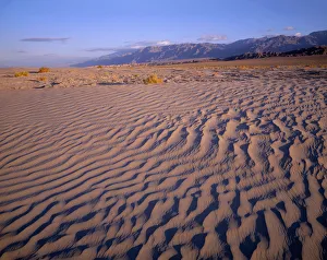
Textures in sand dunes at Mesquite Flats with Grapevine Mountains in distance, Death Valley National Park, CaliforniaThe Mesquite Flat Sand Dunes are at the northern end of the valley floor and are nearly surrounded by mountains on all sides
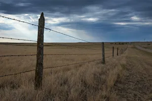
Fence in Savannah near Minuteman Nuclear Missile Site, South Dakota, USAMinuteman Missile National Historic Site was established in 1999 to illustrate the history and significance of the Cold War, the arms race, and intercontinental ballistic missile (ICBM) development
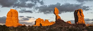
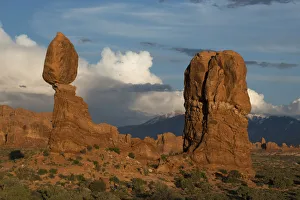
Balanced Rock during sunset, Arches National Park, Utah, USAArches National Park is a US National Park in eastern Utah. The park is located on the Colorado River 4 miles (6 km) north of Moab, Utah
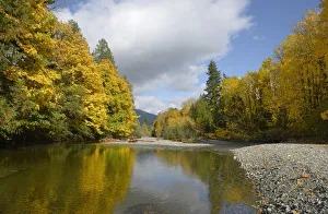
Robertson River leading into Cowichan Lake in fall, Cowichan Valley, Vancouver Island, British Columbia, CanadaCowichan Lake is a large freshwater lake located on southern Vancouver Island, British Columbia, Canada. It is located along the Cowichan Valley in the Cowichan Valley Regional District
Sunny landscape with Never Summer Mountains, Rocky Mountain National Park, Colorado, USAThe Never Summer Mountains are a mountain range in the Rocky Mountains in north central Colorado in the United States consisting of seventeen named peaks
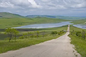
Country road leading through meadows, Davit Gareja, GeorgiaMeadows are of ecological importance because they are open, sunny areas that attract and support flora and fauna that couldnt thrive in other conditions
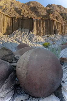
Large Concretion and Erosion formations, Theodore Roosevelt National Park North Unit, North Dakota, USATheodore Roosevelt National Park is a United States National Park comprising three geographically separated areas of badlands in western North Dakota. The park was named for U.S
Cloudy sky over autumn forest in Manti-La Sal National Forest, Utah, USAThe Manti-La Sal National Forest covers more than 1.2 million acres (4, 900 km2) and is located in the central and southeastern parts of the U.S
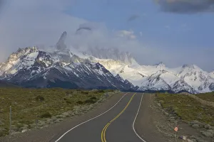
Road leading to Mount Fitzroy, Patagonia, ArgentinaMonte Fitz Roy (also known as Cerro Chalten, Cerro Fitz Roy, or simply Mount Fitz Roy) is a mountain located near El Chalten village, in the Southern Patagonian Ice Field in Patagonia
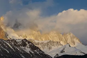
View of Mount Fitzroy at sunrise, Patagonia, ArgentinaMonte Fitz Roy (also known as Cerro Chalten, Cerro Fitz Roy, or simply Mount Fitz Roy) is a mountain located near El Chalten village, in the Southern Patagonian Ice Field in Patagonia
Early morning clouds and colorful rock formations, Valley of Fire State Park, Nevada, USAValley of Fire State Park is the oldest state park in Nevada, USA and was designated as a National Natural Landmark in 1968. It covers an area of 42, 059 acres (17, 021 ha) and was dedicated in 1935
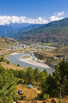
Puna Tsang Chu river running through Punakha, BhutanA river is a natural flowing watercourse, usually freshwater, flowing towards an ocean, sea, lake or another river. In some cases a river flows into the ground
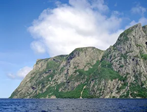
Billion year old rock of Long Range Mountains form steep cliffs above Western Brook Pond, Gros Morne National ParkGros Morne National Park is a world heritage site located on the west coast of Newfoundland. At 1, 805 km2 it is the second largest national park in Atlantic Canada; it is surpassed by Torngat
Balanced Rock against blue sky in Arches National Park, Utah, USAArches National Park is a US National Park in eastern Utah. The park is located on the Colorado River 4 miles (6 km) north of Moab, Utah
Overview of Angel Lake Road State Scenic Byway, Humboldt National Forest, Nevada, USAAngel Lake is a glacial tarn in the northern part of the East Humboldt Range, in central Elko County in the northeastern part of the state of Nevada
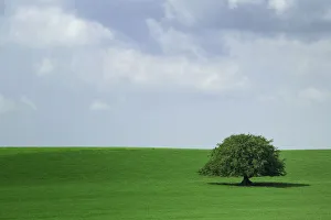
Lone tree growing in field, IrelandIreland is an island in the North Atlantic. It is separated from Great Britain to its east by the North Channel, the Irish Sea, and St Georges Channel
Landscape with Engelhorner mountain, Bern Canton, SwitzerlandThe Grosses Engelhorn is a mountain of the Bernese Alps, located west of Innertkirchen in the Bernese Oberland. It is one of the highest summits of the Engelhorner
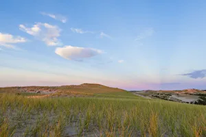
Grass on dunes at sunset, Provincetown, Cape Cod National Seashore, Massachusetts, USADunes at sunset in The Provincelands in the Cape Cod National Seashore, Provincetown, Massachusetts
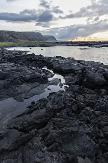
Lava rock shoreline at sunrise, Hawaii, USASunrise over the lava rock shoreline of the Big Island of Hawaii
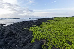
Green vine growing on lava rock shoreline, Hawaii, USASunrise over the green vine growing on the lava rock shoreline of the Big Island of Hawaii
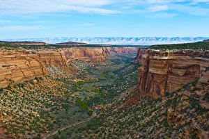
Landscape of Ute Canyon, Colorado National Monument, Vistas along Rim Rock Drive, Grand Junction, Fruita, Colorado, USANorth America, USA, Colorado, Fruita, Grand Junction, Vistas along Rim Rock Drive, Colorado National Monument, Ute Canyon
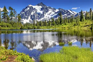
Mount Shuksan reflecting in lake, Washington State, USAPicture Lake Evergreens Mount Shuksan Mount Baker Highway Snow Mountain Trees Washington Pacific Northwest USA
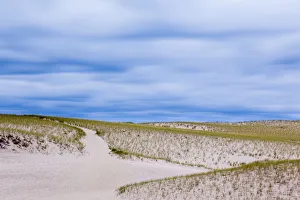
Path through Provinceland Dunes, Provincetown, Cape Cod National Seashore, Massachusetts, USAA trail in the Provinceland Dunes in Cape Cod National Seashore in Provincetown, Massachusetts
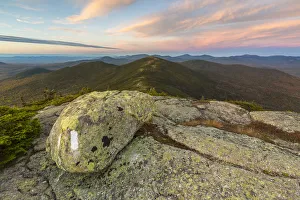
Appalachian Trail on Saddleback Mountain with High Peaks Region at sunset, Maine, USASunset on the Appalachian Trail on Saddleback Mountain in Maines High Peaks Region. The summit of The Horn is in the background