mail_outline sales@mediastorehouse.com
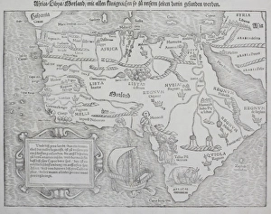
Distorted antique map of Africa
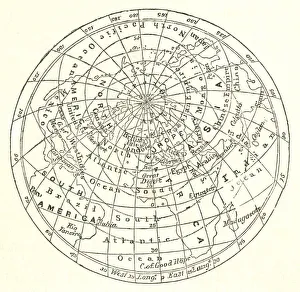
Victorian map of the Arctic CircleA Victorian map of the Arctic Circle and beyond. From Peter Parleyas Annual - A Christmas and New Yearas Present for Young Peoplea published in London by Darton & Co in 1851
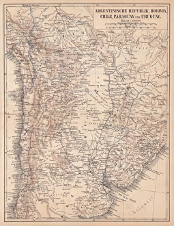
Argentina, Bolivia, Chile, Paraguay and Uruguay, lithograph, published in 1874South American countries: Argentina, Bolivia, Chile, Paraguay and Uruguay. Lithograph, published in 1874
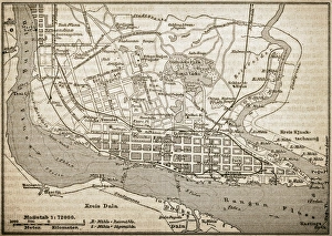
RangoonAntique illustration of Rangoon
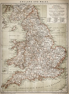
England and WalesAntique map of England and Wales
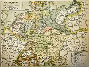
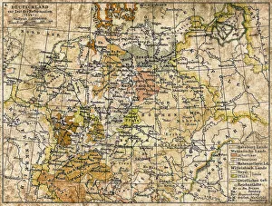
Antique map of Germany from 1815
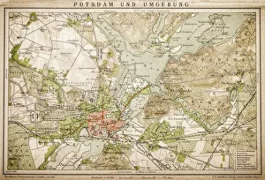
Potsdam and environmentAntique illustration of a Potsdam and environment
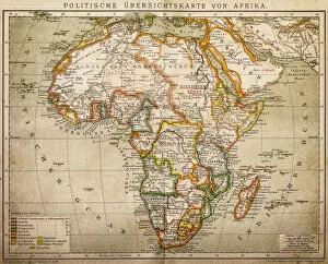
Political outline map of Africa from 1898
Germany 1547Antique map of Germany from 1547
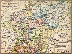
GermanyAntique map of Germany from 1648
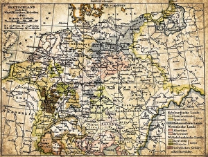
Germany map from 1786Antique map of Germany from 1786
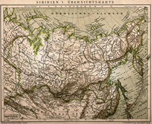
Siberia outline mapAntique illustration of Siberia outline map
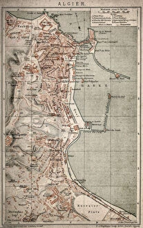
Algiers mapAntique illustration of a Algiers map
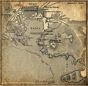
Cartagena, SpainAntique illustration of a Cartagena, Spain map
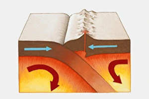
Digital illustration showing Himalayas and European Alps colliding and forced together to form mountain ranges
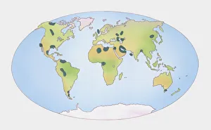
Illustration of showing distribution of oil and gas shown on world map
Illustration showing distribution of coal producing countries shown on world map
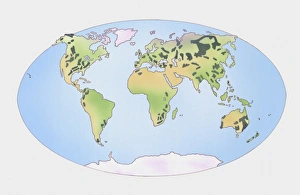
Map of the World
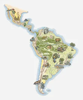
Illustrated map of Central and Southern America
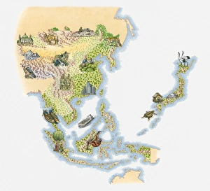
Illustrated map of East and Southeast Asia
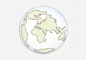
Illustration of continent distribution c. 65 mya, Cenozoic era
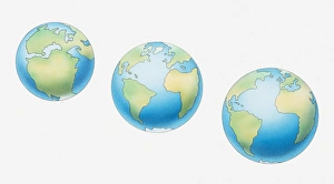
Illustration of three globes and development of continents, 200 million years ago, 50 million years ago, and present day
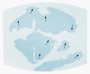
Illustration showing Earths continents 135 million years ago and their direction of movement
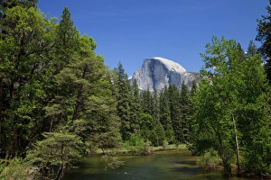
Merced River and Half Dome
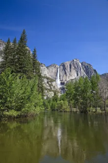
Yosemite Waterfall and Merced River
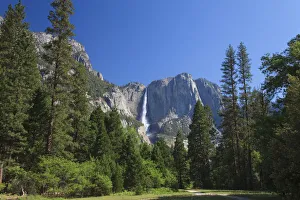
Yosemite Waterfall
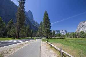
Yosemite National Park
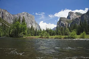
Merced River and El Capitan in Yosemite National Park
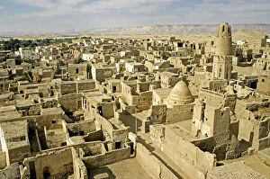
Oasis Dachla UNESCO protected old town El Kasr Egypt
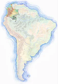
Highly detailed hand-drawn map of Brazil within the outline of South America with a compass rose and the equator
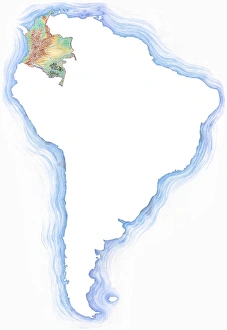
Highly detailed hand-drawn map of Colombia within the outline of South America with a compass rose and the equator
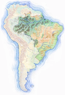
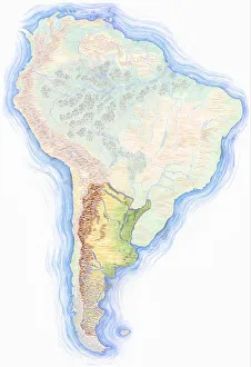
Highly detailed hand-drawn map of South America with Argentina highlighted
Cube with a map of Europe and Africa being put together from smaller cubes, 3D illustration
Cube with a map of America, 3D illustration
Colourful Easter eggs, painted with different continents, 3D illustration
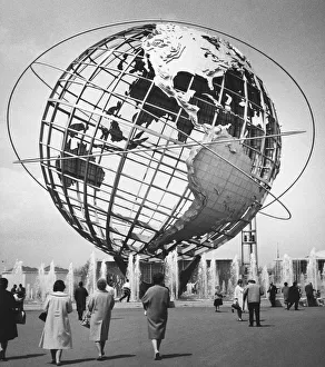
Large globe model outdoors, (B&W)New York Worlds Fair, 1964
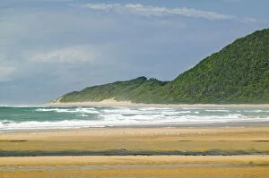
Indian Ocean seascape and sandy beach at Greater St. Lucia Wetland Park World Heritage Site, St. Lucia, South Africa
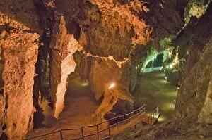
Lighted caves of Cradle of Humankind, a World Heritage Site in Gauteng Province, South Africa, the site of 2.8 million year old early hominid fossil and Mrs. Ples
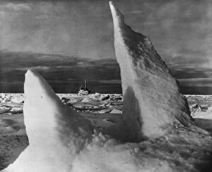
The White Continentcirca 1950: A scene from the Crown Film Unit production The White Continent, about life in the Antarctic with The Norsel ice-breaker trapped fast by pack ice
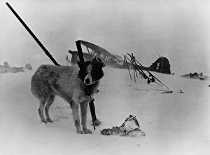
The White Continentcirca 1950: A scene from the Crown Film Unit production The White Continent, about life in the Antarctic. Original Publication: Picture Post - 5893 - Who Hates The Crown Film Unit - pub