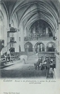
St. Andrew's Church, pulpit, Eisleben, Mansfeld-Suedharz county, Saxony-Anhalt, Germany, view from around 1910
accurate, archive, arts, building, buildings, card, cards, church building, church of st. andrew, churches, copy, county, date, dates, depiction, depictions, deserted, digital, digitally, drawing
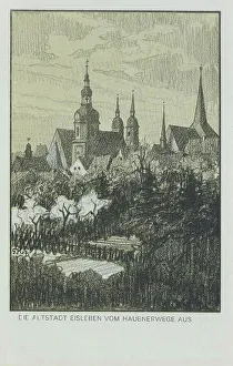
Old town Eisleben, county Mansfeld-Suedharz, Saxony-Anhalt, Germany, view around ca 1910
accurate, archive, arts, card, cards, cities, city center, city centre, city portrait, city scape, city view, copy, county, date, dates, depiction, depictions, deserted, digital, digitally, downtown
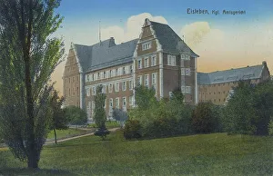
Local court in Eisleben, county Mansfeld-Suedharz, Saxony-Anhalt, Germany, view around ca 1910
accurate, archive, arts, building, buildings, card, cards, copy, county, county court, county courts, court, court house, courthouses, courts, date, dates, depiction, depictions, deserted, digital
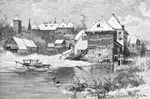
Eisleben, county Mansfeld-Suedharz, Saxony-Anhalt, Germany, view around ca 1910
accurate, archive, arts, card, cards, copy, county, date, dates, depiction, depictions, deserted, digital, digitally, drawing, eastern germany, europe's, exact, facing, formerly, frg, german
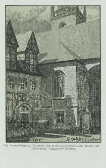
Annenkirche in Eisleben, county Mansfeld-Suedharz, Saxony-Anhalt, Germany, view around ca 1910
accurate, archive, arts, building, buildings, card, cards, church building, church of st. anne, churches, copy, county, date, dates, depiction, depictions, deserted, digital, digitally, drawing
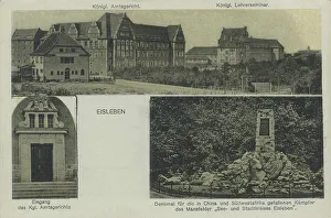
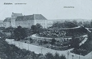
Scherbelberg and teachers seminar in Eisleben, Mansfeld-Suedharz district, Saxony-Anhalt, Germany
accurate, archive, arts, card, cards, copy, county, course, date, dates, depiction, depictions, deserted, digital, digitally, drawing, eastern germany, europe's, exact, facing, formerly, frg
The Castle of Aufsess, Aufsess, 1890, Bayreuth County, Franconia, Bavaria, Germany, Historic
1900s, 19th-century, art work, arts, artwork, artworks, attraction, attractions, bayern, black, black-and-white, black-white, building, buildings, castell, castelo, castles, county, defence work
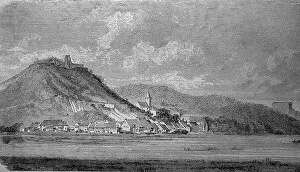
Donaustauf with the Walhalla in the background, district of Regensburg, Upper Palatinate, Germany, in the year 1880
1900s, 19th-century, architectural style, architectural styles, attraction, attractions, background, background graphic, background image, bavarian, bayern, black, black-and-white, black-white
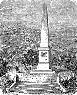
The Canossa Column on the Burgberg near Harzburg, Goslar District, Lower Saxony, Germany, in 1890, Historic
1900s, 19th-century, attraction, attractions, black, black-and-white, black-white, building, buildings, castell, castelo, castle hill, castle hills, castle ruin, castle ruins, castles, contemporary
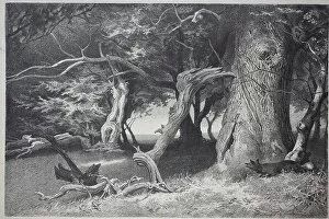
Old trees in the Hasbruch, a 627-hectare oak and beech forest in the Oldenburg district of Lower Saxony
art work, arts, artwork, artworks, beech, beech forest, beech forests, beech tree forest, beeches, big, black, black-and-white, black-white, county, deciduous forest, deciduous forests
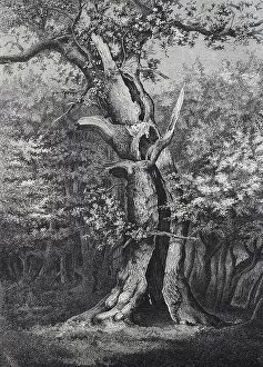
Holm oak in the Hasbruck, a 627-hectare oak and beech forest in the Oldenburg district of Lower Saxony, Germany
1900s, 19th-century, attraction, attractions, beech, beech forest, beech forests, beech tree forest, beeches, big, countryside, county, deciduous forest, deciduous forests, deciduous trees, deserted
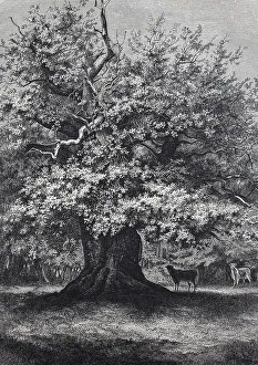
Amalien-Eiche, a well-known oak tree in the Hasbruch, a 627 hectare oak and beech forest in the Oldenburg district of
1900s, 19th-century, attraction, attractions, beech, beech forest, beech forests, beech tree forest, beeches, big, countryside, county, deciduous forest, deciduous forests, deciduous trees, deserted
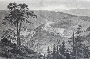
Schwarzburg Castle, Saalfeld-Rudolstadt County, Thuringia, Germany, Historical
1900s, 19th-century, art work, arts, artwork, artworks, attraction, attractions, black, black-and-white, black-white, building, buildings, castell, castelo, castles, county, defence work
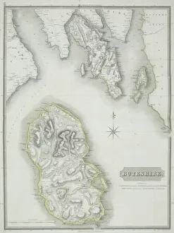
Antique map of Buteshire county in Scotland
antique, archival, border, buteshire, cartography, continent, coordinates, county, district, document, geography, historical, islands, key, legend, map, nobody, ocean, orientation, scale, scotland