mail_outline sales@mediastorehouse.com
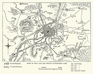
Franco Prussian War - Plan of Metz and French campVintage engraving of a scene fro the Franco Prussian War. Plan of Metz and French entrenched camp
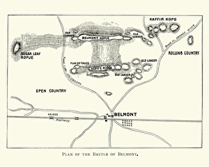
Second Boer War - Battle of BelmontVintage engraving of a plan of the Battle of Belmont an engagement of the Second Boer War on 23 November 1899, where the British under Lord Methuen assaulted a Boer position on Belmont kopje
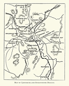
Second Boer War - Plan Ladysmith and surrounding heightsVintage engraving of a Plan Ladysmith and surrounding heights. 1899
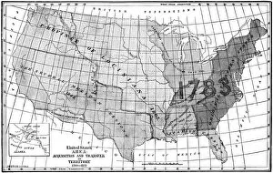
United States area: Acquisition and transfer of territory 1780 to 1870United States area: Acquisition and transfer of territory 1780 to1870
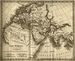
The World as Known to the Ancients (steel engraving)A creased and stained steel engraving of a map which shows The World as Known to the Ancientsa which aŠcontains all the Parts of which it is thought the Ancients had any knowledgea
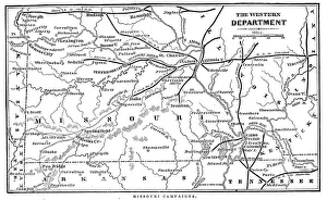
Missouri CampaignsVintage engraving from 1863 of a map of the Missouri Campaigns from the time of the American Civil War
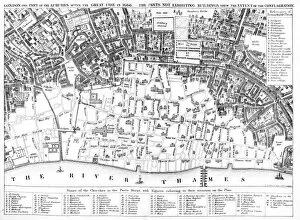
London after the Great FirePlan of London of the Great fire of 1666 showing which parts had been burnt down. The Great Fire of London was a major conflagration that swept through the central parts of the English city of
Decorative border illustration 1853Frame illustration 1853
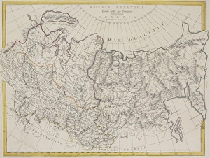
Antique map of Russia and Asiatica
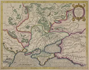
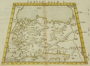
Antique map of Tabula Chersones
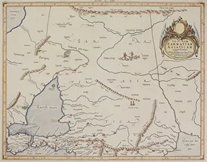
Antique map of Sarmatiam Asiaticam
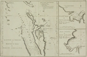
Antique charts of New Zealand
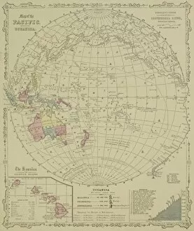
Antique map of Pacific Oceanica with inset of islands
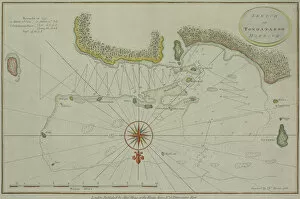
Antique map of Tongataboo in the South Pacific
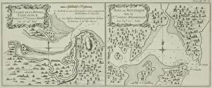
Antique maps of Botany Bay and Endeavour River in Australia
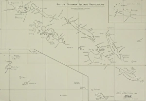
Antique map of British Solomon Islands Protectorate
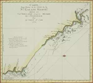
Antique map of coast of southeast Australia
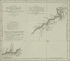
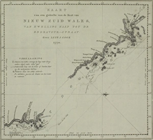
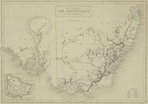
Antique map of New South Wales in Australia
Antique map of northwest Jordan with Sea of Galilee
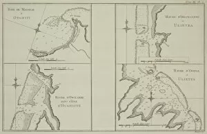
Antique maps of Tahiti and other South Pacific islands
Antique map of Arabia and adjacent Africa and Persia
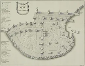
Antique map of fortified city of Ptolemaida
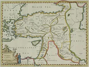
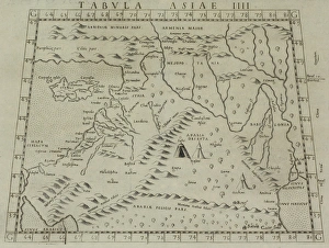
Antique map of Turkey in Asia
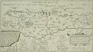
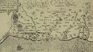
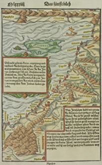
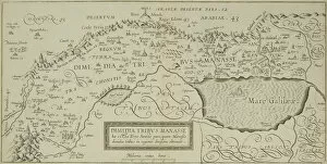
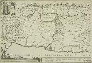
Antique map of tribes of Aser in the holy land
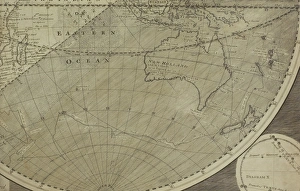
Antique map of Indian Ocean in southern hemisphere
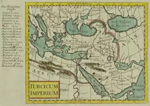
Antique map of the Turkish Empire
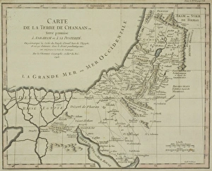
Antique map of Palestine
Antique map of coast of New South Wales in Australia
Antique map of coast of present day Lebanon and Syria
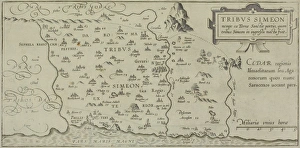
Antique map showing distribution of Simeon tribe in the holy land
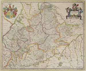
Antique map of Wirtenberg in Germany
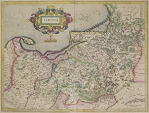
Antique map of Prussia
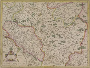
Antique map of present day Poland and Hungary
Antique map of New South Wales in Australia with inset
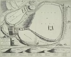
Antique plan of Jerusalem, Israel
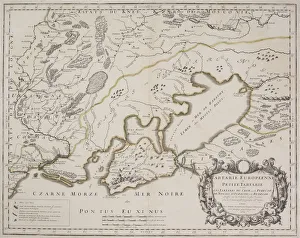
Antique map of Petite Tartarie north of the Black Sea
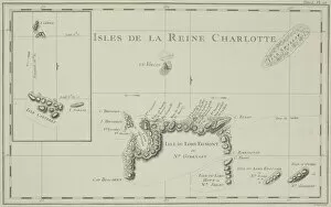
Antique map of the Queen Charlotte Islands off Australia
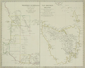
Paired antique maps of Western Australia and Van Diemen Island
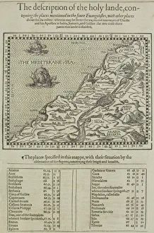
Antique map of the holy land with table of data
Antique map of the Gulf of Suez with Egypt and Israel
Antique document and map
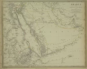
Antique map of Arabia with Egypt, Nubia, and Abyssinia
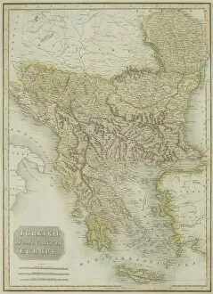
Antique map of Turkish dominions in Europe
Antique map of the holy land with the Sea of Galilee
Antique map of Turkey and the Black Sea
Antique map of holy land with Nile River Delta
Antique map of the holy land
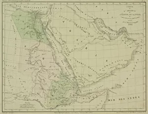
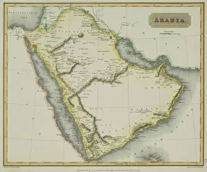
Antique map of Arabia