mail_outline sales@mediastorehouse.com
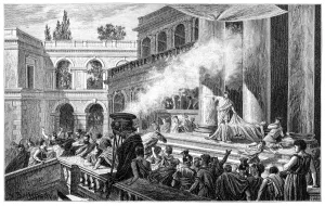
PompeiiIllustration of Pompeii
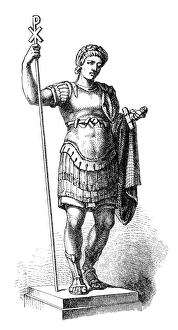
Constantine the Great (c. 272-337), Roman emperorillustration of a Constantine the Great (c.272-337), Roman emperor
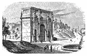
Arch of Constantine, Romeillustration of a Arch of Constantine, Rome
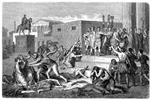
The proscription of 43 B. C of the TriumvirnIllustration of The proscription of 43 B.C of the Triumvirn
Marcus Aemilius Lepidus (triumvir, c. 89 / 88-12 BC), Roman patricianIllustration of a Marcus Aemilius Lepidus (triumvir, c.89/88-12 BC), Roman patrician
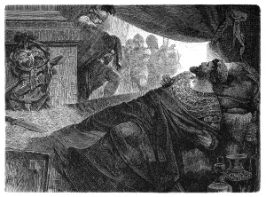
Marc Antony delivering the funeral oration over the dead body of Julius CaesarIllustration of Marc Antony delivering the funeral oration over the dead body of Julius Caesar
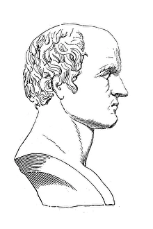
Mithridatesillustration of a Mithridates
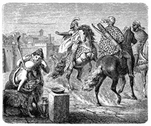
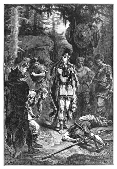
Jugurtha leaves Rome after agreeing to keep the peace, a vow the crafty desert warrior will soon break. While in Rome, he also arranged to assassinate a rival to his throne
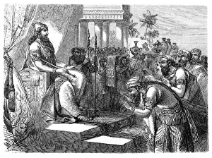
Paying homage to an Assyrian rulerIllustration of a Paying homage to an Assyrian ruler
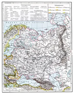
Map of Russia from 1896Illustration of a Map of Russia from 1896
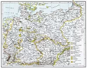
German Reich mapIllustration of a German Reich map
Illustration of the city Columbus began to build when he returned to Hispaniola
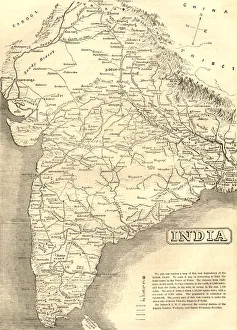
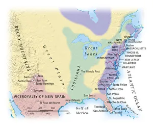
Mid-Victorian map of IndiaA mid-Victorian map of the Indian subcontinent at the time of the British Empire, showing various missionary society stations
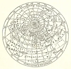
Victorian map of the Arctic CircleA Victorian map of the Arctic Circle and beyond. From Peter Parleyas Annual - A Christmas and New Yearas Present for Young Peoplea published in London by Darton & Co in 1851
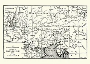
Map of the Campaign preceding the Treaty of Camp-formioVintage engraving of a Map of the Campaign preceding the Treaty of Camp-formio, 1797
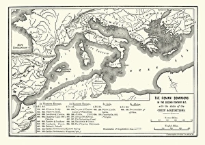
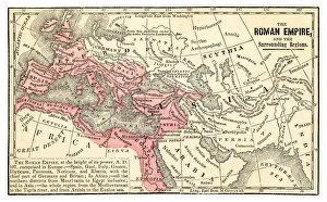
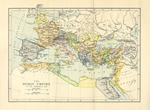
Map of Roman dominions in the Second Century BCVintage engraving of Map of Ancient Roman dominions in the Second Century BC
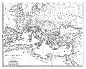
Victorian Map of The Roman EmpireEngraved illustrations of the Roman Empire Under Constantine the Great from Iconographic Encyclopedia of Science, Literature and Art, Published in 1851. Copyright has expired on this artwork
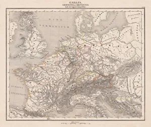
Ancient Europe under Emporer Augstus (63 BC-14 AD), published 1861Ancient map of Gaul, Germania and Britannia during the time of the first Roman Emporer Augstus (63 BC - 14 AD). Legend in Latin language. Steel engraving with colored borderlines, published in 1861
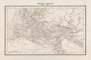
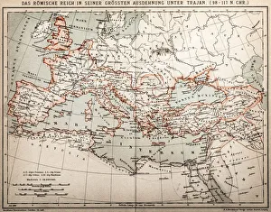
Roman Empire with provinces (115-117 AD), steel engraving, published 1861The Roman Empire and its provinces at the time of its greatest extent under Emperor Trajan in the years 115-117 AD. Legend in Latin language
Assyria and Phersia Empire c. 500 BC, steel engraving, published 1661Antique map from Assyrian and Persian Empire, c. 500 BC. Legend in Latin language. Steel engraving with hand colored borderlines, published in 1861
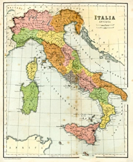
Antique Map of Ancient ItalyVintage engraving showing a Antique Map of Ancient Italy, 1864
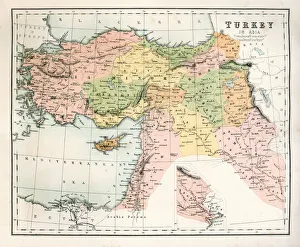
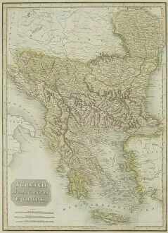
Antique Map of TurkeyAntique map of Turkey from 1867
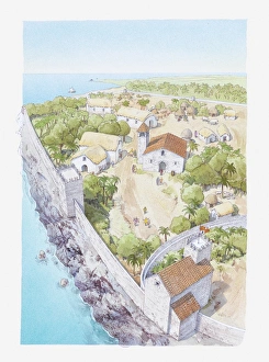
Prasat Bayon, Angkor ThomAngkor Thom located in present day Cambodia, was the last and most enduring capital city of the Khmer empire
Clovis punishing a rebel engraving 1894Great Men and Famous Women
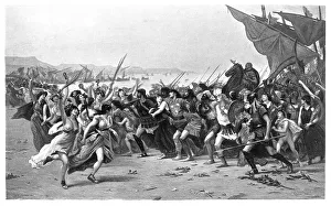
The Battle of Salamis engraving 1894Great Men and Famous Women
Roman empire map 1875The Independent Course Comprehensive Geography by James Monteith, A.S. Barnes & Co, New York & Chicago 1875
Antique map of Turkish dominions in Europe
Roman Empire in the Apostolic Age Map, Engraving, 1892Very rare, beautifully detailed engraving of Roman Empire in the Apostolic Age Map, Engraving, Published in 1892. Original edition from my own archives. Copyright has expired on this artwork
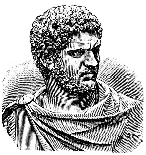
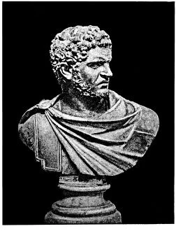
Caracalla (188 - 217), or Marcus Aurelius Severus Antoninus Augustus, Roman Emperor, circa 200 AD
Roman empire under Trajan
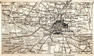
KonigsbergAntique map of Konigsberg
Jean-Baptiste Greuze A girl with a broken jugIllustration of a Jean-Baptiste Greuze A girl with a broken jug
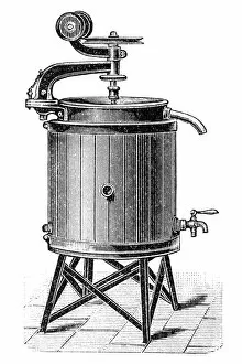
Pasteurization of milkApparatus for the pasteurization of milk
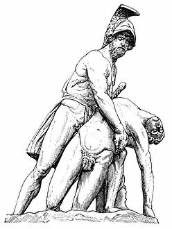
Menelaus with the corpse of PatroclusAntique illustration of a Menelaus with the corpse of Patroclus
Caracalla, formally Marcus Aurelius Severus Antoninus AugustusAntique illustration of a Caracalla, formally Marcus Aurelius Severus Antoninus Augustus
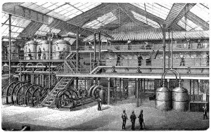
Sugar factoryAntique illustration of a Sugar factory
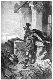
Gaius Marius Among Ruins of CarthageAntique illustration of a Gaius Marius Among Ruins of Carthage
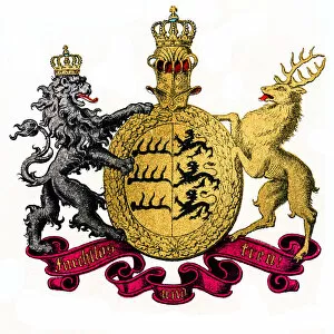
Kingdom of Wurttemberg, GermanyIllustration of Kingdom of Wurttemberg, Germany
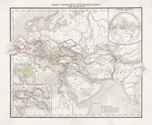
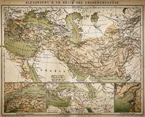
Map of Alexanders empire and conquestsAntique illustration Map of Alexanders empire and conquests
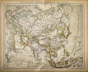
Political Map of AsiaAntique illustration of Political Map of Asia
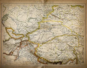
Map of inner AsiaAntique illustration of a inner Asia
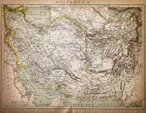
Map of West AsiaAntique illustration of a West Asia
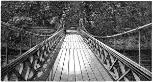
Bridge of Four LionsAntique illustration engraving of German Empire Kingdom Prussia Brandenburg Province Berlin: Tiergarten: Bridge of Four Lions
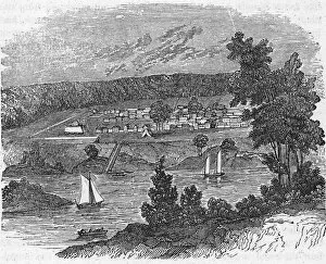
Vista Of Colonial Savannah, GeorgiaA view of the city of Savannah, Georgia, from across the Savannah River shows boats in the harbor below the town, 1778. (Image from Kean Collection/Getty Images)
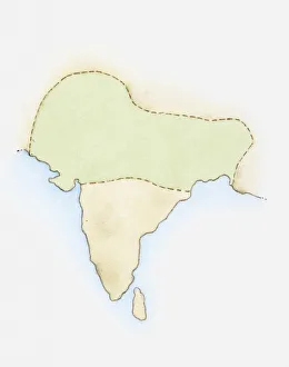
Illustration, map of India with Mauryan Empire highlighted in green
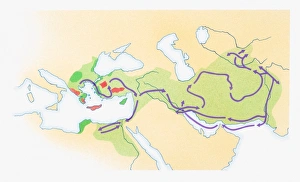
Illustration of Alexander the Greats route in purple and Empire in green
Digital illustration of map showing 15th century European colonization of the Americas
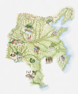
Illustrated map of ancient Chinese empire showing monuments, workers and warriors