mail_outline sales@mediastorehouse.com
Parisiennettes Tickling the nose of the EstablishmentVintage french cartoon by H Gerbault. Parisiennettes, a young french woman Tickling the nose of the Establishment with a giant feather. 1897
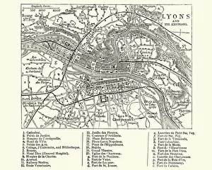
Map of Lyons, France, 19th CenturyVintage engraving of a Map of Lyons, France, 19th Century
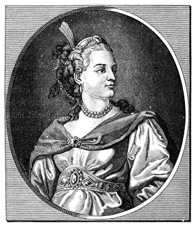
Antique illustration of 18th century French actress and tragedian ClaironAntique illustration of portrait of 18th century French actress and tragedian Hyppolite Clairon, portrayed as a beautiful young lady
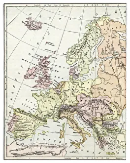
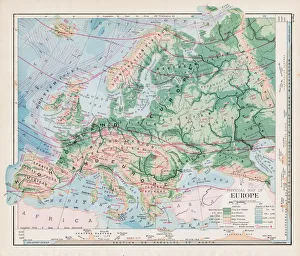
Map of Europe 1897Natural Elementary Geography by Redway and Hinman - NY/Cincinnati/Chicago 1897
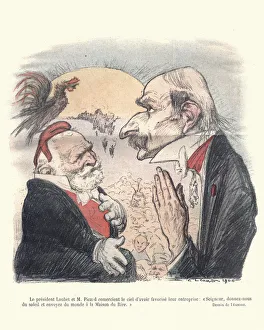
Satirical cartoon Emile Loubet President of FranceVintage engraving of a French satirical cartoon of Emile Loubet. Emile Francois Loubet was the eighth President of France
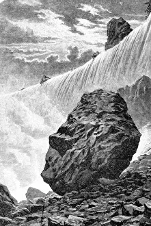
Niagara Falls
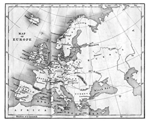
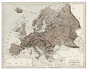
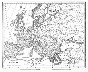
Map of Europe 1877Warrens Common School Geography 1877
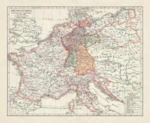
Map of Europe at the Napoleonic Wars of Liberty (1813)Map of Central Europe at the beginning of the Napoleonic Wars of Liberty in 1813. Lithograph, published in 1897
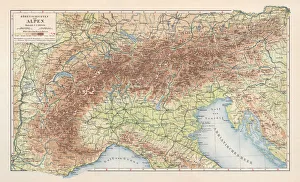
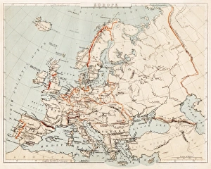
Topographic map of the European Alps, lithograph, published in 1897Topographic map of the European Alps. Lithograph, published in 1897
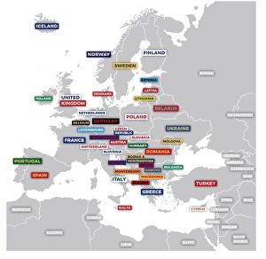
Labeled European MapLabeled European map concept showing countries with labels. EPS 10 file. Transparency effects used on highlight elements
Vintage Map of Europe Mid 19th CenturyVinateg Map of Europe Mid 19th Century, circa 1850
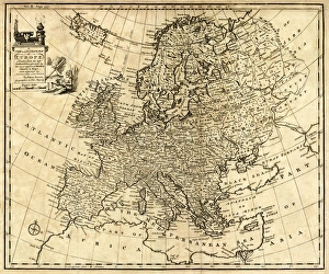
Antique Map of Europe 1744An engraved map of Europe with ornamental cartouche and relief shown pictorially by Emanuel Bowen 1744, London, Geographer to His Majesty
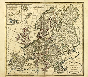
Antique Map of Europe, 1785An accurate map of Europe from the best authorities. London: C. Dilly & G. Robinson: 1785. Original size: 35.7 x 37.4 cm. Coloured, Inset: Spitsbergen, East and West Greenland, and Iceland
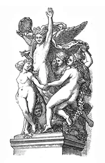
The dance, by Jean Baptiste CarpeauxIllustration of The dance, by Jean Baptiste Carpeaux
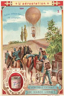
French Military Hot Air BalloonIllustrated postcard depicting a hot air balloon being used by the French military for surveying the rural countryside, France, 1894. (Kean Collection/Getty Images)
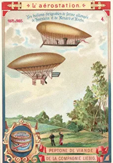
Early Steerable DIrigibles In FlightIllustrated postcard depicting two early dirigibles in flight, designed by Haenlein, Renard and Krebs, France, 1870s. (Kean Collection/Getty Images)
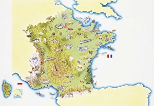
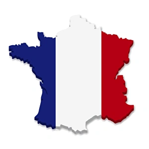
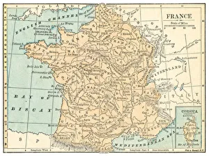
Map of France
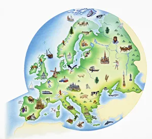
Map of Europe with illustrations of famous landmarks and items associated with various countries
Senanque abbey and its lavender field, ProvenceFamous Senanque abbey in Vaucluse with its lavender field in full bloom. Gordes, Provence, France. The abbey of Senanque was founded the 9th of the Calends of July 1148 (23th of June)
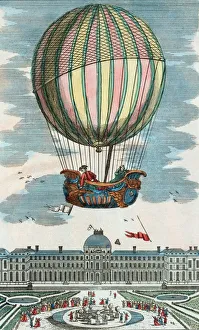
First manned hydrogen balloon flight
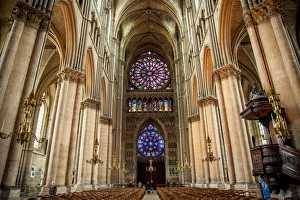
Interior of Notre-Dame de Reims, Reims Cathedral
Indian eagle owl portrait with open mouth (bubo bengalensis), Pyrenees, France
Outline and flag of France, 3D
Flamingos -Phoenicopteridae-, mating, Camargue, Southern France, France
White horses running through water, France
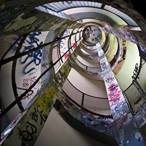
FrigosSpiral staircase seen from above. Graffitti
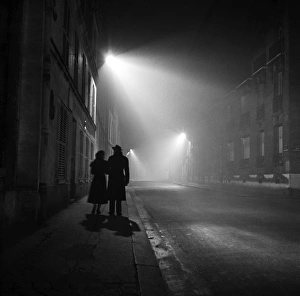
Paris At NightPARIS FRANCE - NOVEMBER 1: A couple stroll down a foggy street at night on November 1 1948 in Paris, France. (Photo by Michael Ochs Archive/Getty Images)
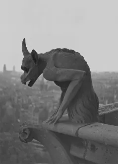
Gargoylecirca 1930: A Gargoyle on the cathedral of Notre Dame on the Ile de la Cite in central Paris. (Photo by Edward Charles Le Grice/Le Grice/Getty Images)
German Team17th July 1954: The Mercedes team load one of their cars into a transporter for the 1954 French Grand Prix at Reims, which they later won. It was the first time German cars had competed for 15 years
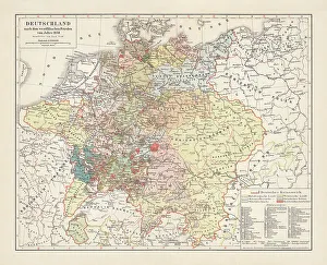
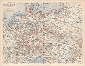
Map of Germany, after the Peace of Westphalia in 1648. Lithograph, published in 1897
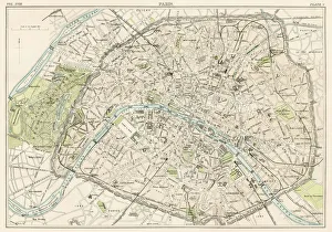
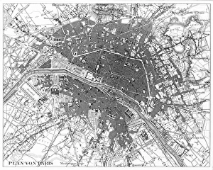
Paris city map 1885Encyclopedia Britannica 9th Edition New York Charles Scribners and Sons 1885 Vol XVIII
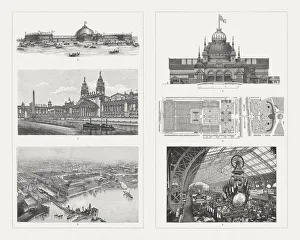
Buildings of the world Exhibitions, 19th centuryExhibition buildings of world exhibitions in the 19th century: 1-3) Buildings for the World Exhibition 1893 in Chicago, USA: 1) Machine exhibition building, 2) Building for horticulture
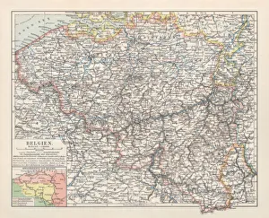
Map of Belgium, lithograph, published in 1897Map of Belgium with the territorial language areas. Lithograph, published in 1897
Map of Europe 1889Indiana Educational Series The Complete Geography - Indianapolis 1889
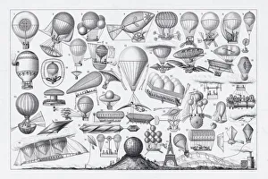
Balloons, Airships and Flying Machines Engraving from 18th Century FranceEngraved Illustrations of Hot Air Balloon Engraving from the 18th Century in France, Published in 1851. Copyright has expired on this artwork. Digitally restored
Carcassonne Municipal TheatreDetail (balcony shot from an extreme angle from below) of the Art Deco municipal theatre in Carcassonne
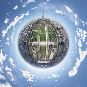
360 Aerial Panorama of Eiffel TowerIts an exclusive aerial view above one of the worlds most famous landmarks: The Eiffel Tower in Paris
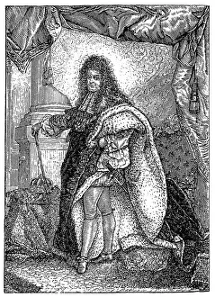
Louis XIV, King of France by Hyacinthe RigaudIllustration of Louis XIV, King of France by Hyacinthe Rigaud
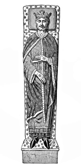
Tomb of King Richard LionheartIllustration of an effigy of King Richard I of England (1157 - 1199) at Fontevraud Abbey in Anjou, France, where most of the Kings body is buried
Map of Europe 1869Cornells Grammars-School Geography - S.S. Cornell - New York D. Appleton and Company 1869
Victorian Map of EuropeEngraved illustrations of Europe in the Time of Charlemagne from Iconographic Encyclopedia of Science, Literature and Art, Published in 1851. Copyright has expired on this artwork. Digitally restored
Paris, France Circa 1850 EngravingEngraved illustrations of the City of Paris from Iconographic Encyclopedia of Science, Literature and Art, Published in 1851. Copyright has expired on this artwork. Digitally restored
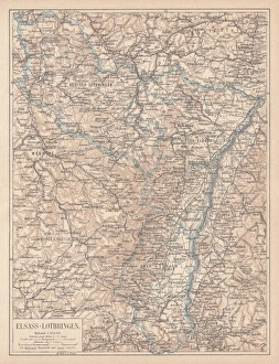
Map of Alsace-Lorraine, lithograph, published in 1875Ancient map of Alsace-Lorraine (German: Elsass-Lothringen). Lithograph, published in 1875
German Empire of 1871-1918, lithograph, published in 1875German Empire within the borders of 1871 - 1918. Lithograph, published in 1875
France map 1875The Independent Course Comprehensive Geography by James Monteith, A.S. Barnes & Co, New York & Chicago 1875
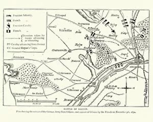
Franco Prussian War Plan of the Battle of CoulmiersVintage engraving of a scene from the Franco Prussian War. Plan of the Battle of Coulmiers (Baccon), The Battle of Coulmiers was fought on November 9
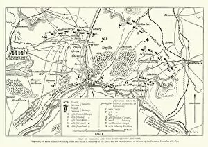
Franco Prussian War Battle plan of Siege of OrleansVintage engraving of a scene from the Franco Prussian War. Battle plan of Siege of Orleans
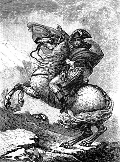
Napoleon Bonaparte riding a horse