mail_outline sales@mediastorehouse.com
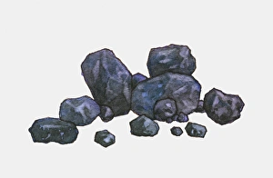
Illustration of pieces of mined coal
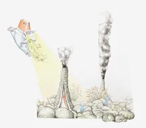
Illustration of smokers (sea vents, hydrothermal vents) on the ocean floor in volcanically active areas of mid-ocean ridges
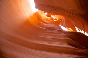
Rock formation in Antelope Canyon
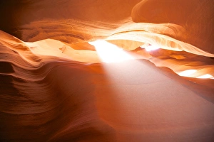
Light coming through rocks at Antelope Canyon, AZ
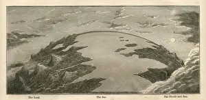
Topographical Land Sea Sky Earth Globe, Antique 1871 IllustrationColor stock photo of an antique illustration of a topographical earth globe showing land, sea and sky examples. Salvaged from an 1871 geography book
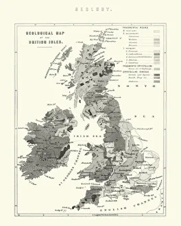
Victorian Geological Map of the British IslesVintage engraving of a Victorian Geological Map of the British Isles
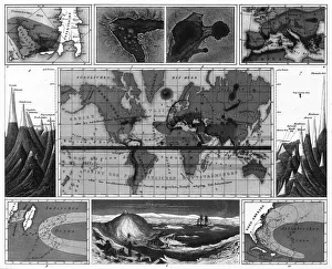
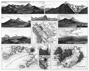
Volcanic and Hurricane Charts; Craters; and Antarctica EngravingEngraved Illustrations of Volcanic and Hurricane Charts; Craters; and Antarctica from Iconographic Encyclopedia of Science, Literature and Art, Published in 1851
Stratification in Mountains and Basins; Fissures and Craters EngravingEngraved Illustrations of Stratification in Mountains and Basins; Fissures and Craters from Iconographic Encyclopedia of Science, Literature and Art, Published in 1851
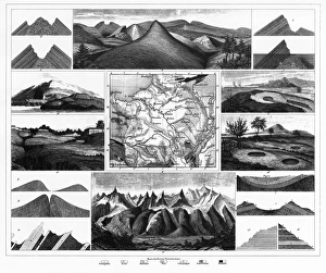
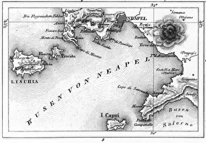
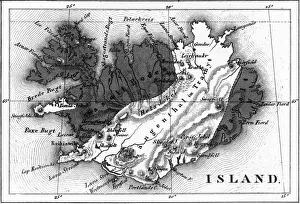
Volcanoes and Volcanic Formations and Stratification EngravingEngraved Illustrations of Volcanoes and Volcanic Formations and Stratification from Iconographic Encyclopedia of Science, Literature and Art, Published in 1851. Copyright has expired on this artwork
Map of Bay of Naples and Naples EngravingEngraved Illustrations of Volcanoes and Volcanic Formations and Stratification and the Map of Bay of Naples and Naples, Italy from Iconographic Encyclopedia of Science, Literature and Art
Map of Volcanic Chart of Iceland EngravingEngraved Illustrations of Volcanoes and Volcanic Formations and Stratification and the Map of Volcanic Chart of Iceland from Iconographic Encyclopedia of Science, Literature and Art
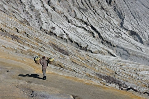
Worker at Kawah IjenWorker walking at Kawah Ijen in Jave Island Indonesia
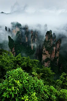
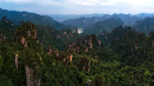
Zhangjiejia national parkFoggy over Zhangjiejia national park
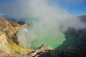
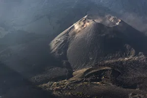
Kawah IjenThe volcano located at the east of Java Island. Crater filled with sulfur
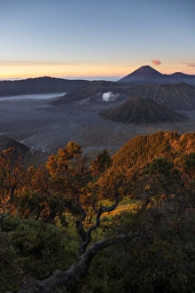
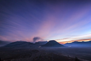
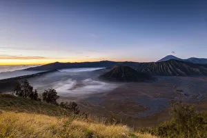
Sunrise at Bromo volcanoMount Bromo is an active volcano and part of the Tengger massif, in East Java, Indonesia
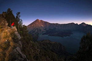
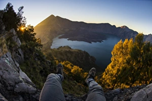
Rinjani VolcanoMount Rinjani or Gunung Rinjani is an active volcano in Indonesia on the island of Lombok. It rises to 3, 726 metres (12, 224 ft), making it the second highest volcano in Indonesia
Baby Rinjani (Gunung Baru)Mount Rinjani or Gunung Rinjani is an active volcano in Indonesia on the island of Lombok. It rises to 3, 726 metres (12, 224 ft), making it the second highest volcano in Indonesia
On the crater rimMount Rinjani or Gunung Rinjani is an active volcano in Indonesia on the island of Lombok. It rises to 3, 726 metres (12, 224 ft), making it the second highest volcano in Indonesia
Bromo sunsetMount Bromo is an active volcano and part of the Tengger massif, in East Java, Indonesia
Phu Hin Rong Kla National Park is a national park located in the Loei, Phitsanulok and Phetchabun Provinces of Thailand. The protected area is located in the forested mountains of the Luang Prabang
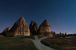
Cappadocia with the starsTonnaja Travel Photography, 489787645
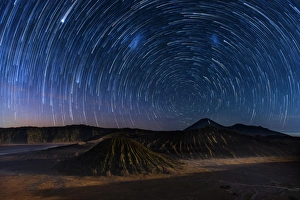
Startrail over Bromo volcanoTonnaja Travel Photography, 490562399
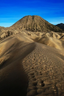
Mountain Batok and Sand DuneTonnaja Travel Photography, 494731461
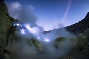
Blue flame at Kawah IjenTonnaja Travel Photography, 499487581
Mount Bromo before sunriseTonnaja Travel Photography, 499487659
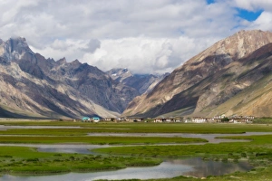
Rangdum village in Zanskar valleyTonnaja Travel Photography, 636936304
Panoramic Zhangjiajie National Forest Park, Hunan, ChinaThe panoramic aerial view of Tianzi mountain area in Zhangjiajie National Forest Park
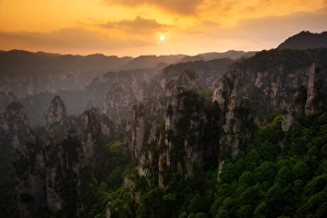
The sunset view of Zhangjiajie National Forest Park, Hunan, ChinaTonnaja Travel Photography, 688157646
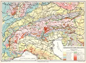
Alps Geological Map 1895Meyers Conversation Lexicon. A reference book of general knowledge, 5th edition 17 volumes Bibliographisches Institut - Leipzig 1895-1897
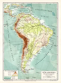
South America geological map 1895Meyers Konversations-Lexikon. Ein Nachschlagewerk des allgemeinen Wissens, 5th edition 17 volumes Bibliographisches Institut - Leipzig 1895-1897
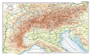
Alps geological map 1895Meyers Konversations-Lexikon. Ein Nachschlagewerk des allgemeinen Wissens, 5th edition 17 volumes Bibliographisches Institut - Leipzig 1895-1897
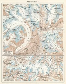
Glacier lithograph 1895Encyclopedia Britannica 9th Edition Vol I New York, Samuel Hall 1878
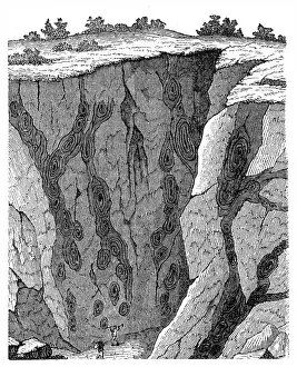
Veins in limestone on Monte CalviIllustration of a Veins in limestone on
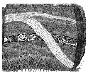
Section of a terrain, double vein
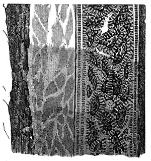
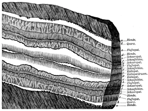
Part of a Freiberg ore mine: sulphur, quartz, gneissIllustration of a Freiberg ore mine: sulphur, quartz, gneiss
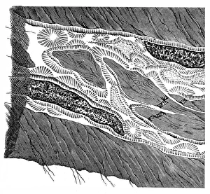
Section of a terrain, ramification and enforcement
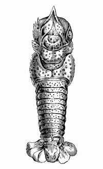
Pemphix sueuriFossil of Pemphix sueuri
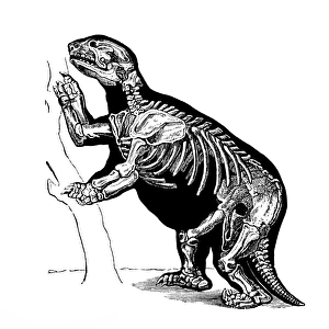
Giant ground sloth, Megatherium (Mylodon robustus)
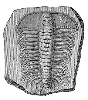
Trilobite (Asaphus caudatus)Illustration of a Trilobite (Asaphus caudatus)
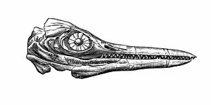
Chthyosaurus platyodonIllustration engraving of a chthyosaurus platyodon eye and jaw
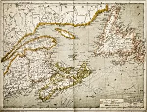
Eastern Canada and NewfoundlandIllustration of a Eastern Canada and Newfoundland
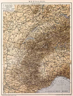
Western AlpsAntique illustration of a Western Alps
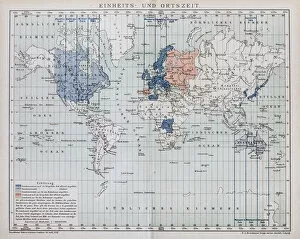
Local time world mapAntique illustration of a local time world map
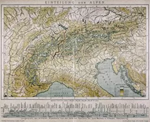
Classification of the AlpsAntique illustration of a classification of the Alps
Section of a terrainSection of Freiberg with a symmetrical lay - out structure
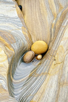
CreationNatural patterns and shapes made in the rocks by the continuing pounding of the sea
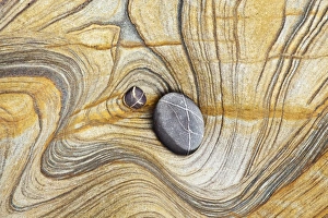
Coastal shapesRocks shaped & sculptured by the heavy waves crashing against rocks at Northumberland England
Untarnished landScene with warm light and turning sky and clouds pleasant magenta