mail_outline sales@mediastorehouse.com
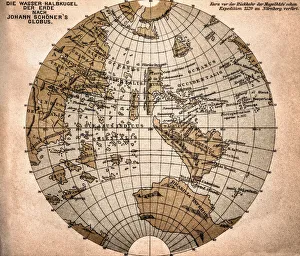
World map from 1520Western hemisphere of the Johannes SchAoner globe from 1520. expedition
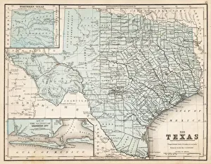
Map of Texas 1867Mitchells Modern Atlas - Published by E.H. Buttler & Co - Philadelphia 1867
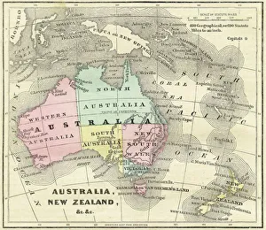
Map of Australia and New Zealand 1856Colton and Fitchs Modern School Geography by George W. Fitch - New York 1856
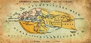
Map of the world according to Strabo 63 B.C
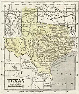
Map of Texas 1856Colton and Fitchs Modern School Geography by George W. Fitch - New York 1856
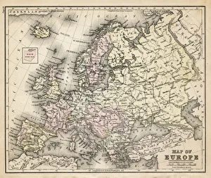
old map of european old map form 1883, showing european countries
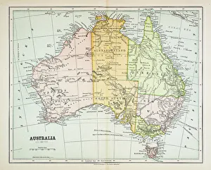
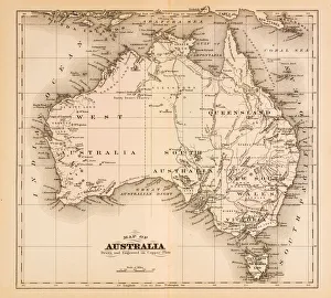
Map of Australia 1883Map of Australia
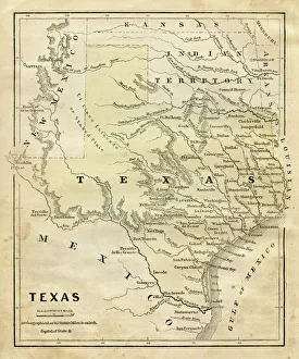
Map of Texas 1855System of Geography for the use of schools by Sidney E. Morse - Published by Harper & Brothers - New York 1855
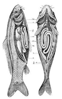
Common carp anatomyillustration engraving of a common carp anatomy
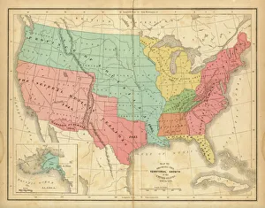
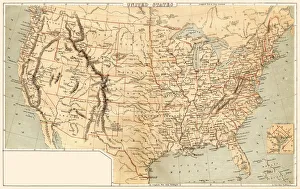
Map of United States 1876Map of United States showing the territorial growth between 1780 and 1876
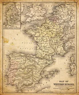
western europe map 1883a map of Western europe from 1883
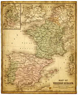
western europe 1867a map of Western europe from 1867, overlay with grunge burnt texture paper
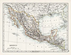
Mexico map 1897The World-Wide Atlas of Modern Geography, Political and Physical W. & A.K. Johnston - London 1897
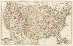
Map of United States 1869Cornells Grammars-School Geography - S.S. Cornell - New York D. Appleton and Company 1869
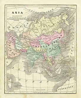
Map of Asia 1856Colton and Fitchs Modern School Geography by George W. Fitch - New York 1856
Map of United States 1867Mitchells Modern Atlas - Published by E.H. Buttler & Co - Philadelphia 1867
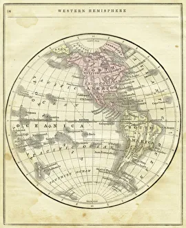
Western Hemisphere map 1856Colton and Fitchs Modern School Geography by George W. Fitch - New York 1856
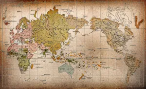
World mapthe dissemination of human races by Muller and Peschel
Map of Australia 1874Map of Australia
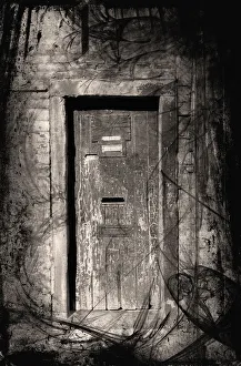
Haunted doorwayGrunge doorway, entrance to the haunted house
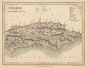
Hand coloured antique map of Sussex EnglandThis detailed map of Sussex is from Dugdales England and Wales Delineated. The map was drawn by G.Cole and engraved by John Roper for publication first in The Beauties Of England And Wales
old map of central european old map form 1870, showing central europe countries
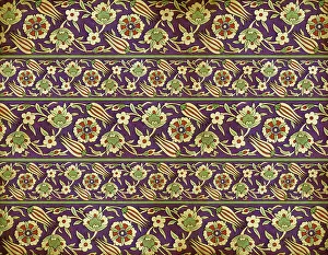
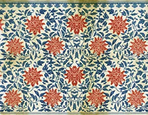
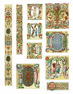
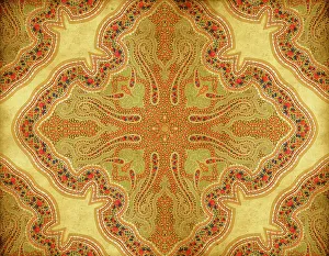
Old Persian WallpaperOrnaments from "L'Ornement Polychrome" First and Second Series published in 1873 by Albert Charles Auguste Racinet (1825-1893) a french designer, lithographer and art historian
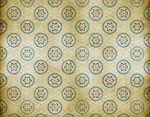
Old Floral WallpaperOrnaments from "L'Ornement Polychrome" First and Second Series published in 1873 by Albert Charles Auguste Racinet (1825-1893) a french designer, lithographer and art historian
Old Asian WallpaperOrnaments from "L'Ornement Polychrome" First and Second Series published in 1873 by Albert Charles Auguste Racinet (1825-1893) a french designer, lithographer and art historian
Traditional Assyrian WallpaperOrnaments from "L'Ornement Polychrome" published in 1873 by Albert Charles Auguste Racinet (1825-1893) a french designer, lithographer and art historian. Photographed and edited by J
Ornaments Italy 16th CenturyOrnaments from "L'Ornement Polychrome" First and Second Series published in 1873 by Albert Charles Auguste Racinet (1825-1893) a french designer, lithographer and art historian
Old Dirty Chinese PaintingOrnaments from "L'Ornement Polychrome" First and Second Series published in 1873 by Albert Charles Auguste Racinet (1825-1893) a french designer, lithographer and art historian
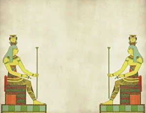
Traditional Egyptian Pharao OrnamentOrnaments from "L'Ornement Polychrome" First and Second Series published in 1873 by Albert Charles Auguste Racinet (1825-1893) a french designer, lithographer and art historian
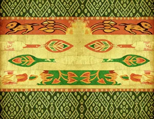
Traditional Indian WallpaperOrnaments from "L'Ornement Polychrome" First and Second Series published in 1873 by Albert Charles Auguste Racinet (1825-1893) a french designer, lithographer and art historian
Old Dirty Chinese OrnamentOrnaments from "L'Ornement Polychrome" First and Second Series published in 1873 by Albert Charles Auguste Racinet (1825-1893) a french designer, lithographer and art historian
Old Dirty Chinese WallpaperOrnaments from "L'Ornement Polychrome" First and Second Series published in 1873 by Albert Charles Auguste Racinet (1825-1893) a french designer, lithographer and art historian
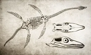
Plesiosaurus Skeleton
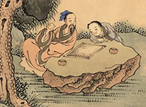
Chinese Mahjong playersMahjong, game of Chinese origin dating to over two thousand years ago. For centuries, Mahjong remained exclusive of the royal class. It was against the law for commoners to play
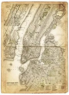
map of new york city 1874very old map showing new york city, new jersey, and hoboken) 1874 - composite with grunge sepia paper
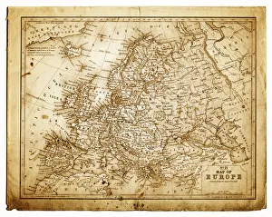
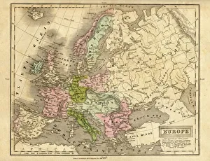
europe map 1829an old map form 1829, showing the whole europe
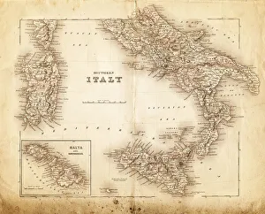
map of italy 1855an old map of southern italy (inset showing malta) - 1855
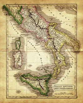
map of italy during the Roman Empiremap of antique italy during the Roman Empire, Meridional parts - Sardinia, Corsica and Sicily
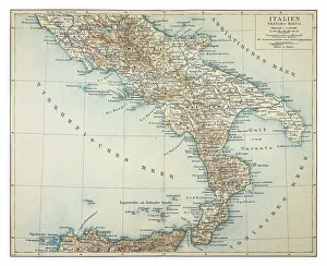
map of italy 1863an old map of italy - 1863
Map of southern Italy 1895
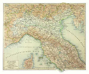
Map of northern Italy 1895
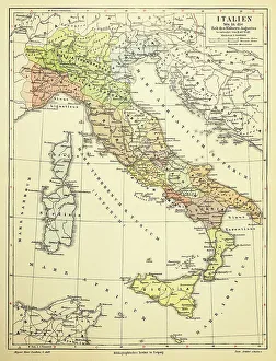
Map of Italy 1895
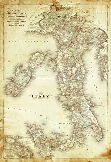
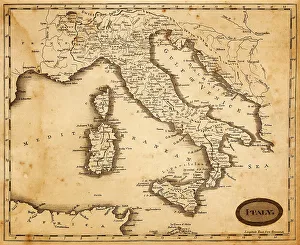
map of italy 1812an old map of italy - 1812
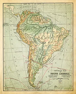
old map of south americaan old south american map (1881)
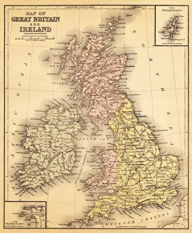
great britain and irelandmap from 1883 - great britain and ireland
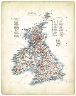
Map of Great Britain 1862French map of Great Britain 1862 - Scotland and Ireland map composed with two vintage stained papers
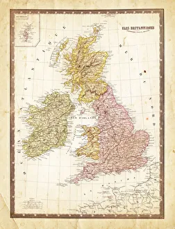
Antique map of Great Britain 1863Antique map of Great Britain, Ireland and Scotland
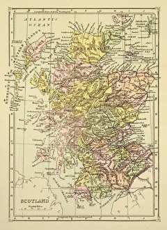
Map of Scotland 1894Map of Scotland