mail_outline sales@mediastorehouse.com
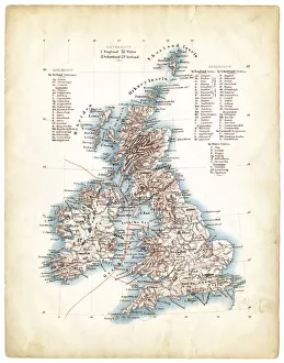
Antique map of Great Britain 1863Antique map of Great Britain, Ireland and Scotland
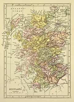
Map of Scotland 1894Map of Scotland
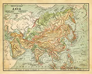
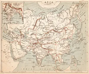
Physical map of asia - 1881
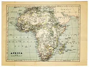
map of africa 1882Part Of, Grunge, Burnt, Rusty, Rust, Torn, Retro Revival, Old-fashioned, Africa, Sepia Toned, Map, Cartography, Physical Geography, Direction, Sea, Atlantic Ocean, Paper, Textured Effect
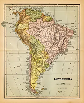
south america 1883an old south american map (1883)
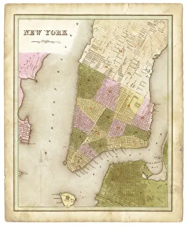
map of New York city 1838very old map showing New York city - composite with grunge sepia paper
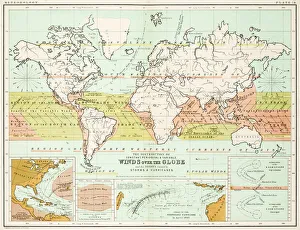
Winds - Map of the world 1861Map of the world - Winds over the globe - storms and hurricanes
the world 1877antique map of the world - 1877
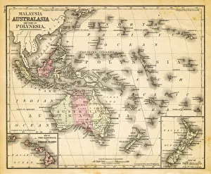
map of australia, malaysia and polynesiaold map of australia, malaysia and polynesia - 1883
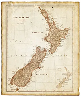
Old map of New Zealand and Tasmania 1899 - combined with textures overlay
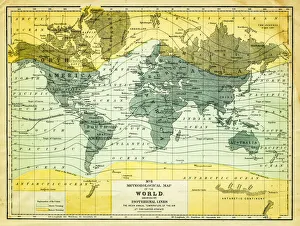
map of the world 1867meteorological map of the world 1867 - showing isothermal lines
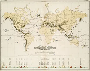
Map of the world 1861Map of the world - The distribution of Earthquakes and Volcanoes over the globe
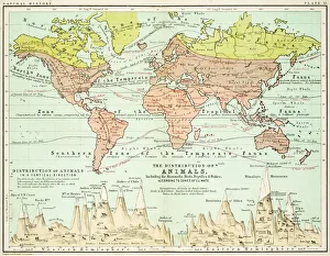
Animals - Map of the world 1861Map of the world - The distributions of animals
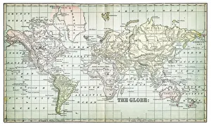
map of the world 1873antique map of the world - from a french atlas - 1872
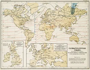
Climate map of the world 1861Map of the world - Climatological Chart
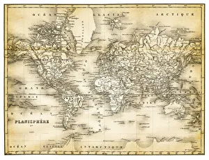
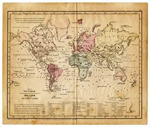
map of the world 1855map of the world illustrating the principal features of the land and the co-tidal lines - 1855
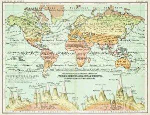
Agricultural Map of the world 1861map of the world showing the distribution of the most important Tress, Shrubs, Grains and Fruits according to zones of climate and moisture plants
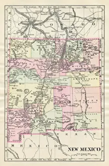
Map of New Mexico 1885Map of New Mexico
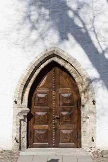
close-up image of a fragment of wooden ancient door
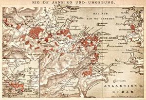
Map of Rio de Janeiro 1898Map of Rio de Janeiro - In German Language
Vintage Japanese Woodblock print of ActorThis vintage Japanese woodblock print is by Yoshikuni Toyokawa active 1803-1840, was a pupil of Asayama Ashikuni. He was both a printmaker and a poet. His favourite subjects were actor prints
Old Dirty Chinese WallpaperOrnaments from L Ornement Polychrome First and Second Series published in 1873 by Albert Charles Auguste Racinet (1825-1893) a french designer, lithographer and art historian
Windsor castle19th century illustration of Windsor Castle.Windsor Castle is a medieval castle and royal residence in Windsor in the English county of Berkshire
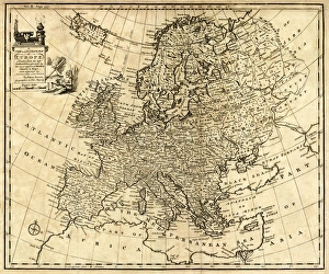
Antique Map of Europe 1744An engraved map of Europe with ornamental cartouche and relief shown pictorially by Emanuel Bowen 1744, London, Geographer to His Majesty
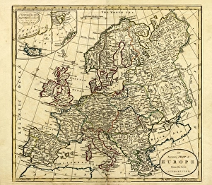
Antique Map of Europe, 1785An accurate map of Europe from the best authorities. London: C. Dilly & G. Robinson: 1785. Original size: 35.7 x 37.4 cm. Coloured, Inset: Spitsbergen, East and West Greenland, and Iceland
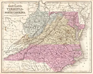
Map of Maryland Virginia North Carolina 1867Mitchells Modern Atlas - Published by E.H. Buttler & Co - Philadelphia 1867
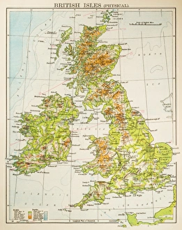
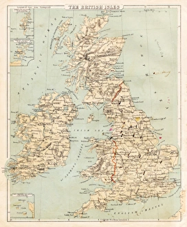
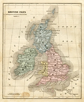
Map of British Isles 1897Map of British Isles
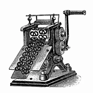
Pretzel makerAntique illustration of a Pretzel maker
World War Soldier posterPatriotic army poster
Middle states USA map 1869Cornells Grammars-School Geography - S.S. Cornell - New York D. Appleton and Company 1869
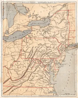
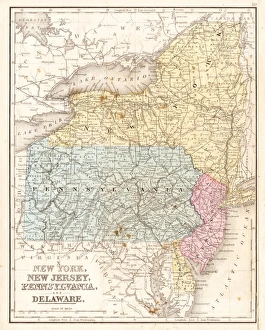
MId-atlantic states usa map 1867Mitchells Modern Atlas - Published by E.H. Buttler & Co - Philadelphia 1867
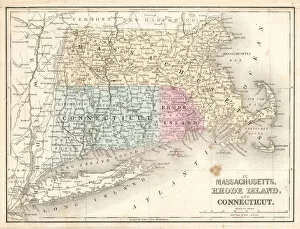
Rhode Island Massachusetts Connecticut 1867Mitchells Modern Atlas - Published by E.H. Buttler & Co - Philadelphia 1867
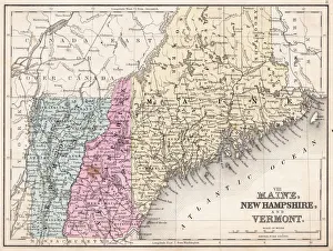
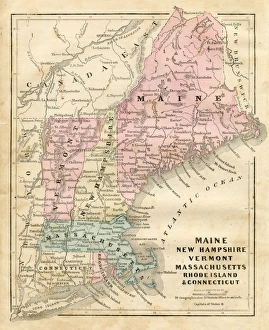
Maine New Hampshire and Vermont 1867Mitchells Modern Atlas - Published by E.H. Buttler & Co - Philadelphia 1867
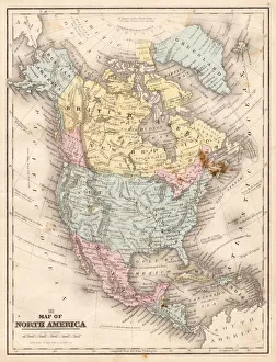
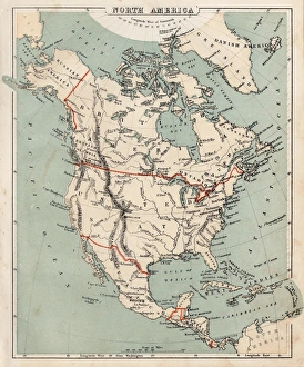
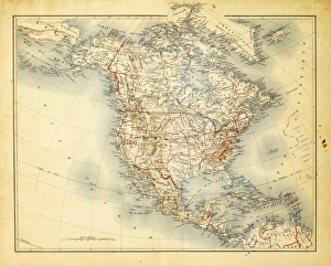
Map of North America 1867Mitchells Modern Atlas - Published by E.H. Buttler & Co - Philadelphia 1867
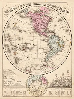
Western Hemisphere map 1867Mitchells Modern Atlas - Published by E.H. Buttler & Co - Philadelphia 1867
Map of Asia 1869Cornells Grammars-School Geography - S.S. Cornell - New York D. Appleton and Company 1869
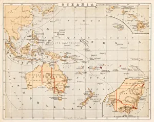
Map of Australia Oceania 1869Cornells Grammars-School Geography - S.S. Cornell - New York D. Appleton and Company 1869
Map of the British isles 1869Cornells Grammars-School Geography - S.S. Cornell - New York D. Appleton and Company 1869
Map of North America 1869Cornells Grammars-School Geography - S.S. Cornell - New York D. Appleton and Company 1869
Maine New Hampshire and Connecticut 1856Colton and Fitchs Modern School Geography by George W. Fitch - New York 1856
map of the British isles 1856Colton and Fitchs Modern School Geography by George W. Fitch - New York 1856
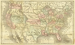
Map of United States 1856Colton and Fitchs Modern School Geography by George W. Fitch - New York 1856
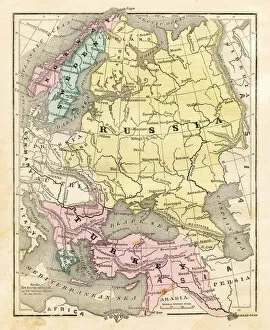
Map of Russia Turkey 1856Colton and Fitchs Modern School Geography by George W. Fitch - New York 1856
Map of North America 1856Colton and Fitchs Modern School Geography by George W. Fitch - New York 1856
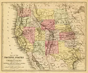
map of the Pacific states (California, Oregon, Washington) an territories with a part of central and souther states - USA (1883)
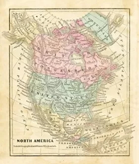
Map of North America 1882Antique Map of North America 1882
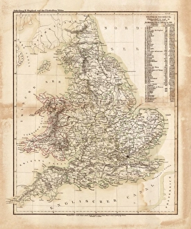
Map of great Britain 1831Antique map of great Britain 1870
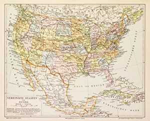
Map of United States and Mexico 1897Map of United States and Mexico