mail_outline sales@mediastorehouse.com
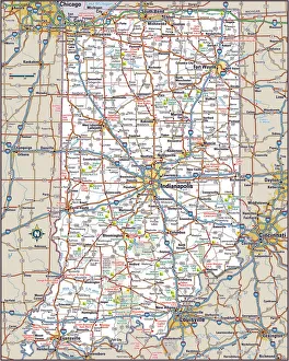
Indiana Highway MapReference Maps, Top Sellers Art Prints, 103312674
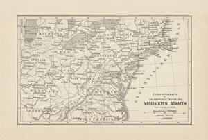
Map of Northeast United States, published in 1882Map of the Northeast United States of America. Wood engraving, published in 1882
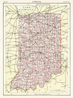
Indiana USA map 1881Encyclopedia Britannica 9th Edition Vol XII Philadelphia j.M. Stoddart & Co 1881
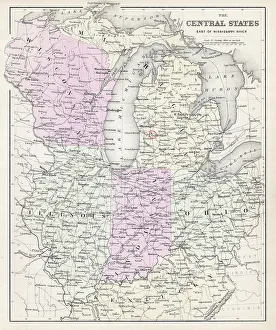
Map of Central states 1877Warrens Common School Geography 1877
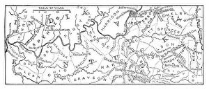
Old map of the Ohio River between Indiana and Kentucky - Scanned 1887 map
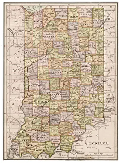
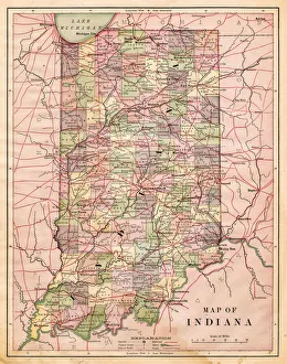
Map of Indiana 1889Indiana Educational Series The Complete Geography - Indianapolis 1889
indiana Ohio Kentucky map 1881Coltons Common School Geography 1881 New York Sheldon and Co
Antquie Map of the United StatesVintage map of the United States of America from 1837
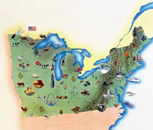
USA, Northern States of America, map with illustrations showing distinguishing features
Map of Indiana USA 1881Harpers School Geography, New York, Harpers and Brothers, 1881
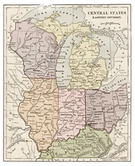
Central states eastern division map 1889Indiana Educational Series The Complete Geography - Indianapolis 1889
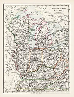
United States North East Central map 1897The World-Wide Atlas of Modern Geography, Political and Physical W. & A.K. Johnston - London 1897
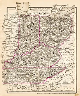
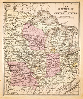
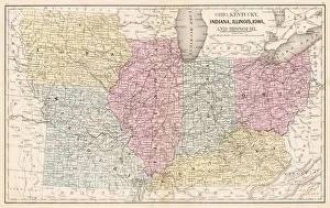
Map of Central States USA 1883Warrens Common School Geography
Southern States 1852 Map
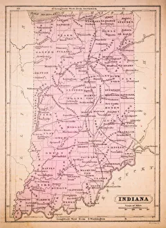
Indiana 1852 Map
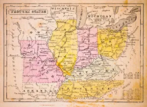
Western States 1852 Map
United States of America, Atlantic coast, lithograph, published in 1878United States of America, Atlantic coast. Lithograph, published in 1878
Ohio Indiana Illinois map 1867Mitchellas Modern Atlas - Published by E.H. Butler and Co - Philadelphia 1867
Pilot Pond in Banff