mail_outline sales@mediastorehouse.com
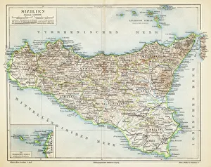
Sicily map 1895Meyers Konversations-Lexikon. Ein Nachschlagewerk des allgemeinen Wissens, 5th edition 17 volumes Bibliographisches Institut - Leipzig 1895-1897
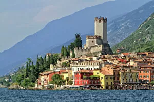
Townscape with Lake Garda, Malcesine, Verona province, Veneto, Italy
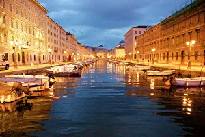
Grand canal with boats at night in Trieste, Italy
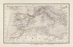
Roman Republic and Carthage during the Second Punic War (218-201-BC)Ancient map of the Roman Republic and Carthage during the Second Punic War (218 to 201 BC). Legend in Latin language. Steel engraving with hand colored borderlines, published in 1861
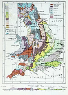
Antique colored illustrations: Geological map of England and Wales
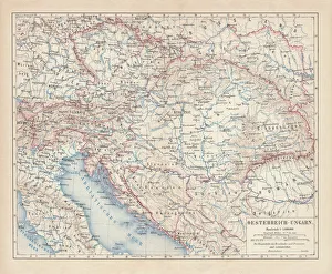
Austro-Hungarian Empire, Habsburg Monarchy, lithograph, published in 1877Ancient map of Austro-Hungarian Empire. Habsburg Monarchy. Lithograph, published in 1877
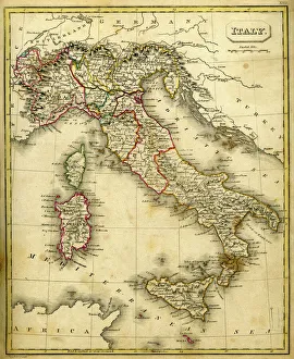
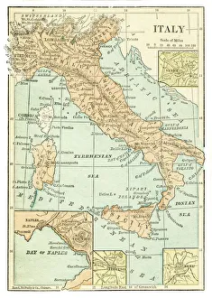
Antique Damaged Map of Italy 19th CenturyAntique damaged map of Italy 19th Century
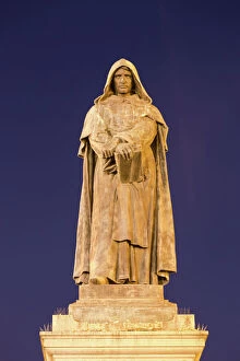
Statue of Giordano Bruno, Campo de Fiori, at night, Rome, Lazio, Italy
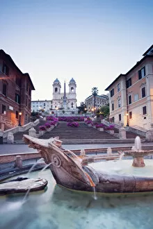
Spanish steps, famous square in Rome, ItalySpanish steps and TrinitA dei Monti church at sunrise, with fountain della Barcaccia in the foreground. Rome, Italy
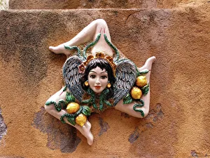
The Sicilian coat of arms, Taormina, Sicily, Italy
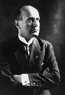
Benito Mussolini Portrait 192512th November 1925: Italian fascist dictator Benito Mussolini (1883 - 1945). (Photo by Topical Press Agency/Getty Images)
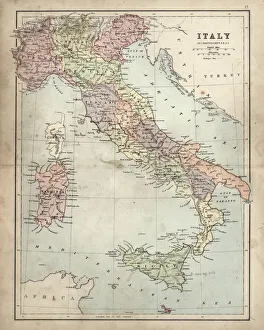
Antquie Map of ItalyVintage map of Italy fron 1837
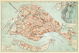
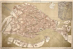
Map of Venice 1897Map of the city of Venice, Italy
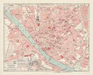
City map of Florence, Italy, lithograph, published in 1897City map of Florence - capital city of the Italian region of Tuscany. Lithograph, published in 1897
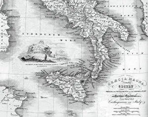
Vintage map of Magna Graecia, showing the settlements of the ancient greeks in Italy. Magna GrA|cia is the name of the coastal areas of Southern Italy on the Tarentine Gulf that was extensively
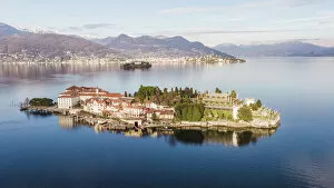
Sunset over Isola Bella, Lake Maggiore, ItalyBorromean islands in the gulf of Pallanza, Lake Maggiore, Piedmont, Italy
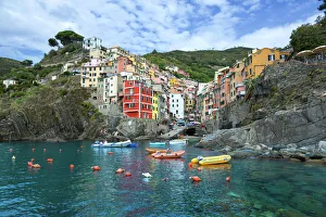
Riomaggiore, Cinque Terre, ItalyBeautiful view of Riomaggiore, Cinque Terre
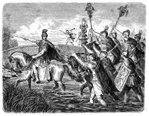
Caesar crossing the RubiconIllustration of a Caesar crossing the Rubicon. This event of crossing a small stream in Northern Italy became one of ancient historys most pivotal events, for from it sprang the Roman Empire
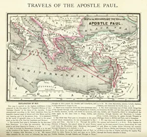
Travels of The Apostle Paul Map EngravingEngraved illustration of the Travels of The Apostle Paul Map Engraving from The Popular Pictorial Bible, Containing the Old and New Testaments, Published in 1862
Italy map 1875The Independent Course Comprehensive Geography by James Monteith, A.S. Barnes & Co, New York & Chicago 1875
Torcello Cathedral, The Cathedral of Santa Maria Assunta (Cattedrale di Santa Maria Assunta) is a basilica church on the island of Torcello, Venice, northern Italy
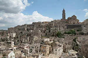
Sassi di Matera, Basilicata, ItalyLonely Planet describes Matera as Italys most extraordinary town" due to its incredible old town, the Sassi (i sassi)
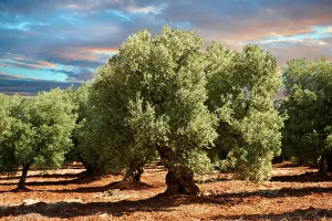
Ancient Cerignola olive trees -Olea europaea-, Ostuni, Apulia, Italy
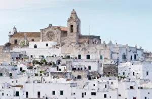
View of the town with the cathedral, Ostuni, Apulia, Italy
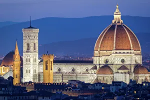
Florence, Tuscany, Italy
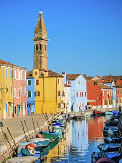
Burano in VeniceThe unbelievably colourful Burano, one of the islands in the Venice lagoon, where every house is painted a bright shade of blue, yellow, pink, purple
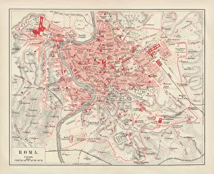
City map of Rome, lithograph, published in 1878City map of Rome, Italy. Lithograph, published in 1878
Map of Venice 1898Antique illustration of a Map of Venice 1898
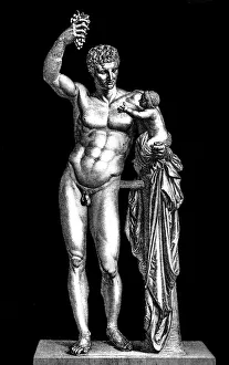
Hermes and the Infant DionysusAntique illustration of a Hermes and the Infant Dionysus
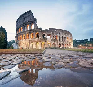
Colosseum reflected at sunrise, Rome, ItalyThe Colosseum (Flavian Amphitheatre) at sunrise, still illuminated by artificial light. Rome, Italy
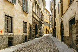
Cobbled street in Citta Alta (Old Town) in Bergamo, Lombardy, ItalyCitta Alta in Bergamo, Lombardy, Italy
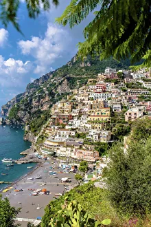
Beauty of Positano, Amalfi Coast, ItalyBeautiful Positano, with the beach and ships in the mediterranean sea at summer in Amalfi Coast, Italy
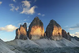
Sunset over Tre Cime di Lavaredo / Drei Zinnen, DolomitesTravel in the Dolomiteais, Italian Alps, Europe, Summertime
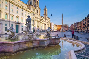
Piazza Navona, Rome, Lazio, ItalyFontana del Moros sculptures
Positano, italy. Amalfi CoastHigh view of Positano, italy. Amalfi Coast. Costa Amalfitana
Cinque Terre coastline villages, La Spezia, ItalyFacing the mediterranean sea, Cinque Terre (meaning Five lands ) coastline villages, La Spezia, Italy. This is a high view of colorful Vernazza, the other are Monterosso al Mare, Manarola
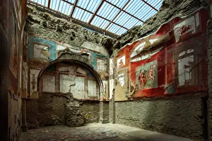
Painted Murals And Frescoes Inside A Room At The Ancient Roman Ruins At Herculaneum (Ercolano), Campania, ItalyLocated in the shadow of Mount Vesuvius, Herculaneum (Ercolano) was an ancient Roman town destroyed by volcanic pyroclastic flows in 79 AD
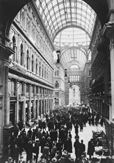
Galleria Umbertocirca 1930: Galleria Umberto, Naples, one of Europes most famous shopping arcades. (Photo by General Photographic Agency/Getty Images)
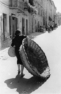
Giant BasketA woman carrying a large wicker basket through a street in Assisi. Picture Post - 5409 - Assisi - pub. 1951 (Photo by Thurston Hopkins/Getty Images)
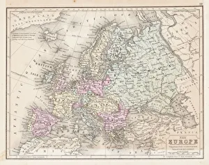
Europe map 1867Mitchellas Modern Atlas - Published by E.H. Butler and Co - Philadelphia 1867
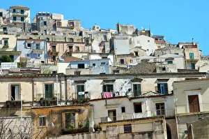
View at the old town of Modica Italy
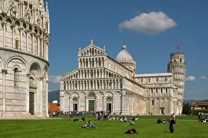
Leaning Tower of Pisa and Duomo in ItalyLeaning Tower of Pisa and cathedral (Duomo) at Cathedral Square (Piazza dei Miracoli, Piazza del Duomo) in Pisa. UNESCO World Heritage Site. Pisa, Tuscany, Italy
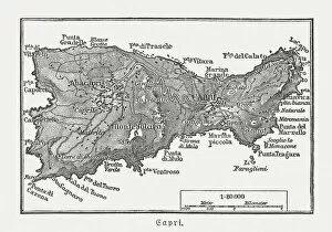
Map of Capri, Italian island, wood engraving published in 1897Map of Capri, Italian island. Wood engraving, published in 1897
Gaul in the time of Julius Caesar, published in 1867Gaul in the time of Roman politican Gaius Iulius Caesar (100 - 44 BC). Steel engraving with hand-colored borderlines and Latin legend, published in 1867
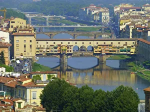
Ponte Vecchio, FlorenceThe Ponte Vecchio ( Old Bridge ) is a Medieval stone arch bridge over the Arno River, in Florence, Italy, noted for still having shops built along it, as was once common
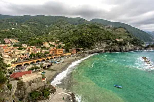
Monterosso al Mare panoramic view in a cloudy day. Unesco World heritage site
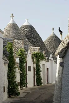
Trulli houses, UNESCO World Heritage Site, Alberobello, Apulia, Italy
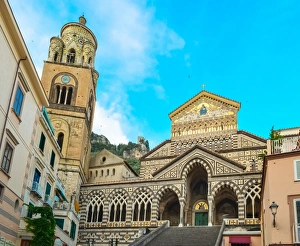
Duomo di Amalfi cathedral facade with bell tower, Amalfi, ItalyDuomo di Amalfi cathedral facade in Romanesque, Byzantine and Arabic styles with bell tower, Amalfi, Italy, a UNESCO Heritage site