mail_outline sales@mediastorehouse.com
King Penguins, Aptenodytes patagonicus, in a bird colony on South Georgia Island, on the Falkland islands
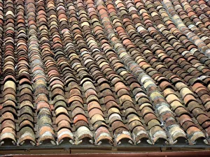
Roof tiles, Trinidad, CubaRoof tiles in wavy pattern, Trinidad, Cuba
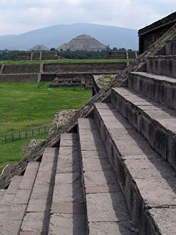
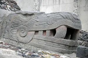
Pyramids of Teotihuacan
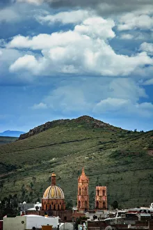
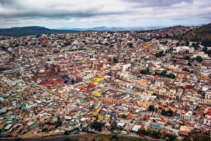
Zacatecas landscapeThe state name derives from the name of its capital, Zacatecas. This word is derived from Nahuatl and means -where there is abundant zacate (grass), Zacatecas is located in North-Central Mexico
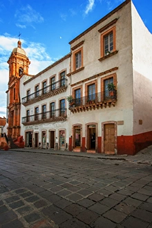
Zacatecas buildingsThe state name derives from the name of its capital, Zacatecas. This word is derived from Nahuatl and means -where there is abundant zacate (grass), Zacatecas is located in North-Central Mexico
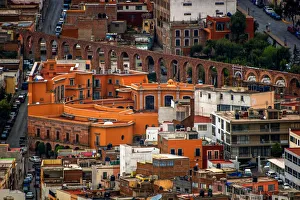
Zacatecas Quinta RealZacatecas is a city and municipality in Mexico, and the capital and largest city of the state of Zacatecas. Located in the north central Mexico the city had its start as a Spanish mining camp in
Day of the Dead catrina skelelton dollsNorth America, Mexico, Guanajuato State, Guanajuato, Day of the Dead catrina skeleton dolls in market. The historic city of Guanajuato is a UNESCO World Heritage Site
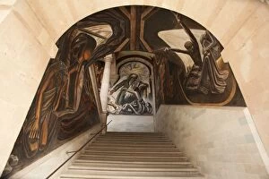
Mexican mural and archNorth America, Mexico, Guanajuato State, Guanajuato, Alhondiga de Granaditas, murals of Miguel Hidalgo (Mexican revolutionary hero), painted by Jose Chavez Morado
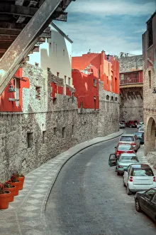
Guanajuato city undergroundGuanajuato, the capital of Guanajuato state, is a UNESCO World Heritage Site and a charming colonial era city situated in a picturesque valley surrounded by the Sierra de Guanajuato mountains
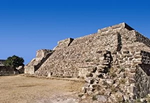
Mexico, Oaxaca, Monte Alban, pre-Columbian archaeological site, built 600 BC by the Zapotecs
Panoramic skyline, San Miguel de Allende
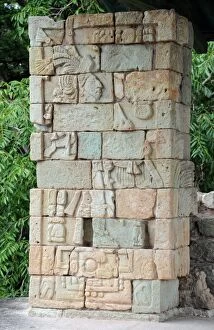
Ancient Mayan Stone Sculpture, CopanAncient Mayan sculpted stone blocks at the West Court of the Acropolis, Copan.Copan is an archaeological site of the Maya civilization in the west of Honduras
Ancient Mayan Stone Block Depicting Kings of CopanImage shows Altar Q, a sculpted stone block depicting the 16 rulers of the Copan dynasty, located in the West Court.Copan is an archaeological site of the Maya civilization in the west of Honduras
Stela A, Ancient Mayan Stone Statue, CopanStela A, ancient Mayan stone statue in the Monument Plaza (Great Plaza) of Copan.Copan is an archaeological site of the Maya civilization in the west of Honduras
Reconstruction of the Rosalila Temple, CopanReconstruction of the Rosalila temple at the site museum of Copan.CopAan is an archaeological site of the Maya civilization in the west of Honduras
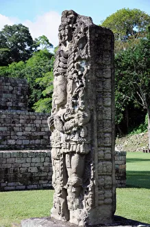
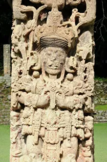
Stela B, Ancient Mayan Stone Statue, CopanStela B, ancient Mayan stone statue in the Monument Plaza (Great Plaza) of Copan.Depicting Eighteen Rabbit (Uaxaclajuun Ub aah K awiil)
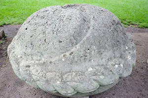
Ancient Mayan Sacrificial Altar, CopanRounded stone sacrificial altar of Stela A, with curved groove to channel blood flow during sacrifices.Location: Monument Plaza (Great Plaza)
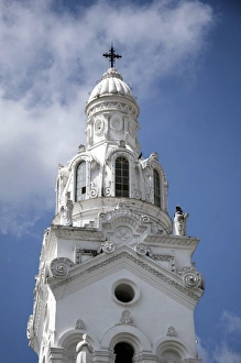
Latin American Colonial ArchitectureThis Spanish colonial bell tower is located in the UNESCO city of Quito, Ecuador
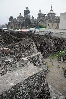
Ancient Ruins of Tenochtitlan, Mexico CityAncient Aztec ruins of Templo Mayor, Tenochtitlan, part of the Historic Center of Mexico City, UNESCO World Heritage Site
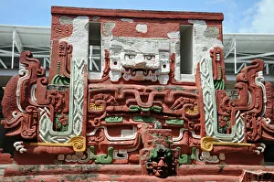
Aztec Sculpture, Templo Mayor, Mexico CityAncient Aztec ruins of Templo Mayor, Tenochtitlan, part of the Historic Center of Mexico City, UNESCO World Heritage Site
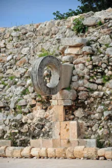
Stone Goal Ring in Ancient Mayan Ball Court, UxmalAncient Mayan ball court at Uxmal where Mesoamerican ballgame was played. Part of the Uxmal UNESCO World Heritage Site
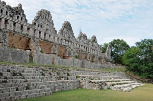
Ancient Mayan RuinsRuined walls and steps known at the House of the Doves, within the ancient Mayan city of Uxmal
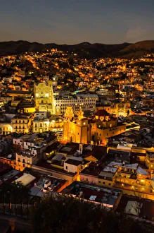
City of Guanajuato, Mexico at nightGuanajuato, Mexico seen from El Pipila Monument
Handicrafts for sale, Chichen ItzaYucatan, Mexico
Colorful sunset in Torres del Paine, Chile
Panorama of a colorful sunset in Torres del Paine, Chile
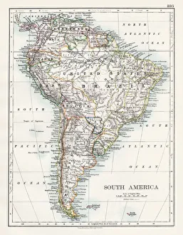
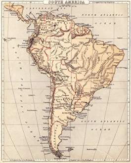
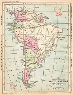
South America map 1897The World-Wide Atlas of Modern Geography, Political and Physical W. & A.K. Johnston - London 1897
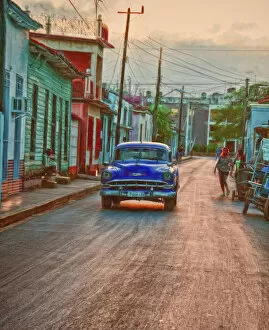
Coming UpVintage car on a street in Remedios, Cuba
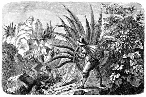
Mexican Agave Harvester for TequilaIllustration of a Mexican Agave Harvester for Tequila
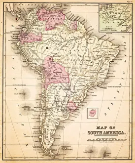
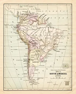
Map of South America 1883Warrens Common School Geography
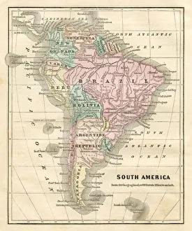
South America map 1881Coltons Common School Geography 1881 New York Sheldon and Co
Map of South America 1869Cornells Grammars-School Geography - S.S. Cornell - New York D. Appleton and Company 1869
Map of South America 1855System of Geography for the use of schools by Sidney E. Morse - Published by Harper & Brothers - New York 1855
Map of South America 1856Colton and Fitchs Modern School Geography by George W. Fitch - New York 1856
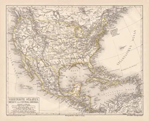
United States of America, Mexico and Central America, published in 1878United States of America, Mexico and Central America. Lithograph, published in 1878
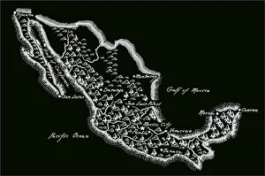
Antique MexicoMexico Map, - Antique style. Includes mountains and water bodies. High detail - vector illustration
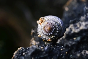
Spiral shellMacro of small sea shell on rocky shore looks to be spiraling into bokeh
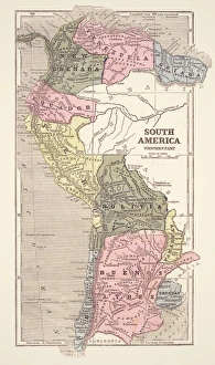
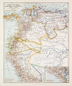
Map of Peru Ecuador Venezuela 1896Map of Peru Ecuador Venezuela
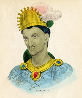
Montezuma illustration 1859The natural history of the human species; its typical forms, primaeval distribution, filiations, and migrations
South America map 1875The Independent Course Comprehensive Geography by James Monteith, A.S. Barnes & Co, New York & Chicago 1875
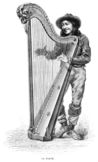
Harp engraving 1885Le Monde Physique par Amedee Guillemin - Paris / Librairie Hachette et Cie 1881
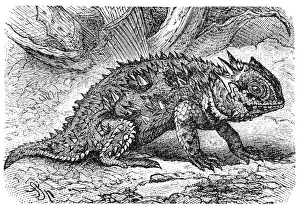
Horned lizard (Phrynosoma orbiculare)Horned lizard also known as horny toad or frog in natural habitat
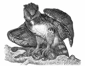
Harpy eagle (Harpia harpyja)
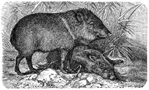
PeccaryIllustration of a Collared peccary or Pecari tajacu or Dicotyles tajacu or Tayassu tajacu or Musk hog or Mexican hog or Quenk
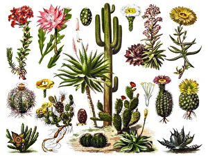
Aloe veraIllustration of a Aloe vera
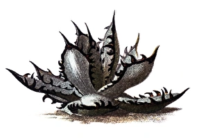
CactusIllustration of a Cactus engraving
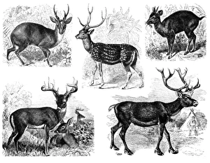
DeerAntique illustration of a deer