mail_outline sales@mediastorehouse.com
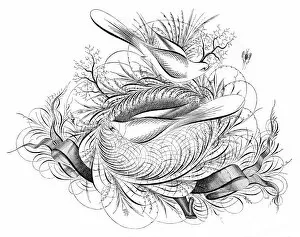
Birds and ribbons penmanship calligraphy 1881Real PenWork, Self Instructor in Penmanship. Copyright 1881 by the Publishers Knowles and Maxim, Pittsfield, Mass
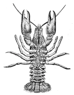
Crayfish engraving 1888Illustrated Natural History of the Three Kingdoms Illustrierte Naturgeschichte der drei Reiche Franz StrAÔé¼ssles - Wilhelm Nitzschke, Stuttgart 1888
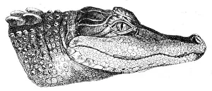
Alligator head engraving 1888Illustrated Natural History of the Three Kingdoms Illustrierte Naturgeschichte der drei Reiche Franz StrAÔé¼ssles - Wilhelm Nitzschke, Stuttgart 1888
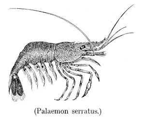
Common prawn engraving 1888Illustrated Natural History of the Three Kingdoms Illustrierte Naturgeschichte der drei Reiche Franz StrAÔé¼ssles - Wilhelm Nitzschke, Stuttgart 1888
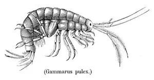
Shrimp crustacean 1888Illustrated Natural History of the Three Kingdoms Illustrierte Naturgeschichte der drei Reiche Franz StrAÔé¼ssles - Wilhelm Nitzschke, Stuttgart 1888
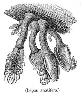
Barnacles engraving 1888Illustrated Natural History of the Three Kingdoms Illustrierte Naturgeschichte der drei Reiche Franz StrAÔé¼ssles - Wilhelm Nitzschke, Stuttgart 1888
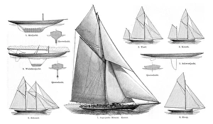
sailboats engraving 1895Meyers Konversations-Lexikon. Ein Nachschlagewerk des allgemeinen Wissens, 5th edition 17 volumes Bibliographisches Institut - Leipzig 1895
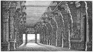
Pagoda at Madura, IndiaHall at the pagoda of Madura
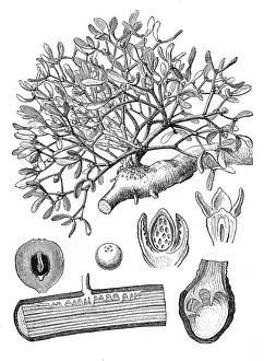
Mistletoe (Viscum album)Antique illustration of Mistletoe (Viscum album)
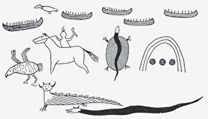
Black and white illustration of North American rock inscriptions
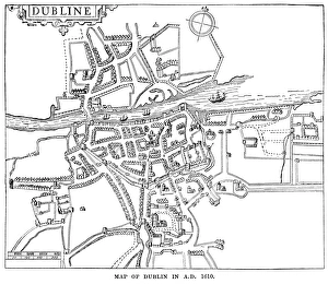
Map of Dublin in 1610 (Victorian engravingA map of Dublin, Ireland, as it was in 1610 AD. Dublin is the capital of the Republic of Ireland, which, at the time the engraving was made, was part of Great Britain
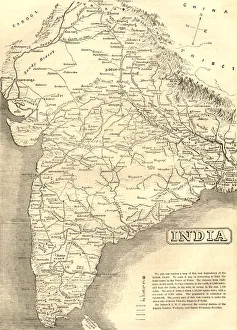
Mid-Victorian map of IndiaA mid-Victorian map of the Indian subcontinent at the time of the British Empire, showing various missionary society stations
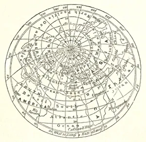
Victorian map of the Arctic CircleA Victorian map of the Arctic Circle and beyond. From Peter Parleyas Annual - A Christmas and New Yearas Present for Young Peoplea published in London by Darton & Co in 1851
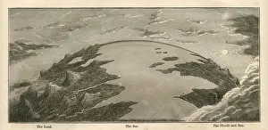
Topographical Land Sea Sky Earth Globe, Antique 1871 IllustrationColor stock photo of an antique illustration of a topographical earth globe showing land, sea and sky examples. Salvaged from an 1871 geography book
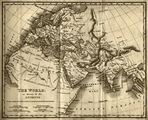
The World as Known to the Ancients (steel engraving)A creased and stained steel engraving of a map which shows The World as Known to the Ancientsa which aŠcontains all the Parts of which it is thought the Ancients had any knowledgea
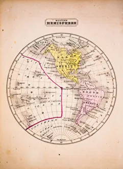
Western Hemisphere 1852 Map
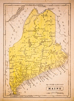
Maine 1852 Map
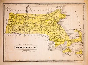
Massachusetts 1852 Map
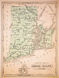
Rhode Island 1852 Map
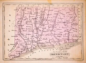
Connecticut 1852 Map
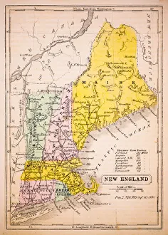
New England 1852 Map
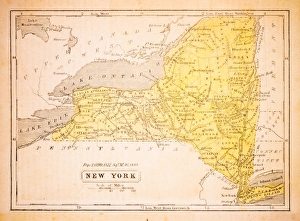
New York 1852 Map
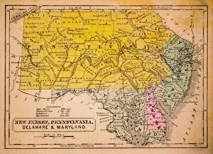
New Jersey, Pennsylvania, Delaware and Maryland 1852 Map
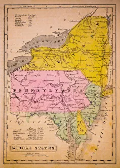
Middle States 1852 Map
Southern States 1852 Map
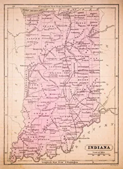
Indiana 1852 Map
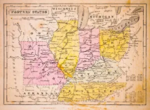
Western States 1852 Map
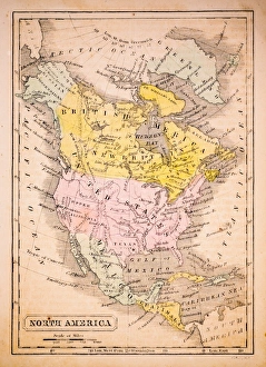
North America 1852 Map
United States 1852 Map
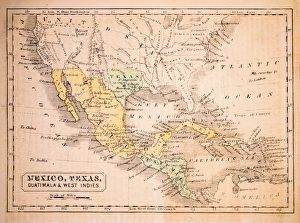
Mexico, Texas, Guatimala and West Indies 1852 Map
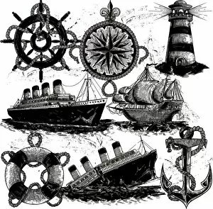
Nautical Elements in classic style
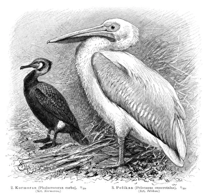
Pelican and Cormorant engraving 1895Meyers Konversations-Lexikon
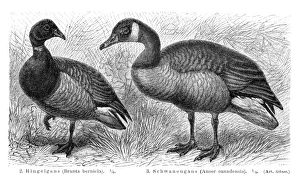
Brant and Canadian goose illustration 1895Meyers Konversations-Lexikon
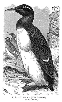
Thick-billed murre engraving 1895Meyers Konversations-Lexikon
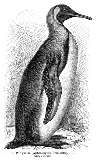
Penguin engraving 1895Meyers Konversations-Lexikon
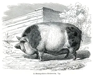
Hampshire Pigs engraving 1895Meyers Konversations-Lexikon
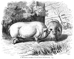
Yorkshire Pigs engraving 1895Meyers Konversations-Lexikon
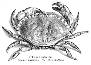
Cancer pagurus crab engraving 1895Meyers Konversations-Lexikon
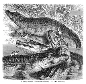
Nile Crocodile engraving 1896Meyers Konversations-Lexikon
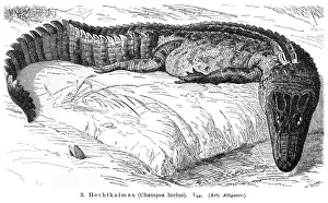
Alligator engraving 1896Meyers Konversations-Lexikon
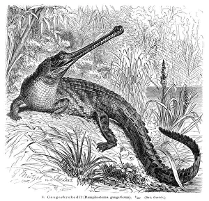
Gharial engraving 1896Meyers Konversations-Lexikon
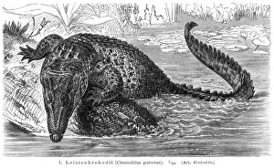
Saltwater crocodile engraving 1896Meyers Konversations-Lexikon
Plan of Leeds (Victorian engraving)A 19th century plan of Leeds in Yorkshire, England. From Our Own Country: Descriptive, Historical, Pictoriala published by Cassell & Co Ltd, 1885
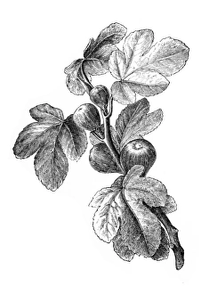
Figs | Antique Design Illustrations19th-century engraving of figs (isolated on white)
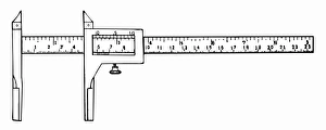
caliperAntique illustration of a caliper
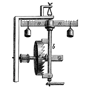
Verge escapementAntique illustration of a watch verge escapement mechanism
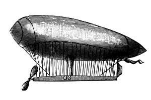
Balloon of Renard and KrebsAntique illustration of balloon of Renard and Krebs
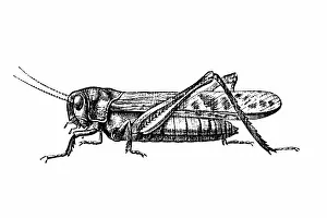
GrasshopperAntique engraving of a grasshopper (isolated on white)