mail_outline sales@mediastorehouse.com
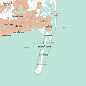
MA Barnstable Chatham Vector Road Map. All source data is in the public domain. U.S. Census Bureau Census Tiger. Used Layers: areawater, linearwater, roads, rails, cousub, pointlm, uac10
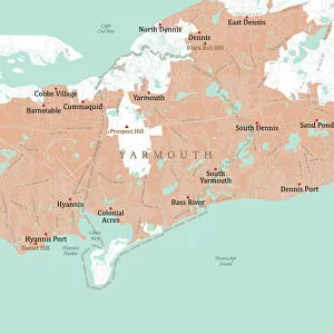
MA Barnstable Yarmouth Vector Road Map. All source data is in the public domain. U.S. Census Bureau Census Tiger. Used Layers: areawater, linearwater, roads, rails, cousub, pointlm, uac10
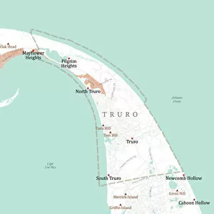
MA Barnstable Truro Vector Road Map. All source data is in the public domain. U.S. Census Bureau Census Tiger. Used Layers: areawater, linearwater, roads, rails, cousub, pointlm, uac10
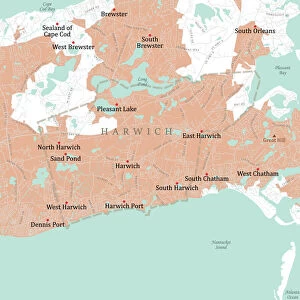
MA Barnstable Harwich Vector Road Map. All source data is in the public domain. U.S. Census Bureau Census Tiger. Used Layers: areawater, linearwater, roads, rails, cousub, pointlm, uac10
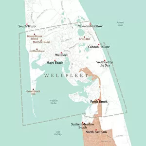
MA Barnstable Wellfleet Vector Road Map. All source data is in the public domain. U.S. Census Bureau Census Tiger. Used Layers: areawater, linearwater, roads, rails, cousub, pointlm, uac10
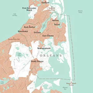
MA Barnstable Orleans Vector Road Map. All source data is in the public domain. U.S. Census Bureau Census Tiger. Used Layers: areawater, linearwater, roads, rails, cousub, pointlm, uac10
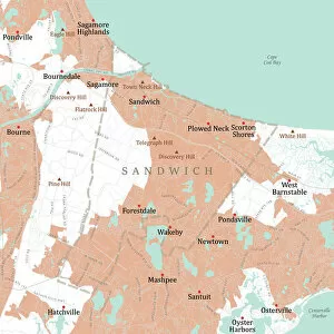
MA Barnstable Sandwich Vector Road Map. All source data is in the public domain. U.S. Census Bureau Census Tiger. Used Layers: areawater, linearwater, roads, rails, cousub, pointlm, uac10
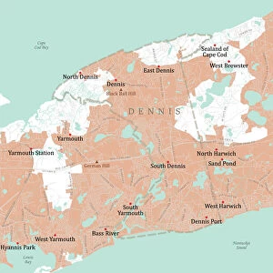
MA Barnstable Dennis Vector Road Map. All source data is in the public domain. U.S. Census Bureau Census Tiger. Used Layers: areawater, linearwater, roads, rails, cousub, pointlm, uac10
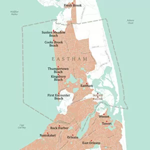
MA Barnstable Eastham Vector Road Map. All source data is in the public domain. U.S. Census Bureau Census Tiger. Used Layers: areawater, linearwater, roads, rails, cousub, pointlm, uac10
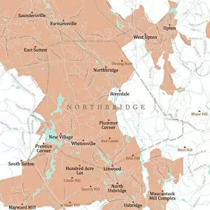
MA Worcester Northbridge Vector Road Map. All source data is in the public domain. U.S. Census Bureau Census Tiger. Used Layers: areawater, linearwater, roads, rails, cousub, pointlm, uac10
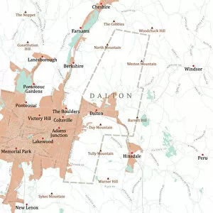
MA Berkshire Dalton Vector Road Map. All source data is in the public domain. U.S. Census Bureau Census Tiger. Used Layers: areawater, linearwater, roads, rails, cousub, pointlm, uac10
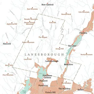
MA Berkshire Lanesborough Vector Road Map. All source data is in the public domain. U.S. Census Bureau Census Tiger. Used Layers: areawater, linearwater, roads, rails, cousub, pointlm, uac10
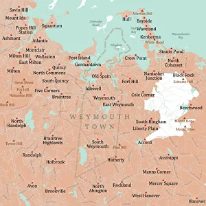
MA Norfolk Weymouth Town Vector Road Map. All source data is in the public domain. U.S. Census Bureau Census Tiger. Used Layers: areawater, linearwater, roads, rails, cousub, pointlm, uac10
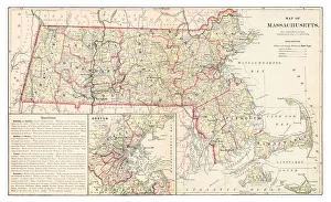
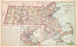
Map of Massachusetts 1877Warrens Common School Geography 1877
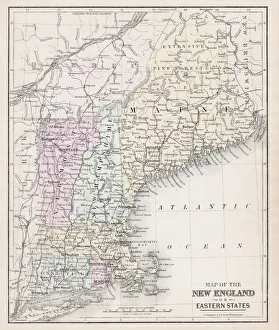
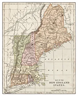
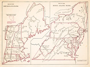
Map of New England 1877Warrens Common School Geography 1877
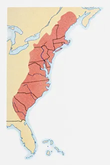
Illustration of states on East Coast of the USA
Map of New England by Explorer John Smith, Circa 1624Beautifully Illustrated Antique Engraved Victorian Illustration of Historical Map of New England from Explorer Captain John Smith, Circa 1624. Source: Original edition from my own archives
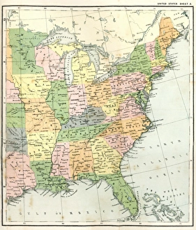
Antique Map of Eastern USAAntique Map from 1867 of Eastern United States of America
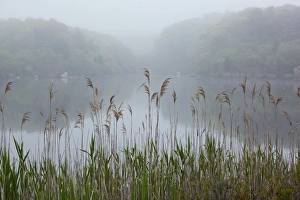
Salt Marsh, Woods Hole, MassachusettsUSA, Massachusetts, Woods Hole, Nobska Point Grass along salt marsh in fog along Cape Cod on summer evening
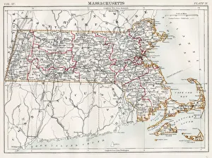
Map of Massachusetts 1883Encyclopedia Britannica 9th Edition New York Samuel L. Hall 1883 Vol XV
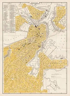
Boston city map 1893Johnsonas Universal Cyclopedia - Charles Kendall - New York 1893
New England States map 1889Indiana Educational Series The Complete Geography - Indianapolis 1889
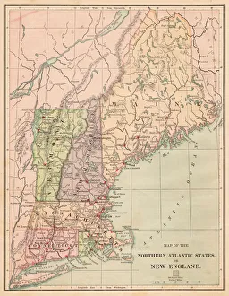
USA Northern Atlantic states 1881Harpers School Geography, New York, Harpers and Brothers, 1881
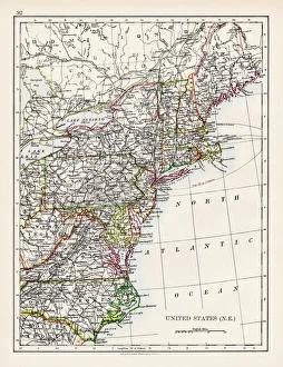
United States North East map 1897The World-Wide Atlas of Modern Geography, Political and Physical W. & A.K. Johnston - London 1897
Sugar maples (Acer saccharum) reflecting in pond, autumnSouth Hadley, Massachusetts, USA
Map of Maine and Vermont1883Warrens Common School Geography
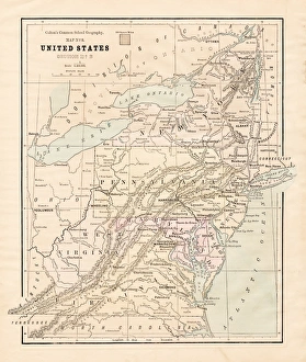
Map of Middle states USA 1883Warrens Common School Geography
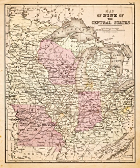
Map of Central States USA 1883Warrens Common School Geography
Map of Massachusetts USA 1883Warrens Common School Geography
New England States USA map 1881Coltons Common School Geography 1881 New York Sheldon and Co
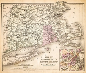
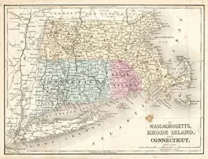
Rhode Island Massachusetts Connecticut 1867Mitchells Modern Atlas - Published by E.H. Buttler & Co - Philadelphia 1867
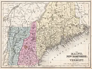
Maine New Hampshire and Vermont 1867Mitchells Modern Atlas - Published by E.H. Buttler & Co - Philadelphia 1867
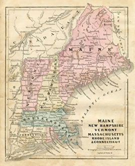
Maine New Hampshire and Connecticut 1856Colton and Fitchs Modern School Geography by George W. Fitch - New York 1856
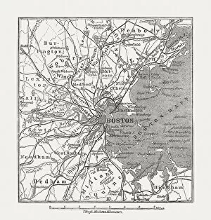
Boston, Massachusetts, USA, wood engraving, published in 1882Map of Boston, Massachusetts, USA. Wood engraving, published in 1882
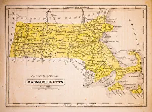
Massachusetts 1852 Map
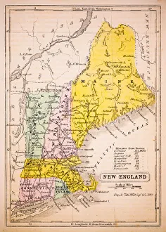
New England 1852 Map
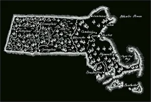
Antique Massachusetts
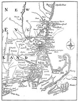
Vintage Map of New England at the beginning of the 18th century
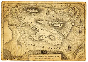
Plan of action at the Battle on Breeds HillVintage engraving of the Plan of action at the Battle of Breeds Hill (also known as the Battle of Bunker Hill), Near Boston on 17th June 1775. Part of the American War of IndependenceView more:
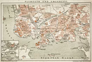
Plymouth and the surrounding area
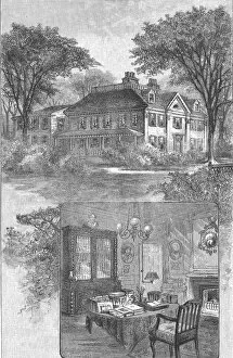
Longfellows Home At CambridgeExterior view of the home of American poet Henry Wadsworth Longfellow, Cambridge, Massachusetts, 1860s. Inset shows an interior view featuring a desk lined with books and papers, a fireplace
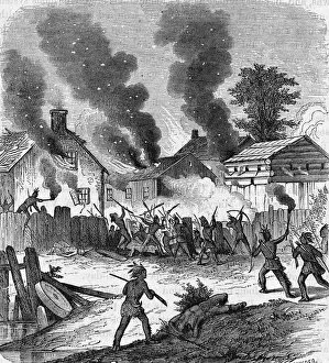
Burning DeerfieldEngraving shows Native Americans settin fire to the town of Deerfield in Franklin County, Massachusetts, 1680s. (Photo by Kean Collection/Getty Images)
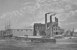
Sugar Refining In BostonIllustration of the Revere sugar refinery in Boston, Massachusetts circa 1870. (Photo by Kean Collection/Getty Images)
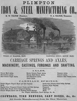
Iron And Steel AdvertAn advert for the Plimpton Iron and Steel Manufacturing Company showing the works in Walpole, Massachusetts circa 1865. (Photo by Kean Collection/Getty Images)
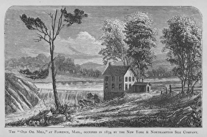
Silk MillIllustration of the Old Oil Mill at Florence, Massachusetts, occupied in 1834 by the New York and Northampton Silk Company. (Photo by Kean Collection/Getty Images)
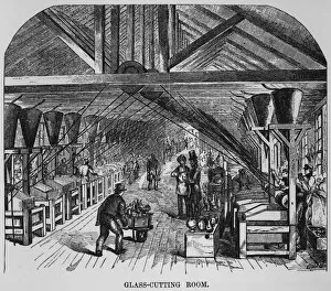
Glass Cutting RoomIllustration of the glass cutting room at the New England Glass Company in Massachusetts in 1855. (Photo by Kean Collection/Getty Images)
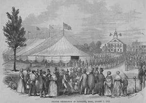
Pilgrim CelebrationIllustration of a pilgrim celebration held in Plymouth, Massachusetts on August 01, 1853. (Photo by Kean Collection/Getty Images)
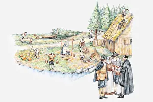
Illustration of daily life of pilgrim settlers and holding prayer meeting in Plymouth Massachusetts