mail_outline sales@mediastorehouse.com
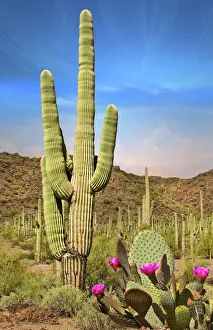
Desert Landscape with Cactus in ArizonaSaguaro and Blooming Prickly Pear Cactus in Arizona Desert Landscape
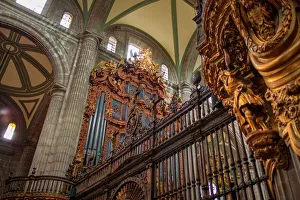
Metropolitan Cathedral Pipe OrgansMetropolitan Cathedral Pipe Organ, view from bellow
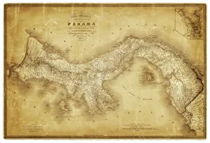
Map of Panama 1864Map of Panama - combined with 2 different texture overlays
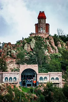
Zacatecas, teleferico system on the Bufa mountain is an old Aerial Tram and dates from 1975, it was meant as a medium of transportation but today is more like a touristic atraction on the city
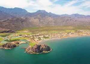
Aerial view of Loreto Bay, Nopolo Rock, Sierra de la Giganta, Baja California Sur, MexicoLoreto (or Concho) is a city in and municipal seat of Loreto Municipality, located on the Gulf of California in eastern Baja California Sur state, Mexico
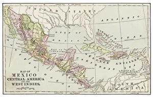
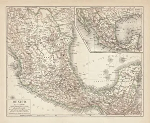
Map of Mexico and Central America 1889Indiana Educational Series The Complete Geography - Indianapolis 1889
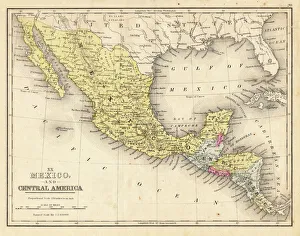
Mexico and Central America map 1867Mitchellas Modern Atlas - Published by E.H. Butler and Co - Philadelphia 1867
Man with trumpet from Mariachi group, MexicoTraditional mexican Mariachi group in Merida, Yucatan, Mexico (MR)
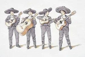
Illustration, mariachi band consisting of four guitarists in grey Mexican hats and matching suits, front view
Mariachi crossing the street Beatles style, MexicoTraditional Mariachi group crossing the street in Beatles style, Izamal, Yucatan, Mexico
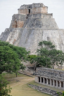
Mayan Step Pyramid and Temple Ruins, UxmalPyramid of the Magician step pyramid and other ruins at Uxmal, UNESCO World Heritage Site, with trees
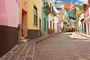
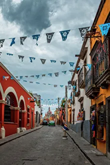
Public street view of Guanajuato City, Mexico. A UNESCO World Heritage Site. 16th century old buildings & streets are preserved
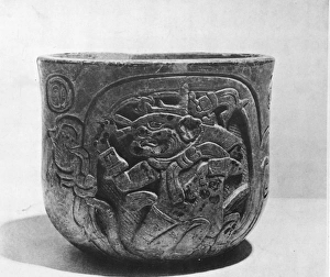
Mayan Pottery With Engraved JaguarAn ancient Mayan pottery beaker engraved with a jaguar design, from the Yucatan, Mexico. (Kean Collection/Getty Images)
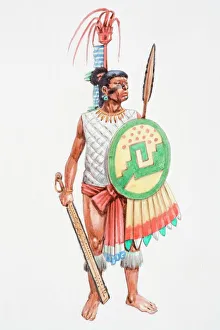
Illustration, Aztec apprentice warrior clad in loincloth carrying a spear-thrower (Atlatl) and oak darts with a stone point
Mexico map 1897The World-Wide Atlas of Modern Geography, Political and Physical W. & A.K. Johnston - London 1897
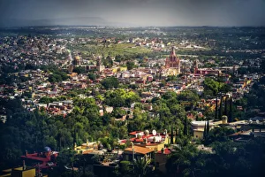
San Miguel de Allende, looking up Calle Aldama
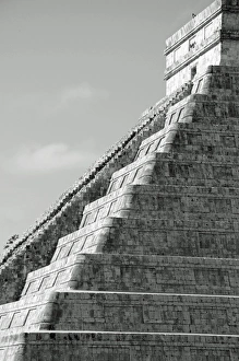
El Castillo Mayan Step Pyramid, Chichen ItzaStone platforms of El Castillo Mayan Step Pyramid, Chichen Itza, Yucatan. UNESCO World Heritage Site
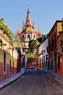
San Miguel de Allende, streetA street of San Miguel de Allende with the church of San Michael Arcangel in the back, the Sna Michael archangel church is the most important landmark in San Miguel de Allende
Mexico, ancient map, lithograph, published in 1877Ancient map of Mexico. Lithograph, published in 1877
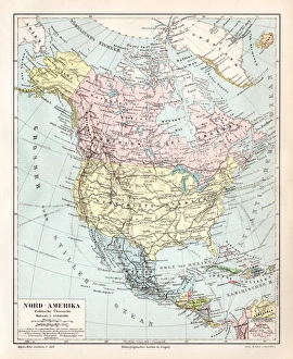
North America political map 1895Meyers Konversations-Lexikon. Ein Nachschlagewerk des allgemeinen Wissens, 5th edition 17 volumes Bibliographisches Institut - Leipzig 1895-1897
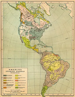
American ethnographic mapIllutration of American ethnographic map
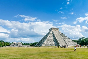
Temple of Kukulkan, usually known El CastilloTemple of Kukulkan, usually referred to as El Castillo ( the castle ), Chichen Itza, YucatAan, Mexico.Image taken outdoors, daylight, some tourists appears on the image
San Miguel de Allende, Guanajuato, MexicoBeautiful colonial city in central Mexico
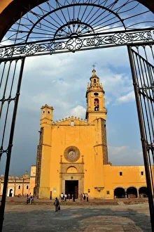
Church of Iglesia de San Gabriel, San Pedro Cholula, Puebla, Mexico, Latin America, North America
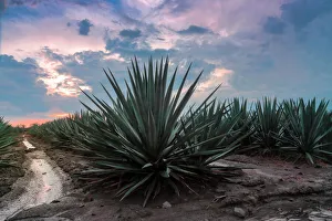
Landscape Blue AgaveThe Agave Landscape and Ancient Industrial Facilities of Tequila is a cultural UNESCO World Heritage Site in Mexico. The 35, 019 hectare site is part of an expansive landscape of blue agave
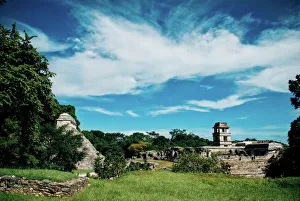
Mayan ruins of Palenque
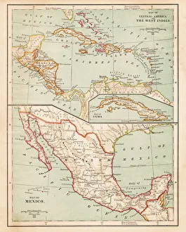
Mexico and West indies map 1875The Independent Course Comprehensive Geography by James Monteith, A.S. Barnes & Co, New York & Chicago 1875
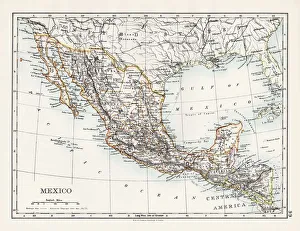
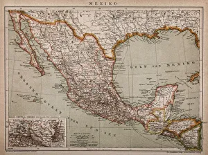
Map of MexicoAntique map of Mexico
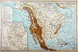
River and mountains map of North AmericaIllustration of a River and mountains map of North America
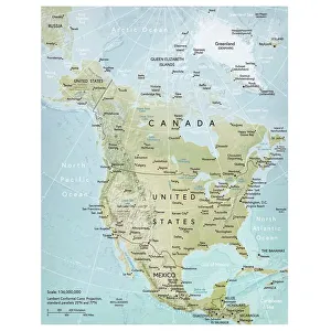
North America mapVector illustration of a detailed map of North America. Reference map was created by the US Central Intelligence Agency and is available as a public domain map at the University of Texas Libraries
1883 Map Of Central America
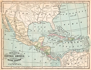
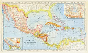
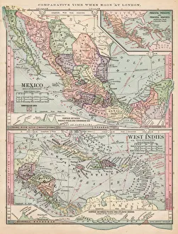
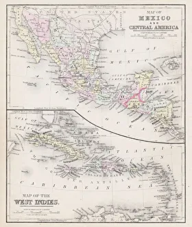
Map of Mexico and West Indies 1895The Rand-McNally Grammar School Geography 1895 - Chicago & New York
Physical map of North America 1895The Rand-McNally Grammar School Geography 1895 - Chicago & New York
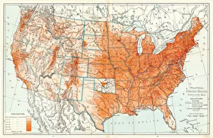
Political Map of United States 1895The Rand-McNally Grammar School Geography 1895 - Chicago & New York
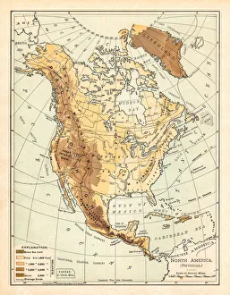
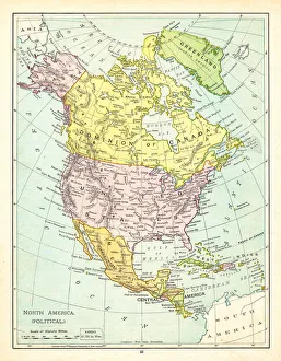
Political Map of North America 1895The Rand-McNally Grammar School Geography 1895 - Chicago & New York
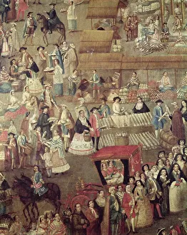
Museo Nacional de Historia, Mexico City, MexicoPlaza Mayor in Mexico, detail of the Market (oil on canvas) (Photo by Art Images via Getty Images)
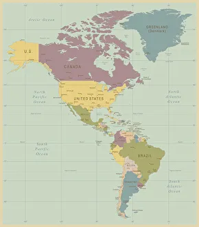
Vintage Map of North and South America534055040
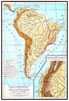
South America, river and mountains mapIllustrator of a South America, river and mountains map
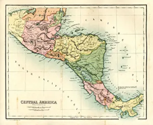
Antique map - Central AmericaAntique map of Central America, 1864
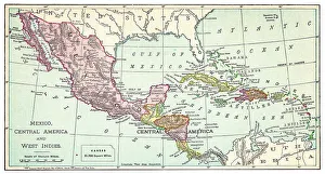
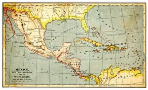
Map of Mexico and West Indies 1889Comprehensive Geography by James Monteith - American Book Company 1882, 1889
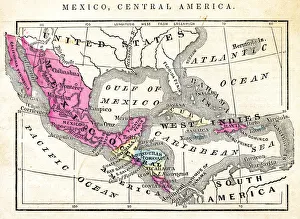
Map of Mexico Central America of 1877The Eclectic Elementary Geography by Wilson & Hinkle / Cincinnati -New York 1881
Map of Mexico and Central America 1871Colton and Fitchs Introductory School Geography - New York: Sheldon and Company 1871
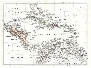
Map of West Indies 1894Johnsons Universal Cyclopedia - Volume VIII New York - A. J. Johnson Company 1894
Map of Mexico and West indies 1883The Eclectic Elementary Geography by Van Antwerp, Bragg & C0 / Cincinnati -New York 1883
Map of Mexico and West Indies 1877Warrens Common School Geography 1877
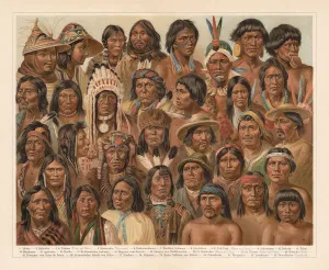
Amrican Native People, lithograph, published in 1897Amrican Native People: 1) Aleutian people; 2) Tlingit people (Koloschen, Koloshi); 3 - 4) Eskimos, man and wife; 5) Kowitschin people, Vancouver, Britisch-Columbia); 6) Absarokee (Crow Nation)
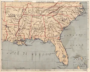
Map of USA Southern states 1869Cornells Grammars-School Geography - S.S. Cornell - New York D. Appleton and Company 1869
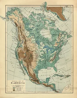
North America Physical Map, Engraving, 1892Very rare, beautifully detailed engraving of North America Physical Map, Engraving, Published in 1892. Original edition from my own archives. Copyright has expired on this artwork. Digitally restored