mail_outline sales@mediastorehouse.com
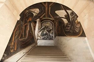
Mexican mural and archNorth America, Mexico, Guanajuato State, Guanajuato, Alhondiga de Granaditas, murals of Miguel Hidalgo (Mexican revolutionary hero), painted by Jose Chavez Morado
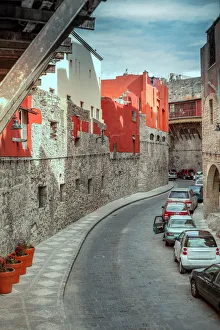
Guanajuato city undergroundGuanajuato, the capital of Guanajuato state, is a UNESCO World Heritage Site and a charming colonial era city situated in a picturesque valley surrounded by the Sierra de Guanajuato mountains
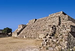
Mexico, Oaxaca, Monte Alban, pre-Columbian archaeological site, built 600 BC by the Zapotecs
Panoramic skyline, San Miguel de Allende
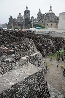
Ancient Ruins of Tenochtitlan, Mexico CityAncient Aztec ruins of Templo Mayor, Tenochtitlan, part of the Historic Center of Mexico City, UNESCO World Heritage Site
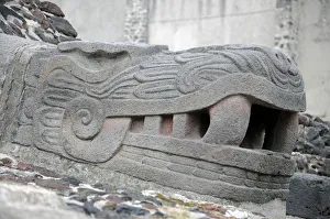
Aztec Sculpture, Templo Mayor, Mexico CityAncient Aztec ruins of Templo Mayor, Tenochtitlan, part of the Historic Center of Mexico City, UNESCO World Heritage Site
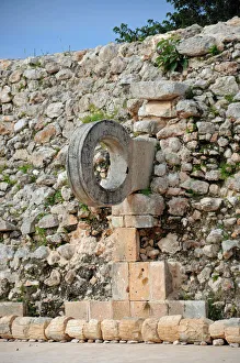
Stone Goal Ring in Ancient Mayan Ball Court, UxmalAncient Mayan ball court at Uxmal where Mesoamerican ballgame was played. Part of the Uxmal UNESCO World Heritage Site
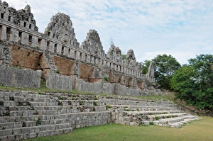
Ancient Mayan RuinsRuined walls and steps known at the House of the Doves, within the ancient Mayan city of Uxmal
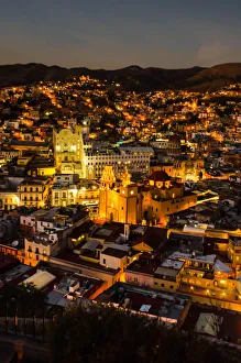
City of Guanajuato, Mexico at nightGuanajuato, Mexico seen from El Pipila Monument
Handicrafts for sale, Chichen ItzaYucatan, Mexico
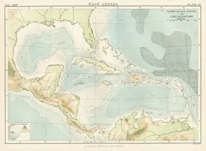
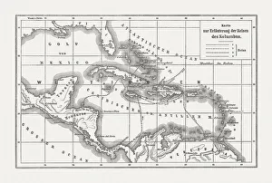
West Indies map 1885Encyclopedia Britannica 9th Edition New York Charles Scribners and Sons 1885 Vol XXIV
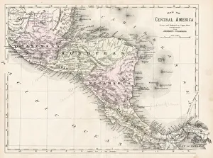
Central America map 1893Johnsonas Universal Cyclopedia - Charles Kendall - New York 1893
Chichen ItzaMayan Temple at Chichen Itza, Cancun, Mexico
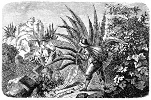
Mexican Agave Harvester for TequilaIllustration of a Mexican Agave Harvester for Tequila
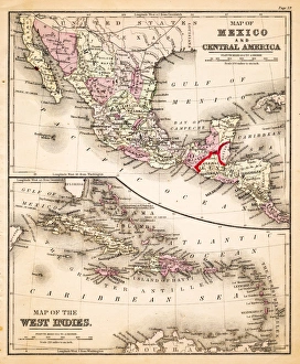
Map of Mexico and West Indies 1883Warrens Common School Geography
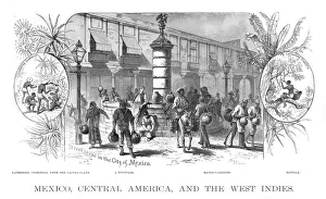
Mexico Central america scene illustration 1886Mexico Central america scene illustration Maps Monteith Physical Geography 1886
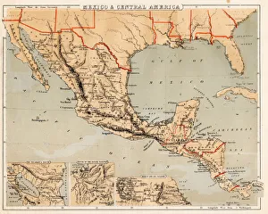
Mexico and Central America map 1881Coltons Common School Geography 1881 New York Sheldon and Co
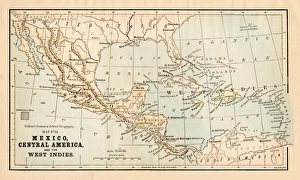
Mexico and Central America map 1869Cornells Grammars-School Geography - S.S. Cornell - New York D. Appleton and Company 1869
Mexico and Central America map 1856Colton and Fitchs Modern School Geography by George W. Fitch - New York 1856
Voyages of Christopher Columbus, wood engraving, published c. 1882Map with the routes of the four voyages of Christopher Columbus in the Caribbean Sea. Wood engraving, published c. 1882
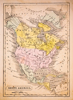
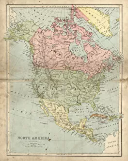
North America 1852 Map
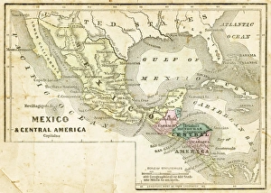
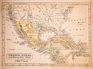
Mexico, Texas, Guatimala and West Indies 1852 Map
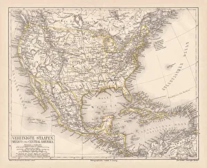
United States of America, Mexico and Central America, published in 1878United States of America, Mexico and Central America. Lithograph, published in 1878
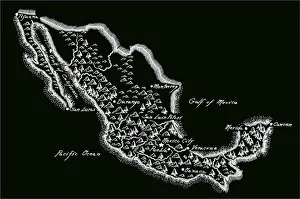
Antique MexicoMexico Map, - Antique style. Includes mountains and water bodies. High detail - vector illustration
Mexican sunflower field at Doi Mae U-KhoLate of every year. Mexican sunflower field bloom at Doi Mae U-Kho, Maehongson
Foggy morning and Mexican sunflower fieldDoi Hua Mae Kim has a lot of Mexican sunflower field. It bloom on November every year
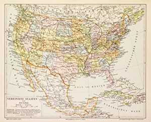
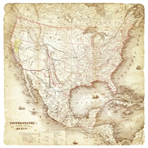
Map of United States and Mexico 1897Map of United States and Mexico
Map of United States and Mexico 1849Map of United States and Mexico
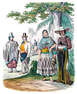
Mexicans in traditional clothes engraving 1853
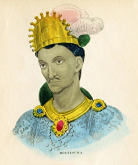
Montezuma illustration 1859The natural history of the human species; its typical forms, primaeval distribution, filiations, and migrations
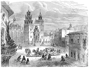
Guanajuato gran plaza Mexico engraving 1875The Independent Course Comprehensive Geography by James Monteith, A.S. Barnes & Co, New York & Chicago 1875
Farmers and cattle Mexico engraving 1875The Independent Course Comprehensive Geography by James Monteith, A.S. Barnes & Co, New York & Chicago 1875
Central America and West Indies map 1875The Independent Course Comprehensive Geography by James Monteith, A.S. Barnes & Co, New York & Chicago 1875
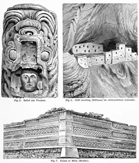
Anceitn american art engraving 1895Meyers Konversations-Lexikon. Ein Nachschlagewerk des allgemeinen Wissens, 5th edition 17 volumes Bibliographisches Institut - Leipzig 1895-1897
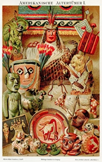
American antiquities chromolithograph 1895Meyers Konversations-Lexikon. Ein Nachschlagewerk des allgemeinen Wissens, 5th edition 17 volumes Bibliographisches Institut - Leipzig 1895-1897
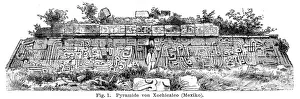
Antique pyramid in Mexico 1895Meyers Konversations-Lexikon. Ein Nachschlagewerk des allgemeinen Wissens, 5th edition 17 volumes Bibliographisches Institut - Leipzig 1895-1897
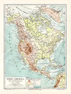
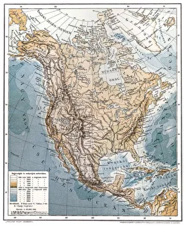
North America geological map 1895Meyers Konversations-Lexikon. Ein Nachschlagewerk des allgemeinen Wissens, 5th edition 17 volumes Bibliographisches Institut - Leipzig 1895-1897
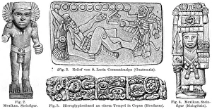
Old central american art figures 1895Meyers Konversations-Lexikon. Ein Nachschlagewerk des allgemeinen Wissens, 5th edition 17 volumes Bibliographisches Institut - Leipzig 1895-1897
Antique damaged map of North America in the 19th CenturyVintage engraving of a Antique map of North America in the 19th Century, 1873
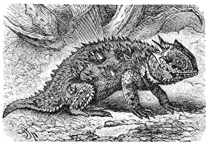
Horned lizard (Phrynosoma orbiculare)Horned lizard also known as horny toad or frog in natural habitat
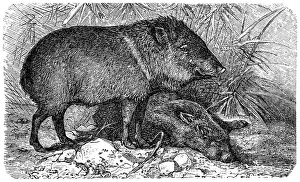
PeccaryIllustration of a Collared peccary or Pecari tajacu or Dicotyles tajacu or Tayassu tajacu or Musk hog or Mexican hog or Quenk
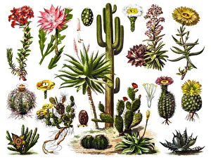
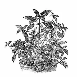
Aloe veraIllustration of a Aloe vera
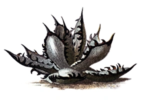
CactusIllustration of a Cactus engraving
North AmericaAntique illustration of a North America
Mexican Speckled Wandering Jew (Tinantia pringlei)Illustration engraving of a Mexican Speckled Wandering Jew (Tinantia pringlei)
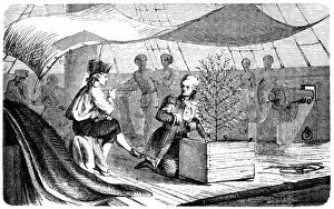
De Clie on voyages to Martinique with coffee plantsAntique illustration of a De Clie on voyages to Martinique with coffee plants
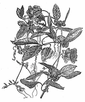
Cobaea scandens (cup-and-saucer vine, cathedral bells, Mexican ivy, monastery bells)Illustration of a Cobaea scandens (cup-and-saucer vine, cathedral bells, Mexican ivy, monastery bells)
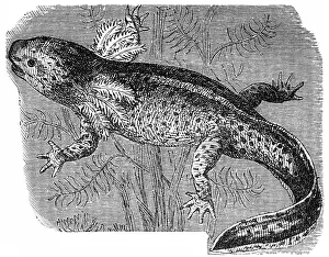
Axolotl or a Mexican walking fish or Mexican salamander (Ambystoma mexicanum)Illustration of a Axolotl or a Mexican walking fish or Mexican salamander (Ambystoma mexicanum)