mail_outline sales@mediastorehouse.com
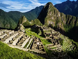
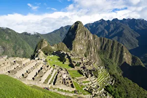
Machu Picchu is one of the most famos touristic attractions in the world and in 2007 voted as one of the seven world wonders
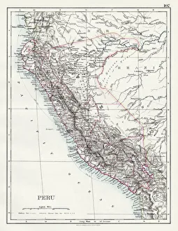
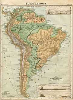
Peru map 1897The World-Wide Atlas of Modern Geography, Political and Physical W. & A.K. Johnston - London 1897
Machu Picchu, Peru
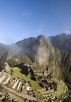
Machu Picchu, a UNESCO world heritage site in Peru. It is ruins city of Inca kingdom. The city ruins of Machu Picchu is surrounded by high mountains. The picture is captured in a clear blue sky day
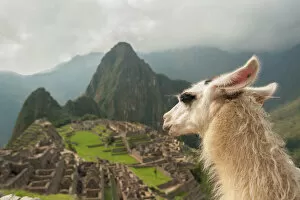
Llama overlooking ruins of the ancient city of Machu Picchu, PeruThe Inca citadel in the Andes Mountains and the river valley below
Oblong-Winged Katydid -Amblycorypha oblongifolia-, green morph, male, Tambopata Nature Reserve, Madre de Dios Region, Peru
Flag of Peru
Workers of Leafcutter Ants -Atta cephalotes- carrying leaf pieces into their nest, Tambopata Nature Reserve, Madre de Dios region, Peru
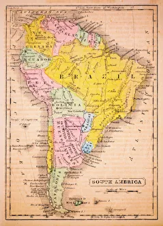
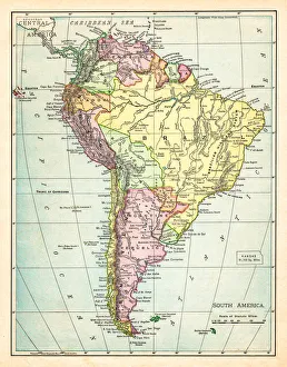
South America 1852 Map
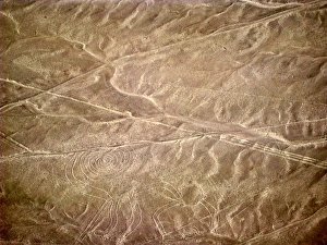
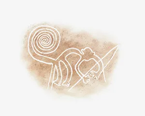
Nazca lines representing monkeyAerial view of Nazca lines representing monkey
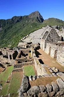
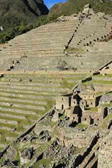
Terraces, Machu PicchuMachu Picchu, the site of ancient Inca ruins, Peru. UNESCO World Heritage Site
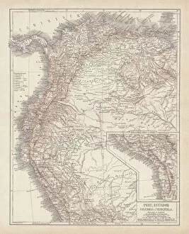
Peru, Ecuador, Colombia, Venezuela, lithograph, published in 1877Ancient map of Peru, Ecuador, Colombia, and Venezuela. Lithograph, published in 1877
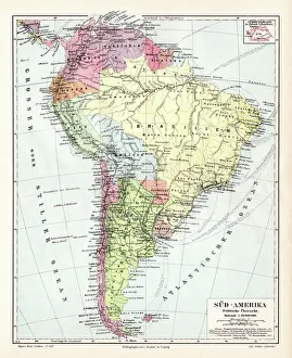
South America political map 1895Meyers Konversations-Lexikon. Ein Nachschlagewerk des allgemeinen Wissens, 5th edition 17 volumes Bibliographisches Institut - Leipzig 1895-1897
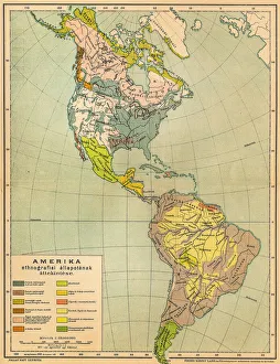
American ethnographic mapIllutration of American ethnographic map
Illustration of Nazca Line monkey drawing in desert sand, Nazca Lines, Nazca, Peru
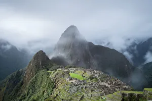
Clearing Cloud from Machu PicchuI had waited for an hour in the rainy afternoon until the cloud started to clear from the beautiful ancient ruins of Machu Picchu, Peru
Brazilian Wandering Spider or Banana Spider, Phoneutria genus, spider family Ctenidae, Tambopata Nature Reserve, Madre de Dios Region, Peru
IncaAśs sacred city, Machu Pichu, PeruView of the incaAśs city Machu Picchu and Huayna Picchu behind it, Cusco, Peru
South America Map Illustration, Travel, Exploration, Antique 1871 IllustrationColor stock photo of an antique South America map illustration. Salvaged from an 1871 geography book
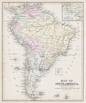
Map of South America 1895The Rand-McNally Grammar School Geography 1895 - Chicago & New York
Map of South America 1877Warrens Common School Geography 1877
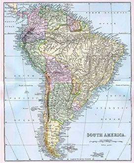
Map of South America 19th CenturyVintage map of South America from the 19th Century
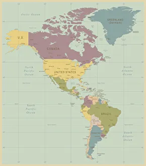
Vintage Map of North and South America534055040
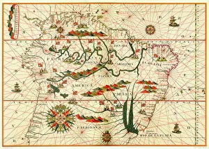
Map of South America, from a Spanish Atlas, 1582
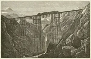
Viaduct of the Lima Oroya Railway (Peru), published in 1872Viaduct of the Lima Oroya Railway (Peru), built by the German architect Albert Fink (1827-1897). Woodcut engraving, published in 1872
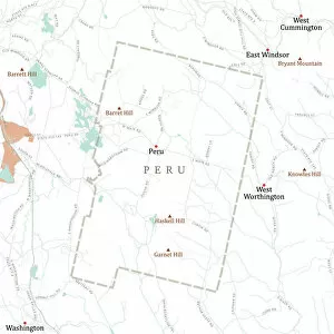
MA Berkshire Peru Vector Road Map. All source data is in the public domain. U.S. Census Bureau Census Tiger. Used Layers: areawater, linearwater, roads, rails, cousub, pointlm, uac10
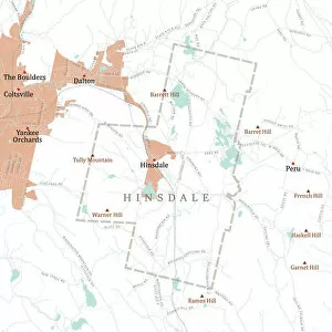
MA Berkshire Hinsdale Vector Road Map. All source data is in the public domain. U.S. Census Bureau Census Tiger. Used Layers: areawater, linearwater, roads, rails, cousub, pointlm, uac10