mail_outline sales@mediastorehouse.com
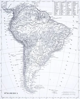
Engraving: South AmericaEngraved illustrations of South America from Iconographic Encyclopedia of Science, Literature and Art, Published in 1851. Copyright has expired on this artwork. Digitally restored
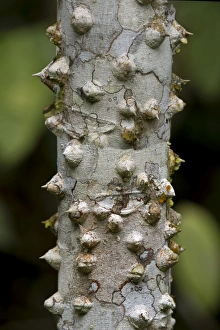
Thorny bark of the silk floss tree -Ceiba speciosa-, Tambopata Nature Reserve, Madre de Dios region, Peru
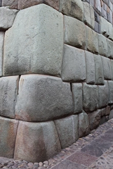
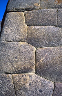
Granite blocks fit perfectly in Inca wall, CuscoInca Stone wall made from huge granite blocks fitted skillfully together using no cement, a fine example of Inca craftmanship, Cusco, Peru, South America
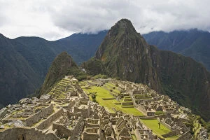
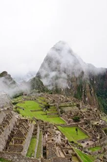
ancient, architecture, crumbling, day, fog, historic, historical, machu picchu, mistyRuins at Machu Picchu, Peru
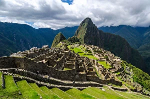
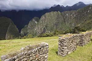
terrace, ancient, crumbling, day, historic, historical, landscape, machu picchu, mountainsRuins at Machu Picchu, Peru
day, lake, landscape, machu picchu, mountain range, mountainous, mountains, nobodyLake and valley of Machu Picchu, Peru
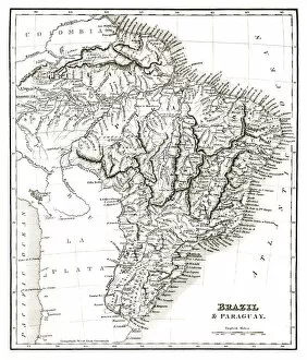
Map of Brazil and Paraguay (early 19th century steel engraving)A steel engraving of a map from the early 19th century of Brazil and Paraguay in South America, from A System of Geography, Popular and Scientific, or A Physical, Political
Map of South America (early 19th century steel engraving)A steel engraving of a map from the early 19th century of Brazil and Paraguay in South America, from A System of Geography, Popular and Scientific, or A Physical, Political
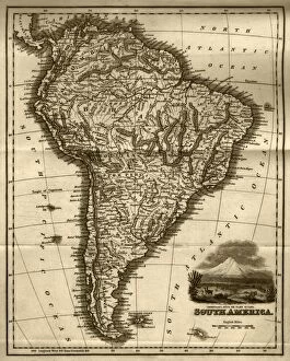
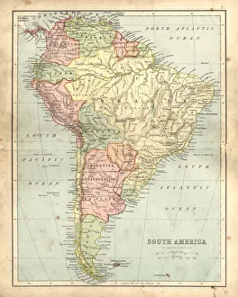
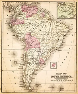
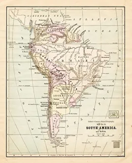
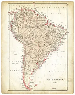
Antquie Map of South AmericaVintage map of South America from 1837
Antique damaged map of South America in the 19th CenturyVintage engraving of a Antique map of South America in the 19th Century, 1873
El Faro de la Marina (Lighthouse) guides ships past Miraflores in Lima. The lighthouse is a popular location to enjoy a picnic and a spectacular view
Cavia porcellus, Two Non-self Peruvian guinea pigs
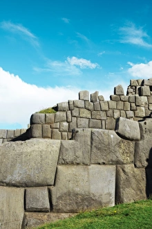
Saksaywaman citadel walls made with big stone blocks, CuscoInca walls of perfectly matches stones in a sunny day. Saksaywaman is a citadel on the northern outskirts of the city of Cusco, Peru, the historic capital of the Inca Empire
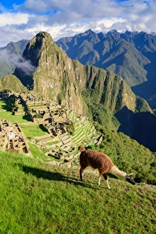
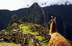
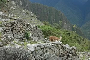
Llama walking in front of Machu Picchu, PeruA llama, local mammal animal eating grass and walking pass Machu Picchu, a UNESCO world heritage site in Cusco, Peru. The weather is sunny with clear blue sky
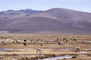
Lamas in the mountains near Arequipa, Peru, South America
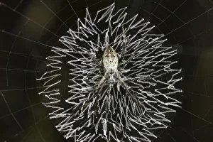
Orb-web spider, grass cross spider -Argiope catenulata- perched in the center of its circular web with a zig-zag pattern of white spider silk or stabilimentum, Tambopata Nature Reserve
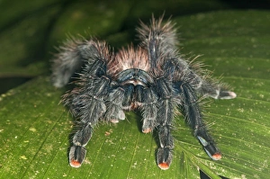
Pinktoe Tarantula -Avicularia avicularia-, Tambopata Nature Reserve, Madre de Dios Region, Peru
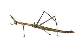
Horse Head Grasshopper -Pseudoproscopia latirostris-, Tambopata Nature Reserve, Madre de Dios Region, Peru
LlaMachu PicchuThis a picture of a Llama staring at the Inca ruins of Machu Picchu, Peru
Stonewall in CuscoInca walls in the town of Cusco, Cusco Region, Peru, South America. Cusco was the site of the historic capital of the Inca Empire and was declared a World Heritage Site
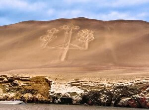
The Paracas Candelabra
A lama in Machu Picchu
Hiking Machu PicchuArriving Over Machu Picchu after a long day, Peru
Macha Picchu morningClouds enshrouding Machu Picchu after sunrise
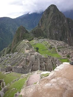
Machu Picchu Terrasses, Cusco, PeruA daylight shot of famous Machu Picchu with only little tourists in the photo
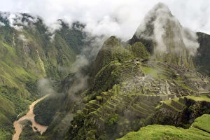
Inca ruins at Machu Picchu, UNESCO World Heritage Site, with clouds and the Urubamba River, Urubamba Valley, Andes, Peru
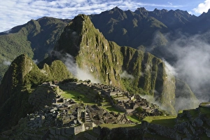
Inca ruins of Machu Picchu in the morning light, UNESCO World Cultural Heritage Site, Urubamba Valley, Andes, Peru
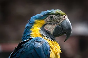
Portrait of GuacamayoThis is a view of Guacamayo from Per. Wild animal that lives in the Amazon jungle and surrounding areas
Peru, Urubamba Province, Cusco, View to Machu Picchu
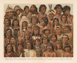
Amrican Native People, lithograph, published in 1897Amrican Native People: 1) Aleutian people; 2) Tlingit people (Koloschen, Koloshi); 3 - 4) Eskimos, man and wife; 5) Kowitschin people, Vancouver, Britisch-Columbia); 6) Absarokee (Crow Nation)
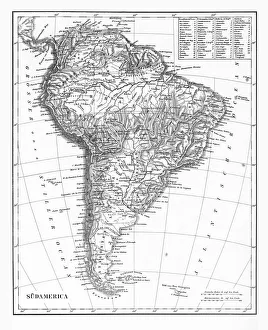
The Continent of South America, Circa 1850Engraved illustrations of the Map of South America from Iconographic Encyclopedia of Science, Literature and Art, Published in 1851. Copyright has expired on this artwork. Digitally restored
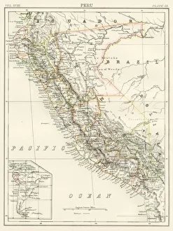
Peru map 1885Encyclopedia Britannica 9th Edition New York Charles Scribners and Sons 1885 Vol XVIII
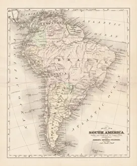
South America map 1893Johnsonas Universal Cyclopedia - Charles Kendall - New York 1893
South America map 1881Harpers School Geography, New York, Harpers and Brothers, 1881
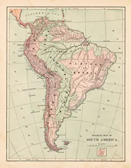
Map of South America 1883Warrens Common School Geography
South America map 1881Coltons Common School Geography 1881 New York Sheldon and Co
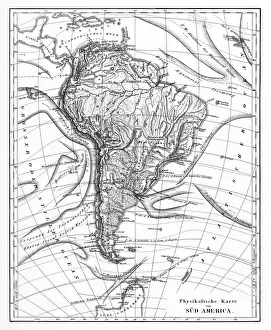
Victorian Map of North AmericaEngraved illustrations of the Physical Map of South America from Iconographic Encyclopedia of Science, Literature and Art, Published in 1851. Copyright has expired on this artwork. Digitally restored
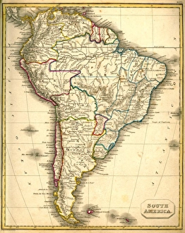
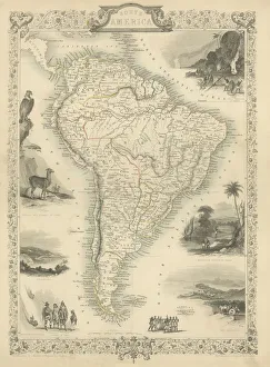
South America Engraved map 1851Finely engraved map of South America, Illustrations by J Marchant Engraved by J Rodgers Map Drawn and Engraved by J Rapkin, 1851
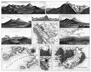
Volcanoes and Volcanic Formations and Stratification EngravingEngraved Illustrations of Volcanoes and Volcanic Formations and Stratification from Iconographic Encyclopedia of Science, Literature and Art, Published in 1851. Copyright has expired on this artwork
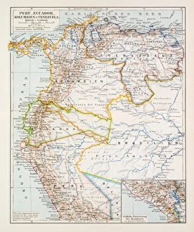
Map of Peru Ecuador Venezuela 1896Map of Peru Ecuador Venezuela
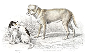
Indian carrier dog engravingThe Naturalists Library by William Jardine
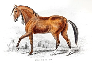
Peruvian Paso Fino Horse 1841Peruvian Paso Horse 1841
South America map 1875The Independent Course Comprehensive Geography by James Monteith, A.S. Barnes & Co, New York & Chicago 1875
Peruvian anceint ceramic engraving 1895Meyers Konversations-Lexikon. Ein Nachschlagewerk des allgemeinen Wissens, 5th edition 17 volumes Bibliographisches Institut - Leipzig 1895-1897
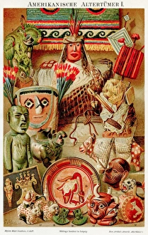
American antiquities chromolithograph 1895Meyers Konversations-Lexikon. Ein Nachschlagewerk des allgemeinen Wissens, 5th edition 17 volumes Bibliographisches Institut - Leipzig 1895-1897
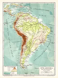
South America geological map 1895Meyers Konversations-Lexikon. Ein Nachschlagewerk des allgemeinen Wissens, 5th edition 17 volumes Bibliographisches Institut - Leipzig 1895-1897
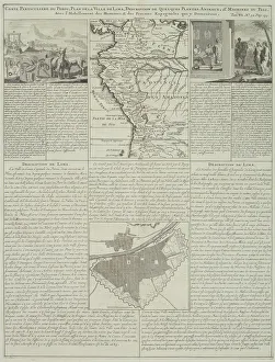
Antique map of Peru and Ecuador with plans for Lima
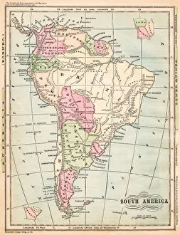
South America map 1878Encyclopedia Britannica 9th Edition Vol I New York, Samuel Hall 1878