mail_outline sales@mediastorehouse.com
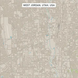
West Jordan Utah US City Street MapVector Illustration of a City Street Map of West Jordan, Utah, USA. Scale 1:60, 000. All source data is in the public domain. U.S
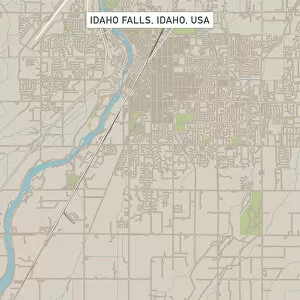
Idaho Falls Idaho US City Street MapVector Illustration of a City Street Map of Idaho Falls, Idaho, USA. Scale 1:60, 000. All source data is in the public domain. U.S
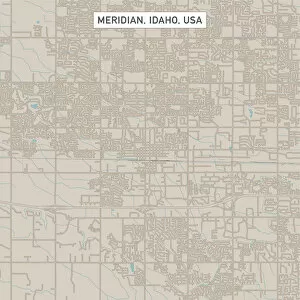
Meridian Idaho US City Street MapVector Illustration of a City Street Map of Meridian, Idaho, USA. Scale 1:60, 000. All source data is in the public domain. U.S
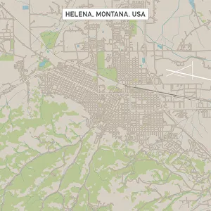
Helena Montana US City Street MapVector Illustration of a City Street Map of Helena, Montana, USA. Scale 1:60, 000. All source data is in the public domain. U.S
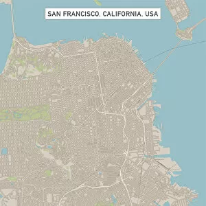
San Francisco California US City Street MapVector Illustration of a City Street Map of San Francisco, California, USA. Scale 1:60, 000. All source data is in the public domain. U.S
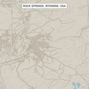
Rock Springs Wyoming US City Street MapVector Illustration of a City Street Map of Rock Springs, Wyoming, USA. Scale 1:60, 000. All source data is in the public domain. U.S
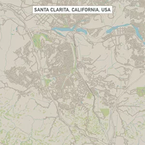
Santa Clarita California US City Street MapVector Illustration of a City Street Map of Santa Clarita, California, USA. Scale 1:60, 000. All source data is in the public domain. U.S
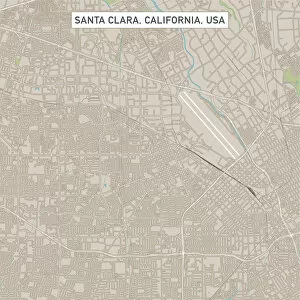
Santa Clara California US City Street MapVector Illustration of a City Street Map of Santa Clara, California, USA. Scale 1:60, 000. All source data is in the public domain. U.S
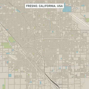
Fresno California US City Street MapVector Illustration of a City Street Map of Fresno, California, USA. Scale 1:60, 000. All source data is in the public domain. U.S
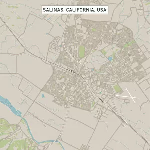
Salinas California US City Street MapVector Illustration of a City Street Map of Salinas, California, USA. Scale 1:60, 000. All source data is in the public domain. U.S
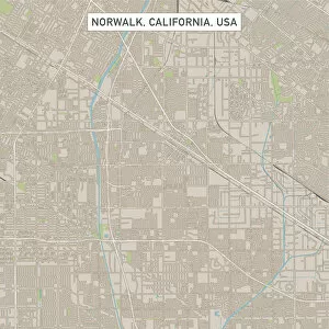
Norwalk California US City Street MapVector Illustration of a City Street Map of Norwalk, California, USA. Scale 1:60, 000. All source data is in the public domain. U.S
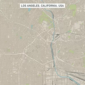
Los Angeles California US City Street MapVector Illustration of a City Street Map of Los Angeles, California, USA. Scale 1:60, 000. All source data is in the public domain. U.S
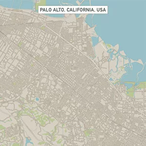
Palo Alto California US City Street MapVector Illustration of a City Street Map of Palo Alto, California, USA. Scale 1:60, 000. All source data is in the public domain. U.S
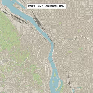
Portland Oregon US City Street MapVector Illustration of a City Street Map of Portland, Oregon, USA. Scale 1:60, 000. All source data is in the public domain. U.S
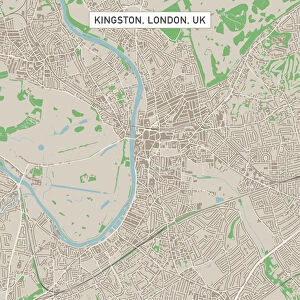
Kingston London UK City Street MapVector Illustration of a City Street Map of Kingston, London, UK. Included files are EPS (v10) and Hi-Res JPG. Data courtesy from Ordnance Survey: VectorMap District https
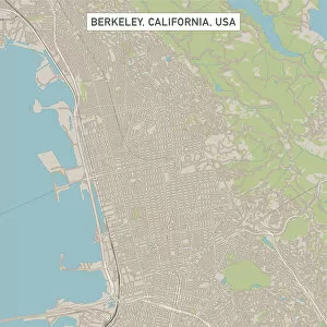
Berkeley California US City Street MapVector Illustration of a City Street Map of Berkeley, California, USA. Scale 1:60, 000. All source data is in the public domain. U.S
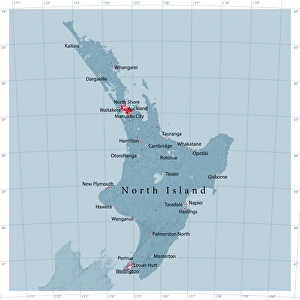
North Island Of New Zealand Vector Road MapDetailed vector map of North Island Of New Zealand, including main cities, roads, rivers and lakes. The colors in the.eps-file are ready for print (CMYK)
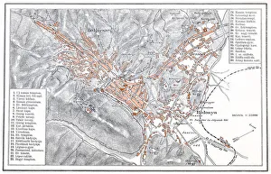
Brasov manIllustration of a Brasov map
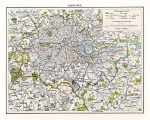
Antquie Map of London, 1895illustration of Antquie Map of London, 1895
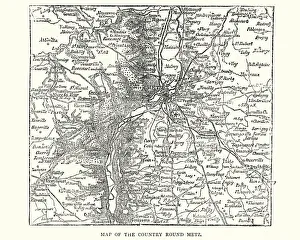
Map of the country around Metz, France, 1870Vintage engraving of a Map of the country around Metz, France, 1870
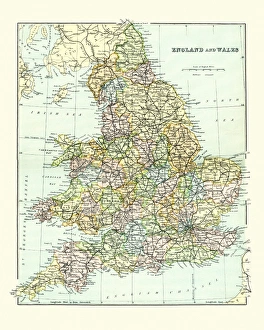
Antique Map of England and Wales 1880sVintage 19th Century map of England and Wales
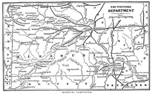
Missouri CampaignsVintage engraving from 1863 of a map of the Missouri Campaigns from the time of the American Civil War
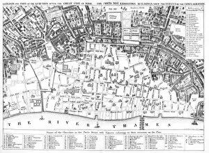
London after the Great FirePlan of London of the Great fire of 1666 showing which parts had been burnt down. The Great Fire of London was a major conflagration that swept through the central parts of the English city of
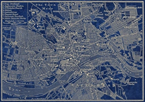
Newcastle Upon TyneAntique illustration of old Newcastle Upon Tyne map
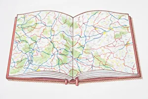
Open atlas, showing road map across double page
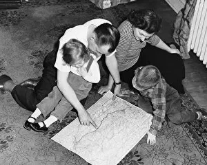
Family looking at roadmap
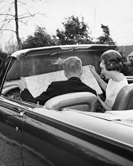
Couple in convertible looking at roadmap