mail_outline sales@mediastorehouse.com
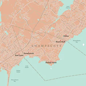
MA Essex Swampscott Vector Road Map. All source data is in the public domain. U.S. Census Bureau Census Tiger. Used Layers: areawater, linearwater, roads, rails, cousub, pointlm, uac10
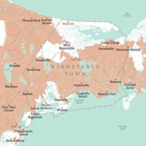
MA Barnstable Town Vector Road Map. All source data is in the public domain. U.S. Census Bureau Census Tiger. Used Layers: areawater, linearwater, roads, rails, cousub, pointlm, uac10
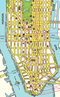
Map of Lower Manhattanhttp://csaimages.com/images/istockprofile/csa_vector_dsp.jpg
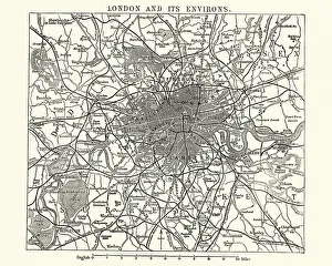
Map of Victorian London and its environs, England, 1870sVintage engraving of a Map of Victorian London and its environs, England, 1870s, 19th Century
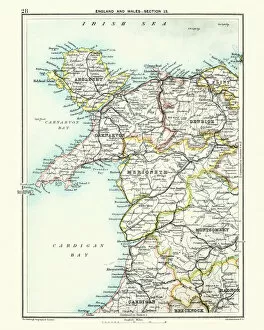
Antique map, North Wales, Anglesey, Carnarvon, 19th CenturyVintage engraving of a Antique map, North Wales, Anglesey, Carnarvon, Denbigh, Merionete, Montgomery19th Century
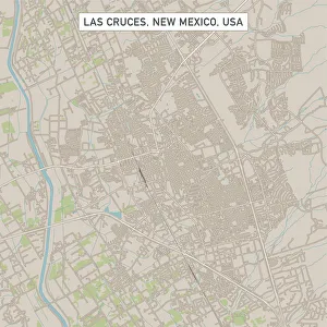
Las Cruces New Mexico US City Street MapVector Illustration of a City Street Map of Las Cruces, New Mexico, USA. Scale 1:60, 000. All source data is in the public domain. U.S
Roswell New Mexico US City Street MapVector Illustration of a City Street Map of Roswell, New Mexico, USA. Scale 1:60, 000. All source data is in the public domain. U.S
Westminster Colorado US City Street MapVector Illustration of a City Street Map of Westminster, Colorado, USA. Scale 1:60, 000. All source data is in the public domain. U.S
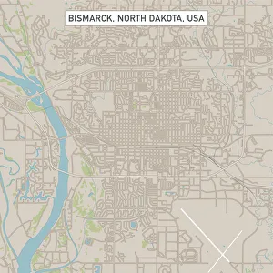
Bismarck North Dakota US City Street MapVector Illustration of a City Street Map of Bismarck, North Dakota, USA. Scale 1:60, 000. All source data is in the public domain. U.S
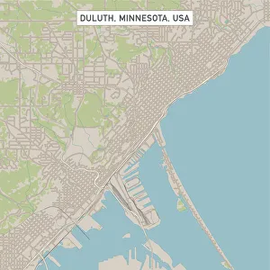
Duluth Minnesota US City Street MapVector Illustration of a City Street Map of Duluth, Minnesota, USA. Scale 1:60, 000. All source data is in the public domain. U.S
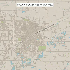
Grand Island Nebraska US City Street MapVector Illustration of a City Street Map of Grand Island, Nebraska, USA. Scale 1:60, 000. All source data is in the public domain. U.S
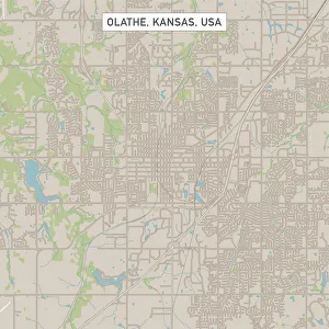
Olathe Kansas US City Street MapVector Illustration of a City Street Map of Olathe, Kansas, USA. Scale 1:60, 000. All source data is in the public domain. U.S
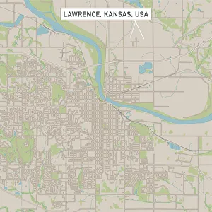
Lawrence Kansas US City Street MapVector Illustration of a City Street Map of Lawrence, Kansas, USA. Scale 1:60, 000. All source data is in the public domain. U.S
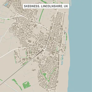
Skegness Lincolnshire UK City Street MapVector Illustration of a City Street Map of Skegness, Lincolnshire, UK. Included files are EPS (v10) and Hi-Res JPG. Data courtesy from Ordnance Survey: VectorMap District https
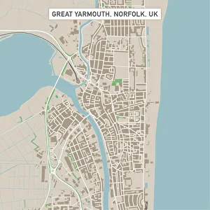
Great Yarmouth Norfolk UK City Street MapVector Illustration of a City Street Map of Great Yarmouth, Norfolk, UK. Included files are EPS (v10) and Hi-Res JPG. Data courtesy from Ordnance Survey: VectorMap District https
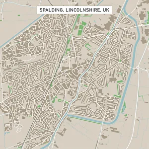
Spalding Lincolnshire UK City Street MapVector Illustration of a City Street Map of Spalding, Lincolnshire, UK. Included files are EPS (v10) and Hi-Res JPG. Data courtesy from Ordnance Survey: VectorMap District https
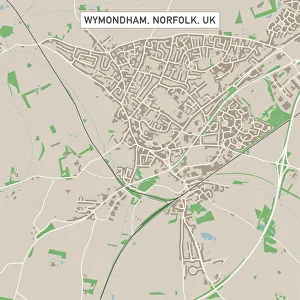
Wymondham Norfolk UK City Street MapVector Illustration of a City Street Map of Wymondham, Norfolk, UK. Included files are EPS (v10) and Hi-Res JPG. Data courtesy from Ordnance Survey: VectorMap District https
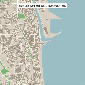
Gorleston-on-Sea Norfolk UK City Street MapVector Illustration of a City Street Map of Gorleston-on-Sea, Norfolk, UK. Included files are EPS (v10) and Hi-Res JPG. Data courtesy from Ordnance Survey: VectorMap District https
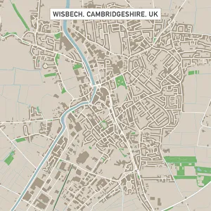
Wisbech Cambridgeshire UK City Street MapVector Illustration of a City Street Map of Wisbech, Cambridgeshire, UK. Included files are EPS (v10) and Hi-Res JPG. Data courtesy from Ordnance Survey: VectorMap District https
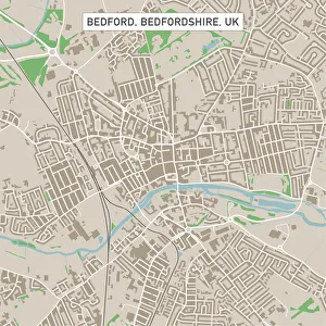
Bedford Bedfordshire UK City Street MapVector Illustration of a City Street Map of Bedford, Bedfordshire, UK. Included files are EPS (v10) and Hi-Res JPG. Data courtesy from Ordnance Survey: VectorMap District https
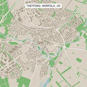
Thetford Norfolk UK City Street MapVector Illustration of a City Street Map of Thetford, Norfolk, UK. Included files are EPS (v10) and Hi-Res JPG. Data courtesy from Ordnance Survey: VectorMap District https
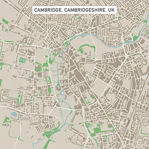
Cambridge Cambridgeshire UK City Street MapVector Illustration of a City Street Map of Cambridge, Cambridgeshire, UK. Included files are EPS (v10) and Hi-Res JPG. Data courtesy from Ordnance Survey: VectorMap District https
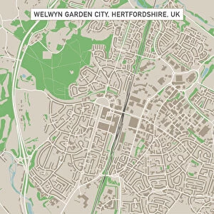
Welwyn Garden City Hertfordshire UK City Street MapVector Illustration of a City Street Map of Welwyn Garden City, Hertfordshire, UK. Included files are EPS (v10) and Hi-Res JPG
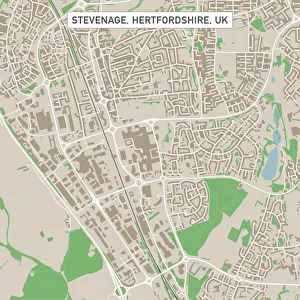
Stevenage Hertfordshire UK City Street MapVector Illustration of a City Street Map of Stevenage, Hertfordshire, UK. Included files are EPS (v10) and Hi-Res JPG. Data courtesy from Ordnance Survey: VectorMap District https
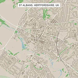
St Albans Hertfordshire UK City Street MapVector Illustration of a City Street Map of St Albans, Hertfordshire, UK. Included files are EPS (v10) and Hi-Res JPG. Data courtesy from Ordnance Survey: VectorMap District https
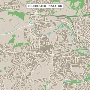
Colchester Essex UK City Street MapVector Illustration of a City Street Map of Colchester, Essex, UK. Included files are EPS (v10) and Hi-Res JPG. Data courtesy from Ordnance Survey: VectorMap District https
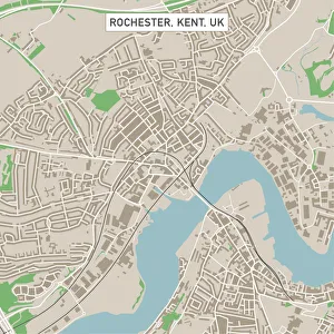
Rochester Kent UK City Street MapVector Illustration of a City Street Map of Rochester, Kent, UK. Included files are EPS (v10) and Hi-Res JPG. Data courtesy from Ordnance Survey: VectorMap District https
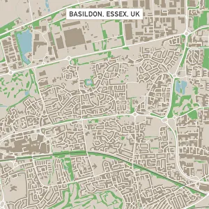
Basildon Essex UK City Street MapVector Illustration of a City Street Map of Basildon, Essex, UK. Included files are EPS (v10) and Hi-Res JPG. Data courtesy from Ordnance Survey: VectorMap District https
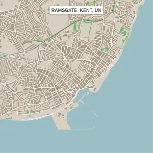
Ramsgate Kent UK City Street MapVector Illustration of a City Street Map of Ramsgate, Kent, UK. Included files are EPS (v10) and Hi-Res JPG. Data courtesy from Ordnance Survey: VectorMap District https
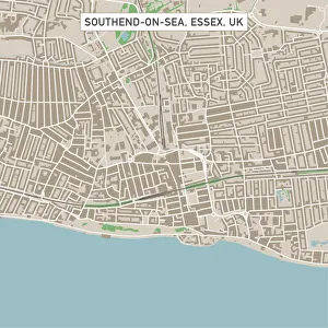
Southend-on-Sea Essex UK City Street MapVector Illustration of a City Street Map of Southend-on-Sea, Essex, UK. Included files are EPS (v10) and Hi-Res JPG. Data courtesy from Ordnance Survey: VectorMap District https
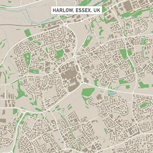
Harlow Essex UK City Street MapVector Illustration of a City Street Map of Harlow, Essex, UK. Included files are EPS (v10) and Hi-Res JPG. Data courtesy from Ordnance Survey: VectorMap District https
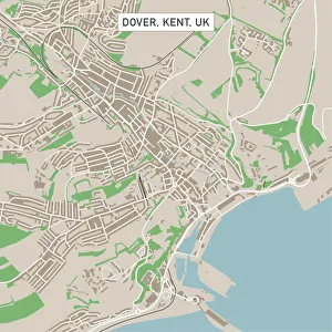
Dover Kent UK City Street MapVector Illustration of a City Street Map of Dover, Kent, UK. Included files are EPS (v10) and Hi-Res JPG. Data courtesy from Ordnance Survey: VectorMap District https
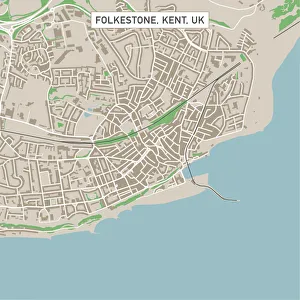
Folkestone Kent UK City Street MapVector Illustration of a City Street Map of Folkestone, Kent, UK. Included files are EPS (v10) and Hi-Res JPG. Data courtesy from Ordnance Survey: VectorMap District https
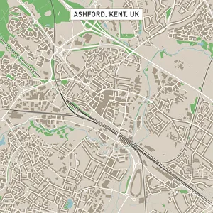
Ashford Kent UK City Street MapVector Illustration of a City Street Map of Ashford, Kent, UK. Included files are EPS (v10) and Hi-Res JPG. Data courtesy from Ordnance Survey: VectorMap District https
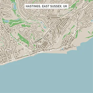
Hastings East Sussex UK City Street MapVector Illustration of a City Street Map of Hastings, East Sussex, UK. Included files are EPS (v10) and Hi-Res JPG. Data courtesy from Ordnance Survey: VectorMap District https
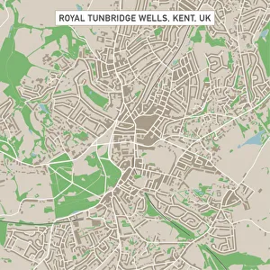
Royal Tunbridge Wells Kent UK City Street MapVector Illustration of a City Street Map of Royal Tunbridge Wells, Kent, UK. Included files are EPS (v10) and Hi-Res JPG. Data courtesy from Ordnance Survey: VectorMap District https
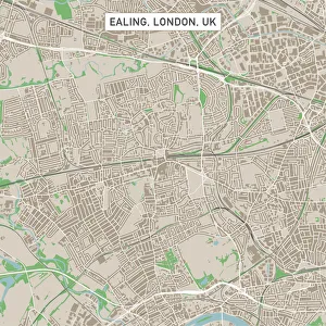
Ealing London UK City Street MapVector Illustration of a City Street Map of Ealing, London, UK. Included files are EPS (v10) and Hi-Res JPG. Data courtesy from Ordnance Survey: VectorMap District https
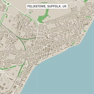
Felixstowe Suffolk UK City Street MapVector Illustration of a City Street Map of Felixstowe, Suffolk, UK. Included files are EPS (v10) and Hi-Res JPG. Data courtesy from Ordnance Survey: VectorMap District https
Clacton-on-Sea Essex UK City Street MapVector Illustration of a City Street Map of Clacton-on-Sea, Essex, UK. Included files are EPS (v10) and Hi-Res JPG. Data courtesy from Ordnance Survey: VectorMap District https
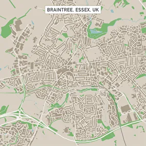
Braintree Essex UK City Street MapVector Illustration of a City Street Map of Braintree, Essex, UK. Included files are EPS (v10) and Hi-Res JPG. Data courtesy from Ordnance Survey: VectorMap District https
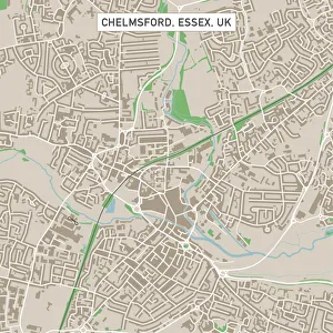
Chelmsford Essex UK City Street MapVector Illustration of a City Street Map of Chelmsford, Essex, UK. Included files are EPS (v10) and Hi-Res JPG. Data courtesy from Ordnance Survey: VectorMap District https
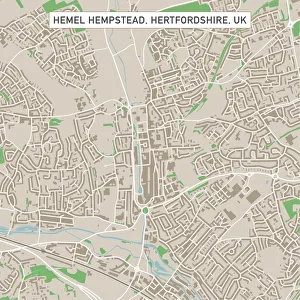
Hemel Hempstead Hertfordshire UK City Street MapVector Illustration of a City Street Map of Hemel Hempstead, Hertfordshire, UK. Included files are EPS (v10) and Hi-Res JPG
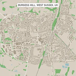
Burgess Hill West Sussex UK City Street MapVector Illustration of a City Street Map of Burgess Hill, West Sussex, UK. Included files are EPS (v10) and Hi-Res JPG. Data courtesy from Ordnance Survey: VectorMap District https
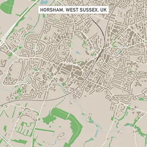
Horsham West Sussex UK City Street MapVector Illustration of a City Street Map of Horsham, West Sussex, UK. Included files are EPS (v10) and Hi-Res JPG. Data courtesy from Ordnance Survey: VectorMap District https
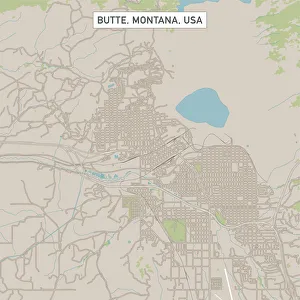
Butte Montana US City Street MapVector Illustration of a City Street Map of Butte, Montana, USA. Scale 1:60, 000. All source data is in the public domain. U.S
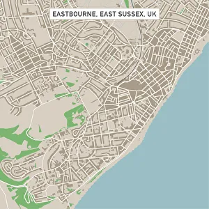
Eastbourne East Sussex UK City Street MapVector Illustration of a City Street Map of Eastbourne, East Sussex, UK. Included files are EPS (v10) and Hi-Res JPG. Data courtesy from Ordnance Survey: VectorMap District https
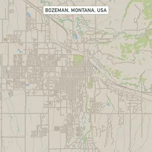
Bozeman Montana US City Street MapVector Illustration of a City Street Map of Bozeman, Montana, USA. Scale 1:60, 000. All source data is in the public domain. U.S
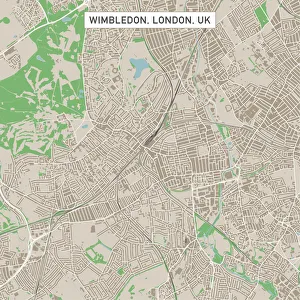
Wimbledon London UK City Street MapVector Illustration of a City Street Map of Wimbledon, London, UK. Included files are EPS (v10) and Hi-Res JPG. Data courtesy from Ordnance Survey: VectorMap District https