mail_outline sales@mediastorehouse.com
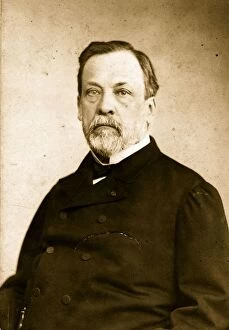
Louis PasteurFrench scientist Louis Pasteur (1822 - 1895), father of modern bacteriology. Original Artwork: By Paul Rochas & Bannel. (Photo by Hulton Archive/Getty Images)
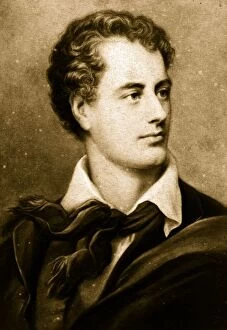
Lord ByronEnglish romantic poet George Gordon Byron, 6th Baron of Rochdale (1788 - 1824). Original Artwork: Fred Bruckmann Studio (Photo by Hulton Archive/Getty Images)
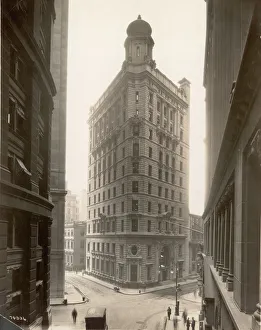
Elias F. Noyes Building In New York Financial DistrictView of the Elias F. Noyes Building at the corner of William Street and Beaver Street, New York, New York, 1910s. (Photo by Edwin Levick/Getty Images)
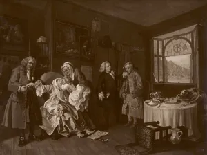
The Ladys DeathThe sixth and last in the series Marriage A La Mode by William Hogarth, satirising the mercenary marriage practices of the British upper classes, circa 1743
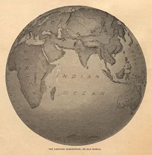
Old, Black and White Illustration of Eastern Hemisphere, From 1800 sOld black and white illustration of the Old World (Eastern Hemisphere), from 1875
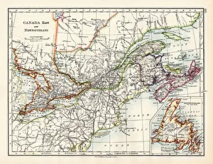
Canada map 1883The World-Wide Atlas of Modern Geography, Political and Physical W. & A.K. Johnston - London 1897
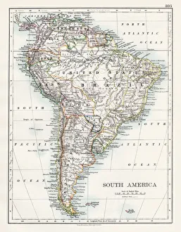
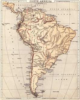
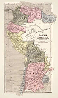
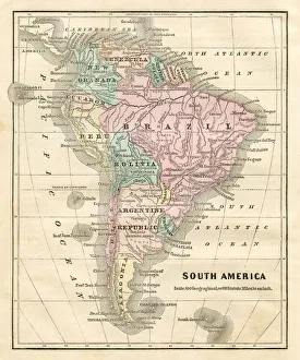
South America map 1897The World-Wide Atlas of Modern Geography, Political and Physical W. & A.K. Johnston - London 1897
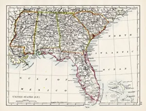
United States South East map 1897The World-Wide Atlas of Modern Geography, Political and Physical W. & A.K. Johnston - London 1897
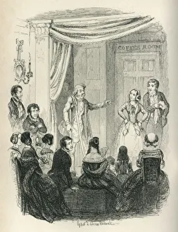
Amateur dramatics by Victorian peopleA British upper class society evening occasion featuring amateur dramatics or charades, including a man hobbling on crutches
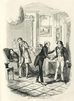
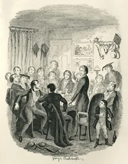
Introductions and gossip in a Victorian houseA new arrival shaking hands with his host is the subject of whispering and speculation by the roomas other inhabitants. From Frank Fairlegh
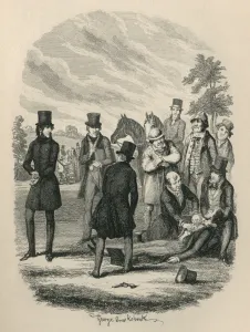
Aftermath of a Victorian duelA doctor tending a wounded - or dead - victim of a duel, while the opponent, the seconds and a few bystanders watch. A pistol lies on the ground
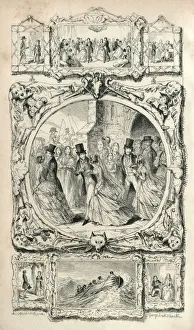
Scenes from Victorian lifeVarious scenes from Victorian life surrounding a circular image of newly married couples emerging from a church. From Frank Fairlegh
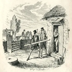
Two Victorian men trying to force entry to a cottageTwo Victorian men trying to force their way into a cottage using a large piece of wood. The terrified inhabitant remonstrates with them while an alarmed-looking gentleman descends from a horse drawn
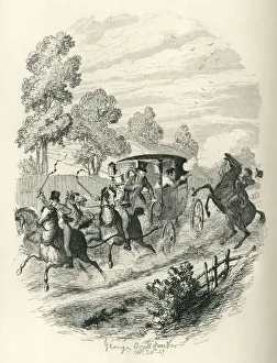
Victorian couple fleeing in a coachA Victorian couple in a horse drawn carriage fleeing the attentions of a man on horseback on a rural road. The man in the carriage is firing his pistol at the rider
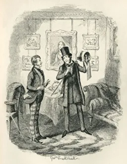
Victorian man holding a ladys bonnetA victorian man holding up a ladyas bonnet and indicating its finer points with his cane to an admiring man wearing check trousers
Victorian public school teachers convivial eveningMasters at an English public school partaking of wine punch during an eveningas conviviality. A small boy, probably a pupil, is opening yet another bottle and the room is thick with cigar smoke
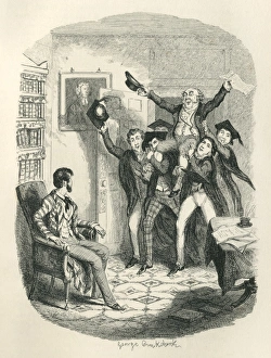
Victorian teachers chairing a colleagueA group of Victorian English public school teachers chairing (carrying) one of their number - a older man, possibly the headmaster - on their shoulders
Sing a Song of Sixpence - nursery rhymeA Victorian engraving of a scene from the nursery rhyme Sing a Song of Sixpencea, showing the four-and-twenty blackbirds singing to the King upon the opening of the pie
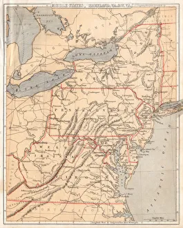
United States North East Central map 1897The World-Wide Atlas of Modern Geography, Political and Physical W. & A.K. Johnston - London 1897
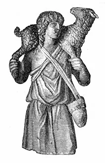
Christ as a good shepherdillustration of a Christ as a good shepherd
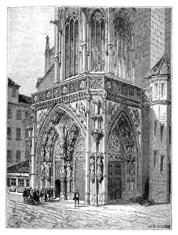
The Frauenkirche ( Church of Our Lady ) in Nuremberg, GermanyIllustration of the Frauenkirche ( Church of Our Lady ) is a church in Nuremberg, Germany
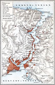
Bosporus mapIllustration of a Bosporus map
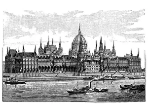
Budapest a Hungarian ParliamentIllustration of a Budapest a Hungarian Parliament
Inside book cover
Map of South America 1869Cornells Grammars-School Geography - S.S. Cornell - New York D. Appleton and Company 1869
Middle states USA map 1869Cornells Grammars-School Geography - S.S. Cornell - New York D. Appleton and Company 1869
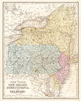
MId-atlantic states usa map 1867Mitchells Modern Atlas - Published by E.H. Buttler & Co - Philadelphia 1867
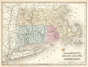
Rhode Island Massachusetts Connecticut 1867Mitchells Modern Atlas - Published by E.H. Buttler & Co - Philadelphia 1867
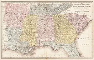
USA Southern States 1867Mitchells Modern Atlas - Published by E.H. Buttler & Co - Philadelphia 1867
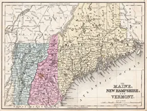
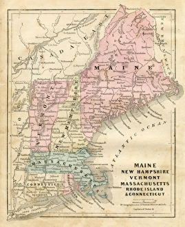
Maine New Hampshire and Vermont 1867Mitchells Modern Atlas - Published by E.H. Buttler & Co - Philadelphia 1867
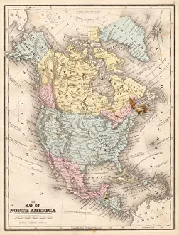
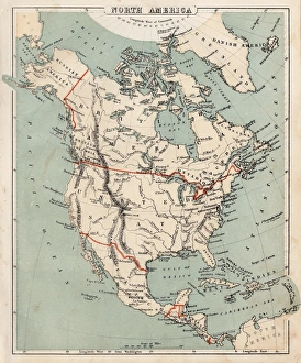
Map of North America 1867Mitchells Modern Atlas - Published by E.H. Buttler & Co - Philadelphia 1867
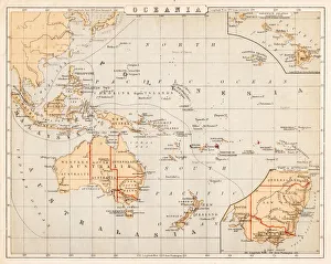
Map of Australia Oceania 1869Cornells Grammars-School Geography - S.S. Cornell - New York D. Appleton and Company 1869
Map of North America 1869Cornells Grammars-School Geography - S.S. Cornell - New York D. Appleton and Company 1869
Map of South America 1855System of Geography for the use of schools by Sidney E. Morse - Published by Harper & Brothers - New York 1855
Maine New Hampshire and Connecticut 1856Colton and Fitchs Modern School Geography by George W. Fitch - New York 1856
Map of South America 1856Colton and Fitchs Modern School Geography by George W. Fitch - New York 1856
Map of United States 1856Colton and Fitchs Modern School Geography by George W. Fitch - New York 1856
Map of North America 1856Colton and Fitchs Modern School Geography by George W. Fitch - New York 1856
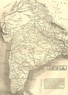
Mid-Victorian map of IndiaA mid-Victorian map of the Indian subcontinent at the time of the British Empire, showing various missionary society stations
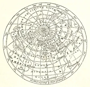
Victorian map of the Arctic CircleA Victorian map of the Arctic Circle and beyond. From Peter Parleyas Annual - A Christmas and New Yearas Present for Young Peoplea published in London by Darton & Co in 1851
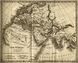
The World as Known to the Ancients (steel engraving)A creased and stained steel engraving of a map which shows The World as Known to the Ancientsa which aŠcontains all the Parts of which it is thought the Ancients had any knowledgea
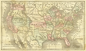
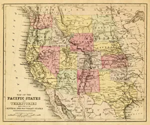
map of the Pacific states (California, Oregon, Washington) an territories with a part of central and souther states - USA (1883)
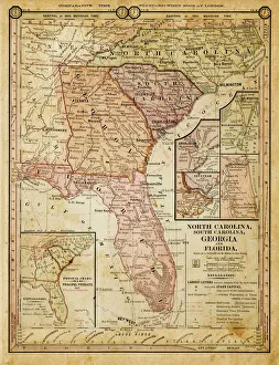
usa - southern states 1884map of north carolina, south carolina, georgia and florida 1884
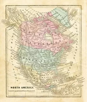
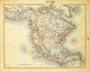
Map of North America 1882Antique Map of North America 1882
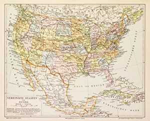
Map of United States and Mexico 1897Map of United States and Mexico
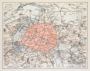
Map of Paris 1895map/plan of the city of Paris, France 1895
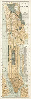
Map of New York City 1894Huge vertical panorama map of New York 1885
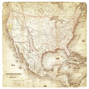
Map of United States and Mexico 1849Map of United States and Mexico