mail_outline sales@mediastorehouse.com
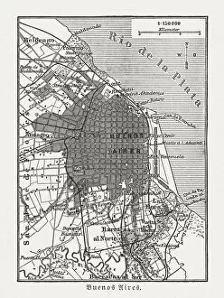
City map of Buenos Aires, Argentina, wood engraving, published 1897City map of Buenos Aires, capital of Argentina. Wood engraving, published in 1897
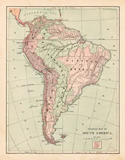
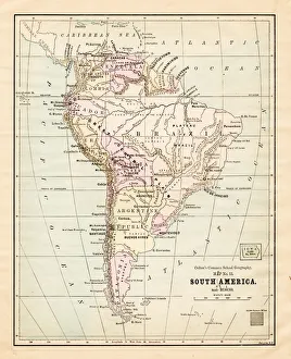
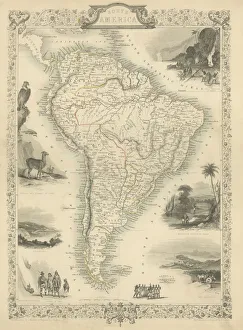
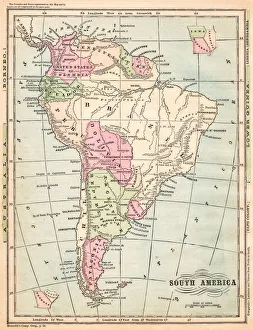
South America map 1881Harpers School Geography, New York, Harpers and Brothers, 1881
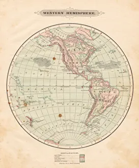
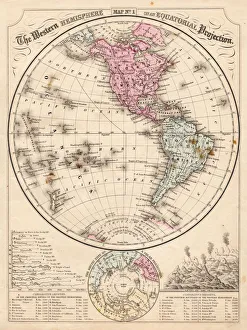
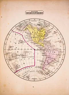
Western Hemisphere map 1881Harpers School Geography, New York, Harpers and Brothers, 1881
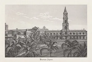
Cabildo and Plaza de Mayo in Buenos Aires, published 1889Cabildo and Plaza de Mayo in Buenos Aires, Argentina. 19th century view. Steel engraving, published in 1889
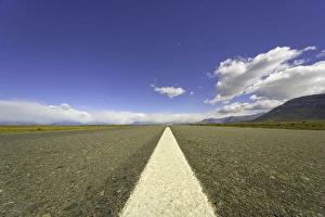
Highway to El Chaltein, Patagonia, ArgentinaWhite dividing stripe and highway leading to Andes across arid pamapas steppe under small cumulus clouds floating in blue sky, fall, Patagonia, Argentina
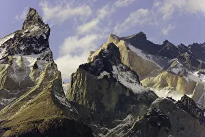
Torres del Paine, Patagonia, ChileSpectacular, smooth and colorful granite crags of mountain range, its steep granite towers known as cuernos (horns), glaciers, and cumulus clouds in blue sky
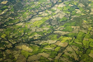
Aerial of farm fields, south of Santiago, ChileAerial view of green mosaic of farm fields intersected by roads, rivers and streams on sunny afternoon, south of Santiago, fall, Chile, South America
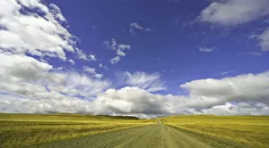
cumulus clouds above road, Patagonia, ArgentinaSpectacular cumulus clouds in blue sky above gravel rural road crossing arid golden pampas grassland, fall, Patagonia, Santa Cruz province, Southern Argentina, South America
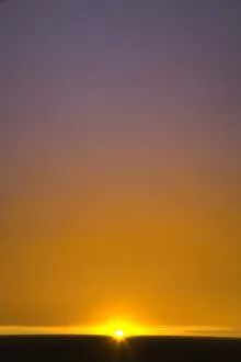
Sunrise above grassland, Patagonia, ArgentinaMornign sun in orange sky rising above horizon and arid grassland pampas steppe used for ranching, fall, Altiplano, Patagonia, Santa Cruz province, Southern Argentina, South America
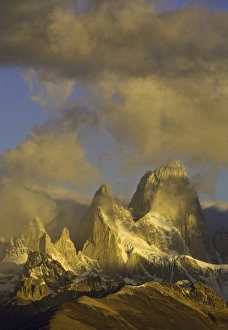
sunset, Fitzroy Massif, Patagonia, ArgentinaSpectacular golden cumulus clouds floating in morning sky above sheer granite towers of Fitzroy Massif range lit by rising sun, fall, Glaciers National Park, Patagonia, Santa Cruz province, Andes
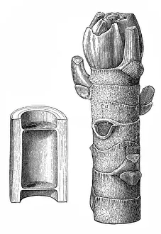
The ambay ( Cecropia adenopus )Illustration of the ambay ( Cecropia adenopus )
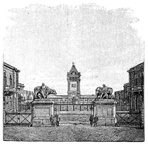
The slaughterhouses main gate, Hude & Hennickeillustration of the slaughterhouses main gate, Hude & Hennicke
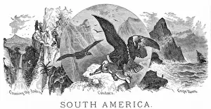
Scenes form South America engraving 1898Warrens Common School Geography
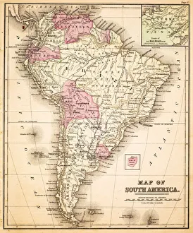
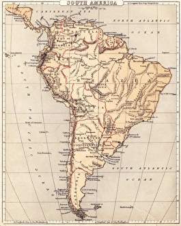
Map of South America 1883Warrens Common School Geography
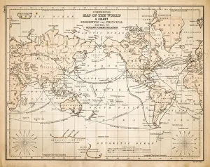
Map of the World 1883Warrens Common School Geography
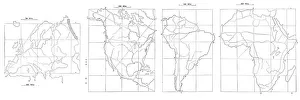
Map drawing technique 1881Coltons Common School Geography 1881 New York Sheldon and Co
South America map 1881Coltons Common School Geography 1881 New York Sheldon and Co
Map of South America 1869Cornells Grammars-School Geography - S.S. Cornell - New York D. Appleton and Company 1869
Western Hemisphere map 1867Mitchells Modern Atlas - Published by E.H. Buttler & Co - Philadelphia 1867
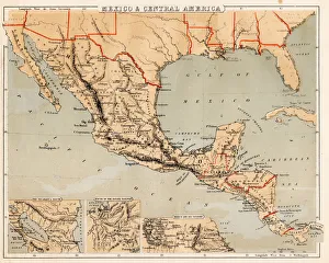
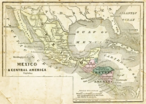
Mexico and Central America map 1869Cornells Grammars-School Geography - S.S. Cornell - New York D. Appleton and Company 1869
Map of South America 1855System of Geography for the use of schools by Sidney E. Morse - Published by Harper & Brothers - New York 1855
Mexico and Central America map 1856Colton and Fitchs Modern School Geography by George W. Fitch - New York 1856
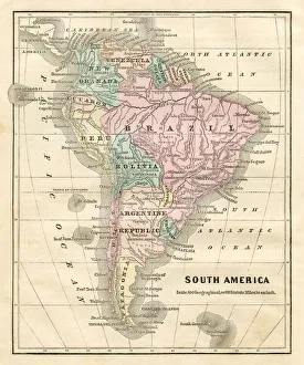
Map of South America 1856Colton and Fitchs Modern School Geography by George W. Fitch - New York 1856
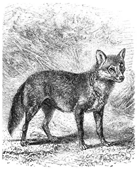
Crab eating Fox (Cerdocyon thous)
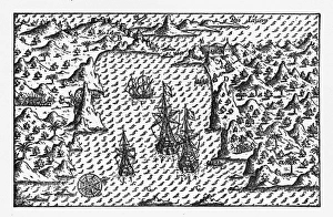
Rio de Janeiro Historical Map by Van Noort, Circa 1598Very Rare, Beautifully Illustrated Antique Engraved Victorian Illustration of Historical Map of Van Noort at Rio de Janeiro, 1598. Copyright has expired on this artwork. Digitally restored
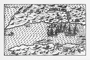
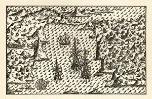
Van Noort at Porto Deseado Historical Map of 1598Very Rare, Beautifully Illustrated Antique Engraved Victorian Illustration of Historical Map of Van Noort at Porto Deseado, 1598. Copyright has expired on this artwork. Digitally restored
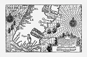
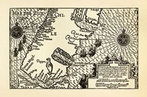
Strait of Magellan Map by Van Noort, Circa 1599Very Rare, Beautifully Illustrated Antique Engraved Victorian Illustration of Historical Map of Van Noort at the Strait of Magellan, 1599. Copyright has expired on this artwork. Digitally restored
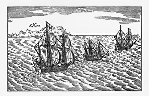
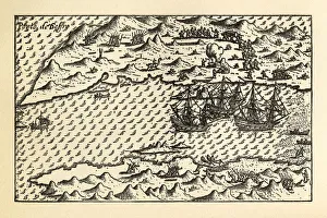
Van Noort Sailing the Strait of Magellan, Engraving of 1600Very Rare, Beautifully Illustrated Antique Engraved Victorian Illustration of Historical Engraving of Van Noort Sailing the Strait of Magellan, 1600. Copyright has expired on this artwork
Iguacu falls (Cataratas do Iguacu)
Map of Van Noort at the Strait of Magellan, 1599Very Rare, Beautifully Illustrated Antique Engraved Victorian Illustration of Historical Map of Van Noort at the Strait of Magellan, 1599. Copyright has expired on this artwork. Digitally restored
Historical Map of Van Noort at Porto Deseado, 1598Very Rare, Beautifully Illustrated Antique Engraved Victorian Illustration of Historical Map of Van Noort at Porto Deseado, 1598. Copyright has expired on this artwork. Digitally restored
Historical Map of Van Noort at Rio de Janeiro, 1598Very Rare, Beautifully Illustrated Antique Engraved Victorian Illustration of Historical Map of Van Noort at Rio de Janeiro, 1598, from The Golden Book of the Dutch Navigators
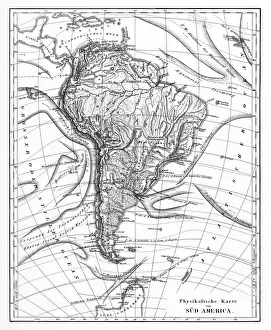
Victorian Map of North AmericaEngraved illustrations of the Physical Map of South America from Iconographic Encyclopedia of Science, Literature and Art, Published in 1851. Copyright has expired on this artwork. Digitally restored
Western Hemisphere 1852 Map
South America Engraved map 1851Finely engraved map of South America, Illustrations by J Marchant Engraved by J Rodgers Map Drawn and Engraved by J Rapkin, 1851
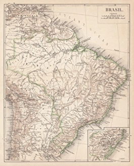
Map of Brazil. Lithograph, lithograph, published in 1874Antique map of Brazil. Lithograph, published in 1874
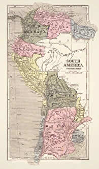
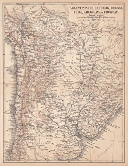
Argentina, Bolivia, Chile, Paraguay and Uruguay, lithograph, published in 1874South American countries: Argentina, Bolivia, Chile, Paraguay and Uruguay. Lithograph, published in 1874
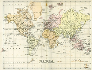
Antique Map of the WorldVintage map of the World from 1884
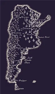
Antique ArgentinaArgentina Map, - Antique style. Includes mountains and water bodies. High detail - vector illustration
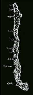
Antique ChileChile Map, - Antique style. Includes mountains and water bodies. High detail - vector illustration
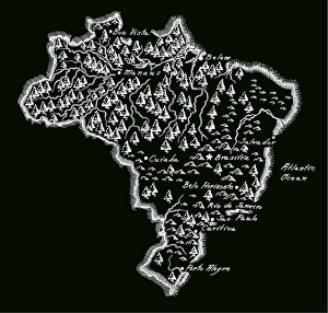
Antique BrazilBrazil Map, - Antique style. Includes mountains and water bodies. High detail - vector illustration
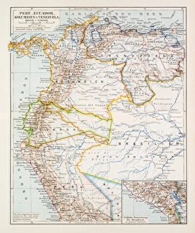
Map of Peru Ecuador Venezuela 1896Map of Peru Ecuador Venezuela
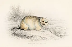
The Chinchilla engraving 1855
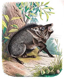
The Peccary engraving 1853
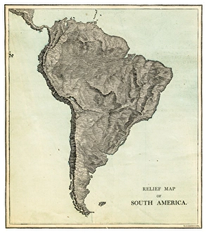
South America relief map 1875The Independent Course Comprehensive Geography by James Monteith, A.S. Barnes & Co, New York & Chicago 1875
South America map 1875The Independent Course Comprehensive Geography by James Monteith, A.S. Barnes & Co, New York & Chicago 1875
Harp engraving 1885Le Monde Physique par Amedee Guillemin - Paris / Librairie Hachette et Cie 1881
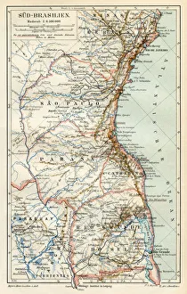
South Brazil map 1895Meyers Konversations-Lexikon. Ein Nachschlagewerk des allgemeinen Wissens, 5th edition 17 volumes Bibliographisches Institut - Leipzig 1895-1897