mail_outline sales@mediastorehouse.com
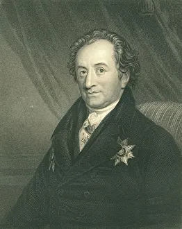
Johann Wolfgang Von Goethe, German writer, artist, and politician (XXXL)Portrait of Goethe engraving by Posselwhite from a picture by george Dawe (1855) Now in the public domain
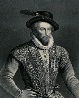
Sir Walter Raleigh (XXXL)" Portrait of Sir Walter Raleigh ( 1552-1618) engraved by W.Holl(1807-1871), published by A.Fullarton and Co in 1870.Adobe RGB.Very high resolution.Queen Elisabeth I:"
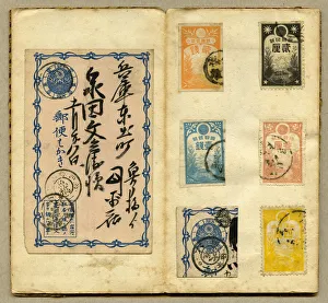
Japanese postcard and stamps xxlargeJapanese postcard and japanese stamps ( mont fujiyama )extralarge.Koban stamps 1876
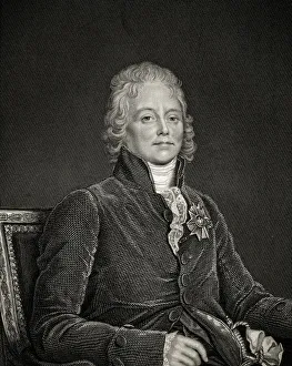
TalleyrandCharles Maurice de Talleyrand Perigord 1754-1838 French politician and diplomat
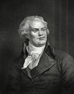
Georges Danton (XXXL)Portrait of Danton Georges Jaques, (1759-1794). French revolutionary leader
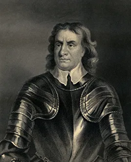
Oliver Cromwell (XXXL)Portrait of Oliver Cromwell(1599-1658) engraved by W.Holl ( 1807-1871) and published by A.Fullarton and Co in 1870.Restored by Pictore.Similar portraits from my portfolio:
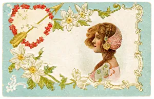
Valentines postcard (XXXL)Valentines postcard
Portrait 1880 (XXXL)Portrait engraving 1880 on black background
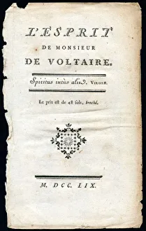
The spirit of Mr De VOLTAIRE (XXXL)Old paper (1759) for backgrounds.High resolution with plenty of detail!
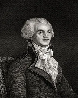
Maximilien Robespierre (Sepia toned)Maximilien Robespierre 1758-1794 Jacobin leader during French Revolution Engraved by W H Mote from the book Historical Sketches of Statesmen published London 1843
garden of edenVery old 19th Century engraved image of garden of eden.Author unknown.Now in the public domain.No modified image/Adobe RGB colorspace
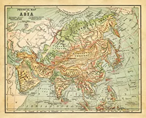
Physical map of asia - 1881
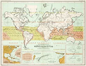
Winds - Map of the world 1861Map of the world - Winds over the globe - storms and hurricanes
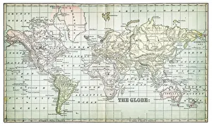
the world 1877antique map of the world - 1877
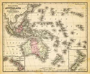
map of australia, malaysia and polynesiaold map of australia, malaysia and polynesia - 1883
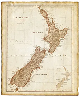
Old map of New Zealand and Tasmania 1899 - combined with textures overlay
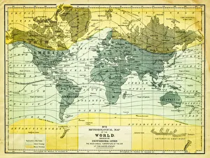
map of the world 1867meteorological map of the world 1867 - showing isothermal lines
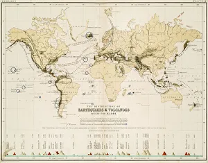
Map of the world 1861Map of the world - The distribution of Earthquakes and Volcanoes over the globe
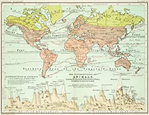
Animals - Map of the world 1861Map of the world - The distributions of animals
map of the world 1873antique map of the world - from a french atlas - 1872
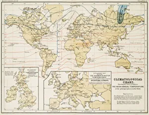
Climate map of the world 1861Map of the world - Climatological Chart
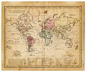
map of the world 1855map of the world illustrating the principal features of the land and the co-tidal lines - 1855
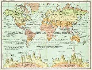
Agricultural Map of the world 1861map of the world showing the distribution of the most important Tress, Shrubs, Grains and Fruits according to zones of climate and moisture plants
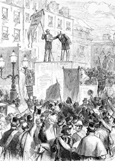
100-year anniversary of O Connell in Dublin100-year, 19th Century Style, Aging Process, Anniversary, Antique, Art, Black And White, Book, Celebration, Classical Style, Crowd, Document, Drawing, Dublin - Ireland, Engraved Image, Engraving
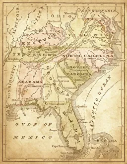
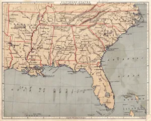
usa - southern states 1870east and southern states usa in light color- east coast, mexican gulf and atlantic ocean (1870)
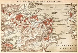
Map of Rio de Janeiro 1898Map of Rio de Janeiro - In German Language
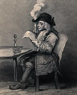
Caricature of the politician (XXXL)The politician engraved(1850)by A.Wright.Fac simile of the original engraving from the design by W.Hogarth(1697-1764).Restored by Pictore.The politician reading the newspaper with the candle held
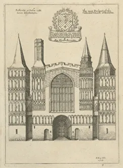
The West Prospect of Rochester Cathedral, 1660This is an antique print from the series The Cathedrall and Conventuall Churches of England and Wales Orthographically delineated
Old Dirty Chinese WallpaperOrnaments from L Ornement Polychrome First and Second Series published in 1873 by Albert Charles Auguste Racinet (1825-1893) a french designer, lithographer and art historian
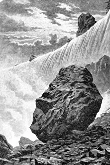
Niagara Falls
Map of USA Southern states 1869Cornells Grammars-School Geography - S.S. Cornell - New York D. Appleton and Company 1869
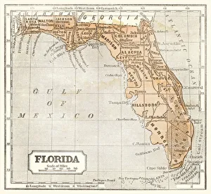
Map of Florida 1855System of Geography for the use of schools by Sidney E. Morse - Published by Harper & Brothers - New York 1855
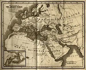
Probable Settlement of the Descendants of Noah (steel engraving)A creased and stained steel engraving of a map which shows The Countries of the Ancient World Exhibiting the Probable Settlement of the Descendants of Noaha, from A System of Geography
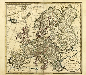
Antique Map of Europe, 1785An accurate map of Europe from the best authorities. London: C. Dilly & G. Robinson: 1785. Original size: 35.7 x 37.4 cm. Coloured, Inset: Spitsbergen, East and West Greenland, and Iceland
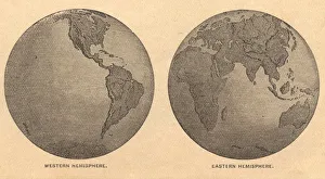
Old, Map of Eastern and Western Hemispheres, From 1875Old black and white illustration of the Eastern Hemisphere and the Western Hemisphere, from the 1800 s
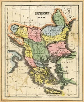
Turkey in EuropeVintage map of Turkey in Europe.Engraved, Published and Edited in 1845in the Pictorial Sunday-Book by J.Morrison&CoRestored By PictoreVery high resolution ( XXXL)
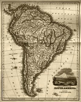
Map of South America (early 19th century steel engraving)A steel engraving of a map from the early 19th century of Brazil and Paraguay in South America, from A System of Geography, Popular and Scientific, or A Physical, Political
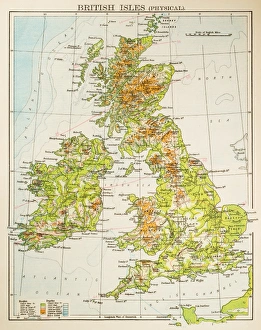
Map of British Isles 1897Map of British Isles
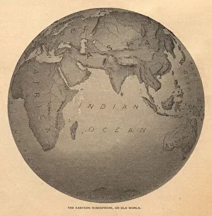
Old, Black and White Illustration of Eastern Hemisphere, From 1800 sOld black and white illustration of the Old World (Eastern Hemisphere), from 1875
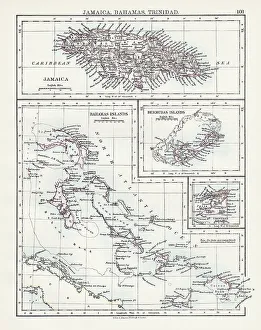
Jamaica Bahamas Trinidad map 1897The World-Wide Atlas of Modern Geography, Political and Physical W. & A.K. Johnston - London 1897
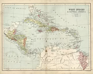
Antique map of West Indies and Central America, 19th Century, 1873
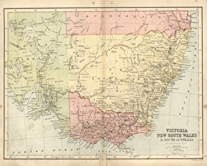
Antique damaged map of Victoria, New South Wales, 19th CenturyVintage engraving of a Antique damaged map of Victoria, New South Wales, and South Australia in the 19th Century, 1873
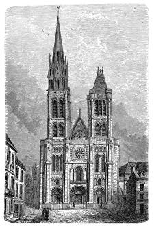
Paris, France - Saint DenisIllustration of a Paris, France - Saint Denis
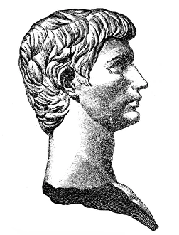
Lucius Junius Brutusillustration of a Lucius Junius Brutus
Book endpaper engraving
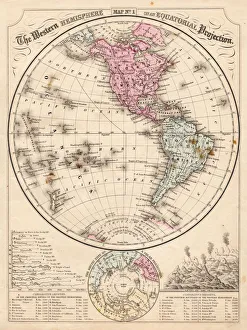
Western Hemisphere map 1867Mitchells Modern Atlas - Published by E.H. Buttler & Co - Philadelphia 1867
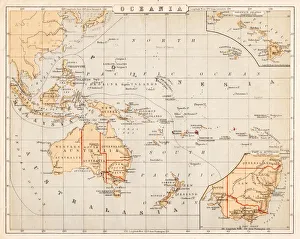
Map of Australia Oceania 1869Cornells Grammars-School Geography - S.S. Cornell - New York D. Appleton and Company 1869