mail_outline sales@mediastorehouse.com
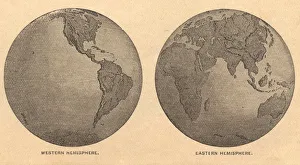
Old, Map of Eastern and Western Hemispheres, From 1875Old black and white illustration of the Eastern Hemisphere and the Western Hemisphere, from the 1800 s
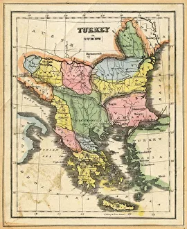
Turkey in EuropeVintage map of Turkey in Europe.Engraved, Published and Edited in 1845in the Pictorial Sunday-Book by J.Morrison&CoRestored By PictoreVery high resolution ( XXXL)
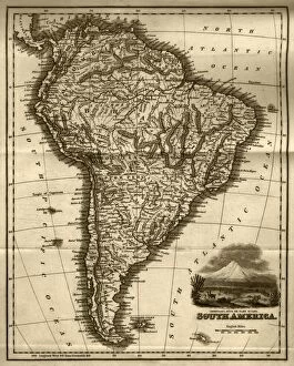
Map of South America (early 19th century steel engraving)A steel engraving of a map from the early 19th century of Brazil and Paraguay in South America, from A System of Geography, Popular and Scientific, or A Physical, Political
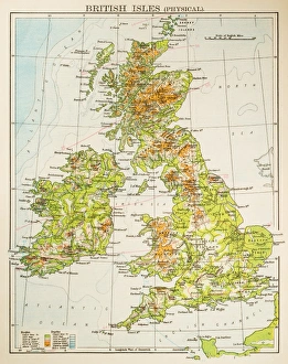
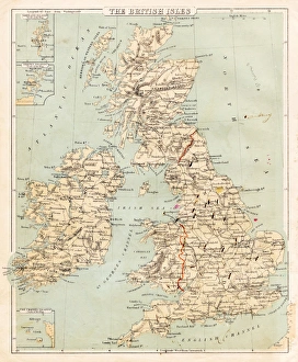
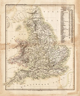
Map of British Isles 1897Map of British Isles
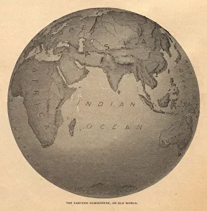
Old, Black and White Illustration of Eastern Hemisphere, From 1800 sOld black and white illustration of the Old World (Eastern Hemisphere), from 1875
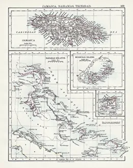
Jamaica Bahamas Trinidad map 1897The World-Wide Atlas of Modern Geography, Political and Physical W. & A.K. Johnston - London 1897
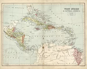
Antique map of West Indies and Central America, 19th Century, 1873
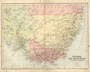
Antique damaged map of Victoria, New South Wales, 19th CenturyVintage engraving of a Antique damaged map of Victoria, New South Wales, and South Australia in the 19th Century, 1873
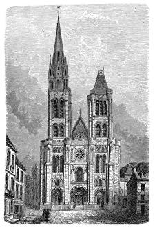
Paris, France - Saint DenisIllustration of a Paris, France - Saint Denis
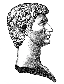
Lucius Junius Brutusillustration of a Lucius Junius Brutus
Book endpaper engraving
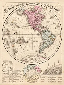
Western Hemisphere map 1867Mitchells Modern Atlas - Published by E.H. Buttler & Co - Philadelphia 1867
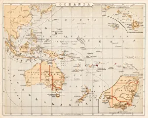
Map of Australia Oceania 1869Cornells Grammars-School Geography - S.S. Cornell - New York D. Appleton and Company 1869
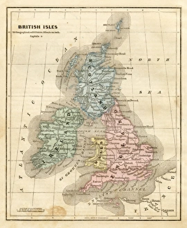
Map of the British isles 1869Cornells Grammars-School Geography - S.S. Cornell - New York D. Appleton and Company 1869
map of the British isles 1856Colton and Fitchs Modern School Geography by George W. Fitch - New York 1856
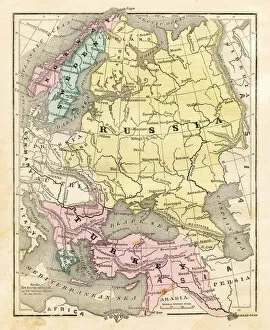
Map of Russia Turkey 1856Colton and Fitchs Modern School Geography by George W. Fitch - New York 1856
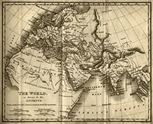
The World as Known to the Ancients (steel engraving)A creased and stained steel engraving of a map which shows The World as Known to the Ancientsa which aŠcontains all the Parts of which it is thought the Ancients had any knowledgea
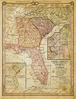
usa - southern states 1884map of north carolina, south carolina, georgia and florida 1884
Map of great Britain 1831Antique map of great Britain 1870
Poultry engravings 1899Poultry engraving (chicken, roster, ducks, geese, turkey, quail) - In German Language
Red antique book
Our Lady of Victory church in ViennaAntique illustration of Our Lady of Victory church which is one of the most impressive churches in Vienna
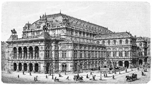
Opera theater in ViennaAntique illustration of Opera theater in Vienna
The Votive Church (Votivkirche) in ViennaAntique illustration of a The Votive Church (Votivkirche) in Vienna
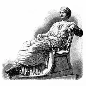
AgrippinaAntique illustration engraving of Agrippina
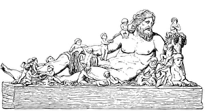
Resting NiloAntique illustration of a Resting Nilo
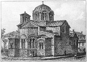
San Teodoros church in Athens
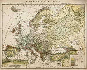
Rain map of EuropeAntique illustration of a rain map of Europe
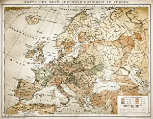
Population tightness map of Europe
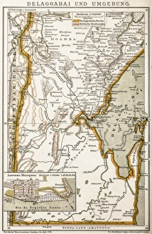
Maputo BayAntique map of Maputo Bay (BaAia de Maputo), formerly Delagoa Bay, BaAia da Lagoa (in Portuguese) is an inlet of the Indian Ocean on the coast of Mozambique
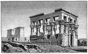
Temple of PhilaeAntique illustration of a Temple of Philae
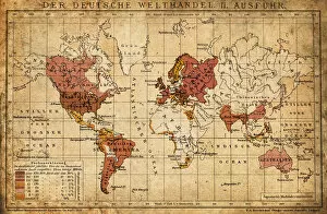
German world trade export map 1898Illustration engraving of the German world trade export map from 1898
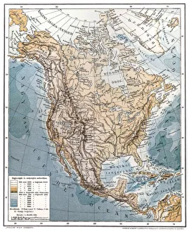
North AmericaAntique illustration of a North America
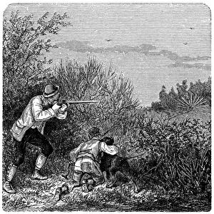
Bird huntingIllustration of a men with guns and dog hunting birds
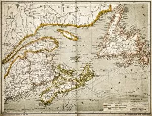
Eastern Canada and NewfoundlandIllustration of a Eastern Canada and Newfoundland
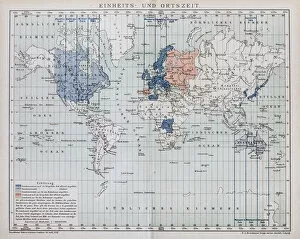
Local time world mapAntique illustration of a local time world map
Galla Placidias tomb in Ravennaillustration of a Galla Placidias tomb in Ravenna
Cathedral(Basilica) church of St. Martin, ToursCathedral church of St. Martin (Basilica of St. Martin), Tours, is a Roman Catholic basilica dedicated to Saint Martin of Tours, on whose tomb it was built
Sculpure of Jesus Christ at Church Wall Great St. Martin Church, Cologne - Germany
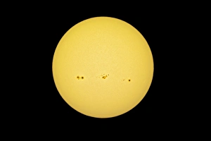
Sun with solar spots in the white light, yellow filter
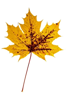
Yellow, autumn-coloured maple leaf -Acer- with brown spots
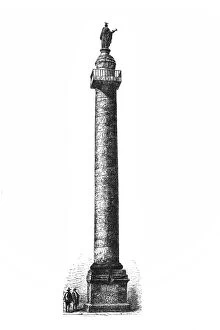
Trajans Column