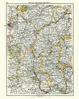
Antique map, Leicester, Warwick, Northampton, Oxford, Buckingham 19th Century
Vintage engraving of a Antique map, Leicester, Warwick, Northampton, Oxford, Buckingham. England 19th Century
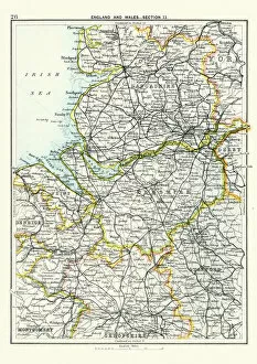
Antique map, Lancashire, Cheshire, Stafford, Liverpool, 19th Century
Vintage engraving of a Antique map, Lancashire, Cheshire, Stafford, Liverpool, Shropshire, Derby, England 19th Century
Paint supplies spread out on street
brushes, container, day, detail, gallons, high angle view, jars, nobody, objects, outdoor, paint, painting, pans, repetitive, rollers, still life, supplies, trays, wet, Henri Silberman, 86069275