mail_outline sales@mediastorehouse.com
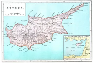
Map of CyprusVintage 19th Century map of Cyprus in the eastern Mediterranean Sea
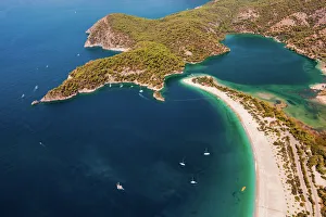
View of Oludeniz, TurkeyTo get this view you take the Lycian Way which is a pathway behind the Montana Pine Resort in OluDeniz in Turkey. It takes about 30 minutes
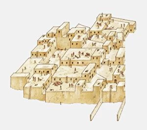
Catal Huyuk, ancient settlement in Anatolia, Turkey, from c. 6500 BC
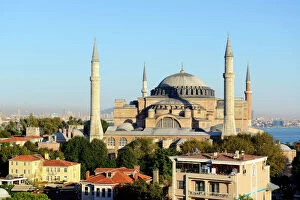
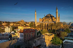
Hagia Sophia, Ayasofya, UNESCO World Heritage Site, European side, Istanbul, Turkey
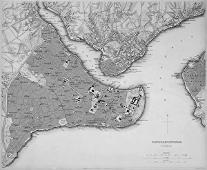
Antique map of Constantinople, present day Istanbul
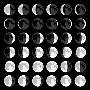
Moon Phase SequenceThere are eight phases in the moon. In order they are new Moon, waxing crescent, first quarter, waxing gibbous, full Moon, waning gibbous, third quarter and waning crescent
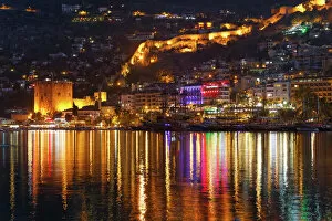
Kizil Kule, Red Tower, with the ramparts and the harbour, Alanya, Turkish Riviera, Province of Antalya, Mediterranean Region, Turkey
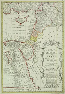
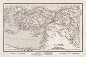
Antique map of the Middle East with Egypt, Syria, and Israel. Date unknown
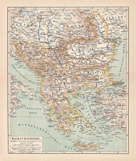
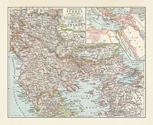
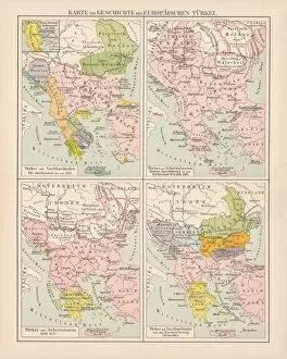
Balkan Peninsula in 1878, lithographAncient map Balkan. The political classification of the Balkan Peninsula after the Treaty of Berlin in 1878. Lithograph, published in 1878
Turkey Ottoman Empire map 1895Meyers Konversations-Lexikon. Ein Nachschlagewerk des allgemeinen Wissens, 5th edition 17 volumes Bibliographisches Institut - Leipzig 1895-1897
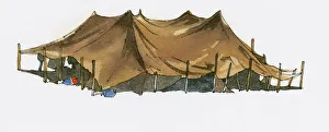
Illustration of Bedouin tent near Black Sea coast
Icmeler near Marmaris, Turkish Aegean, Turkey, Asia
Ottoman Empire, lithograph, published in 1878Ancient map of Ottoman Empire. Lithograph, published in 1878
Balloons flying over CappadociaHot air balloon flying over rock landscape at Cappadocia Turkey
Hot air balloon in the blue sky, Goreme, Cappadocia, Nevsehir Province, Central Anatolia Region, Turkey
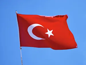
Turkish national flag
View of Marmaris, Bozburun Peninsula at back, the Aegean, Marmaris, Provinz Mugla, Aegais, Turkey
The Galata BridgeTurkish minare peak over the Galata Bridge. The Galata Bridge is a famous bridge in Istabul, full of resturaunts and cafe s. The bridge crosses a body of water called the Golden Horn
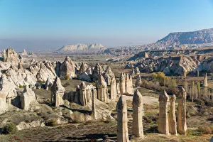
The Love valley CappadociaThe Love Valley in Goreme National Park (Goreme Milli Parklar in Turkish) UNESCO World Heritage Site
Balloons in cappadociaHot air balloon flying over cappadocia
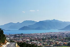
Paradise bayAerial view over Oludeniz in Mugla Province, South West coast of Turkey
Everning light shine over Hagia Sophia
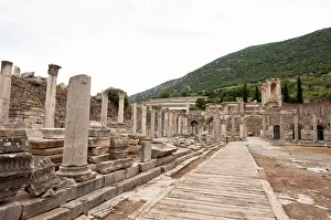
Commercial Agora in Ephesusview of the Agora from the The Gate of Mazeus and Mythridates. Being the most important trade center of Ephesus, Agora was built in the third century B.C
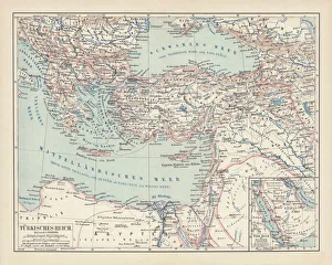
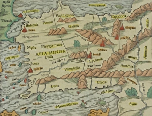
Antique map of Asia Minor
Colorful night light at Galata Bridge
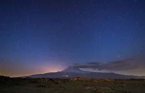
Night view of Mount Ararat with stars
Hot air ballooning in the sunrise in Cappadocia
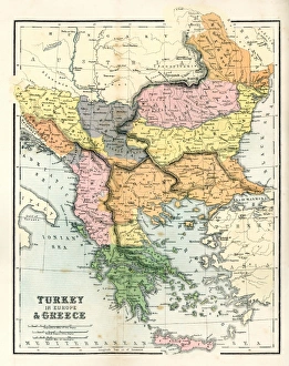
Historical map of the Ottoman Empire (Turkey), European part, 1897Historical map of European part of the Ottoman Empire (Turkey) at the end of the 19th century. Lithograph, published in 1897
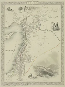
Antique map of Syria
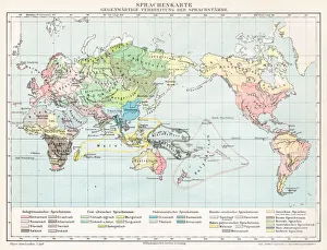
Lenguages of the world map 1895Meyers Konversations-Lexikon. Ein Nachschlagewerk des allgemeinen Wissens, 5th edition 17 volumes Bibliographisches Institut - Leipzig 1895-1897
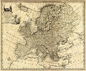
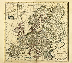
Antique Map of Europe 1744An engraved map of Europe with ornamental cartouche and relief shown pictorially by Emanuel Bowen 1744, London, Geographer to His Majesty
Antique Map of Europe, 1785An accurate map of Europe from the best authorities. London: C. Dilly & G. Robinson: 1785. Original size: 35.7 x 37.4 cm. Coloured, Inset: Spitsbergen, East and West Greenland, and Iceland
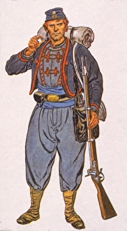
Meaghers ZouavesIllustration of one of Meaghers Zouaves, a member of the 69th New York regiment of volunteer Civil War soldiers, 1860s. Zouaves were soldiers who wore unusual uniforms
Illustration of flag of Turkey, with white crescent moon and five-pointed star on red field
Illustration of Damask Rose (Rosa damascena) grown in Isparta
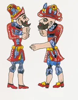
Illustration of Ottoman shadow puppets, Karagoz and Hacivat
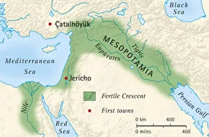
Digital illustration of the fertile crescent of Mesopotamia and Egypt and location of first towns
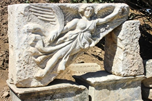
Statue of the goddess Nike, Ephesus, TurkeyStone carving of the goddess Nike at the ruins of the ancient city of Ephesus. The sports equipment company Nike, Inc. is named after the Greek goddess Nike
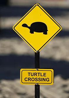
Yellow warning sign turtle crossing, turtles crossing the beach for laying their eggs, Manavgat, Turkey
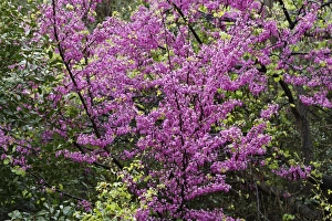
Flowering Judas Tree -Cercis siliquastrum-, Dilek National Park, Kusadasi, Aydin province, Aegean region, Turkey
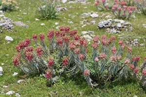
Flowering Myrtle Spurge -Euphorbia myrsinites-, Dilek National Park, Kusadasi, Aydin province, Aegean region, Turkey
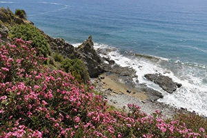
Flowering oleander -Nerium oleander- on the coast, Turkish Riviera, Alanya, Antalya province, Cilicia, Turkey
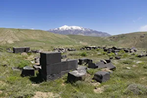
Ruins of the Urartian palace fortress of Kef Kalesi or Kefkalesi, volcano Mount Suphan or Suphan Dagi at the back, Adilcevaz, Bitlis Province, Eastern Anatolia Region, Anatolia, Turkey
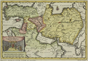
Antique map of Persia and the Middle East
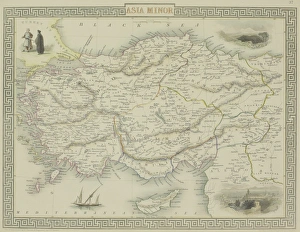
Antique map of Asia Minor, present day Turkey
Seleucid Empire, 3rd to 2nd century BC, published in 1861The Seleucid Empire was created after the death of Alexander the Great and dominated the Near East from the 3rd to 2nd century BC. Legend in Latin language
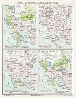
Ottoman Empire, 14th-19th century, lithograph, published in 1878Ancient map of the history of European Turkey, 15th - 19th century. Lithograph, published in 1878
Antique Map of GreeceAntique map of Greece from 1867