mail_outline sales@mediastorehouse.com
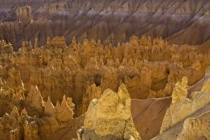
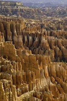
pinnacles from Sunset Point, Bryce Canyon N. PColorful sandstone hoodoos, spires and pinnacles from Sunset Point, fall, Bryce Canyon National Park, Utah
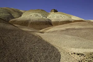
Bentonite Hills, Capitol Reef N. PColorful mounds of Bentonite Hills, layers of soft stone of various colors with color-banded, popcorn like clay surface, fall, Capitol Reef National Park, Utah
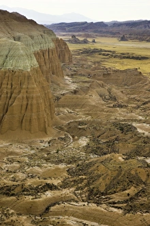
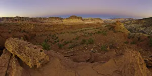
Upper Cathedral Valley, Capitol Reef N. P. NatiRugged landscape of arid Upper Cathedral Valley and sandstone buttes, Capitol Reef National Park, Utah
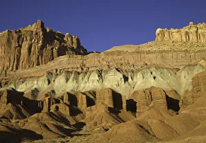
The Castle and Fluted Wall, Capitol Reef N. PThe Castle above Fluted Wall formations of multi-hued sandstone layers shaped by erosion, fall, Capitol Reef National Park, Utah
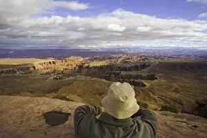
USA, Utah, Canyonlands National Park, man above canyon, rear viewGrand View Point, evening in Oct 2005
USA, Utah, Fisher Towers, moon behind Moenkopi and Cutler formations
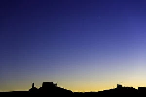
USA, Utah, Colorado Plateau, silhouettes of buttes and mesas at duskOct 2005
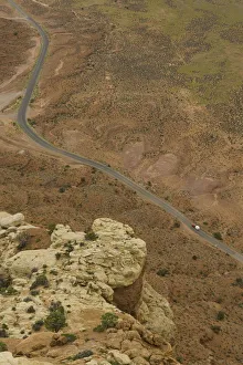
USA, Utah, SUV with trailer on desert highway, elevated viewThis dirt road follows undeveloped desert along the San Juan River, dividing Grand Gulch Primitive Area and Valley of the Gods, Oct 2005
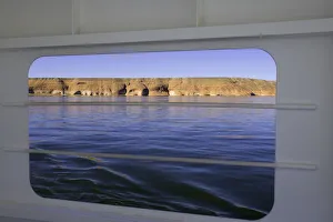
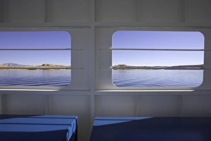
USA, Utah, Lake Powell and sandstone bluffs, view from ferry windowGlen Canyon National Recreation Area, Oct 2005
USA, Utah, Lake Powell, view from ferry windowGlen Canyon National Recreation Area, Oct 2005
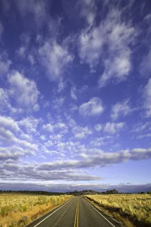
USA, Utah, Canyonlands National Park, cumulus clouds over roadwayautumn evening, Oct 2005
Sandstone pinnacles, Bryce Canyon N. PColorful sandstone hoodoos, spires and pinnacles, fall, Bryce Canyon National Park, Utah
Sandstone buttes, Capitol Reef N. PSweeping view of colorful sandstone peaks and buttes of Waterpocket Fold, and cumulus clouds in clear blue sky above arid desert, fall morning, Capitol Reef National Park, Utah
Panorama Point, Capitol Reef National ParkEvening landscape of red and yellow sandstone formations seen from Panorama Point, Capitol Reef National Park
Wall Street formationColorful sandstone walls of Wall Street formation, hoodoos, spires and pinnacles, Navajo Loop Trail, in Bryce Canyon National Park
Sandstone buttes and fins, Capitol ReefSprawling view of arid rugged desert and sandstone buttes and fins from Lower South Desert Overlook. Capitol Reef National Park
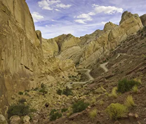
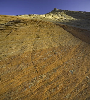
Waterpocket Fold, Capitol Reef National ParkSteep sandstone rocks of Waterpocket Fold near Burr Trail, Capitol Reef National Park, Utah
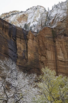
cottonwood trees, red sandstone walls, Zion N. PGolden cottonwood trees and red Navajo sandstone walls in fresh snow, fall, Zion Canyon, Zion National Park, Utah
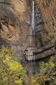
cottonwood trees, seasonal waterfall, Zion N. PYellow cottonwood trees and seasonal waterfall, and red sandstone walls of Zion Canyon, fall, Zion National Park, Utah
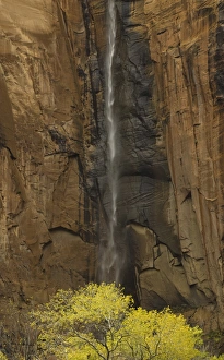
cottonwood and seasonal waterfall, Zion N. PYellow cottonwood tree and seasonal waterfall, and red sandstone walls of Zion Canyon, fall, Zion National Park, Utah
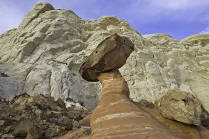
Fanciful toadstool shape of eroded sandstone, UtahFanciful toadstool shape of eroded red and white Navajo sandstone with harder layer protecting its top, fall, Paria River Rimrock Toadstools, Utah
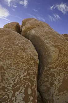
sandstone rock, Grand Staircase Escalante, UtahRichly patterened sandstone rock, fall evening, Paria Wilderness Area, Grand Staircase Escalante National Monument, Utah
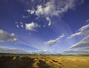
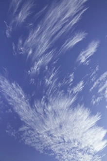
Cirrus clouds, UtahCirrus clouds floating in blue sky, fall evening, Grand Staircase Escalante National Monument, Utah
sandstone canyon walls, Zion National Park, UtahRed and yellow sandstone canyon walls, Zion National Park, Utah
USA, Utah, cars on dirt road climbing plateau in desert, autumnThis dirt road follows undeveloped desert along the San Juan River, dividing Grand Gulch Primitive Area and Valley of the Gods, Oct 2005
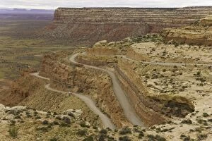
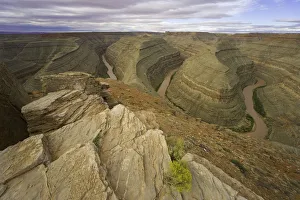
USA, Utah, Goosenecks State Park, San Juan River and canyon, autumnOct 2005
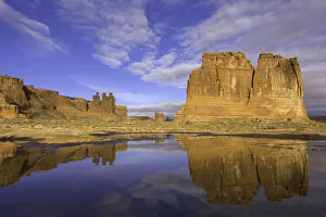
USA, Utah, Arches National Park, Courthouse Towers and pond, autumnThis pond was created by rainwater, morning in Oct 2005
Mutantnature2015 Colorado Plateau Utah
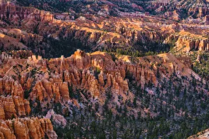
Bryce Canyon HoodosBryce canyon hoodos. tent rocks, fairy chimney, and spires protrudes from arid drainage base - badlands. Located in Bryce National Park, Utah
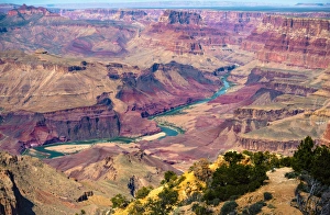
Colorado River ViewThe Colorado River (near Lake Mead) is one of the principal rivers of the Southwestern United States and northern Mexico (the other being the Rio Grande)
Trees on a Mountainside located near Zion National ParkThe view of a tree filled hillside along Navajo Lake, Utah. Deep within the Mountains. Selective color treatment enhances the various foliage and terrain
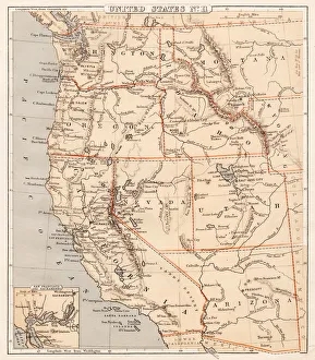
Pacific USA states map 1869Cornells Grammars-School Geography - S.S. Cornell - New York D. Appleton and Company 1869
Western Pacific USA states map 1856Colton and Fitchs Modern School Geography by George W. Fitch - New York 1856
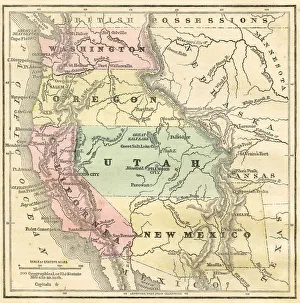
United States 1852 Map
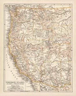
United States of America, West Coast, ithograph, published in 1878United States of America, States on the Pacific Ocean. Lithograph, published in 1878
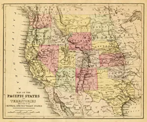
map of the Pacific states (California, Oregon, Washington) an territories with a part of central and souther states - USA (1883)
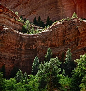
Red Rock outcrop along Taylor Creek Kolob Canyons area Zion National Park Utah. A high shelf layered with conifer and deciduous trees in a backlit catchlight
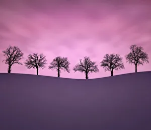
Moments TogetherSometimes you can find beauty in such frigid cold. Six intriguing trees atop a snowy rolling hillside at sunset in -10A'F weather. Located in rural Wisconsin
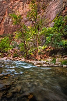
River Walk Zion National Park Virgin RiverThe River Walk. Cliffs and vegetation along Virgin River in Zion National Park in Utah. The amazing Virgin River meandering through the sandstone cliffs of Zion National Park Utah
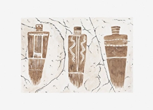
Rock art, Utah
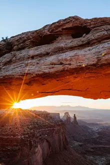
Mesa arch sunrise, Canyonlands national park, Utah, USA
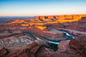
Sunrise at Dead Horse point, Canyonlands, USADead Horse point state park, Utah, USA
Sunset at Bryce Canyon National Park, Utah, USABryce Canyon National Park, Utah, USA
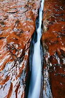
The Crack with water flowing, Zion, Utah, USARiver in Zion Canyon National Park, Utah, USA
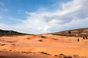
Coral Pink Sand Dunes State Park, Utah, USA
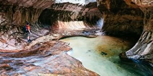
Man inside the Subway, Zion National park, USAThe Subway, Zion Canyon National Park, Utah, USA
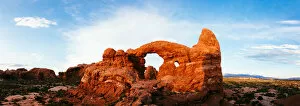
Turret arch at sunset, Arches NP, Utah, USAArches National park, Utah, USA
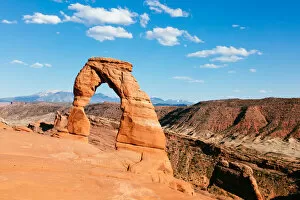
Delicate Arch, Arches National Park, Utah, USA