mail_outline sales@mediastorehouse.com
Choose a picture from our Images Dated 21st August 2016 Collection for your Wall Art and Photo Gifts
26 items
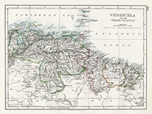
Venezuela and the Guayanas map 1897The World-Wide Atlas of Modern Geography, Political and Physical W. & A.K. Johnston - London 1897
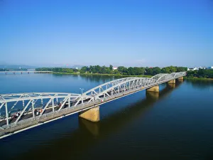
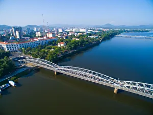
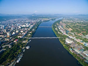
Trang Tien (or Truong Tien) bridge from above in Hue, Vietnam
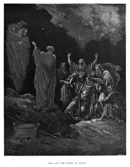
Saul and the witch of Endor 1870The Dore Gallery by Edmund Ollier - Cassel, Petter and Galpin (London-New York) 1870
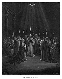
The descent of the spirit engraving 1870The Dore Gallery by Edmund Ollier - Cassel, Petter and Galpin (London-New York) 1870
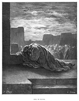
Ezra in prayer engraving 1870The Dore Gallery by Edmund Ollier - Cassel, Petter and Galpin (London-New York) 1870
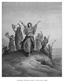
Japhthahs Daughter engraving 1870The Dore Gallery by Edmund Ollier - Cassel, Petter and Galpin (London-New York) 1870
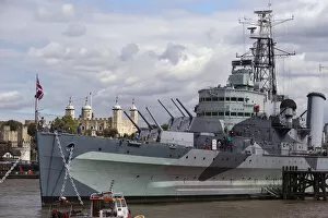
Europe, Uk, England, London, View Of Boat - Military Warship - HMS Belfast, A Royal Navy Light Cruiser, Permanently Moored In London On The River Thames An An Exhibit
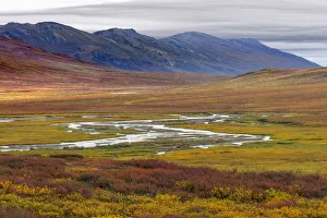
Landscape with tundra and mountain range in Brooks Range, Alaska, USAThe Brooks Range is a mountain range in far northern North America stretching some 700 miles (1, 100 km) from west to east across northern Alaska into Canadas Yukon Territory
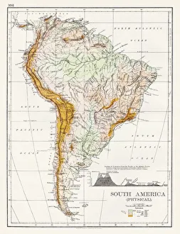
South America Physical map 1897The World-Wide Atlas of Modern Geography, Political and Physical W. & A.K. Johnston - London 1897
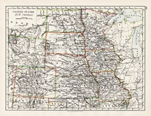
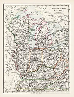
United States NW Central 1897The World-Wide Atlas of Modern Geography, Political and Physical W. & A.K. Johnston - London 1897
Canada map 1883The World-Wide Atlas of Modern Geography, Political and Physical W. & A.K. Johnston - London 1897
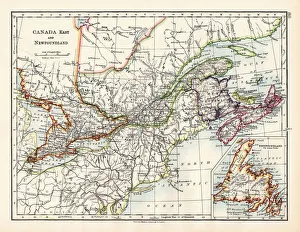
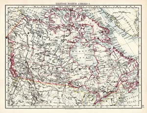
British North America map 1897The World-Wide Atlas of Modern Geography, Political and Physical W. & A.K. Johnston - London 1897
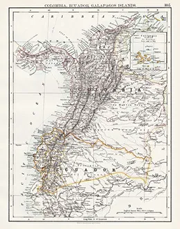
Colombia Ecuador Galapagos map 1897The World-Wide Atlas of Modern Geography, Political and Physical W. & A.K. Johnston - London 1897
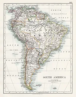
South America map 1897The World-Wide Atlas of Modern Geography, Political and Physical W. & A.K. Johnston - London 1897
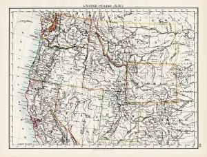
United States North West map 1897The World-Wide Atlas of Modern Geography, Political and Physical W. & A.K. Johnston - London 1897
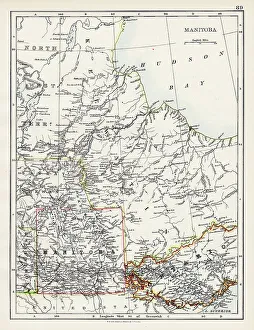
Manitoba map 1897The World-Wide Atlas of Modern Geography, Political and Physical W. & A.K. Johnston - London 1897
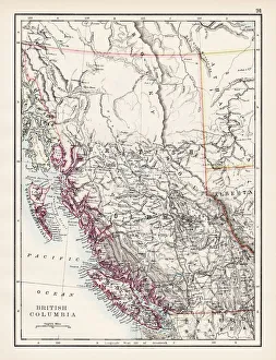
British Columbia map 1897The World-Wide Atlas of Modern Geography, Political and Physical W. & A.K. Johnston - London 1897
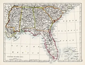
United States South East map 1897The World-Wide Atlas of Modern Geography, Political and Physical W. & A.K. Johnston - London 1897
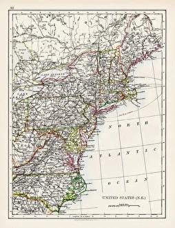
United States North East map 1897The World-Wide Atlas of Modern Geography, Political and Physical W. & A.K. Johnston - London 1897
United States North East Central map 1897The World-Wide Atlas of Modern Geography, Political and Physical W. & A.K. Johnston - London 1897
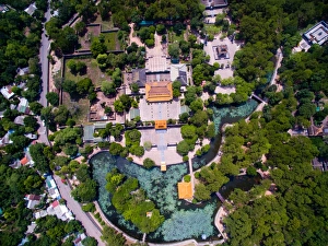
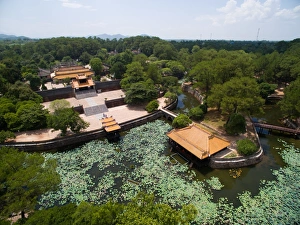
Tomb of Tu Duc emperor from above in Hue, Vietnam
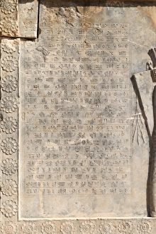
Part of a wall that contains a text in PersianA portion of the wall shows a long written in Persian. The wall is part of a building in the ancient city of Persepolis. Persepolis also known as Takht-e-Jamshid was the ceremonial capital of
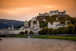
View of Salzach River and Skyline of the Historic Centre of Salzburg City, AustriaSalzburg is the fourth-largest city in Austria and the capital of the federal state of Salzburg. Salzburgs Old Town (Altstadt)