
Home > The Magical World of Illustration > Palmer Illustrated Collection
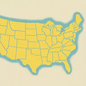
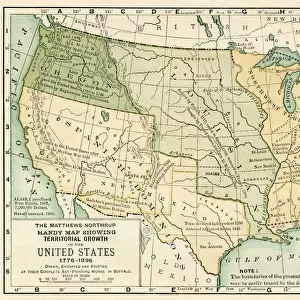
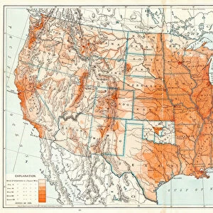
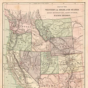
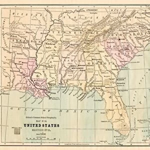
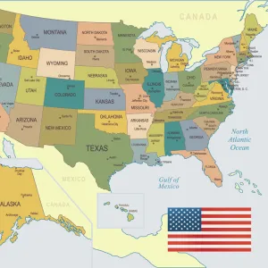
USA states map 1875

USA states map 1875


Photo Prints
Jigsaw Puzzles
Poster Prints
Cards
Framed Photos
Home Decor
Mounted Prints
Canvas Prints
Fine Art Prints
Metal Prints


We accept all major credit cards

Wall Art and Photo Gifts from Fine Art Storehouse

USA states map 1875

The Independent Course Comprehensive Geography by James Monteith, A.S. Barnes & Co, New York & Chicago 1875

THEPALMER

Media ID 13612191

© This content is subject to copyright

Globe Navigational Equipment Michigan Minnesota Paper Wisconsin


FEATURES IN THESE COLLECTIONS

> The Magical World of Illustration > Palmer Illustrated Collection

> Map > Historical Maps

> Map > USA Maps

> Map


MADE IN THE UK
Safe Shipping with 30 Day Money Back Guarantee

FREE PERSONALISATION*
We are proud to offer a range of customisation features including Personalised Captions, Color Filters and Picture Zoom Tools

SECURE PAYMENTS
We happily accept a wide range of payment options so you can pay for the things you need in the way that is most convenient for you

* Options may vary by product and licensing agreement. Zoomed Pictures can be adjusted in the Basket.


redeem
Beautiful Photo Prints and Gifts
image
Professionally Printed
inventory
Photo Prints are in stock
thumb_up
Professional quality finish
diamond
Made with high-grade materials
inventory_2
Carefully packed to aid safe arrival


Related Images


Map of the United States
States USA map 1875
States USA map 1875
Map of usa north east states 1900
USA Southern states map 1889
North America Green Map with United States, Canada, Mexico, geographical borders and rivers
Map of USA 1898
Map of USA 1898
Map of United States 1899
Map of north states USA 1896
Political Map of United States 1895
Digital illustration of world map
Pacific States USA map 1881
Souther States USA map 1881

+

Shipping

+

Choices

+

Guaranteed


Related Collections


Map
Map
Browse 9,862 Prints
Palmer Illustrated Collection
Browse 2,535 Prints
USA Maps
USA Maps
Browse 723 Prints
Historical Maps
Historical Maps
Browse 3,316 Prints