Home > The Magical World of Illustration > Palmer Illustrated Collection
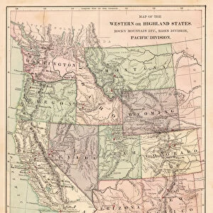
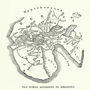
Polar projection of the world map 1856

![]()
Wall Art and Photo Gifts from Fine Art Storehouse
Polar projection of the world map 1856
Colton and Fitchs Modern School Geography by George W. Fitch - New York 1856
THEPALMER
Media ID 13612307
© Roberto A Sanchez
62990 Antarctica Arctic Business Finance And Industry Cartographer Earth East East Asia Equator Line Globe Man Made Object Globe Navigational Equipment Hemisphere North Pole Planet Earth Polar Climate Pole South Pole Space Time Zone Topography World Map
FEATURES IN THESE COLLECTIONS
> The Magical World of Illustration
> Palmer Illustrated Collection
> Map
> Historical Maps
> Map
MADE IN THE UK
Safe Shipping with 30 Day Money Back Guarantee
FREE PERSONALISATION*
We are proud to offer a range of customisation features including Personalised Captions, Color Filters and Picture Zoom Tools
SECURE PAYMENTS
We happily accept a wide range of payment options so you can pay for the things you need in the way that is most convenient for you
* Options may vary by product and licensing agreement. Zoomed Pictures can be adjusted in the Basket.