mail_outline sales@mediastorehouse.com
3,748 Photographic Prints
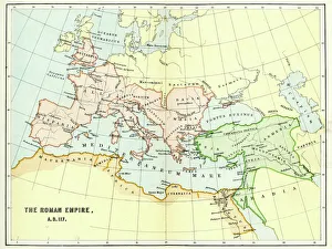
Map of the Roman Empire in AD 117Vintage engraving of a Map of the Roman Empire in AD 117
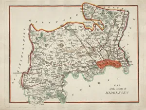
Antique Map of MiddlesexAn antique map of Middlesex engraved by R. Scott and published by Archibald Fullarton and Co. Glasgow. c. 1833. folding copy, later hand colouring
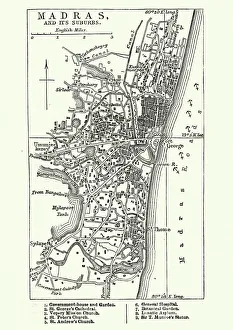
Map of Madras (Chennai), India, 19th CenturyVintage engraving of Map of Madras (Chennai), India, 19th Century
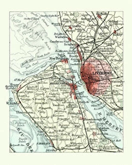
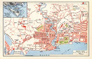
Antique map, Liverpool and Birkenhead, England, 19th CenturyVintage engraving of a Antique map, Liverpool and Birkenhead, England, 19th Century
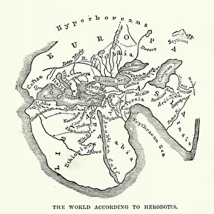
Earth map according to HerodotusAntique illustration of a earth map according to Herodotus
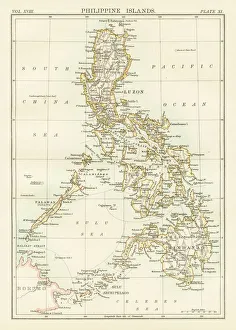
Philippines map 1885Encyclopedia Britannica 9th Edition New York Charles Scribners and Sons 1885 Vol XVIII
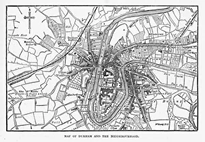
Map of the City of Durham, England Victorian Engraving, 1840Very Rare, Beautifully Illustrated Antique Engraving of Map of the City of Durham, England Victorian Engraving, 1840. Source: Original edition from my own archives
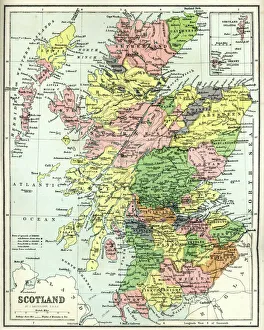
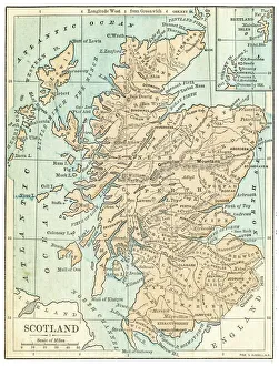
Antique map of Scotland, 1864
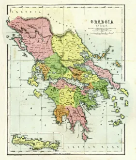
Antique map of Ancient Greece, 1864
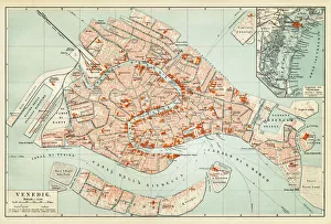
Map of Venice 1897Map of the city of Venice, Italy
Scotland map 1875The Independent Course Comprehensive Geography by James Monteith, A.S. Barnes & Co, New York & Chicago 1875
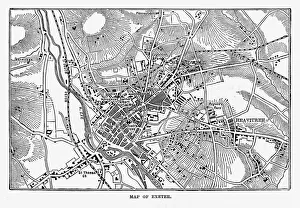
Map of Exeter in Devon, England Victorian Engraving, 1840Very Rare, Beautifully Illustrated Antique Engraving of Map of Exeter in Devon, England Victorian Engraving, 1840. Source: Original edition from my own archives
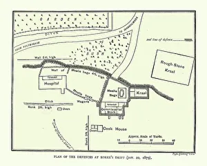
Plan of the Defence of Rorke's Drift, Anglo-Zulu WarVintage engraving of Plan of the Defence of Rorke's Drift, was an engagement in the Anglo-Zulu War. The successful British defence of the mission station of Rorke's Drift
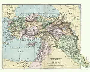
Map of Turkey in Asia, 19th CenturyVintage engraving of a Map of Turkey in Asia, 19th Century
Ancient rome, regions map of RomeIllustration from 19th century
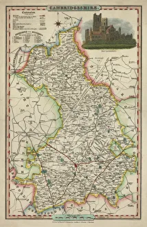
Antique map of CambridgeshireAn antique map of Cambridgeshire 1840.ašJames Pigot (1794-1842)aš showing the whole county and all its major towns and cities.Pigot started as an engraver for Deans Manchester Directory
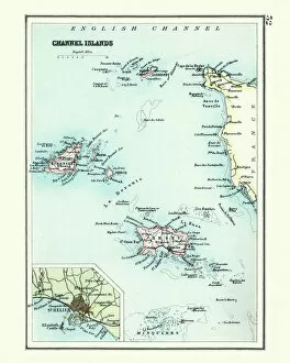
Antique map, Channel Island, Jersey, Guernsey, Alderney 19th CenturyVintage engraving of a Antique map, Channel Island, Jersey, Guernsey, Alderney 19th Century with detail of St Helier
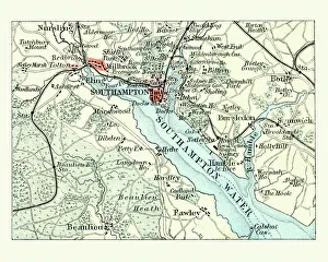
Antique map, Southampton, England, 19th CenturyVintage engraving of a Antique map Southampton, , England, 19th Century
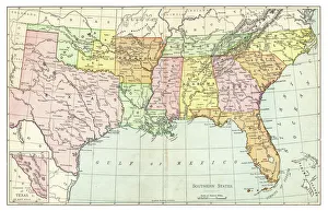
Map of Southern States USA 1895The Rand-McNally Grammar School Geography 1895 - Chicago & New York
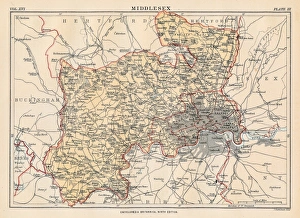
Middlesex map 1883Encyclopedia Britannica 9th Edition New York Samuel L. Hall 1883 Vol XVI
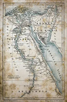
Map of EgyptIllustration of a Map of Egypt
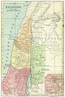
Palestine map 1875The Independent Course Comprehensive Geography by James Monteith, A.S. Barnes & Co, New York & Chicago 1875
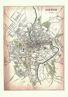
Antique Map of Norwich, England, 1880Vintage Antquie Map of the city of Norwich, Norfolk, England in 1880
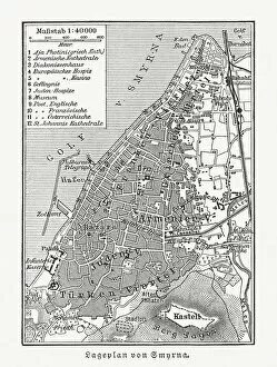
Historical city map of Smyrna (Izmir), Turkey, woodcut, published 1897Historical city map of Smyrna (Izmir), Turkey. Wood engraving, published in 1897
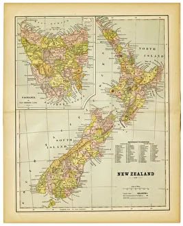
map of new zealand 1883map of new zealand and tasmania inset- 1883
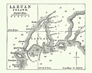
Map of Labuan Island, Malaysia, 19th CenturyVintage engraving of Map of Labuan Island, Malaysia, 19th Century
Map of the Ancient World according to HerodotusVintage engraving of a Map of the Ancient World according to Herodotus. Herodotus was a Greek historian who was born in Halicarnassus, Caria and lived in the fifth century BC
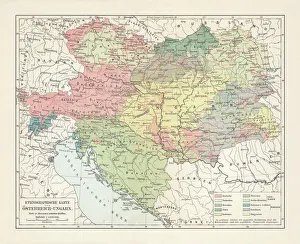
Ethnological map of the Austro-Hungarian Empire, lithograph, published in 1897Ethnological map of the Austro-Hungarian Empire. Lithograph, published in 1897
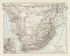
Map of South Africa 1900Meyers hand-Atlas Leipzig und Wien Verlag des Bibliographischen Instituts 1900
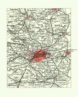
Antique map, Manchester, England, 19th CenturyVintage engraving of a Antique map, Manchester, England, 19th Century
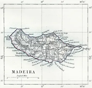
Madeira island map 1883Encyclopedia Britannica 9th Edition New York Samuel L. Hall 1883 Vol XV
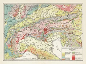
Geological map of the European Alps, lithograph, published in 1897Geological map of the European Alps. Lithograph, published in 1897
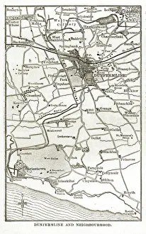
Victorian Map of Dunfermline, Scotland. Engraving, Circa 1840Very Rare, Beautifully Illustrated Antique Engraving of Victorian Map of Dunfermline, Scotland from Our Own Country, Great Britain, Descriptive, Historical, Pictorial. Published in 1880
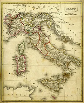
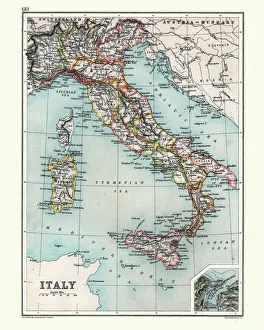
Antquie Map of ItalyVintage map of Italy fron 1837
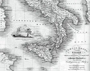
Vintage map of Magna Graecia, showing the settlements of the ancient greeks in Italy. Magna GrA|cia is the name of the coastal areas of Southern Italy on the Tarentine Gulf that was extensively
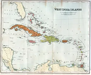
Vintage map of the West India Islands 1860s
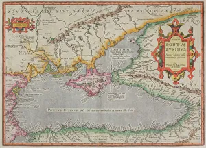
Antique map of the Black Sea and surrounding lands
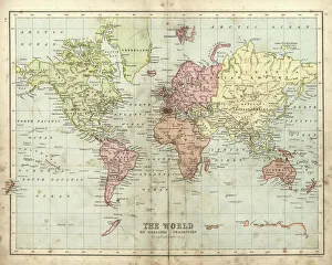
Antique map of the world, 1873Vintage engraving of a Victorian Antique map of the world, 1873
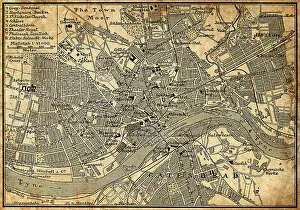
Map of Newcastle Upon TyneAntique illustration of old Newcastle Upon Tyne map
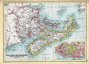
Old Map of Nova Scotia and New Brunswick, Prince Edward Island, detail of Halifax, 1890s, 19th CenturyVintage illustration Old Map of Nova Nova Scotia and New Brunswick, Prince Edward Island, detail of Halifax, 1890s, 19th Century
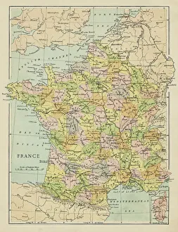
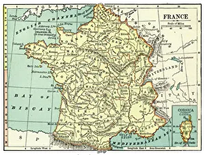
Map of FranceMarcus Ward's Home Atlas - London, 1894
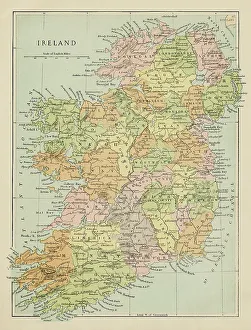
Map of IrelandMarcus Ward's Home Atlas - London, 1894
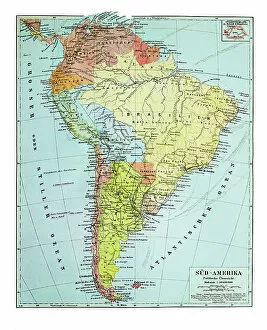
Old map of South America continentAntique Illustration. Copyright has expired on this artwork. From my own archives, digitally restored
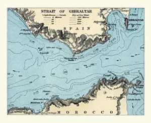
Antique map, Sea chart of Strait of Gibraltar, Victorian 1890s, 19th Century
Map of Singapore 1898 Original edition from my own archives Source : Brockhaus 1898
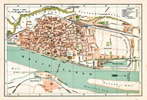
Antique map of Mainz Germany 1896Map of Mainz Germany 1896 Original edition from my own archives Source : Brockhaus 1896
Antique Map of Italy, with detail of straits of Messina, 19th Century
Map of France 1889Comprehensive Geography by James Monteith - American Book Company 1882, 1889