mail_outline sales@mediastorehouse.com
3,716 Photographic Prints
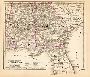
Alabama Florida Georgia map 1881Coltons Common School Geography 1881 New York Sheldon and Co
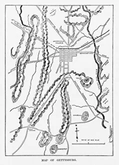
Battle of Gettysburg Map, July 3, 1863 Civil War EngravingEngraving of the Map of the Battle of Gettysburgs, Pennsylvania, July 3, 1863 Civil War Engraving from Famous Leaders and Battle Scenes of the Civil War, Published in 1864
Old Map ElementsOld map icons, eps 9
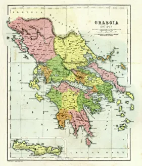
Antique map of Ancient Greece, 1864
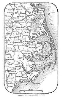
Map of Pamlico and Albemarle SoundsVintage engraving from 1863 of a map of Map of Pamlico and Albemarle Sounds at the time of the American Civil War
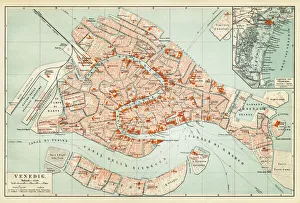
Map of Venice 1897Map of the city of Venice, Italy
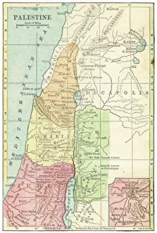
Palestine map 1875The Independent Course Comprehensive Geography by James Monteith, A.S. Barnes & Co, New York & Chicago 1875
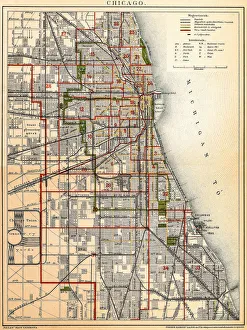
Chicago mapAntique illustration of a Chicago map
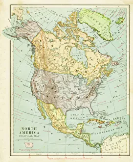
Map of North America 1899Maurys Geographical Series Manual of Geography - New York 1899
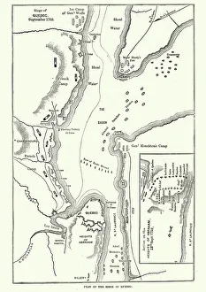
Map of the Siege of Quebec, Canada 1759Vintage engraving of a Map of the Siege of Quebec, Canada 1759. The Battle of the Plains of Abraham, also known as the Battle of Quebec was a pivotal battle in the Seven Years War
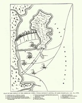
Map of the Battle of Valcour Island, 1776Vintage engraving of Map of the Battle of Valcour Island, 1776. The naval Battle of Valcour Island, also known as the Battle of Valcour Bay, took place on October 11, 1776, on Lake Champlain
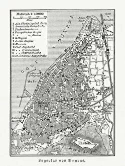
Historical city map of Smyrna (Izmir), Turkey, woodcut, published 1897Historical city map of Smyrna (Izmir), Turkey. Wood engraving, published in 1897
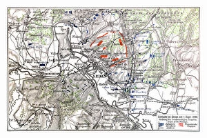
Map of Battle of Sedan, it was fought during the Franco-Prussian War from 1 to 2 September 1870Illustration of a Battle of Sedan was fought during the Franco-Prussian War from 1 to 2 September 1870. It resulted in the capture of Emperor Napoleon III and large numbers of his troops
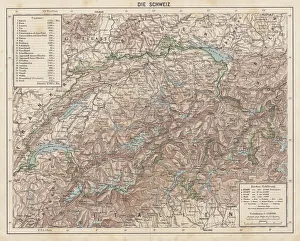
Switzerland, Topographic map, published in 1881Topographic map of Switzerland. Facsimile, published in 1881
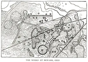
woodcut map illustration of Newark Earthworks, OhioWoodcut map of Newark Earthworks, Ohio, USA. Built during Hopewell culture. 1889 facsimile of 1862 map in Prehistoric Man by Daniel Wilson
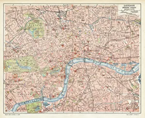
London city map 1895Meyers Konversations-Lexikon. Ein Nachschlagewerk des allgemeinen Wissens, 5th edition 17 volumes Bibliographisches Institut - Leipzig 1895-1897
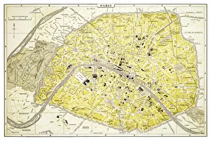
Map of Paris 1894map/plan of the city of Paris, France
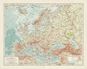
Topographic map of Europe, lithograph, published in 1897Topographic map of Europe. Lithograph, published in 1897
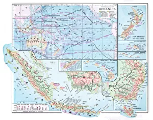
Map of Oceania 1877Warrens Common School Geography 1877
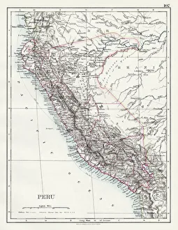
Peru map 1897The World-Wide Atlas of Modern Geography, Political and Physical W. & A.K. Johnston - London 1897
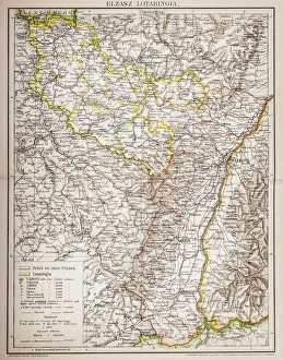
Alsace-Lorraine map 1880Illustration of a Alsace-Lorraine map 1880
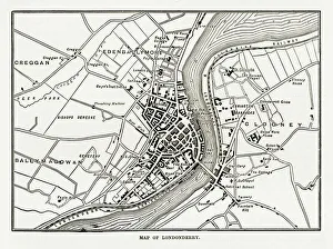
Map of Londonderry, Derry, Donegal, Northern Ireland, Victorian Engraving, 1840Very Rare, Beautifully Illustrated Antique Engraving of Map of Londonderry, Derry, Donegal, Northern Ireland, Victorian Engraving, 1840. Source: Original edition from my own archives
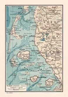
Northern Friesland (Nordfriesland), and islands, Schleswig-Holstein, Germany, lithograph, published 1887North Frisian Islands and Northern Friesland (Nordfriesland), the northernmost district of Germany, part of the state of Schleswig-Holstein. Lithograph, published in 1887
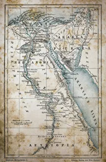
Map of EgyptIllustration of a Map of Egypt
Cluj Napoca, romania mapIllustration of a Cluj Napoca, romania map
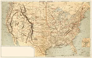
Map of United States 1869Cornells Grammars-School Geography - S.S. Cornell - New York D. Appleton and Company 1869
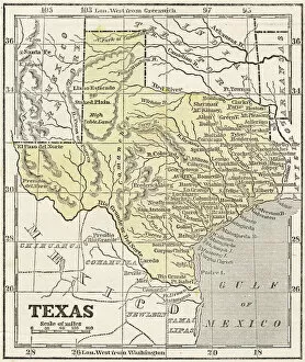
Map of Texas 1855System of Geography for the use of schools by Sidney E. Morse - Published by Harper & Brothers - New York 1855
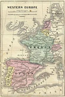
France Spain Portugal map 1856Colton and Fitchs Modern School Geography by George W. Fitch - New York 1856
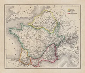
Gaul in the time of Julius Caesar, published in 1867Gaul in the time of Roman politican Gaius Iulius Caesar (100 - 44 BC). Steel engraving with hand-colored borderlines and Latin legend, published in 1867
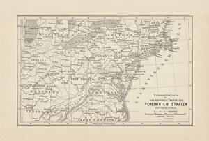
Map of Northeast United States, published in 1882Map of the Northeast United States of America. Wood engraving, published in 1882
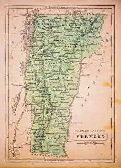
Vermont 1852 Map
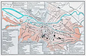
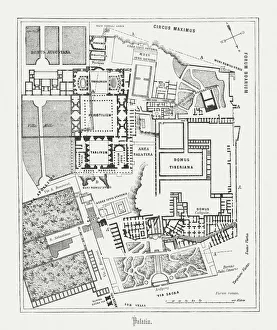
Floor plan of Palatine Hill in Rome, published in 1878Floor plan of the archaeological remains of the Palatine Hill in Rome. The Palatine Hill (Latin: Mons Palatinus, Italian: Monte Palatino)
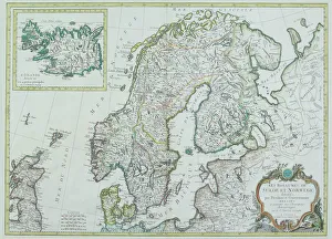
Map of Scandinavia
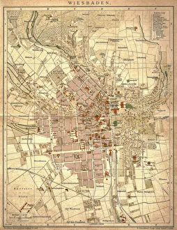
Wiesbaden, germanyAntique illustration of a Wiesbaden, Germany from 1898
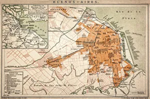
Buenos Aires mapAntique engraving map of Buenos Aires
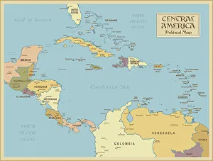
A vintage Central America Political MapCentral America is the thin section of land that links the North American continent with the South American continent. Geographically part of North America, it is made up of seven small
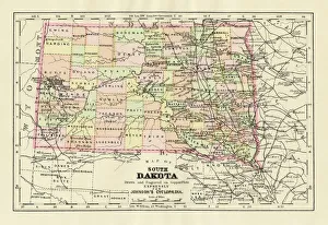
Map of South Dakota 1894Johnsons Universal Cyclopedia - Volume IV New York - A. J. Johnson Company 1894
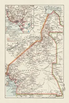
Topographic map of Cameroon, lithograph, published in 1897Topographic map of Cameroon, during the German colonial era at the end of the 19th century. Lithograph, published in 1897
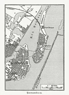
Historical city map of Recife, Pernambuco, Brazil, wood engraving, published 1897Historical city map of Recife, Pernambuco, Brazil. Wood engraving, published in 1897
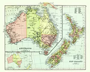
Antique map of Australia, New Zealand, 1897, late 19th CenturyVintage engraving of a Antique map of Australia, New Zealand, 1897, late 19th Century
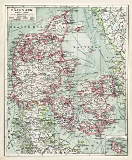
Map of Denmark 1900Meyers hand-Atlas Leipzig und Wien Verlag des Bibliographischen Instituts 1900
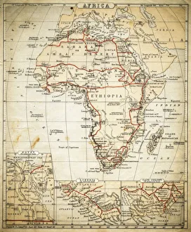
Africa map of 1869Cornells Grammar School Geography By S.S. Cornell - New York 1869
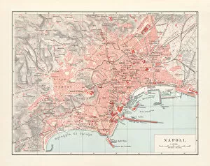
City map of Naples (Italian: Napoli), Italy, lithograph, published 1897City map of Naples (Italian: Napoli), Campania, Italy. Lithograph, published in 1897
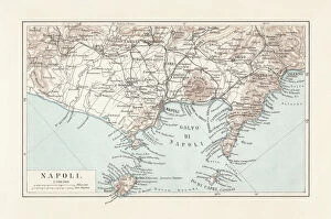
Map of Naples and surrounding, Campania, Italy, lithograph, published 1897Topographic map of Naples (Italian: Napoli) and surrounding, Campania, Italy. Lithograph, published in 1897
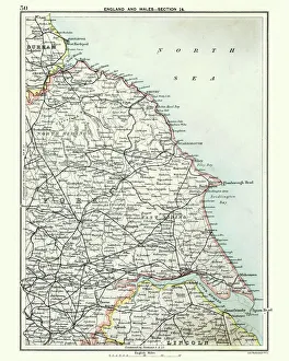
Antique map, North and East Yorkshire 19th CenturyVintage engraving of a Antique map, North and East Yorkshire 19th Century
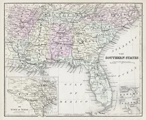
Map of Southern States USA 1877Warrens Common School Geography 1877
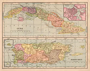
Cuba and Puerto Rico map 1898
Bosnia and Montenegro map 1893Illustration of a Bosnia and Montenegro map 1893