mail_outline sales@mediastorehouse.com
3,747 Jigsaw Puzzles
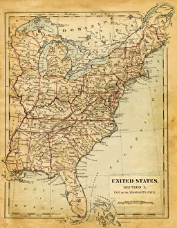
Map of USA - East of Mississippi river 1876Maurys Geographical Series - The Word we live in by M.F. Maury LLD - New York and Baltimore 1876
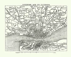
Map of Liverpool and its environs, England, 1870sVintage engraving of Map of Liverpool and its environs, England, 1870s, 19th Century
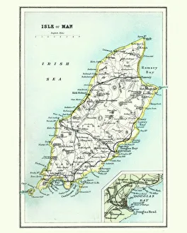
Antique map, Isle of Man 19th CenturyVintage engraving of a Isle of Man 19th Century with detail of Douglas
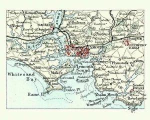
Antique map, Plymouth and Devonport, England, 19th CenturyVintage engraving of a Antique map, Plymouth and Devonport, England, 19th Century
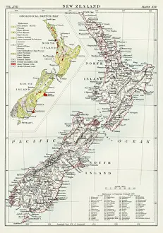
New Zealand map 1884Encyclopedia Britannica 9th Edition New York Charles Scribners and Sonsl 1884 Vol XVII
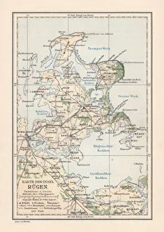
Map of RAOEgen, Baltic Sea, largest island of Germany, lithographMap of RAOEgen - Germanys largest island in the Baltic Sea. Lithograph, published in 1884
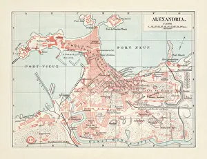
City map of Alexandria, Egypt, lithograph, published in 1897City map of Alexandria, Egypt. Lithograph, published in 1897
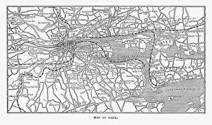
Map of Cork, County Cork, Ireland Victorian Engraving, 1840Very Rare, Beautifully Illustrated Antique Engraving of Map of Exmoor, England Victorian Engraving, 1840. Source: Original edition from my own archives. Copyright has expired on this artwork
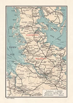
Map of Schleswig-Holstein, northernmost state of Germany, lithograph, published 1887Map of Schleswig-Holstein, northernmost state of Germany. Lithograph, published in 1887
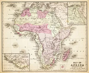
Map of Africa 1883Warrens Common School Geography
France Spain Portugal map 1856Colton and Fitchs Modern School Geography by George W. Fitch - New York 1856
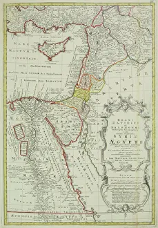
Antique map of the Middle East with Egypt, Syria, and Israel. Date unknown
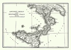
Map of Ancient Sicily and Southern ItalyVintage engraving of a Map of Ancient Sicily and Southern Italy
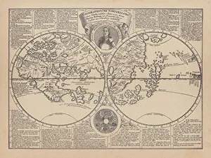
World map by Martin Behaim, 1492, wood engraving, published 1884World map by Martin Behaim, 1492. Woodcut engraving from my archive, published in 1884
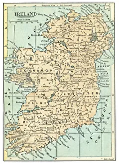
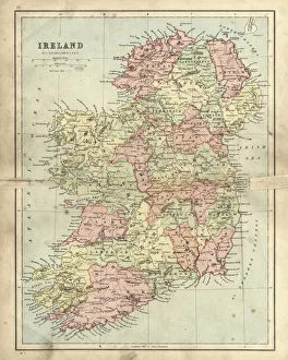
Ireland map 1875The Independent Course Comprehensive Geography by James Monteith, A.S. Barnes & Co, New York & Chicago 1875
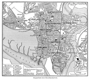
Southampton England map 1895Meyers Konversations-Lexikon. Ein Nachschlagewerk des allgemeinen Wissens, 5th edition 17 volumes Bibliographisches Institut - Leipzig 1895-1897
Antique damaged map of Ireland in the 19th CenturyVintage engraving of a Antique damaged map of Ireland in the 19th Century, 1873
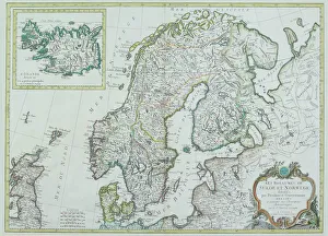
Map of Scandinavia
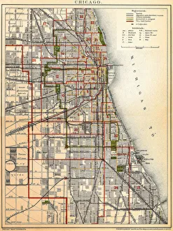
Chicago mapAntique illustration of a Chicago map
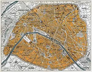
City map of ParisAntique illustration of a City map of Paris
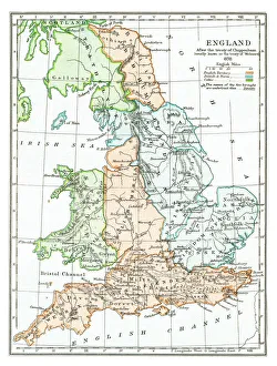
Old map of England after treaty of Chippenham in 878Antique Illustration, Copyright has expired on this artwork. From my own archives, digitally restored. The Battle of Chippenham was a January 878 battle between a Viking army led by Guthrum
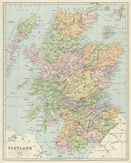
Old map of ScotlandAntique Illustration. Copyright has expired on this artwork. From my own archives, digitally restored
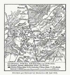
Map of the Battle of Waterloo, Belgium, 18 June 1815Topographic map of the Battle of Waterloo, Belgium. The defeat of the French army under the command of Napoleon Bonaparte on 18 June 1815 marked the end of the Napoleonic Wars
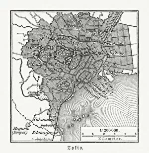
Historical city map of Tokyo, Japan, woodcut, published 1897Historical map of Tokyo, capital city of Japan. Wood engraving, published in 1897
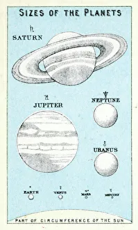
Sizes of the PlanetsVintage engraving showing the sizes of the planets, 1891
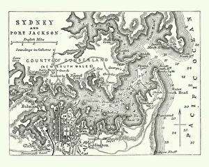
Map of Sydney and Port Jackson, Australia, 19th CenturyVintage engraving of Map of Sydney and Port Jackson, Australia, 19th Century
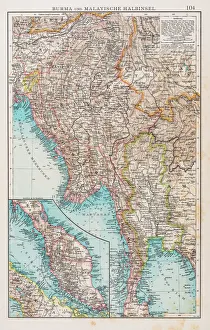
Map of Burma and Malay Peninsula 1896Andres Allgemeiner Handatlas - Bielefeld und Leipzig 1896
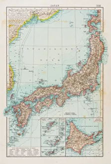
Map of Japan 1896Andres Allgemeiner Handatlas - Bielefeld und Leipzig 1896
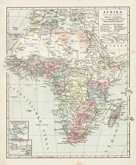
Map of Africa 1900Meyers hand-Atlas Leipzig und Wien Verlag des Bibliographischen Instituts 1900
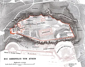
Map of the Acropolis in AthensIllustration from 19th century
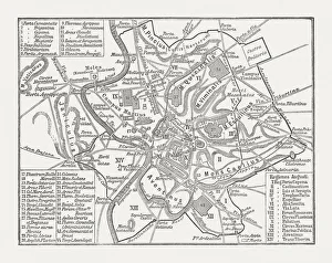
City map of ancient Rome, wood engraving, published in 1878City map of ancient Rome at the time of Emperor Augustus (63 BC - 14 AD). Woodcut engraving, published in 1878
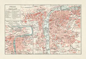
Historical city map of Prague, Czech Republic, lithograph, published 1897Historical city map of Prague, capital and largest city of Czech Republic. Lithograph, published in 1897
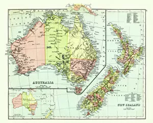
Antique map of Australia, New Zealand, 1897, late 19th CenturyVintage engraving of a Antique map of Australia, New Zealand, 1897, late 19th Century
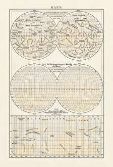
Historical map of planet Mars, lithograph, published in 1897. Lithograph, published in 1897
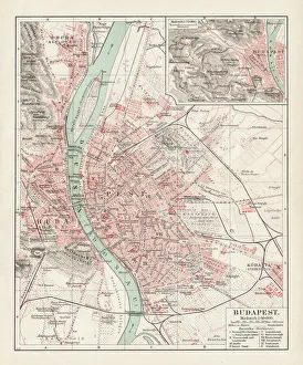
Map of Budapest 1900Meyers hand-Atlas Leipzig und Wien Verlag des Bibliographischen Instituts 1900
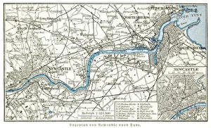
Newcastle upon Tyne city map 1895Meyers Konversations-Lexikon. Ein Nachschlagewerk des allgemeinen Wissens, 5th edition 17 volumes Bibliographisches Institut - Leipzig 1895-1897
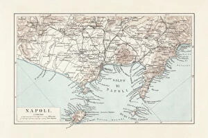
Map of Naples and surrounding, Campania, Italy, lithograph, published 1897Topographic map of Naples (Italian: Napoli) and surrounding, Campania, Italy. Lithograph, published in 1897
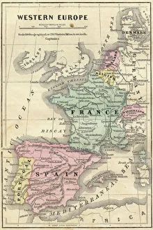
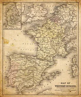
western europe map 1883a map of Western europe from 1883
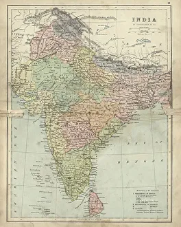
Antique damaged map of India 19th CenturyVintage engraving of a Antique damaged map of India in the 19th Century, 1873
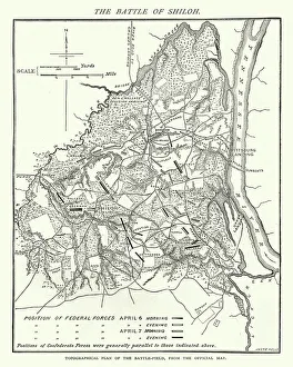
American Civil War, Map of Battle of ShilohVintage engraving of the Battle of Shiloh also known as the Battle of Pittsburgh Landing, was a major battle in the Western Theater of the American Civil War, fought April 6a'7, 1862
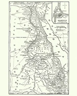
Map of Sudan, late 19th CenturyVintage engraving of a Map of Sudan, late 19th Century
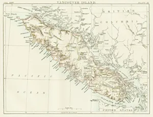
Vancouver island map 1885Encyclopedia Britannica 9th Edition New York Charles Scribners and Sons 1885 Vol XXIV
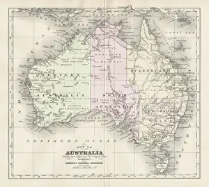
Australia map 1893Johnsonas Universal Cyclopedia - Charles Kendall - New York 1893
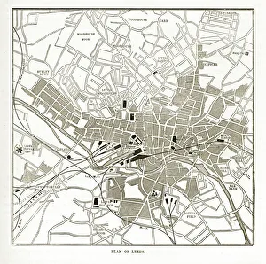
Victorian Map of Leeds, England Engraving, Circa 1840Very Rare, Beautifully Illustrated Antique Engraving of Victorian Map of Leeds, England from Our Own Country, Great Britain, Descriptive, Historical, Pictorial. Published in 1880
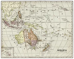
Oceania map 1889Indiana Educational Series The Complete Geography - Indianapolis 1889
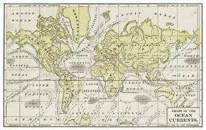
Chart of ocean currents 1889Indiana Educational Series The Complete Geography - Indianapolis 1889
Danube riverIllustration of a Danube river
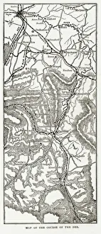
Map of the River Dee, Wales Victorian Engraving, Circa 1840Very Rare, Beautifully Illustrated Antique Engraving of Map of the Course of the River Dee, Wales Victorian Engraving, 1840 from Our Own Country, Great Britain, Descriptive, Historical, Pictorial