mail_outline sales@mediastorehouse.com
3,748 Poster Prints
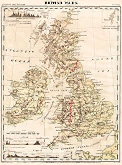
British Isles map 1867Guyots Geographical Series The Earth and its inhabitants 1867 New York
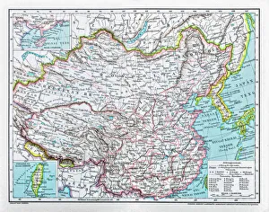
China mapillustration of a South Eastern Asia map
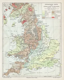
England and wales map 1895Meyers Konversations-Lexikon. Ein Nachschlagewerk des allgemeinen Wissens, 5th edition 17 volumes Bibliographisches Institut - Leipzig 1895-1897
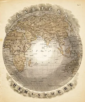
World eastern hemispheres 1883Warrens Common School Geography
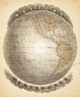
World western hemispheres 1883Warrens Common School Geography
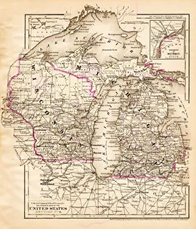
Wisconsin Michigan map 1881Coltons Common School Geography 1881 New York Sheldon and Co
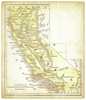
Old map of California 1856Colton and Fitchs Modern School Geography by George W. Fitch - New York 1856
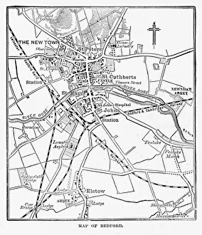
Map of the City of Bedford, England Victorian Engraving, 1840Very Rare, Beautifully Illustrated Antique Engraving of Map of the City of Bedford, England Victorian Engraving, 1840. Source: Original edition from my own archives
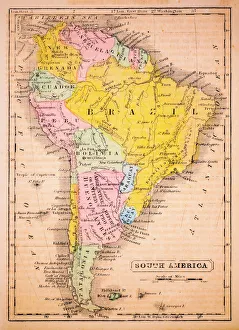
South America 1852 Map
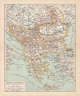
Balkan Peninsula in 1878, lithographAncient map Balkan. The political classification of the Balkan Peninsula after the Treaty of Berlin in 1878. Lithograph, published in 1878
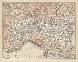
Ancient map of Northern Italy, lithograph, published in 1876Ancient map of Northern Italy. Lithograph, published in 1876
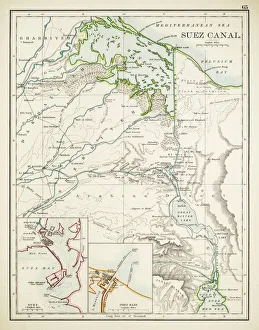
Map of Suez Canal 1897
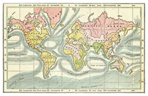
Ocean currents map 1875The Independent Course Comprehensive Geography by James Monteith, A.S. Barnes & Co, New York & Chicago 1875
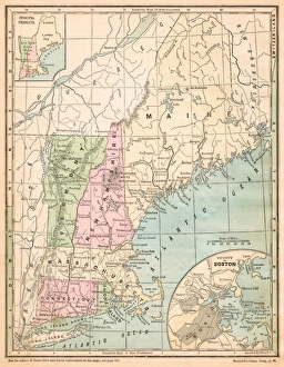
USA New England states map 1875The Independent Course Comprehensive Geography by James Monteith, A.S. Barnes & Co, New York & Chicago 1875
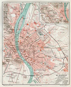
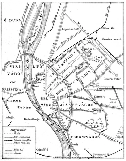
Budapest city map 1895Meyers Konversations-Lexikon. Ein Nachschlagewerk des allgemeinen Wissens, 5th edition 17 volumes Bibliographisches Institut - Leipzig 1895-1897
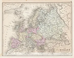
Europe map 1867Mitchellas Modern Atlas - Published by E.H. Butler and Co - Philadelphia 1867
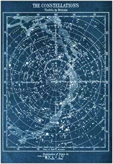
Antique colored illustrations: The constellations visible in Britain
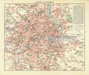
London and Environs Historical Map, Engraving, 1892Very rare, beautifully detailed engraving of London and Environs Historical Map, Engraving, Published in 1892. Original edition from my own archives. Copyright has expired on this artwork
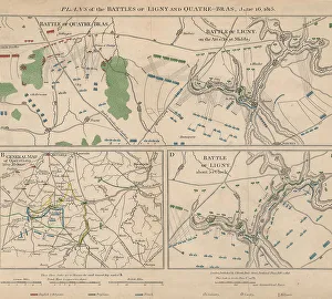
Napoleonic WarsPlans of the battle of Ligny and Quatre-Bras in Belgium during the Napoleonic Wars, 16th June 1815. Here Napoleon Bonaparte defeated the Prussian Army under Gebhard von Blucher
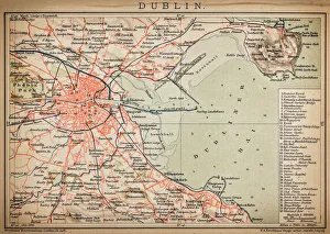
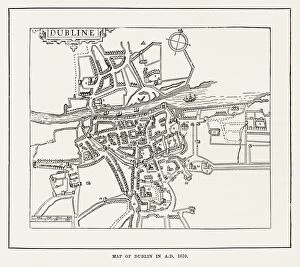
DublinAntique map of Dublin
SingaporeAntique illustration of a Republic of Singapore
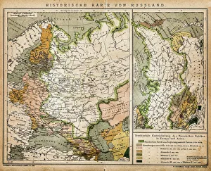
Historic map of RussiaIllustration of a historic map of Russia
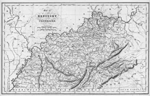
Kentucky And TennesseeAn engraved map of Kentucky and Tennessee by Isaac Taylor Hinton, published by Simpkin & Marshall and printed by Fenner Sears & Co. 1832. (Photo by Hulton Archive/Getty Images)
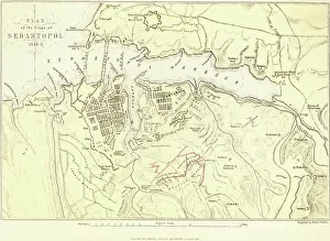
Siege Of SevastopolA plan of the Seige of Sevastopol, during the Crimean War, circa 1855. Engraved by Robert Walker. (Photo by Hulton Archive/Getty Images)
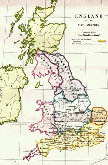
England in the Ninth CenturyAn antique map from 1875 showing the different kingdoms of England in the 9th century
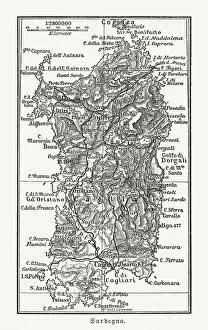
Topographic map of Sardinia, Italy, wood engraving, published 1897Topographic map of Sardinia, Italy - second-largest island in the Mediterranean Sea. Wood engraving, published in 1897
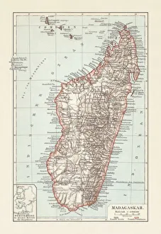
Topografic map of Madagascar, lithograph, published in 1897Topografic map of Madagascar. Lithograph, published in 1897
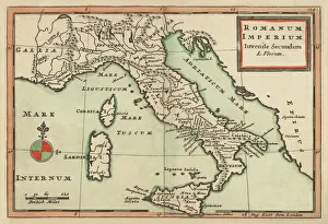
Antique Map of Italy 1732Mediterranean Countries, Antique Maps, 91822666
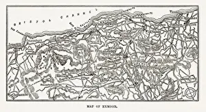
Map of Exmoor, England Victorian Engraving, 1840Very Rare, Beautifully Illustrated Antique Engraving of Map of Exmoor, England Victorian Engraving, 1840. Source: Original edition from my own archives. Copyright has expired on this artwork
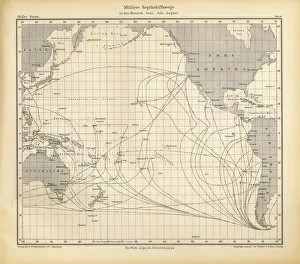
June, July and August Sailing Ship Routes Chart, Pacific Ocean, German Antique Victorian Engraving, 1896Very Rare, Beautifully Illustrated Antique Engraving of June, July and August Sailing Ship Routes Chart, Pacific Ocean, German Antique Victorian Engraving, 1896
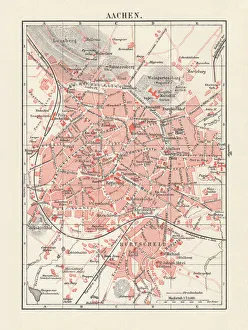
City map of Aachen, Germany, lithograph, published in 1897City map of Aachen, Germany. Lithograph, published in 1897
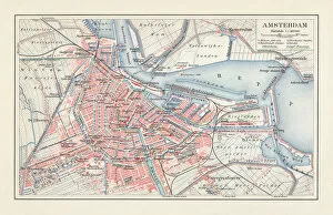
City map of Amsterdam, Netherlands, lithograph, published in 1897City map of Amsterdam, capital of the Netherlands. Lithograph, published in 1897
Historical Map of Dublin, Ireland Victorian Engraving, Circa 1610Very Rare, Beautifully Illustrated Antique Engraving of Historical Map of Dublin, Ireland Victorian Engraving, Circa 1610 from Our Own Country, Great Britain, Descriptive, Historical, Pictorial
Budapest city mapIllustration of a Budapest city map
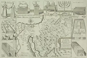
Antique map of Israel with vignettes
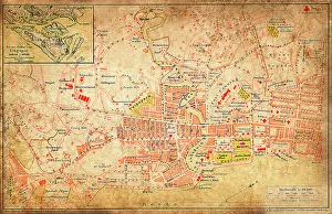
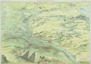
Antique engraving depicting birds eye view of Cairo
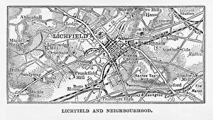
Map of Litchfield in Staffordshire, England Victorian Engraving, 1840Very Rare, Beautifully Illustrated Antique Engraving of Map of Litchfield in Worcestershire, England Victorian Engraving, 1840. Source: Original edition from my own archives
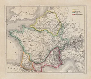
Gaul in the time of Julius Caesar, published in 1867Gaul in the time of Roman politican Gaius Iulius Caesar (100 - 44 BC). Steel engraving with hand-colored borderlines and Latin legend, published in 1867
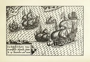
Engraving of Van Noort Landing in Manila Bay, Philippines, 1600Very Rare, Beautifully Illustrated Antique Engraved Victorian Illustration of Historical Engraving of Van Noort Landing in Manila Bay, Philippines, 1600. Copyright has expired on this artwork
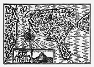
Historical Map of Dutch Navigators Island of Bali IllustrationVery Rare, Beautifully Illustrated Antique Engraved Victorian Illustration of Historical Map of Dutch Navigators on the Island of Bali. Copyright has expired on this artwork. Digitally restored
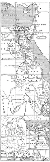
Antique map of Nile River
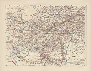
Afghanistan, lithograph, published in 1881Ancient map of Afghanistan. Lithograph, published in 1881
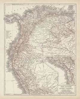
Peru, Ecuador, Colombia, Venezuela, lithograph, published in 1877Ancient map of Peru, Ecuador, Colombia, and Venezuela. Lithograph, published in 1877
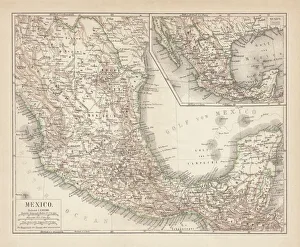
Mexico, ancient map, lithograph, published in 1877Ancient map of Mexico. Lithograph, published in 1877
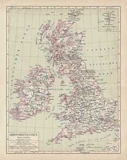
Map of British Isles, lithograph, lithograph, published in 1876Map of British Isles. Lithograph, published in 1876
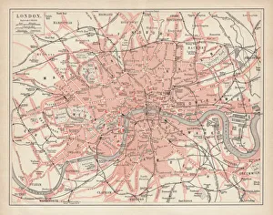
City map of London, lithograph, lithograph, published in 1877City map of London, United Kingdom. Lithograph, published in 1877
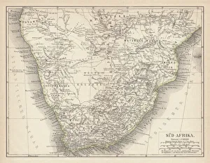
Ancient map of South Africa, lithograph, published in 1876Ancient map of South Africa. Lithograph, published in 1876
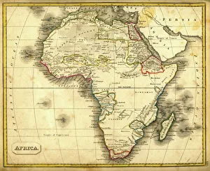
Antquie Map of AfricaVintage map of Africa from 1837