mail_outline sales@mediastorehouse.com
3,716 Poster Prints
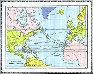
Old chromolithograph map of voyage and discovery - showing the principal routes of the early navigatorsAntique Illustration, Copyright has expired on this artwork. From my own archives, digitally restored
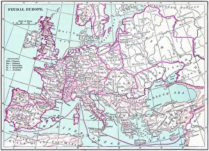
Old chromolithograph map of the feudal EuropeAntique Illustration. Copyright has expired on this artwork. From my own archives, digitally restored
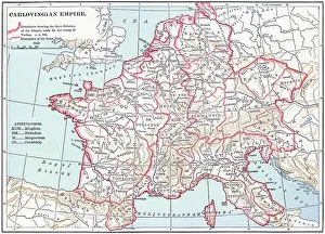
Old chromolithograph map of the Carolingian Empire (800-888) a Frankish-dominated empire in WesternAntique Illustration. Copyright has expired on this artwork. From my own archives, digitally restored
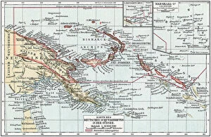
Old chromolithograph map of German South Sea coloniesAntique Illustration. Copyright has expired on this artwork. From my own archives, digitally restored
Old chromolithograph map of Mecklenburg, a historical region in northern Germany comprising the westernAntique Illustration, Copyright has expired on this artwork. From my own archives, digitally restored
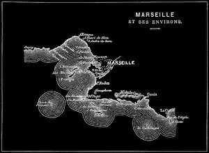
Old engraved illustration of Marseille, the second most populous city in FranceAntique Illustration, Copyright has expired on this artwork. From my own archives, digitally restored
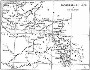
Old engraved illustration of France and Belgium border mapAntique Illustration, Copyright has expired on this artwork. From my own archives, digitally restored
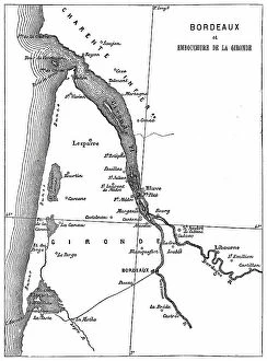
Old engraved map of Bordeaux, port city on the river Garonne in the Gironde department, Southwestern FranceAntique Illustration, Copyright has expired on this artwork. From my own archives, digitally restored
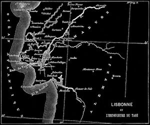
Old engraved map of Lisbon, Capital of Portugal and the Mouth of the Tagus riverCopyright has expired on this artwork. From my own archives, digitally restored
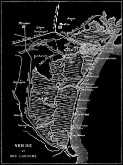
Old engraved map of Venice, ItalyCopyright has expired on this artwork. From my own archives, digitally restored
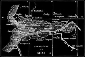
Old engraved map of Seine River, a 777-kilometre-long (483 mi) river in northern FranceCopyright has expired on this artwork. From my own archives, digitally restored
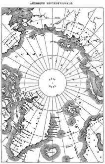
Old engraved map of North Polar RegionsAntique Illustration. Copyright has expired on this artwork. From my own archives, digitally restored
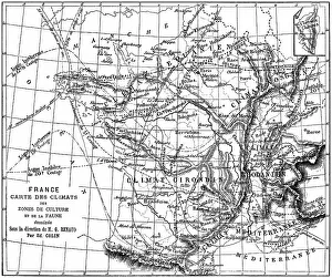
Old engraved illustration of France climate map of growing areas and wildlifeAntique Illustration. Copyright has expired on this artwork. From my own archives, digitally restored
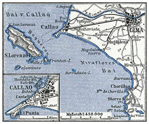
Old engraved map of Lima, the capital and largest city of Peru, located in the valleys of the ChillonCopyright has expired on this artwork. From my own archives, digitally restored
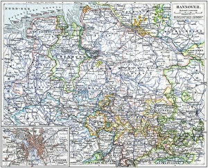
Old chromolithograph map of Hanover, capital and largest city of the German state of Lower SaxonyAntique Illustration, Copyright has expired on this artwork. From my own archives, digitally restored
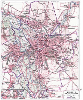
Old chromolithograph map of Leipzig (most populous city in the German state of Saxony) with its suburbsAntique Illustration, Copyright has expired on this artwork. From my own archives, digitally restored
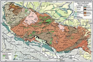
Old chromolithograph geological map of the Harz, a highland area in northern GermanyAntique Illustration, Copyright has expired on this artwork. From my own archives, digitally restored
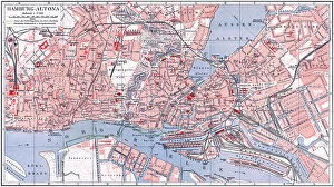
Old chromolithograph map of Altona or Hamburg-Altona, the westernmost urban borough of the German city state of HamburgAntique Illustration, Copyright has expired on this artwork. From my own archives, digitally restored
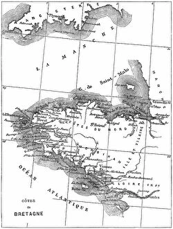
Old engraved map of Brittany, the westernmost region of Metropolitan FranceAntique Illustration, Copyright has expired on this artwork. From my own archives, digitally restored
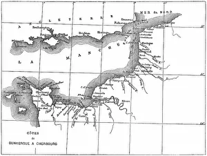
Old engraved map of the English Channel or La Manche, an arm of the Atlantic Ocean that separates Southern EnglandCopyright has expired on this artwork. From my own archives, digitally restored
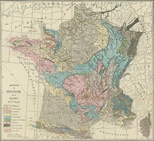
Old engraved illustration of France geological mapCopyright has expired on this artwork. From my own archives, digitally restored
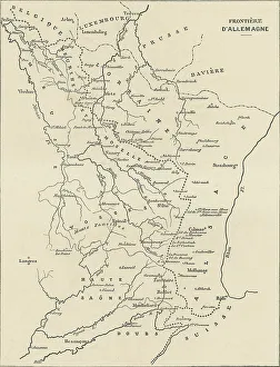
Old engraved illustration of France and Germany border mapAntique Illustration, Copyright has expired on this artwork. From my own archives, digitally restored
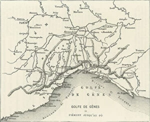
Old engraved map of the Gulf of Genoa, the northernmost part of the Ligurian Sea (largest city on its coast is Genoa)Copyright has expired on this artwork. From my own archives, digitally restored
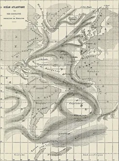
Old engraved map of Atlantic Ocean and its currentsAntique Illustration, Copyright has expired on this artwork. From my own archives, digitally restored
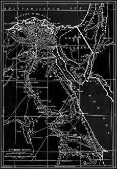
Old chromolithograph map of ancient EgyptCopyright has expired on this artwork. From my own archives, digitally restored
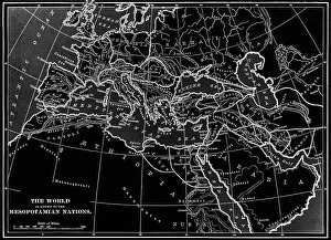
Old chromolithograph map of the World as know to the Mesopotamian NationsAntique Illustration. Copyright has expired on this artwork. From my own archives, digitally restored
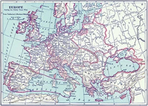
Old chromolithograph map of the Europe during the Thirty Years WarAntique Illustration. Copyright has expired on this artwork. From my own archives, digitally restored
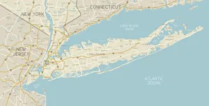
NYC Region and Long Island MapA map of the region around New York City and Long Island, including New Jersey and the coast of Connecticut. Includes major highways, cities, and lakes
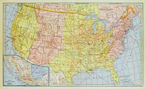
1883 United States Map
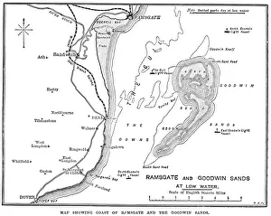
Map of Ramsgate and Goodwin Sands" Vintage engraving showing a Map of Ramsgate and Goodwin Sands, 19th Century"
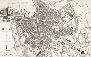
Engraving antique map of Roma Italy from 1851" 18th Century Style, Painted Image, Engraved Image, Woodcut, Illustr, Antique Maps, 174794783
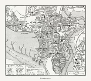
Historical city map of Southampton, Hampshire, England, woodcut, published 1897Historical city map of Southampton, Hampshire, England. Wood engraving, published in 1897
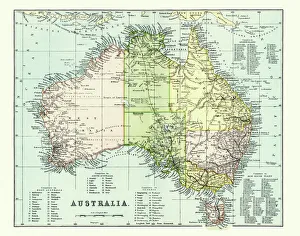
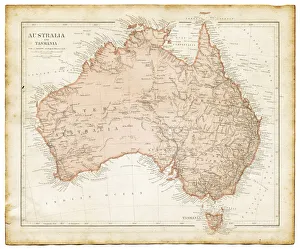
Antique Map of Australia Late 19th CenturyAntique Map of Australia in the late 19th Century
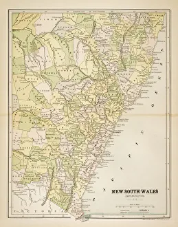
Map of New South Wales 1883Map of the state of New South Wales - Australia
Old map of Australia 1899an old map of Australia 1899 - combined with several different textures and grunge papers
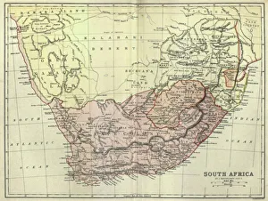
Antique map of South Africa, 1884, 19th CenturyVintage engraving of Antique map of South Africa, 1884, 19th Century
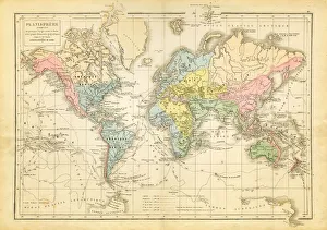
world map 1882french map of the world showing the trajectories of travels and discovery around 1780 and 1822 - map is from 1882
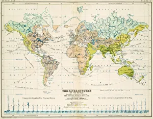
Rivers - Map of the world 1861Map of the world - The river systems
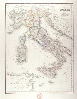
Italy Before UnificationAntique Maps, TR002313
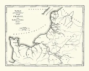
Map of Edward III route through FranceVintage engraving showing a Map of King Edward III route through France, from Barfleur to Calais in 1300. During the hundred years war
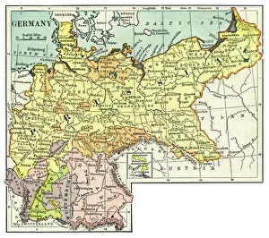
Map of Germany 1889Comprehensive Geography by James Monteith - American Book Company 1882, 1889
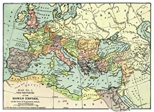
Map of the Roman Empire 1889Comprehensive Geography by James Monteith - American Book Company 1882, 1889
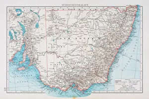
Map of South australia 1896Andres Allgemeiner Handatlas - Bielefeld und Leipzig 1896
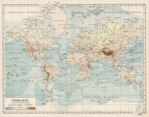
Map of the World 1900Meyers hand-Atlas Leipzig und Wien Verlag des Bibliographischen Instituts 1900
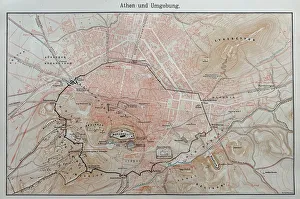
Map of ancient AthensIllustration from 19th century
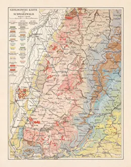
Geological map of the Black Forest, Baden-Wurttemberg, Germany, lithograph, 1897Geological map of the Black Forest, Baden-Wurttemberg, Germany. Lithograph, published in 1897
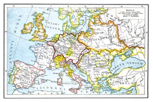
Europe after the Peace Treaty in Westphalia (1648)Illustration of a Europe after the Peace Treaty in Westphalia (1648)
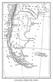
Map of Patagonia - Scanned 1880 Engraving