mail_outline sales@mediastorehouse.com
3,716 Items
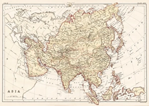
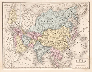
Asia map 1878Encyclopedia Britannica 9th Edition Vol II New York, Samuel Hall 1878
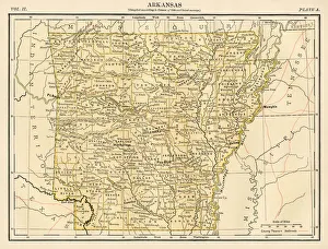
Arkansas map 1878Encyclopedia Britannica 9th Edition Vol II New York, Samuel Hall 1878
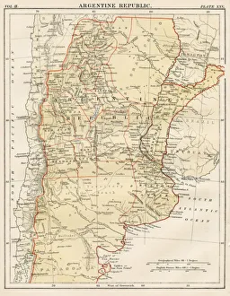
Argentine map 1878Encyclopedia Britannica 9th Edition Vol II New York, Samuel Hall 1878
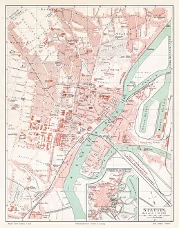
Szczecin Poland map 1895Meyers Konversations-Lexikon. Ein Nachschlagewerk des allgemeinen Wissens, 5th edition 17 volumes Bibliographisches Institut - Leipzig 1895-1897
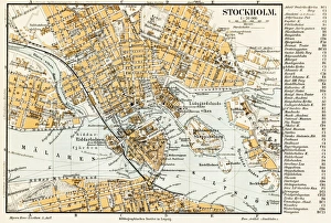
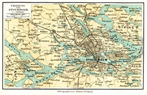
Stockholm Sweden map 1895Meyers Konversations-Lexikon. Ein Nachschlagewerk des allgemeinen Wissens, 5th edition 17 volumes Bibliographisches Institut - Leipzig 1895-1897
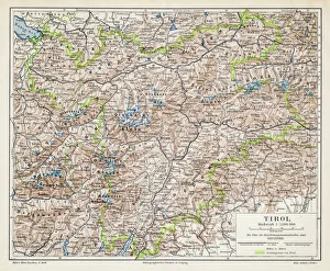
Tyrol map 1895Meyers Konversations-Lexikon. Ein Nachschlagewerk des allgemeinen Wissens, 5th edition 17 volumes Bibliographisches Institut - Leipzig 1895-1897
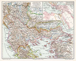
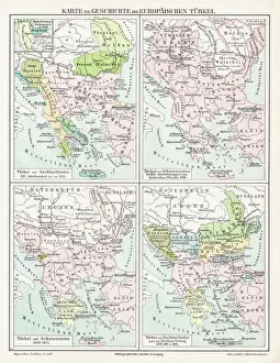
Turkey map 1895Meyers Konversations-Lexikon. Ein Nachschlagewerk des allgemeinen Wissens, 5th edition 17 volumes Bibliographisches Institut - Leipzig 1895-1897
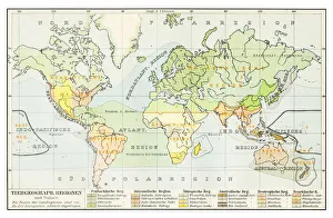
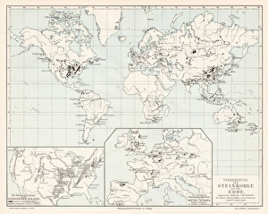
Geographical distribution of animals map 1895Meyers Konversations-Lexikon. Ein Nachschlagewerk des allgemeinen Wissens, 5th edition 17 volumes Bibliographisches Institut - Leipzig 1895-1897
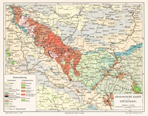
Thuringia Germany map 1895Meyers Konversations-Lexikon. Ein Nachschlagewerk des allgemeinen Wissens, 5th edition 17 volumes Bibliographisches Institut - Leipzig 1895-1897
Turkey Ottoman Empire map 1895Meyers Konversations-Lexikon. Ein Nachschlagewerk des allgemeinen Wissens, 5th edition 17 volumes Bibliographisches Institut - Leipzig 1895-1897
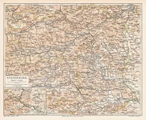
Styria Austria map 1895Meyers Konversations-Lexikon. Ein Nachschlagewerk des allgemeinen Wissens, 5th edition 17 volumes Bibliographisches Institut - Leipzig 1895-1897
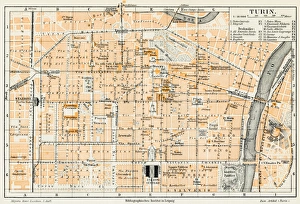
Turin Italy map 1895Meyers Konversations-Lexikon. Ein Nachschlagewerk des allgemeinen Wissens, 5th edition 17 volumes Bibliographisches Institut - Leipzig 1895-1897
World spread of hardwood map 1895Meyers Konversations-Lexikon. Ein Nachschlagewerk des allgemeinen Wissens, 5th edition 17 volumes Bibliographisches Institut - Leipzig 1895-1897
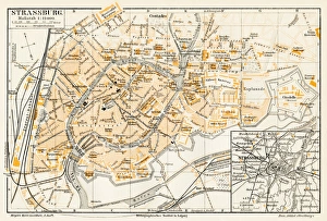
Strasbourg map 1895Meyers Konversations-Lexikon. Ein Nachschlagewerk des allgemeinen Wissens, 5th edition 17 volumes Bibliographisches Institut - Leipzig 1895-1897
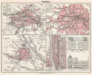
City railways map 1895Meyers Konversations-Lexikon. Ein Nachschlagewerk des allgemeinen Wissens, 5th edition 17 volumes Bibliographisches Institut - Leipzig 1895-1897
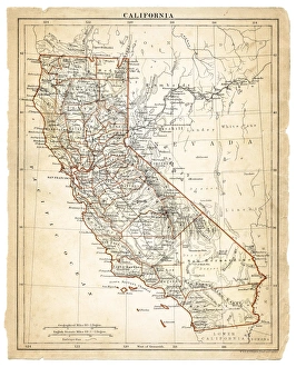
Map of California 1878Encyclopedia Britannica 9th Edition Vol II New York, Samuel Hall 1878
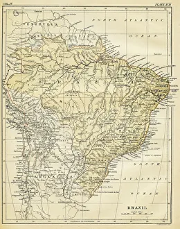
Map of Brazil 1878Encyclopedia Britannica 9th Edition Vol II New York, Samuel Hall 1878
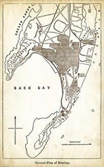
Map of Mumbay India engraving 1878Encyclopedia Britannica 9th Edition Vol II New York, Samuel Hall 1878
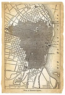
Map of Buenos Aires Argentina 1878Encyclopedia Britannica 9th Edition Vol II New York, Samuel Hall 1878
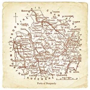
Map of Burgundy 1878Encyclopedia Britannica 9th Edition Vol II New York, Samuel Hall 1878
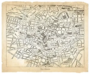
Map of Brussels 1878Encyclopedia Britannica 9th Edition Vol II New York, Samuel Hall 1878
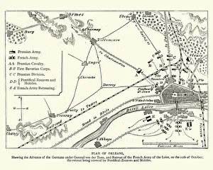
Franco Prussian War - Plan of Second Battle of OrleansVintage engraving of a scene from the Franco Prussian War. Plan of the Second Battle of Orleans, 1870
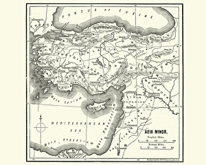
Map of Asia Minor in Ancient TimesVintage engraving of a Map of Asia Minor in Ancient Times
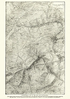
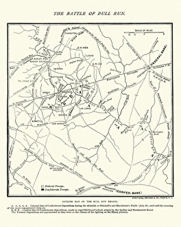
Map of the Battle of Bull RunVintage engraving of a Map of the Battle of Bull Run, The Century Magazine, 1884
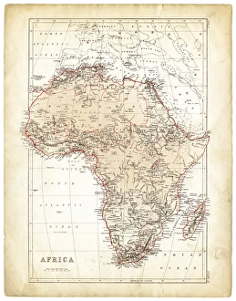
Africa map 1878Encyclopedia Britannica 9th Edition Vol I New York, Samuel Hall 1878
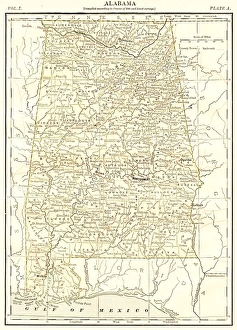
Alabama map 1878Encyclopedia Britannica 9th Edition Vol I New York, Samuel Hall 1878
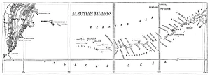
Aleutian islands map 1878Encyclopedia Britannica 9th Edition Vol I New York, Samuel Hall 1878
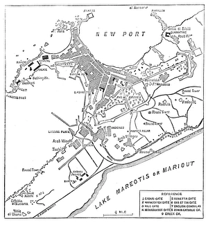
Alexandria map 1878Encyclopedia Britannica 9th Edition Vol I New York, Samuel Hall 1878
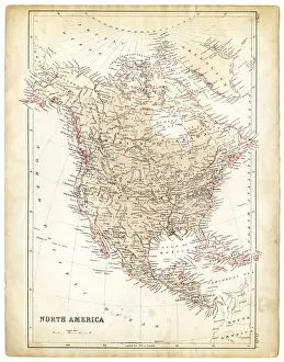
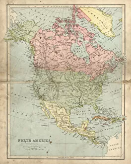
North America map 1878Encyclopedia Britannica 9th Edition Vol I New York, Samuel Hall 1878
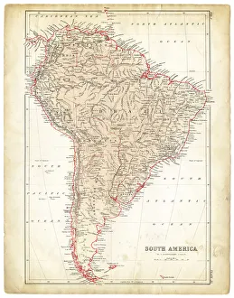
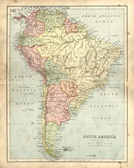
South America map 1878Encyclopedia Britannica 9th Edition Vol I New York, Samuel Hall 1878
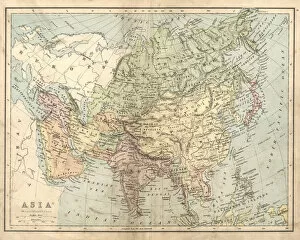
Antique map of Asia in the 19th Century, 1873Vintage engraving of a Victorian Antique map of Asia in the 19th Century, 1873
Antique damaged map of North America in the 19th CenturyVintage engraving of a Antique map of North America in the 19th Century, 1873
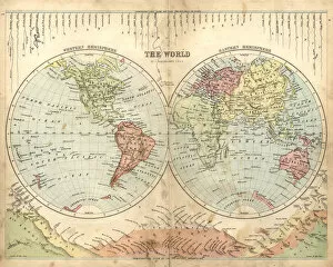
Antique map of the world, 1873Vintage engraving of a Victorian Antique map of the world, 1873
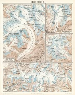
Glacier lithograph 1895Encyclopedia Britannica 9th Edition Vol I New York, Samuel Hall 1878
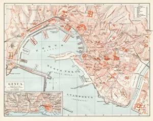
Genoa Itlay map 1895Encyclopedia Britannica 9th Edition Vol I New York, Samuel Hall 1878
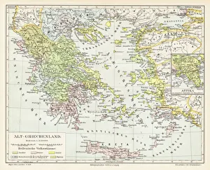
Antique Greece empire map 1895Encyclopedia Britannica 9th Edition Vol I New York, Samuel Hall 1878
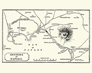
Map of Environs of Naples and Mount Vesuvius 1872Vintage engraving of Map of Environs of Naples and Mount Vesuvius 1872
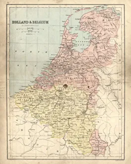
Antique damaged map of Holland & Belgium 19th CenturyVintage engraving of a Antique damaged map of Holland & Belgium in the 19th Century, 1873
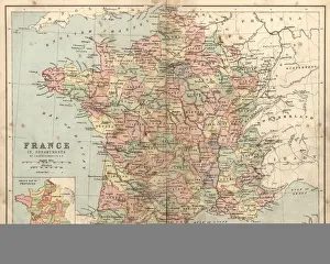
Antique damaged map of France in the 19th CenturyVintage engraving of a Antique damaged map of France in the 19th Century, 1873
Antique damaged map of South America in the 19th CenturyVintage engraving of a Antique map of South America in the 19th Century, 1873
Asia map 1867Mitchellas Modern Atlas - Published by E.H. Butler and Co - Philadelphia 1867
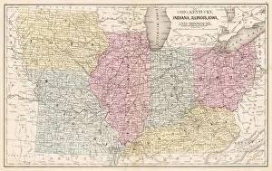
Ohio Indiana Illinois map 1867Mitchellas Modern Atlas - Published by E.H. Butler and Co - Philadelphia 1867
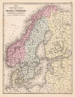
Denmark Sweden Norway map 1867Mitchellas Modern Atlas - Published by E.H. Butler and Co - Philadelphia 1867
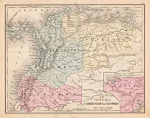
Colombia Ecuador Venezuela map 1867Mitchellas Modern Atlas - Published by E.H. Butler and Co - Philadelphia 1867
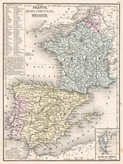
Spain France Portugal map 1867Mitchellas Modern Atlas - Published by E.H. Butler and Co - Philadelphia 1867
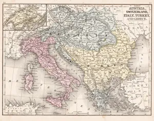
Austria Switzerland Italy map 1867Mitchellas Modern Atlas - Published by E.H. Butler and Co - Philadelphia 1867