Home > Map > Historical Maps
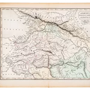
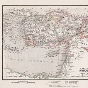
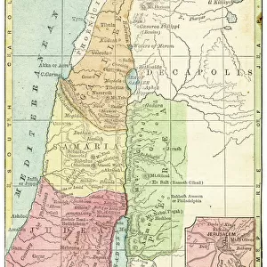
Antique map of Ancient Armenia, Colchis Iberia, Albania, Atlas of Ancient Geography

![]()
Wall Art and Photo Gifts from Fine Art Storehouse
Antique map of Ancient Armenia, Colchis Iberia, Albania, Atlas of Ancient Geography
Vintage illustration of Antique map of Ancient Armenia, Colchis Iberia, Albania, Atlas of Ancient Geography. By Samuel Butler. In Greco-Roman geography, Colchis was an exonym for the Georgian polity of Egrisi located on the coast of the Black Sea, centered in present-day western Georgia
duncan1890
Media ID 25600705
FEATURES IN THESE COLLECTIONS
> Map
> Historical Maps
> Map
MADE IN THE UK
Safe Shipping with 30 Day Money Back Guarantee
FREE PERSONALISATION*
We are proud to offer a range of customisation features including Personalised Captions, Color Filters and Picture Zoom Tools
SECURE PAYMENTS
We happily accept a wide range of payment options so you can pay for the things you need in the way that is most convenient for you
* Options may vary by product and licensing agreement. Zoomed Pictures can be adjusted in the Basket.