Home > Map > Historical Maps

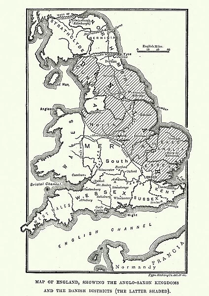
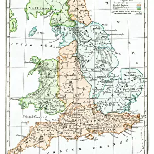
Map of Anglo-Saxon Kingdoms and the Danelaw, 9th Century

 : Map of Anglo-Saxon Kingdoms and the Danelaw, 9th Century


Choose Your Product


We accept all major payment options so you can pay for the things you need in the way that is most convenient for you

Fine Art Storehouse Photo Prints and Wall Art

Map of Anglo-Saxon Kingdoms and the Danelaw, 9th Century

Vintage engraving of a Map of Anglo-Saxon Kingdoms and the Danelaw, 9th Century

duncan1890

Media ID 14549455

© This content is subject to copyright

Great Britain

Your artwork will be printed orientated as per the preview above, with landscape (horizontal) or portrait (vertical) orientation to match the source image


FEATURES IN THESE COLLECTIONS

> Map > Historical Maps

> Map


Made in USA
Safe Shipping, Easy Returns

FREE PERSONALISATION
We are proud to offer a range of customisation including Cropping, Captions, and Filters. Zoom Cropping can be adjusted in the basket

SECURE PAYMENTS
We accept all major payment options so you can pay for the things you need in the way that is most convenient for you


redeem
Beautiful Photo Prints and Gifts
image
Professionally printed
inventory
Photo Prints are in stock
thumb_up
Professional Quality Finish
diamond
Made With High Grade Materials
inventory_2
Carefully Packed To Aid Safe Arrival


Similar Pictures


England in the Ninth Century
Antique map of Britain under the Anglo Saxons
Antique map of Britain under the Ancient Romans
Old map of England in 550
Old map of England after treaty of Chippenham in 878
England and wales map 1895
Praying Hands by Albrecht Durer
Pink Floyds Inflatable Pig Battersea Power Station
Antique colored illustrations: Geological map of England and Wales
Necking Flamingoes
Necking Flamingoes
Oak Tree or Quercus, Victorian Botanical Illustration
Aerial view of Lake Bled, Slovenia

+

Shipping

+

Choices

+

Guarantee