mail_outline sales@mediastorehouse.com
221 Framed Prints
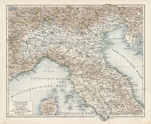
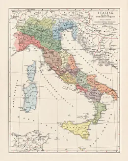
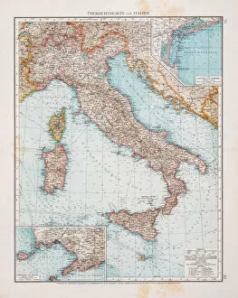
Map of North Italy 1900Meyers hand-Atlas Leipzig und Wien Verlag des Bibliographischen Instituts 1900
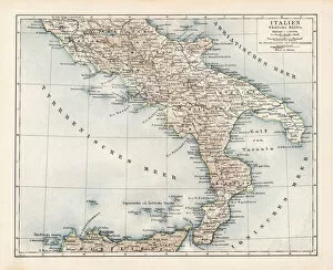
Map of South Italy 1900Meyers hand-Atlas Leipzig und Wien Verlag des Bibliographischen Instituts 1900
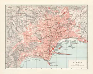
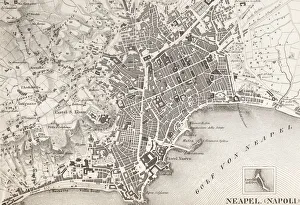
City map of Naples (Italian: Napoli), Italy, lithograph, published 1897City map of Naples (Italian: Napoli), Campania, Italy. Lithograph, published in 1897
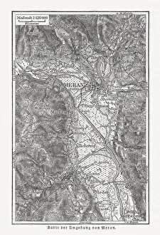
Map of the surroundings of Merano, wood engraving, published 1897Map of the surroundings of Merano, South Tyrol, Italy. Wood engraving, published in 1897
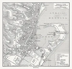
Historical city map of Messina, Italy, wood engraving, published 1897Historical city map of Messina, Italy. Wood engraving, published in 1897
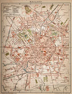
Milan, Italy antique map from 1898
Italy until the time of Emperor Augustus, lithograph, published 1897Map of Italy until the time of Emperor Augustus (63 BC a AD 14). Lithograph, published in 1897
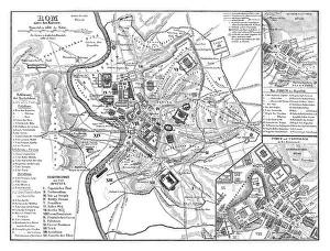
Old map showing Rome arround 1st century BCOld map showing Rome circa 1st century bc Original edition from my own archives Source : Illustriertes Konversations Lexikon 1878
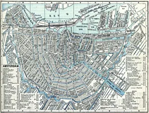
Map of city Amsterdam Netherlands from 1881 Original edition from my own archives Source : Illustriertes Konversations Lexikon 1881
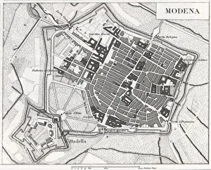
Engraving: ModenaEngraved illustrations of the Provence of Modena from Iconographic Encyclopedia of Science, Literature and Art, Published in 1851. Copyright has expired on this artwork. Digitally restored
18th Century Style, Painted Image, Engraved Image, Woodcut, Illustration and Painting[url=/file_closeup.php?id=11192953 t=_blank][img]/file_thumbview_approve.php?size=1&id=11192953[/img][/url] [url=/file_closeup.php?id=11193877 t=_blank][img]/file_thumbview_approve.php
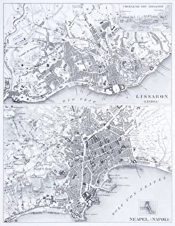
Engraving: Lisbon and NaplesEngraved illustrations of the Cities of Lisbon and Naples from Iconographic Encyclopedia of Science, Literature and Art, Published in 1851. Copyright has expired on this artwork. Digitally restored
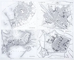
Engraving: Leghorn, Florence, Ancona and ModenaEngraved illustrations of the cities of Leghorn, Florence, Ancona and Modena from Iconographic Encyclopedia of Science, Literature and Art, Published in 1851. Copyright has expired on this artwork
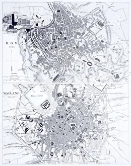
Engraving: Rome and MilanEngraved illustrations of the cities of Rome and Milan from Iconographic Encyclopedia of Science, Literature and Art, Published in 1851. Copyright has expired on this artwork. Digitally restored
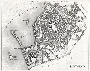
Engraving: Livorno, ItalyEngraved illustrations of the city of Livorno, Italy from Iconographic Encyclopedia of Science, Literature and Art, Published in 1851. Copyright has expired on this artwork. Digitally restored
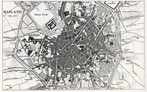
Engraving: Milan, ItalyEngraved illustrations of the city of Milan, Italy from Iconographic Encyclopedia of Science, Literature and Art, Published in 1851. Copyright has expired on this artwork. Digitally restored
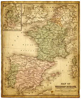
western europe 1867a map of Western europe from 1867, overlay with grunge burnt texture paper
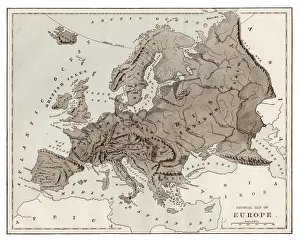
europe map 1829an old map form 1829, showing the whole europe
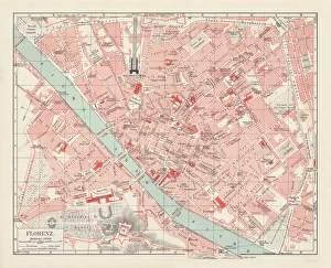
City map of Florence, Italy, lithograph, published in 1897City map of Florence - capital city of the Italian region of Tuscany. Lithograph, published in 1897
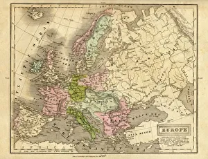
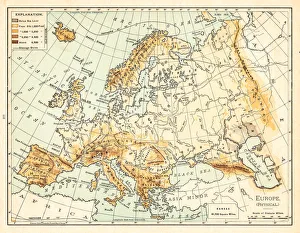
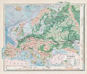
Map of Europe 1897Natural Elementary Geography by Redway and Hinman - NY/Cincinnati/Chicago 1897
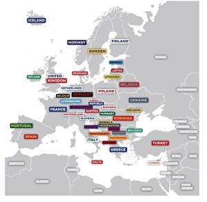
Labeled European MapLabeled European map concept showing countries with labels. EPS 10 file. Transparency effects used on highlight elements
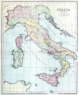
Antique map of ItalyVintage map of Italy in 1861
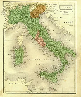
Antique map of Italy
Map of Italy 1896Andres Allgemeiner Handatlas - Bielefeld und Leipzig 1896
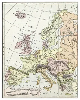
old map of european old map from 1865, europe countries
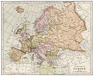
Map of Europe 1895The Rand-McNally Grammar School Geography 1895 - Chicago & New York
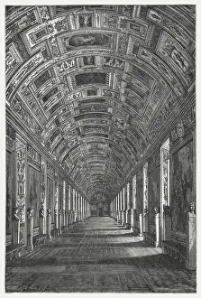
Gallery of Maps, Vatican, published in 1878The Gallery of Maps (Latin: Galleria delle carte geografiche) in the Vatican. Wood engraving, published in 1878
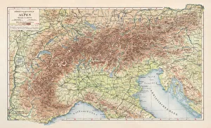
Topographic map of the European Alps, lithograph, published in 1897Topographic map of the European Alps. Lithograph, published in 1897
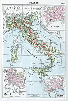
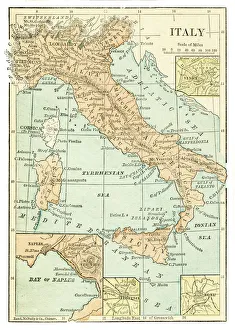
Map of Italywov035.jpg
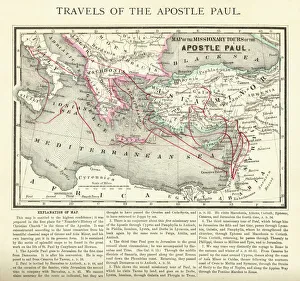
Travels of The Apostle Paul Map EngravingEngraved illustration of the Travels of The Apostle Paul Map Engraving from The Popular Pictorial Bible, Containing the Old and New Testaments, Published in 1862
Vintage Map of Europe Mid 19th CenturyVinateg Map of Europe Mid 19th Century, circa 1850
Italy map 1875The Independent Course Comprehensive Geography by James Monteith, A.S. Barnes & Co, New York & Chicago 1875
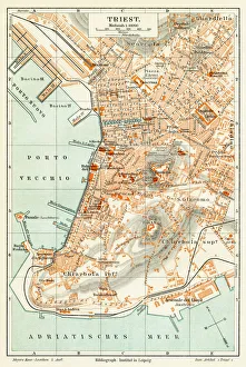
Trieste Italy map 1895Meyers Konversations-Lexikon. Ein Nachschlagewerk des allgemeinen Wissens, 5th edition 17 volumes Bibliographisches Institut - Leipzig 1895-1897
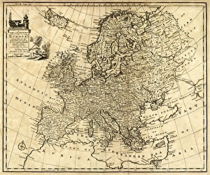
Antique Map of Europe 1744An engraved map of Europe with ornamental cartouche and relief shown pictorially by Emanuel Bowen 1744, London, Geographer to His Majesty
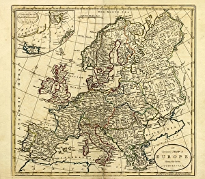
Antique Map of Europe, 1785An accurate map of Europe from the best authorities. London: C. Dilly & G. Robinson: 1785. Original size: 35.7 x 37.4 cm. Coloured, Inset: Spitsbergen, East and West Greenland, and Iceland
Antquie Map of ItalyVintage map of Italy from 1815
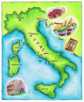
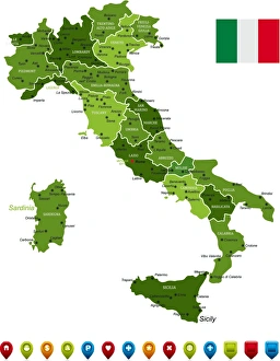
Italy MapHigh Detailed Italy Green Map with Navigation Icons
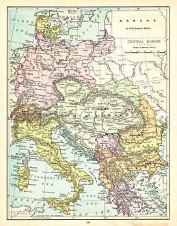
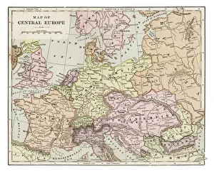
Map of Central Europe 1895The Rand-McNally Grammar School Geography 1895 - Chicago & New York
Map of Europe 1877Warrens Common School Geography 1877
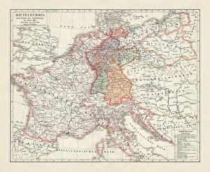
Map of Europe at the Napoleonic Wars of Liberty (1813)Map of Central Europe at the beginning of the Napoleonic Wars of Liberty in 1813. Lithograph, published in 1897
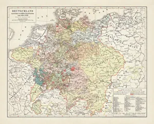
Map of Germany, after the Peace of Westphalia in 1648. Lithograph, published in 1897
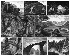
Forests, Lakes, Caves and Unusual Rock Formations EngravingEngraved Illustrations of Forests, Lakes, Caves and Unusual Rock Formations from Iconographic Encyclopedia of Science, Literature and Art, Published in 1851. Copyright has expired on this artwork
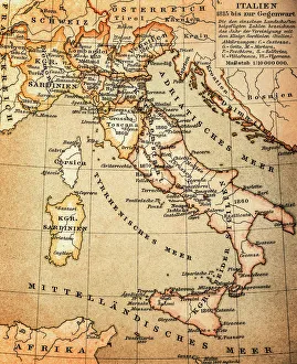
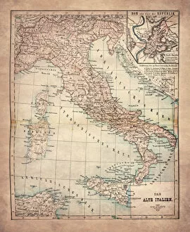
The Old ItalyIllustration of the Old Italy
Map of Europe 1889Indiana Educational Series The Complete Geography - Indianapolis 1889
Map of central Europe 1889Indiana Educational Series The Complete Geography - Indianapolis 1889