mail_outline sales@mediastorehouse.com
1,517 items
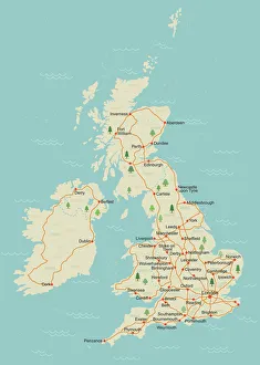
Simple UK mapA simple UK map with roads and major towns and cities named. There is a very slight grunge texture on sea and land, this is on separate layers and are easy to remove. 11 layers in all
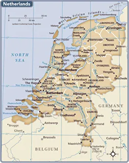
Netherlands country map2011 edition
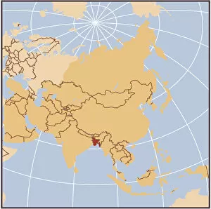
Myanmar (Burma) reference mapFine Art Storehouse Maps: Reference Maps
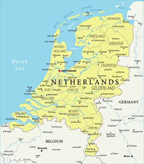
Netherlands Reference Map950857474
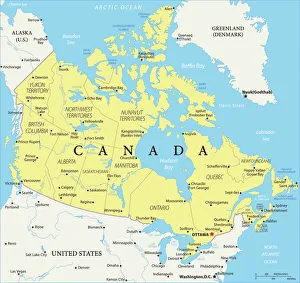
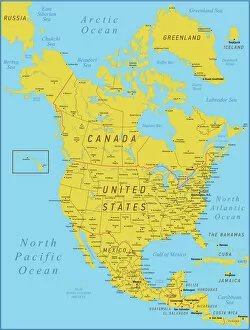
Canada Reference Map935511898
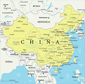
China Reference Map949100300
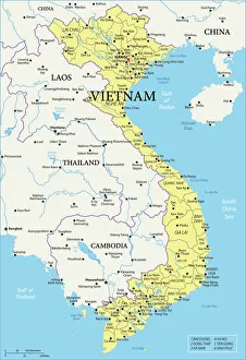
Vietnam Reference Map
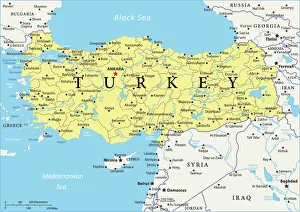
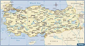
Turkey Reference Map966251888
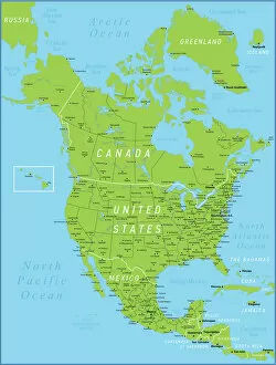
North America Green Map with United States, Canada, Mexico, geographical borders and riversNorth America Map with United States, Canada, Mexico and Cuba Map was found: Map was found: Created with Adobe Illustrator with splines
Map of North America. High detailed orange vector map with Borders and RiversNorth America Map with United States, Canada, Mexico and Cuba Map was found: Map was found: Created with Adobe Illustrator with splines
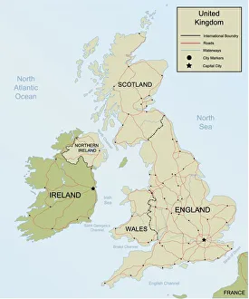
Map of the United KingdomDetailed Hand drawn map of the United Kingdom and Ireland. Map includes Main roadways, waterways, as well as city and Capital Markers.(All separate Layers)
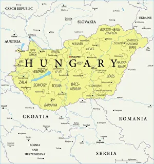
Map of Hungary - Vector illustration
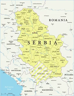
Map of Serbia - Vector illustration
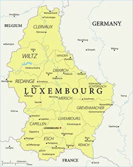
Map of Luxembourg - Vector illustration
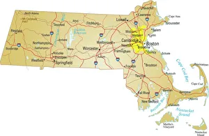
map of MassachusettsVector illustration of map of massachusetts with major roads, river and lakes
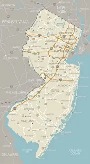
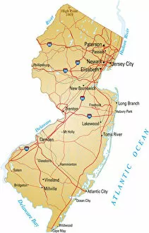
New Jersey MapA detailed map of New Jersey state with cities, roads, major rivers, and lakes. Includes neighboring states and surrounding water
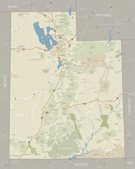
Utah MapA detailed map of Utah state with cities, roads, major rivers and lakes, national forests, national parks and monuments. Includes neighboring states and surrounding water
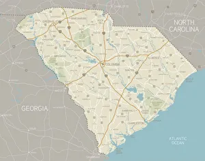
South Carolina MapA detailed map of South Carolina state with cities, roads, major rivers, and lakes. Includes neighboring states and surrounding water
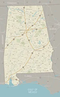
Alabama MapA detailed map of Alabama state with cities, roads, major rivers, and lakes plus National Forests. Includes neighboring states and surrounding water
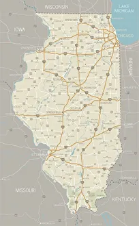
Illinois MapA detailed map of Illinois state with cities, roads, major rivers, and lakes plus National Forests. Includes neighboring states and surrounding water
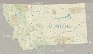
A flat Montana state map and surroundingsA detailed map of Montana state with major rivers, lakes, roads and cities plus National Parks, national forests and indian reservations
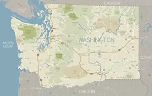
Washington State MapA detailed map of Washington state with major rivers, lakes, roads and cities plus National Parks, national forests and indian reservations
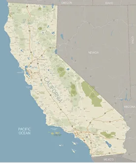
California MapA detailed map of California state with cities, roads, major rivers, and lakes plus National Parks and National Forests. Includes neighboring states and surrounding water
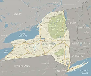
New York State MapA detailed map of the New York State, including surrounding states. Includes major highways, cities, rivers and lakes. Elements are grouped and separate for easy changes
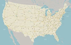
United States Highway MapA very detailed map of the United States with freeways, major highways, major cities and lakes and rivers. Each state was drawn separately so shoreline and waterways are very detailed
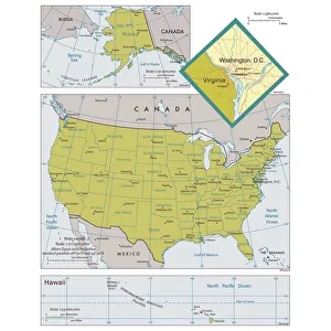
Map of the United States of America with states and major citiesVector illustration of a map of the United States of America with states and major cities Reference map was created by the US Central Intelligence Agency
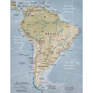
Physical map of South AmericaVector illustration of the physical map of South America Reference map was created by the US Central Intelligence Agency and is available as a public domain map at the University of Texas Libraries
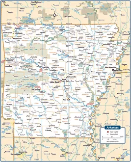
Arkansas State MapArkansas is a southern US state bordering the Mississippi River
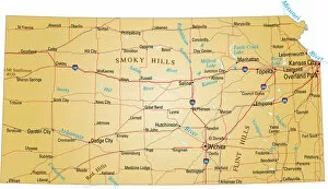
Map of KansasVector illustration of map of Kansas with major roads, rivers and lakes
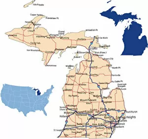
Michigan road mapillustration of Michigan state road map for your design and products
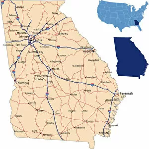
Georgia road mapillustration of Georgia state road & highway map for your design and products
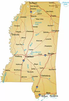
Map of MississippiVector illustration of map of Mississippi with major roads, rivers and lakes
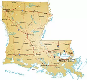
Map of LouisianaVector illustration of map of Louisiana with major roads, rivers and lakes
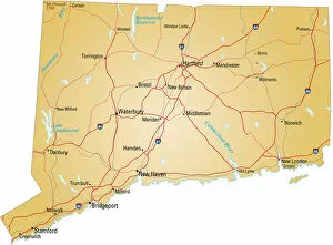
map of ConnecticutVector illustration of map of connecticut with major roads, rivers and lakes
Map of New Jersey with highways on white backgroundVector illustration of map of New Jersey with major roads, rivers and lakes
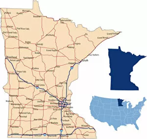
Minnesota road mapillustration of Minnesota state road map for your design and products
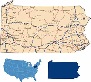
Pennsylvania road mapillustration of Pennsylvania state road map for your design and products
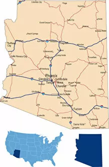
Arizona road mapillustration of Arizona state road map for your design and products
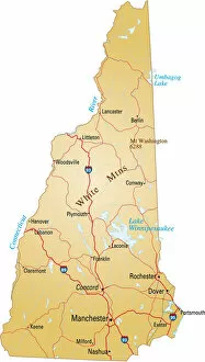
Map of New HampshireVector illustration of map of New Hampshire with major roads, rivers and lakes
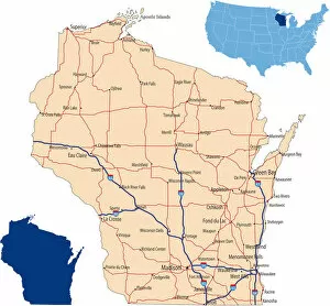
Wisconsin road mapillustration of Wisconsin state road map for your design and products
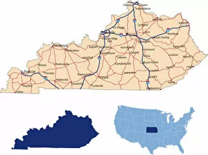
Kentucky road mapillustration of Kentucky state road map for your design and products
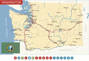
Washington State Map - USAHighly detailed map of Washington state (USA)
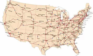
USA highway mapillustration of USA highway map for your design and products
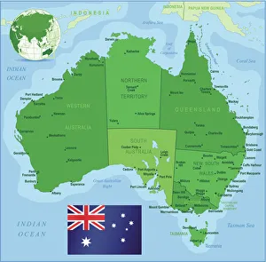
Map of Australia with states, cities and flagHighly detailed vector map of Australia with states, capitals and big cities
Turkey country map2011 edition
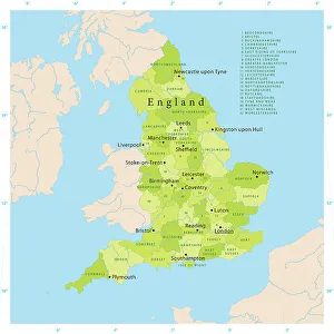
Highly detailed vector map of England. Source data courtesy of NGDC and NASA. Source database: World Data Bank II. The source data is in the public domain. Data updated and improved
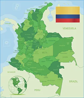
Green Map of Colombia - states, cities and flagColombia, country of northwestern South America. Its 1, 000 miles (1, 600 km) of coast to the north are bathed by the waters of the Caribbean Sea, and its 800 miles (1)
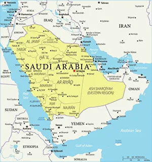
Saudi Arabia Reference Map974230500