mail_outline sales@mediastorehouse.com
1,517 items
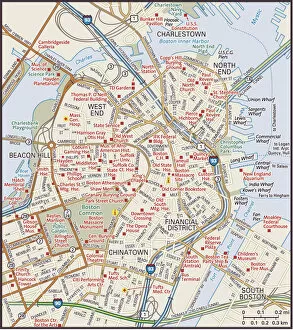
Downtown Boston, Massachusetts2011 edition
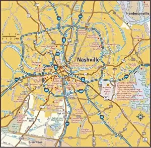
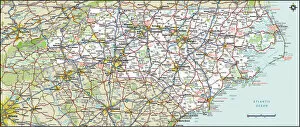
Nashville, Tennessee area2011 edition
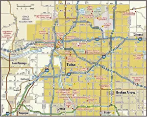
Tulsa area map2010 edition
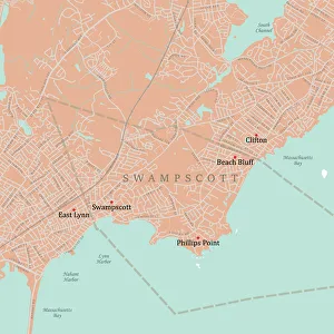
MA Essex Swampscott Vector Road Map. All source data is in the public domain. U.S. Census Bureau Census Tiger. Used Layers: areawater, linearwater, roads, rails, cousub, pointlm, uac10
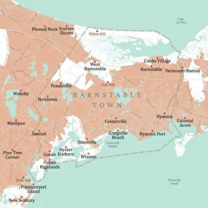
MA Barnstable Town Vector Road Map. All source data is in the public domain. U.S. Census Bureau Census Tiger. Used Layers: areawater, linearwater, roads, rails, cousub, pointlm, uac10
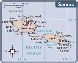
Samoa country map2011 edition
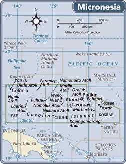
Fed. States of Micronesia country map2011 edition
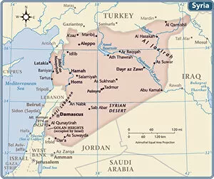
Syria country map2011 edition
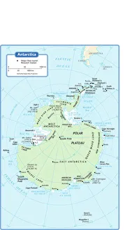
antarctica, azimuthal equal area projection, cartography, indian ocean, map, no people, pacific ocean, political map, south pole, antarctic circle, Reference Maps, 102270271
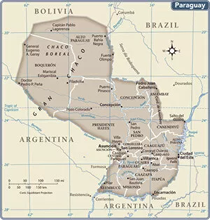
Paraguay country map2011 edition
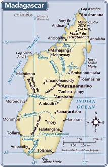
Madagascar country map2011 edition
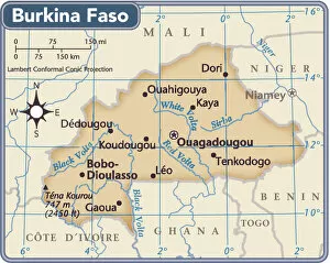
Burkina Faso country map2011 edition
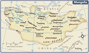
Mongolia country map2011 edition
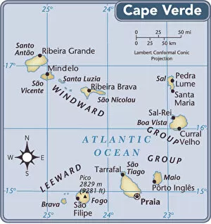
Cape Verde country map2011 edition
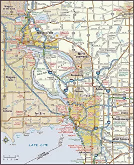
Buffalo, New York area2011 edition
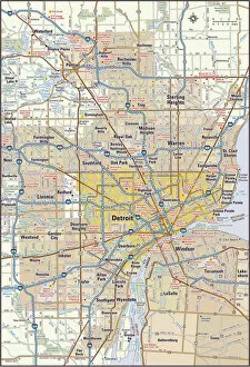
Detroit, Michigan area2011 edition
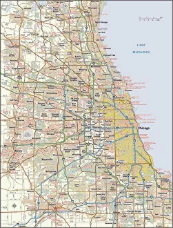
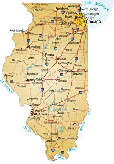
Chicago, Illinois area2011 edition
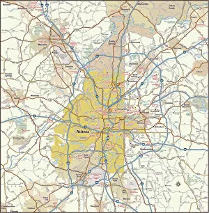
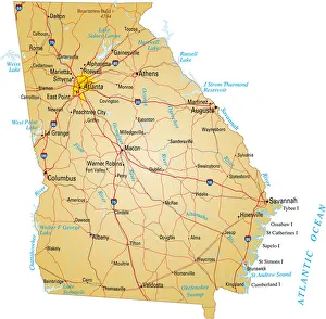
Atlanta, Georgia area2011 edition
103745676Reference Maps, 103745676
103745758Reference Maps, 103745758
102270232Reference Maps, 102270232
103312573Reference Maps, 103312573
103312569Reference Maps, 103312569
103312561Reference Maps, 103312561
103312688Reference Maps, 103312688
103745786Reference Maps, 103745786
103745796Reference Maps, 103745796
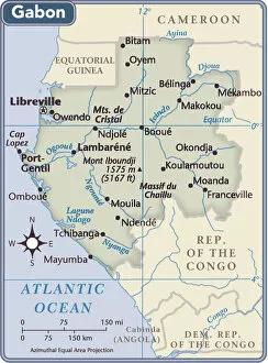
Gabon country map2011 edition
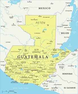
Map of Guatemala - Vector illustration
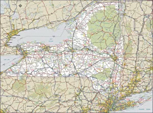
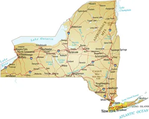
Map of New YorkVector illusttration of map of New York state with major roads, river and lakes
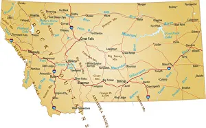
Map of MontanaVector illustration of map of Montana with major roads, rivers and lakes
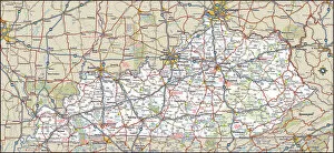
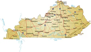
Map of kentuckyvector illustration of map of kentucky with major roads, rivers and lakes
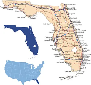
Florida road mapillustration of Florida state road map for your design and products
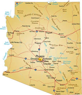
Map of Arizona, USA highways, major roads, and riversVector illustration of map fo Arizona with major roads, rivers and lakes
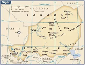
Niger country map2011 edition
139265708Reference Maps, 139265708
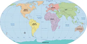
World map, continent labels2011 edition
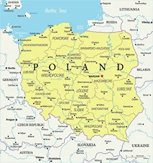
Poland Reference Map956156466
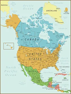
North America Map. Vintage Map with United States, Canada, Mexico and riversNorth America Map with United States, Canada, Mexico and Cuba Map was found
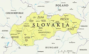
Map of Slovakia - Vector illustration
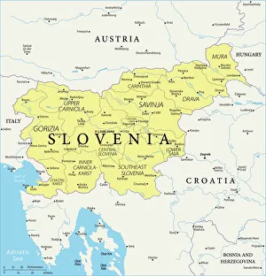
Map of Slovenia - Vector illustration
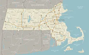
Map of Massachusetts with highwaysA detailed map of Massachusetts state with cities, roads, major rivers, and lakes. Includes neighboring states and surrounding water
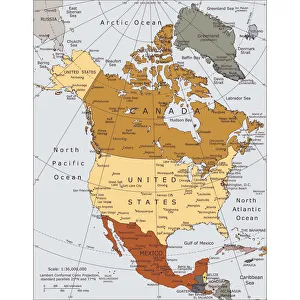
Political map of North AmericaVector illustration of the political map of North America. Reference map was created by the US Central Intelligence Agency
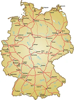
Map of Germany with all names of the main citiesvector illustration of map of germany with major roads, lakes and rivers
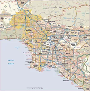
Los Angeles, California area map2011 edition
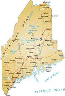
Map of MaineVector illustration of map of Maine with major roads, rivers and lakes
Map of Illinois showing major cities and roadsVector illustration of map of Illinois with major roads, rivers and lakes
A yellow map of the state of Georgia with cities markedVector illustration of map of Georgia with major roads, rivers and lakes