mail_outline sales@mediastorehouse.com
799 items
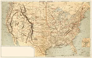
Map of United States 1869Cornells Grammars-School Geography - S.S. Cornell - New York D. Appleton and Company 1869
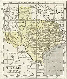
Map of Texas 1855System of Geography for the use of schools by Sidney E. Morse - Published by Harper & Brothers - New York 1855
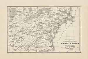
Map of Northeast United States, published in 1882Map of the Northeast United States of America. Wood engraving, published in 1882
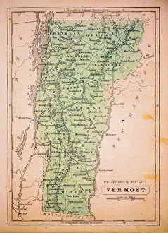
Vermont 1852 Map
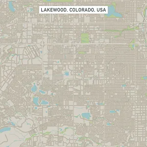
Lakewood Colorado US City Street MapVector Illustration of a City Street Map of Lakewood, Colorado, USA. Scale 1:60, 000. All source data is in the public domain. U.S
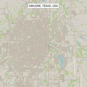
Abilene Texas US City Street MapVector Illustration of a City Street Map of Abilene, Texas, USA. Scale 1:60, 000. All source data is in the public domain. U.S
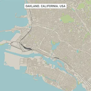
Oakland California US City Street MapVector Illustration of a City Street Map of Oakland, California, USA. Scale 1:60, 000. All source data is in the public domain. U.S
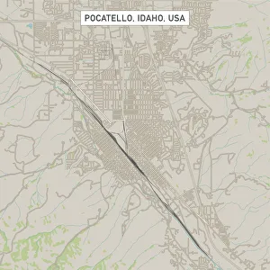
Pocatello Idaho US City Street MapVector Illustration of a City Street Map of Pocatello, Idaho, USA. Scale 1:60, 000. All source data is in the public domain. U.S
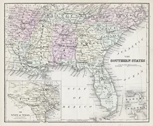
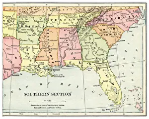
Map of Southern States USA 1877Warrens Common School Geography 1877
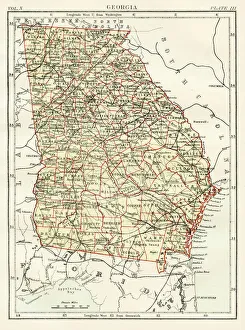
Georgia map 1884Encyclopedia Britannica 9th Edition New York Charles Scribners and Sonsl 1884 Vol X
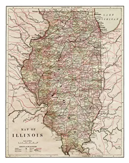
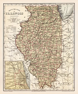
Map of Illinois 1889Indiana Educational Series The Complete Geography - Indianapolis 1889
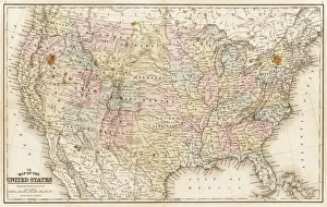
Map of United States 1867Mitchells Modern Atlas - Published by E.H. Buttler & Co - Philadelphia 1867
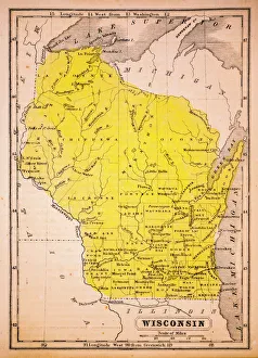
Wisconsin 1852 Map
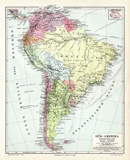
South America political map 1895Meyers Konversations-Lexikon. Ein Nachschlagewerk des allgemeinen Wissens, 5th edition 17 volumes Bibliographisches Institut - Leipzig 1895-1897
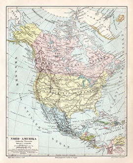
North America political map 1895Meyers Konversations-Lexikon. Ein Nachschlagewerk des allgemeinen Wissens, 5th edition 17 volumes Bibliographisches Institut - Leipzig 1895-1897
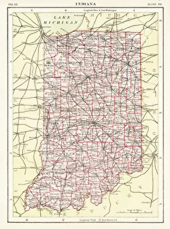
Indiana USA map 1881Encyclopedia Britannica 9th Edition Vol XII Philadelphia j.M. Stoddart & Co 1881
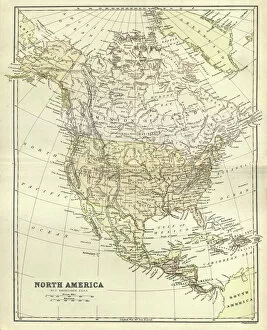
Antique map, North America, Canada and USA, 1884, 19th CenturyVintage engraving of Antique map, North America, Canada and USA, 1884, 19th Century
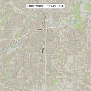
Fort Worth Texas US City Street MapVector Illustration of a City Street Map of Fort Worth, Texas, USA. Scale 1:60, 000. All source data is in the public domain. U.S
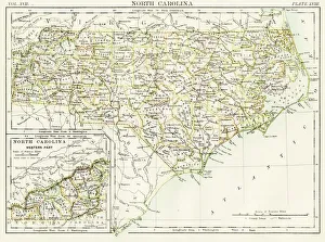
North Carolina map 1884Encyclopedia Britannica 9th Edition New York Charles Scribners and Sonsl 1884 Vol XVII
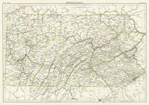
Pennsylvania map 1885Encyclopedia Britannica 9th Edition New York Charles Scribners and Sons 1885 Vol XVIII
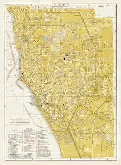
Buffalo city map 1893Johnsonas Universal Cyclopedia - Charles Kendall - New York 1893
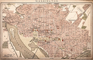
Map of Washington 1898Antique illustration of a Map of Washington 1898
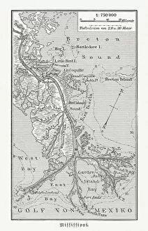
Mouth of the Mississippi river, Louisiana, USA, woodcut, published 1897Map of the mouth of the Mississippi river, Louisiana, USA. Wood engraving, published in 1897
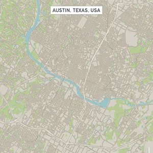
Austin Texas US City Street MapVector Illustration of a City Street Map of Austin, Texas, USA. Scale 1:60, 000. All source data is in the public domain. U.S
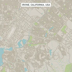
Irvine California US City Street MapVector Illustration of a City Street Map of Irvine, California, USA. Scale 1:60, 000. All source data is in the public domain. U.S
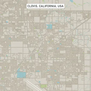
Clovis California US City Street MapVector Illustration of a City Street Map of Clovis, California, USA. Scale 1:60, 000. All source data is in the public domain. U.S
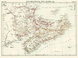
New Brunswick Nova Scotia map 1884Encyclopedia Britannica 9th Edition New York Charles Scribners and Sonsl 1884 Vol XVII
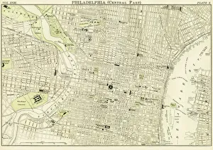
Philadelphia map 1885Encyclopedia Britannica 9th Edition New York Charles Scribners and Sons 1885 Vol XVIII
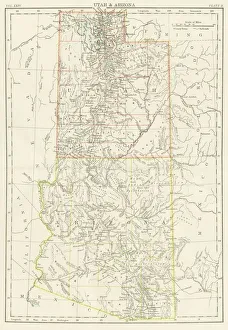
Utah Arizona map 1885Encyclopedia Britannica 9th Edition New York Charles Scribners and Sons 1885 Vol XXIV
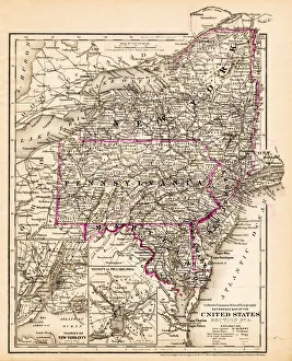
New York Maryland Pennsylvania map 1881Coltons Common School Geography 1881 New York Sheldon and Co
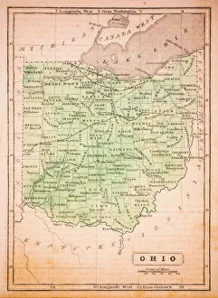
Ohio 1852 Map
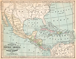
Mexico and West indies map 1875The Independent Course Comprehensive Geography by James Monteith, A.S. Barnes & Co, New York & Chicago 1875
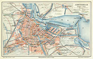
Amsterdam city map 1895Meyers Konversations-Lexikon. Ein Nachschlagewerk des allgemeinen Wissens, 5th edition 17 volumes Bibliographisches Institut - Leipzig 1895-1897
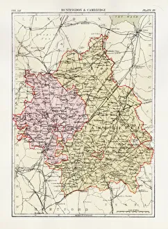
Huntingdon and Cambridge map 1881Encyclopedia Britannica 9th Edition Vol XII Philadelphia j.M. Stoddart & Co 1881
Illinois map 1881Encyclopedia Britannica 9th Edition Vol XII Philadelphia j.M. Stoddart & Co 1881
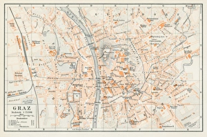
Graz Austria map 1895Encyclopedia Britannica 9th Edition Vol I New York, Samuel Hall 1878
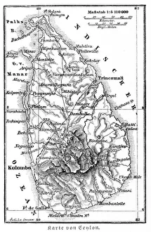
Srilanka former Ceylon map 1895Meyers Konversations-Lexikon. Ein Nachschlagewerk des allgemeinen Wissens, 5th edition 17 volumes Bibliographisches Institut - Leipzig 1895-1897
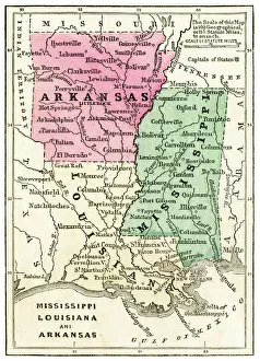
Map of USA southern states 1871Colton and Fitchs Introductory School Geography - New York: Sheldon and Company 1871
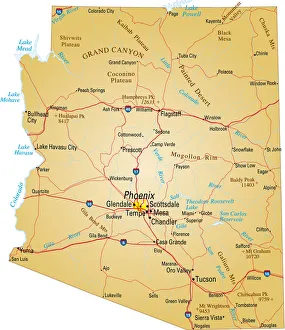
Map of Arizona, USA highways, major roads, and riversVector illustration of map fo Arizona with major roads, rivers and lakes
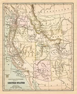
United States map 1881Coltons Common School Geography 1881 New York Sheldon and Co
Map of USA southern states 1897Natural Elementary Geography by Redway and Hinman - NY/Cincinnati/Chicago 1897
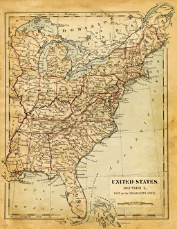
Map of USA - East of Mississippi river 1876Maurys Geographical Series - The Word we live in by M.F. Maury LLD - New York and Baltimore 1876
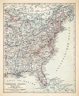
Map of USA Eastern States 1900Meyers hand-Atlas Leipzig und Wien Verlag des Bibliographischen Instituts 1900
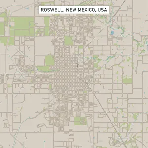
Roswell New Mexico US City Street MapVector Illustration of a City Street Map of Roswell, New Mexico, USA. Scale 1:60, 000. All source data is in the public domain. U.S
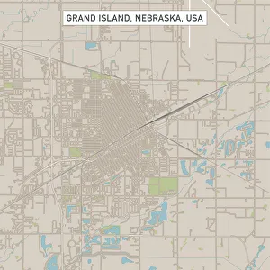
Grand Island Nebraska US City Street MapVector Illustration of a City Street Map of Grand Island, Nebraska, USA. Scale 1:60, 000. All source data is in the public domain. U.S
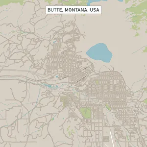
Butte Montana US City Street MapVector Illustration of a City Street Map of Butte, Montana, USA. Scale 1:60, 000. All source data is in the public domain. U.S
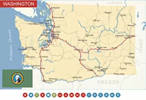
Washington State Map - USAHighly detailed map of Washington state (USA)
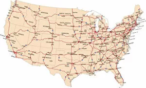
USA highway mapillustration of USA highway map for your design and products