mail_outline sales@mediastorehouse.com
799 items
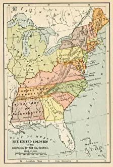
The United States colonies at the beginning of the Revolution map 1895History of the United States by E. Benjamin Andrews - Charles Scribners Son, New York 1895
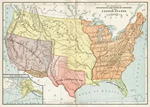
Progessive adquisition of territory by the United States map 1895History of the United States by E. Benjamin Andrews - Charles Scribners Son, New York 1895
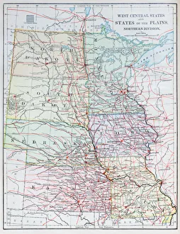
Antique map: USA - West Central States
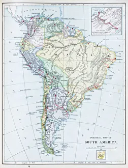
Antique map: South America
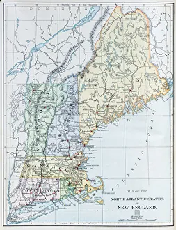
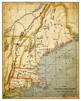
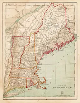
Antique map: USA - North Atlantic States - New England
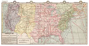
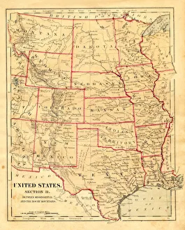
Antique map: USA
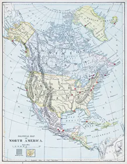
Antique map: North America
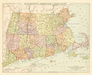
Map Massachusetts, Connecticut, Rhode Island 1881Appletons American Standard Geography 1881
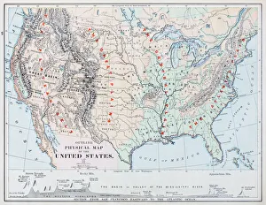
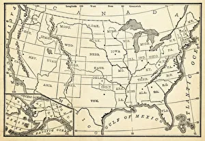
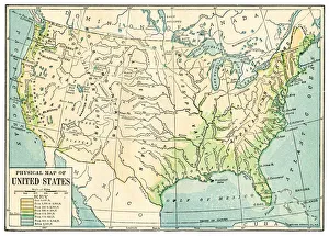
USA map 1898Map from Physical Geography by R. S. Tarr - The MacMillan Company - London 1898
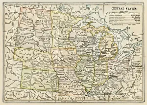
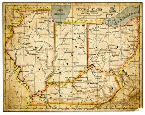
Map of Central States USA 1898Map from Physical Geography by R. S. Tarr - The MacMillan Company - London 1898
Map of USA 1867Map of USA - Warren geography 1867
Map of USA 1896Apple blossoms engraving 1896 Primary Geography - Alex Everett Frye, 1896
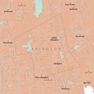
MA Plymouth Abington Vector Road Map. All source data is in the public domain. U.S. Census Bureau Census Tiger. Used Layers: areawater, linearwater, roads, rails, cousub, pointlm, uac10
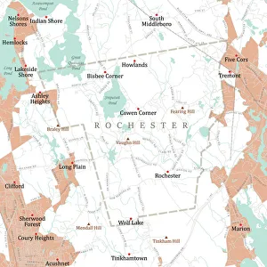
MA Plymouth Rochester Vector Road Map. All source data is in the public domain. U.S. Census Bureau Census Tiger. Used Layers: areawater, linearwater, roads, rails, cousub, pointlm, uac10
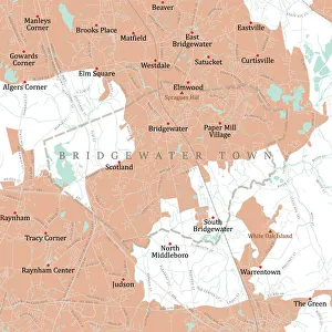
MA Plymouth Bridgewater Town Vector Road Map. All source data is in the public domain. U.S. Census Bureau Census Tiger. Used Layers: areawater, linearwater, roads, rails, cousub, pointlm, uac10
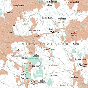
MA Plymouth Middleborough Vector Road Map. All source data is in the public domain. U.S. Census Bureau Census Tiger. Used Layers: areawater, linearwater, roads, rails, cousub, pointlm, uac10
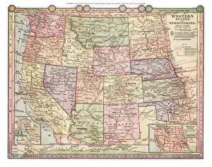
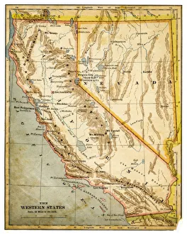
Map of Western states USA 1889Comprehensive Geography by James Monteith - American Book Company 1882, 1889
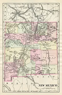
Map of New Mexico 1885Map of New Mexico
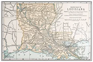
Antique vintage retro USA map: Louisiana
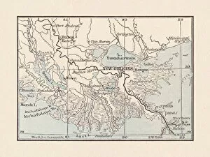
Alluvial land of the Mississippi mouth with New Orleans, 1893Historical map of the alluvial land of the Mississippi mouth and the surrounding of New Orleans, USA. Lithograph, published in 1893
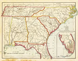
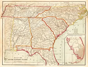
USA South Eastern states map 1877USA South Eastern states map - Florida, North Carolina, South Carolina, Georgia, Alabama, Tennessee (1877)
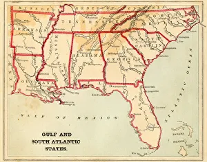
USA South Atlantic States 1868USA South Atlantic States - Florida, North Carolina, South Carolina, Georgia, Alabama, Tennessee, Louisiana (1877)
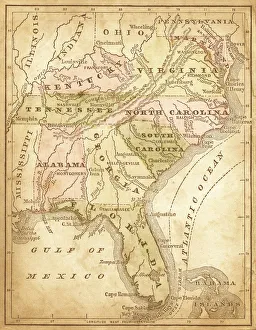
usa - southern states 1870east and southern states usa in light color- east coast, mexican gulf and atlantic ocean (1870)
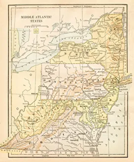
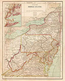
Map Middle Atlantic States USA 1888Butlers Elementary Geography by Jacques W. Redway - Philadelphia 1888
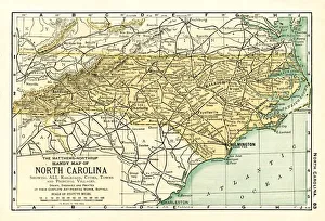
North Carolina USA map 1898Map from the Complete Handy Atlas of the World - 1898
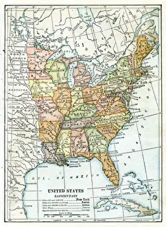
USA eastern states map 1898Map from Physical Geography by R. S. Tarr - The MacMillan Company - London 1898
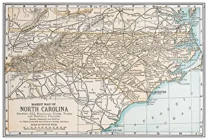
Antique vintage retro USA map: North Carolina
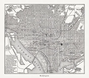
Historical city map of Washington D. C. USA, woodcut, published 1897Historical city map of Washington, District of Colombia, capital city of the United States of America. Wood engraving, published in 1897
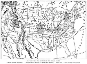
Course of the Great Storm of 1890 in the USAA map showing the course of the Great Storm in late March 1890 in the United States of America, during which the city of Louisville, Kentucky
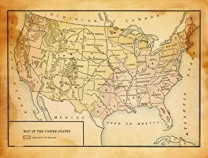
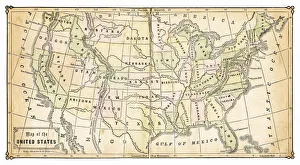
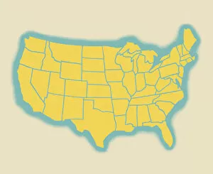
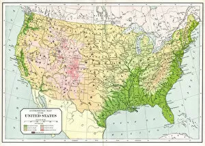
Map of the United States
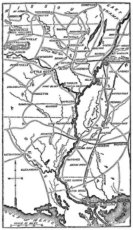
Southern USA From The Civil WarEngraving From 1863 Featuring The Southern American States Of Louisiana, Arkansas, And Missouri From The Time Of The American Civil War
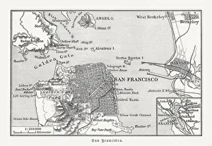
Historical map of San Francisco and surroundings, woodcut, published 1897Historical city map of San Francisco and surroundings, California, USA. Wood engraving, published in 1897
Map of USA 1889Comprehensive Geography by James Monteith - American Book Company 1882, 1889
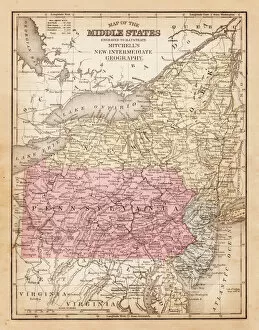
Map of USA Middle states 1881A System of Modern Geography designed for the use of schools and academies by Augustus Mitchell - Published by T. H. Butler / Philadelphia 1881
Map of USA New England states 1883The Eclectic Elementary Geography by Van Antwerp, Bragg & C0 / Cincinnati -New York 1883
Map of USA Eastern Central states 1883The Eclectic Elementary Geography by Van Antwerp, Bragg & C0 / Cincinnati -New York 1883
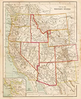
Map of USA Western states 1883The Eclectic Elementary Geography by Van Antwerp, Bragg & C0 / Cincinnati -New York 1883
Map of USA central states1876Maurys Geographical Series - The Word we live in by M.F. Maury LLD - New York and Baltimore 1876
Map of the western states USA 1877The Eclectic Elementary Geography by Wilson & Hinkle / Cincinnati -New York 1881
Maps of the southern states USA 1877The Eclectic Elementary Geography by Wilson & Hinkle / Cincinnati -New York 1881
Map of USA New England 1877The Eclectic Elementary Geography by Wilson & Hinkle / Cincinnati -New York 1881
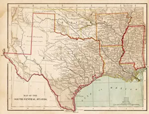
Map of USA South Central states 1877The Eclectic Elementary Geography by Wilson & Hinkle / Cincinnati -New York 1881
Map of USA New England 1877 middle states 1877The Eclectic Elementary Geography by Wilson & Hinkle / Cincinnati -New York 1881
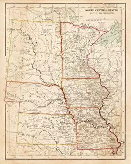
Map of USA North Central States 1877The Eclectic Elementary Geography by Wilson & Hinkle / Cincinnati -New York 1881
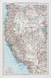
Map of USA pacific states 1896Andres Allgemeiner Handatlas - Bielefeld und Leipzig 1896
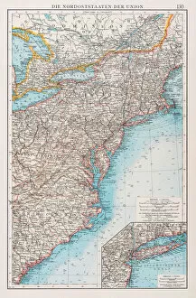
Map of north states USA 1896Andres Allgemeiner Handatlas - Bielefeld und Leipzig 1896
Hypsometric map of USA 1894Johnsons Universal Cyclopedia - Volume VIII New York - A. J. Johnson Company 1894