mail_outline sales@mediastorehouse.com
800 Photographic Prints
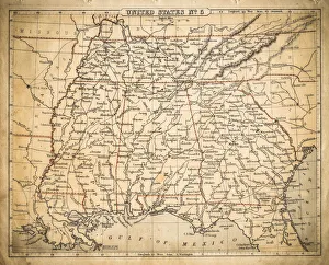
USA Southern States map of 1869Cornells Grammar School Geography By S.S. Cornell - New York 1869
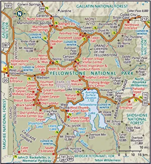
Yellowstone National ParkDetailed map of Yellowstone National Park
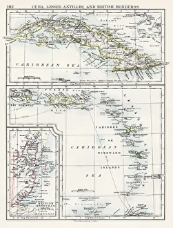
Cuba lesser antilles map 1897The World-Wide Atlas of Modern Geography, Political and Physical W. & A.K. Johnston - London 1897
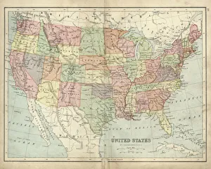
Antique map of USA in the 19th Century, 1873Vintage engraving of a Antique map of United States of America in the 19th Century, 1873
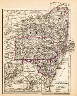
New York Maryland Pennsylvania map 1881Coltons Common School Geography 1881 New York Sheldon and Co
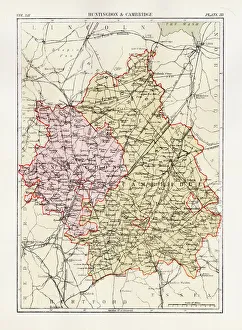
Huntingdon and Cambridge map 1881Encyclopedia Britannica 9th Edition Vol XII Philadelphia j.M. Stoddart & Co 1881
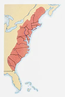
Illustration of states on East Coast of the USA
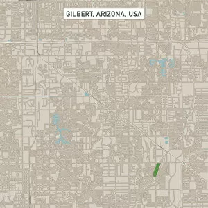
Gilbert Arizona US City Street MapVector Illustration of a City Street Map of Gilbert, Arizona, USA. Scale 1:60, 000. All source data is in the public domain. U.S
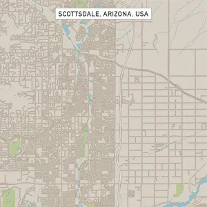
Scottsdale Arizona US City Street MapVector Illustration of a City Street Map of Scottsdale, Arizona, USA. Scale 1:60, 000. All source data is in the public domain. U.S
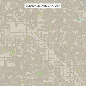
Glendale Arizona US City Street MapVector Illustration of a City Street Map of Glendale, Arizona, USA. Scale 1:60, 000. All source data is in the public domain. U.S
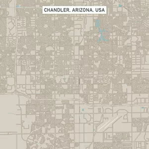
Chandler Arizona US City Street MapVector Illustration of a City Street Map of Chandler, Arizona, USA. Scale 1:60, 000. All source data is in the public domain. U.S
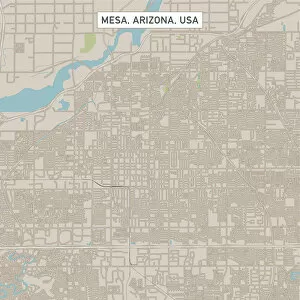
Mesa Arizona US City Street MapVector Illustration of a City Street Map of Mesa, Arizona, USA. Scale 1:60, 000. All source data is in the public domain. U.S
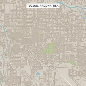
Tucson Arizona US City Street MapVector Illustration of a City Street Map of Tucson, Arizona, USA. Scale 1:60, 000. All source data is in the public domain. U.S
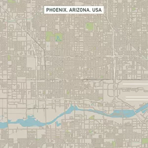
Phoenix Arizona US City Street MapVector Illustration of a City Street Map of Phoenix, Arizona, USA. Scale 1:60, 000. All source data is in the public domain. U.S
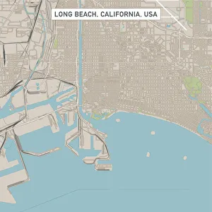
Long Beach California US City Street MapVector Illustration of a City Street Map of Long Beach, California, USA. Scale 1:60, 000. All source data is in the public domain. U.S
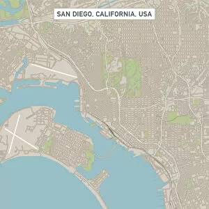
San DiegoCaliforniaUSCityStreetMap_60000Vector Illustration of a City Street Map of San Diego, California, USA. Scale 1:60, 000. All source data is in the public domain. U.S
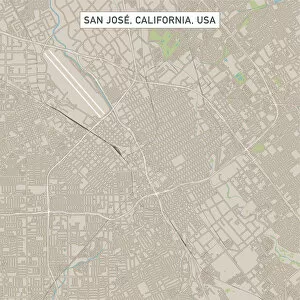
San Jose California US City Street MapVector Illustration of a City Street Map of San Jose, California, USA. Scale 1:60, 000. All source data is in the public domain. U.S
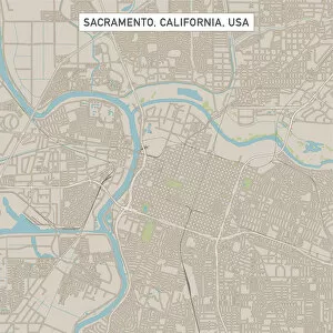
Sacramento California US City Street MapVector Illustration of a City Street Map of Sacramento, California, USA. Scale 1:60, 000. All source data is in the public domain. U.S
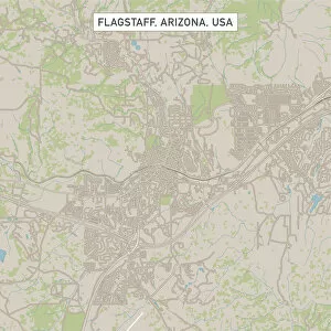
Flagstaff Arizona US City Street MapVector Illustration of a City Street Map of Flagstaff, Arizona, USA. Scale 1:60, 000. All source data is in the public domain. U.S
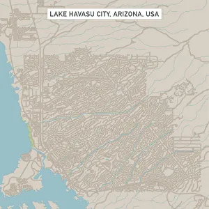
Lake Havasu City Arizona US City Street MapVector Illustration of a City Street Map of Lake Havasu City, Arizona, USA. Scale 1:60, 000. All source data is in the public domain. U.S
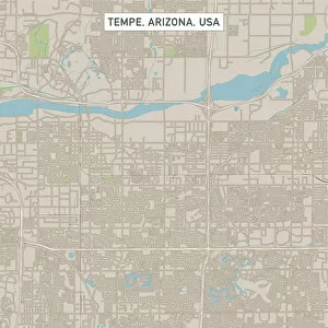
Tempe Arizona US City Street MapVector Illustration of a City Street Map of Tempe, Arizona, USA. Scale 1:60, 000. All source data is in the public domain. U.S
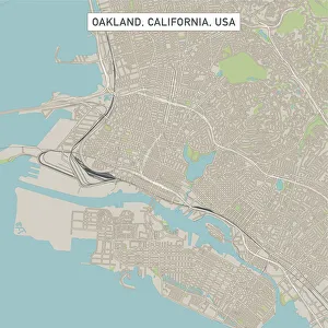
Oakland California US City Street MapVector Illustration of a City Street Map of Oakland, California, USA. Scale 1:60, 000. All source data is in the public domain. U.S
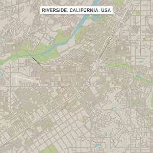
Riverside California US City Street MapVector Illustration of a City Street Map of Riverside, California, USA. Scale 1:60, 000. All source data is in the public domain. U.S
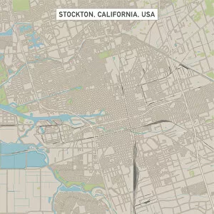
Stockton California US City Street MapVector Illustration of a City Street Map of Stockton, California, USA. Scale 1:60, 000. All source data is in the public domain. U.S
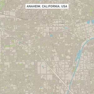
Anaheim California US City Street MapVector Illustration of a City Street Map of Anaheim, California, USA. Scale 1:60, 000. All source data is in the public domain. U.S
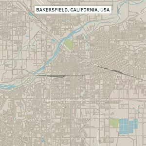
Bakersfield California US City Street MapVector Illustration of a City Street Map of Bakersfield, California, USA. Scale 1:60, 000. All source data is in the public domain. U.S
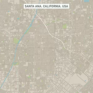
Santa Ana California US City Street MapVector Illustration of a City Street Map of Santa Ana, California, USA. Scale 1:60, 000. All source data is in the public domain. U.S
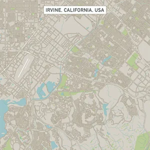
Irvine California US City Street MapVector Illustration of a City Street Map of Irvine, California, USA. Scale 1:60, 000. All source data is in the public domain. U.S
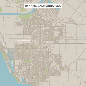
Oxnard California US City Street MapVector Illustration of a City Street Map of Oxnard, California, USA. Scale 1:60, 000. All source data is in the public domain. U.S
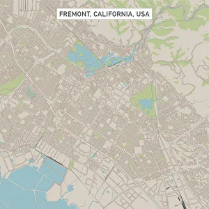
Fremont California US City Street MapVector Illustration of a City Street Map of Fremont, California, USA. Scale 1:60, 000. All source data is in the public domain. U.S
Fontana California US City Street MapVector Illustration of a City Street Map of Fontana, California, USA. Scale 1:60, 000. All source data is in the public domain. U.S
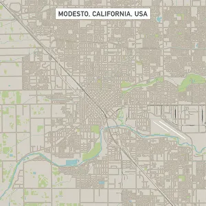
Modesto California US City Street MapVector Illustration of a City Street Map of Modesto, California, USA. Scale 1:60, 000. All source data is in the public domain. U.S
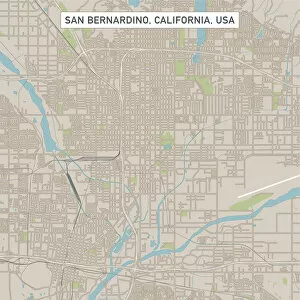
San Bernardino California US City Street MapVector Illustration of a City Street Map of San Bernardino, California, USA. Scale 1:60, 000. All source data is in the public domain. U.S
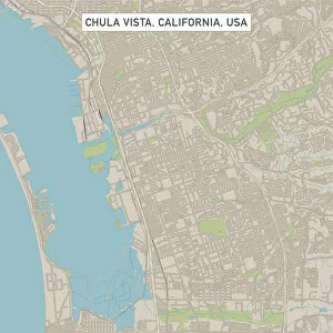
Chula Vista California US City Street MapVector Illustration of a City Street Map of Chula Vista, California, USA. Scale 1:60, 000. All source data is in the public domain. U.S
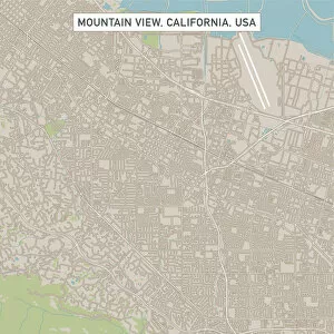
Mountain View California US City Street MapVector Illustration of a City Street Map of Mountain View, California, USA. Scale 1:60, 000. All source data is in the public domain. U.S
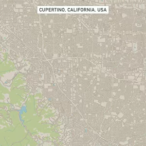
Cupertino California US City Street MapVector Illustration of a City Street Map of Cupertino, California, USA. Scale 1:60, 000. All source data is in the public domain. U.S
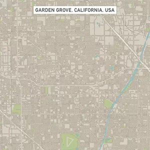
Garden Grove California US City Street MapVector Illustration of a City Street Map of Garden Grove, California, USA. Scale 1:60, 000. All source data is in the public domain. U.S
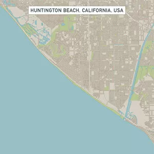
Huntington Beach California US City Street MapVector Illustration of a City Street Map of Huntington Beach, California, USA. Scale 1:60, 000. All source data is in the public domain. U.S
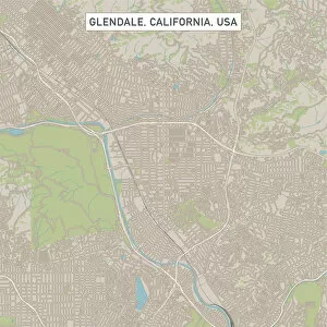
Glendale California US City Street MapVector Illustration of a City Street Map of Glendale, California, USA. Scale 1:60, 000. All source data is in the public domain. U.S
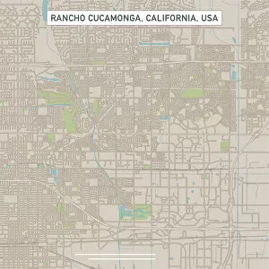
Rancho Cucamonga California US City Street MapVector Illustration of a City Street Map of Rancho Cucamonga, California, USA. Scale 1:60, 000. All source data is in the public domain. U.S
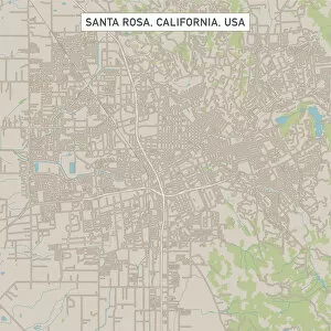
Santa Rosa California US City Street MapVector Illustration of a City Street Map of Santa Rosa, California, USA. Scale 1:60, 000. All source data is in the public domain. U.S
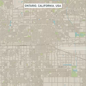
Ontario California US City Street MapVector Illustration of a City Street Map of Ontario, California, USA. Scale 1:60, 000. All source data is in the public domain. U.S
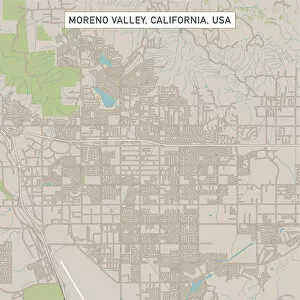
Moreno Valley California US City Street MapVector Illustration of a City Street Map of Moreno Valley, California, USA. Scale 1:60, 000. All source data is in the public domain. U.S
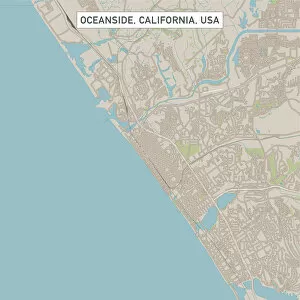
Oceanside California US City Street MapVector Illustration of a City Street Map of Oceanside, California, USA. Scale 1:60, 000. All source data is in the public domain. U.S
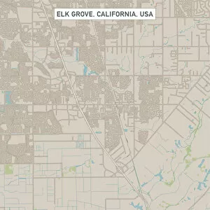
Elk Grove California US City Street MapVector Illustration of a City Street Map of Elk Grove, California, USA. Scale 1:60, 000. All source data is in the public domain. U.S
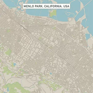
Menlo Park California US City Street MapVector Illustration of a City Street Map of Menlo Park, California, USA. Scale 1:60, 000. All source data is in the public domain. U.S
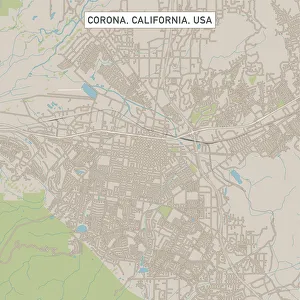
Corona California US City Street MapVector Illustration of a City Street Map of Corona, California, USA. Scale 1:60, 000. All source data is in the public domain. U.S
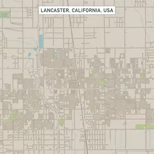
Lancaster California US City Street MapVector Illustration of a City Street Map of Lancaster, California, USA. Scale 1:60, 000. All source data is in the public domain. U.S