Framed Print > Map > Historical Maps
Framed Print : Antique map of Cambridgeshire


![]()
Framed Photos from Fine Art Storehouse
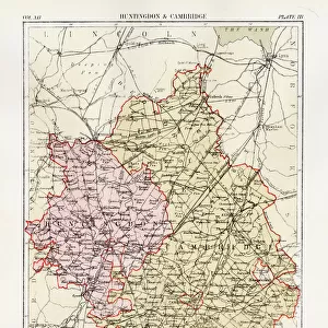
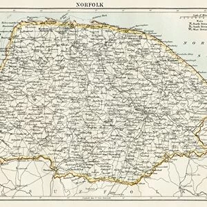
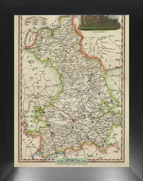
Antique map of Cambridgeshire
An antique map of Cambridgeshire 1840.ašJames Pigot (1794-1842)aš showing the whole county and all its major towns and cities.Pigot started as an engraver for Deans Manchester Directory, but later set up his own business publishing the London and Provincial New Commercial Directory
BernardAllum
Media ID 15311434
© BernardAllum
Antiquities Bedfordshire Circa 9th Century Hertfordshire Kingdom Middle Ages Norfolk Past Republic Of Ireland University
18"x14" Modern Frame
16x12 Print in an MDF Wooden Frame with 180 gsm Satin Finish Paper. Glazed using shatter proof thin plexiglass. Frame thickness is 1 inch and depth 0.75 inch. Fluted cardboard backing held with clips. Supplied ready to hang with sawtooth hanger and rubber bumpers. Spot clean with a damp cloth. Packaged foam wrapped in a card.
Contemporary Framed and Mounted Prints - Professionally Made and Ready to Hang
Estimated Image Size (if not cropped) is 35.6cm x 40.6cm (14" x 16")
Estimated Product Size is 35.6cm x 45.7cm (14" x 18")
These are individually made so all sizes are approximate
Artwork printed orientated as per the preview above, with portrait (vertical) orientation to match the source image.
FEATURES IN THESE COLLECTIONS
> Map
> Historical Maps
> Map
MADE IN THE USA
Safe Shipping with 30 Day Money Back Guarantee
FREE PERSONALISATION*
We are proud to offer a range of customisation features including Personalised Captions, Color Filters and Picture Zoom Tools
SECURE PAYMENTS
We happily accept a wide range of payment options so you can pay for the things you need in the way that is most convenient for you
* Options may vary by product and licensing agreement. Zoomed Pictures can be adjusted in the Cart.