
Framed Print > Map > Historical Maps

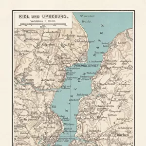
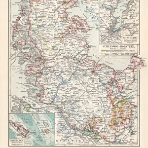
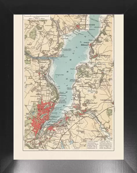
Framed Print : Old city map of Kiel, Schleswig-Holstein, Germany, lithograph, published 1897

Old city map of Kiel, Schleswig-Holstein, Germany, lithograph, published 1897


-
+
$119.99

We accept all major credit cards


Photo Prints
Jigsaw Puzzles
Poster Prints
Home Decor
Canvas Prints
Fine Art Prints
Metal Prints


Framed Photos from Fine Art Storehouse

Old city map of Kiel, Schleswig-Holstein, Germany, lithograph, published 1897

Old city map of Kiel - capital city of northern German state Schleswig-Holstein. Lithograph, published in 1897

ZU_09

Media ID 18292295


18"x14" Modern Frame

16x12 Print in an MDF Wooden Frame with 180 gsm Satin Finish Paper. Glazed using shatter proof thin plexiglass. Frame thickness is 1 inch and depth 0.75 inch. Fluted cardboard backing held with clips. Supplied ready to hang with sawtooth hanger and rubber bumpers. Spot clean with a damp cloth. Packaged foam wrapped in a card.

Contemporary Framed and Mounted Prints - Professionally Made and Ready to Hang

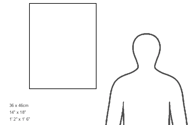
Estimated Image Size (if not cropped) is 35.6cm x 40.6cm (14" x 16")

Estimated Product Size is 35.6cm x 45.7cm (14" x 18")

These are individually made so all sizes are approximate

Artwork printed orientated as per the preview above, with portrait (vertical) orientation to match the source image.


FEATURES IN THESE COLLECTIONS

> Map > Historical Maps

> Map


MADE IN THE USA
Safe Shipping with 30 Day Money Back Guarantee

FREE PERSONALISATION*
We are proud to offer a range of customisation features including Personalised Captions, Color Filters and Picture Zoom Tools

SECURE PAYMENTS
We happily accept a wide range of payment options so you can pay for the things you need in the way that is most convenient for you

* Options may vary by product and licensing agreement. Zoomed Pictures can be adjusted in the Cart.


public
Made in USA
thumb_up
Professional quality finish
diamond
Made with high-grade materials
inventory_2
Carefully packed to aid safe arrival


Related Images


Map of Schleswig-Holstein, northernmost state of Germany, lithograph, published 1887
Map of Kiel, capital of Schleswig-Holstein, Germany, lithograph, published 1887
Topographic map of Northern Italy, lithograph, published 1897
Map of New England in 1684, 17th Century
Map of New England, early 18th Century
Chinese and Japanese Empires
Topographic map of Schleswig-Holstein, German Empire, lithograph, published in 1897
Map of the Ancient World according to Homer
Captain John Smiths map of New England, 17th Century
Map of Germany with all names of the main cities
Map of Massachusetts 1877
Map of Asia 1877
Map of Asia 1877

+

Shipping

+

Choices

+

Guaranteed