mail_outline sales@mediastorehouse.com
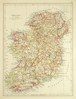
Map of Ireland 1897Map of Ireland
Map of the world 1869Cornells Grammars-School Geography - S.S. Cornell - New York D. Appleton and Company 1869
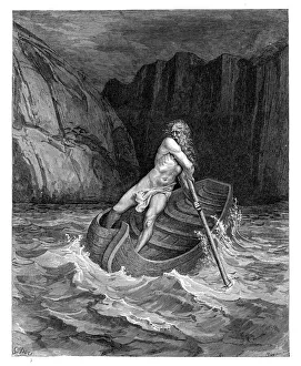
Charon the ferryman engravingCharon the ferryman of Hell engraving by Gustave Dore
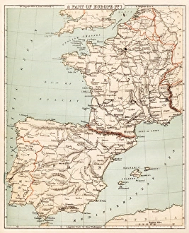
Map of Spain and France 1869Cornells Grammars-School Geography - S.S. Cornell - New York D. Appleton and Company 1869
Map of Berlin 1895Map of Berlin (surroundings), Germany
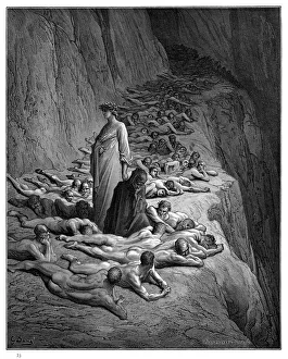
Arrival of souls purgatory engraving 1870The Dore Gallery by Edmund Ollier - Cassel, Petter and Galpin (London-New York) 1870
Satan and Beelzebub engravingSatan and Beelzebub
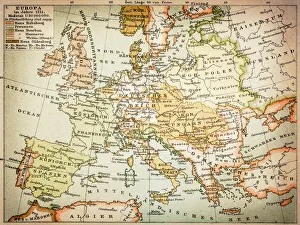
Map of Europe 1721
World map by Mathieu Albert Lotter, Augsburg, 1778World map from 1778. Original hand-colored copper engraving by Matthieu Albert Lotter (1741 - 1810, Augsburg) with route of James Cooks First Circumnavigation (1770), through Tahiti
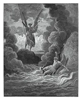
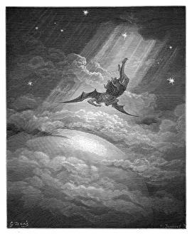
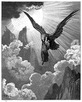
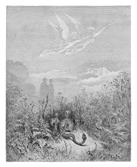
Satan approaching earth engravingSatan approaching the confines of the earth engraving by Gustave Dore
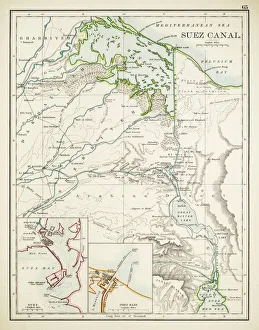
Map of Suez Canal 1897
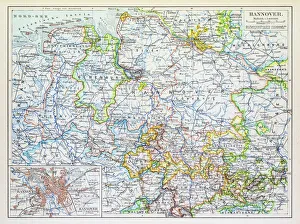
Map of Hannover 1895Map of Hannover, Germany
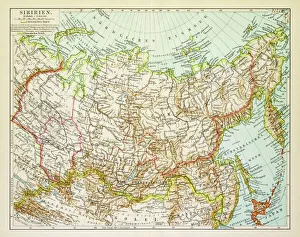
Map of Siberia 1895Map of Siberia
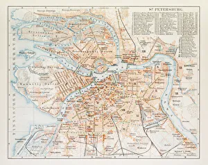
Map of St. Petersburg 1895Map of St. Petersburg, Russia
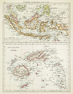
Map of Fiji Sumatra Borneo 1897Map of Fiji, Borneo, Sumatra, java
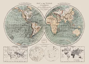
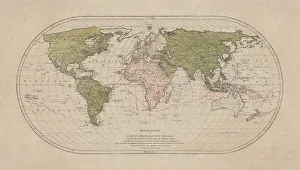
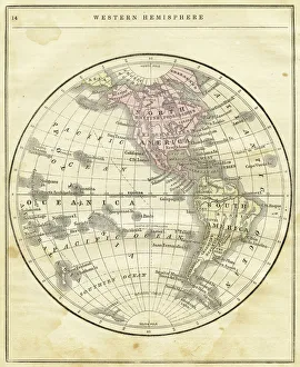
Western Hemisphere map 1856Colton and Fitchs Modern School Geography by George W. Fitch - New York 1856
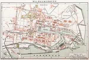
Wilhelmshaven. GermanyAntique illustration of a Wilhelmshaven, Germany map
Dante with Pope Adrian V engraving 1870The Dore Gallery by Edmund Ollier - Cassel, Petter and Galpin (London-New York) 1870
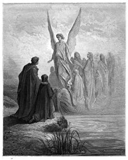
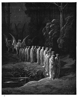
The Apocalyptic Procession engraving 1870The Dore Gallery by Edmund Ollier - Cassel, Petter and Galpin (London-New York) 1870
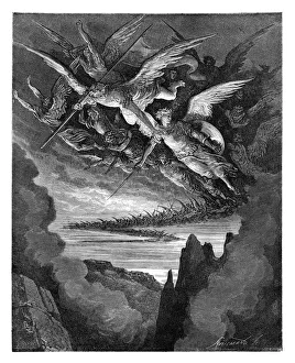
The Fallen Angels engravingThe Fallen Angels of the Wing
Lombardo in the Third Circle of Purgatory engraving 1870The Dore Gallery by Edmund Ollier - Cassel, Petter and Galpin (London-New York) 1870
Dante and the eagle engraving 1870The Dore Gallery by Edmund Ollier - Cassel, Petter and Galpin (London-New York) 1870
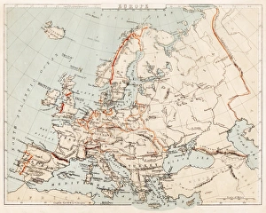
Map of Europe 1869Cornells Grammars-School Geography - S.S. Cornell - New York D. Appleton and Company 1869
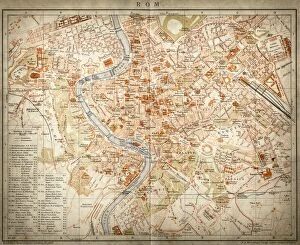
Map of Rome, Italy
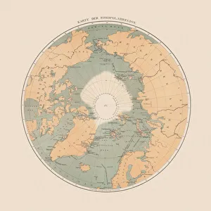
Ancient map of the Arctic Region, lithograph, published in 1883Ancient map of the Arctic Region. Lithograph, published in 1883
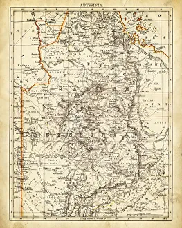
Map of Abyssinia 1897
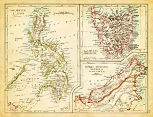
Map of Philippines Tasmania Borneo 1897Map of Tasmania Borneo Philippines
Pia da Tolomei engraving 1870The Dore Gallery by Edmund Ollier - Cassel, Petter and Galpin (London-New York) 1870
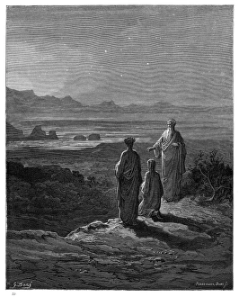
Dante, Virgil and Cato engraving 1870The Dore Gallery by Edmund Ollier - Cassel, Petter and Galpin (London-New York) 1870
Beatrice unveiled engraving 1870The Dore Gallery by Edmund Ollier - Cassel, Petter and Galpin (London-New York) 1870
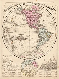
Western Hemisphere map 1867Mitchells Modern Atlas - Published by E.H. Buttler & Co - Philadelphia 1867
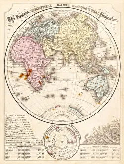
Eastern Hemisphere map 1856Mitchells Modern Atlas - Published by E.H. Buttler & Co - Philadelphia 1867
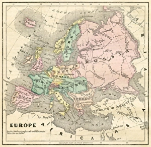
Map of Europe 1856Colton and Fitchs Modern School Geography by George W. Fitch - New York 1856
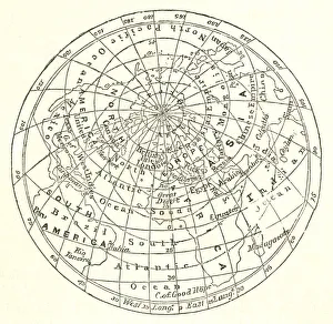
Victorian map of the Arctic CircleA Victorian map of the Arctic Circle and beyond. From Peter Parleyas Annual - A Christmas and New Yearas Present for Young Peoplea published in London by Darton & Co in 1851
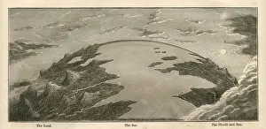
Topographical Land Sea Sky Earth Globe, Antique 1871 IllustrationColor stock photo of an antique illustration of a topographical earth globe showing land, sea and sky examples. Salvaged from an 1871 geography book
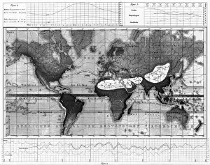
Historical Rainfall and Temperature Charts EngravingEngraved Illustrations of Historical Rainfall and Temperature Map; Temperature Charts of the World from Iconographic Encyclopedia of Science, Literature and Art, Published in 1851
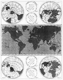
Climate and Weather Charts EngravingEngraved Illustrations of Climate and Weather Charts of the World from Iconographic Encyclopedia of Science, Literature and Art, Published in 1851. Copyright has expired on this artwork
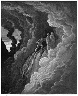
The threshold of Purgatory engravingThe threshold of purgatory engraving by Gustave Dore
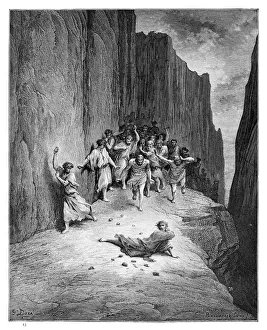
The martyrdom of St. Stephen engraving engraving by Gustave Dore
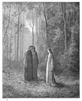
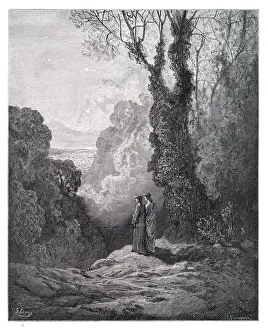
Dante and Virgil engravingDante and Virgil in the Happy Valley engraving by Gustave Dore
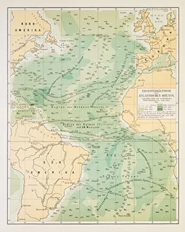
Map of deep Atlantic ocean 1895Different deep zones of the Atlantic ocean Chromolithograph
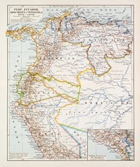
Map of Peru Ecuador Venezuela 1896Map of Peru Ecuador Venezuela
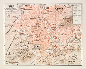
Map of Athens 1895Map of Athens, Greece
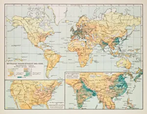
Map of earth population 1895Map of earth population
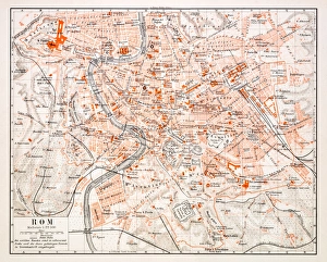
Map of Rome 1896Map of Rome, Italy
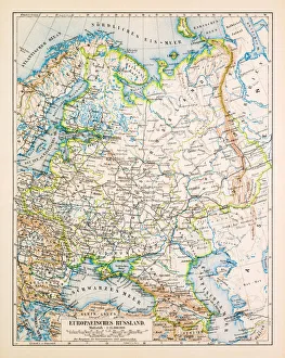
Map of European Russia 1896Map of European Russia
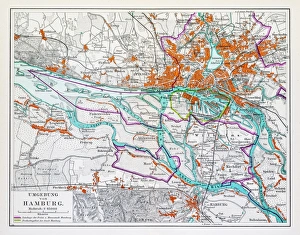
Map of Hamburg 1895Map of Hamburg, Germany
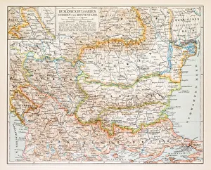
Map of Rumania Bulgaria 1896Map of Rumania, Bulgaria, Serbia, Montenegro