
Atlas Collection (page 2)

Background imageAtlas Collection: 16th century, antique, archival, atlas, book, cartouche, cover, design, elegant, embellishments

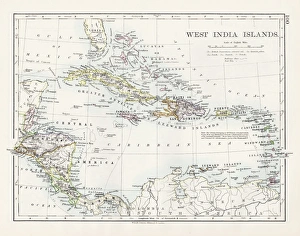
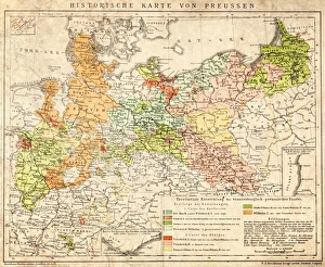
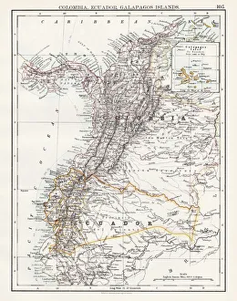
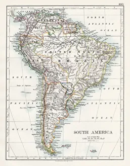
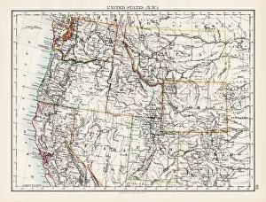
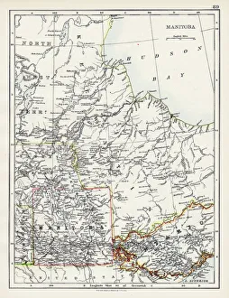
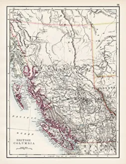
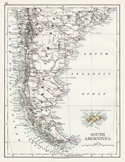
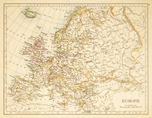
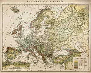
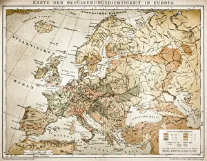
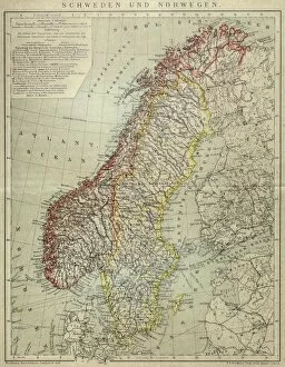
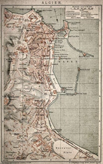
16th century, antique, archival, atlas, book, cartouche, cover, design, elegant, embellishments, engraving, fancy, figures, frontispiece, geography, gerard mercator, germaniae tabule geographicae

Background imageAtlas Collection: 16th century, antique, art, atlas, book, cherubs, columns, cover, eagle, engraving

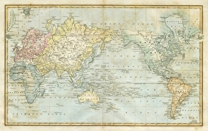
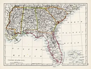
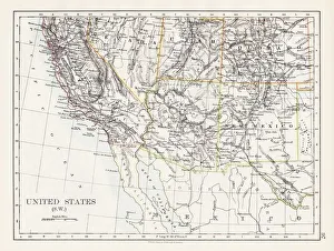
16th century, antique, art, atlas, book, cherubs, columns, cover, eagle, engraving, et graeciae tabule geographice, figures, frontispiece, geography, gerard mercator, historic, history

Background imageAtlas Collection: South America Physical map 1897

South America Physical map 1897
The World-Wide Atlas of Modern Geography, Political and Physical W. & A.K. Johnston - London 1897

Background imageAtlas Collection: United States NW Central 1897

United States NW Central 1897
The World-Wide Atlas of Modern Geography, Political and Physical W. & A.K. Johnston - London 1897

Background imageAtlas Collection: West indies map 1897

West indies map 1897
The World-Wide Atlas of Modern Geography, Political and Physical W. & A.K. Johnston - London 1897

Background imageAtlas Collection: map of the world 1823

map of the world 1823
map of the world - 1823 very detailed lithography

Background imageAtlas Collection: Map of Abyssinia 1897

Map of Abyssinia 1897

Background imageAtlas Collection: Map of Philippines Tasmania Borneo 1897

Map of Philippines Tasmania Borneo 1897
Map of Tasmania Borneo Philippines

Background imageAtlas Collection: Prussia historical map

Prussia historical map
Illustration of a Prussia historical development map

Background imageAtlas Collection: Siberia map, the Amur region

Siberia map, the Amur region
Illustration of a Siberia map, the Amur region

Background imageAtlas Collection: Alexandria map

Alexandria map
Antique illustration of a Mediterranean Sea

Background imageAtlas Collection: abraham ortelius, abrahami ortelii, antique, architecture, archival, atlas, biography

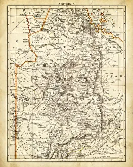
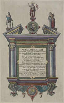
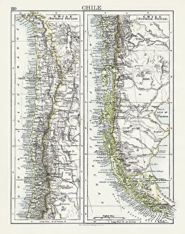
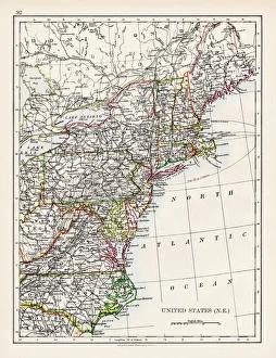
abraham ortelius, abrahami ortelii, antique, architecture, archival, atlas, biography, book, cartographer, cartography, cover, depicting, engraving, fancy, frontispiece, geography, historic, history

Background imageAtlas Collection: 18th century, animal likeness, antique, archival, art, atlas, atlas novus terrarium orbis imperia

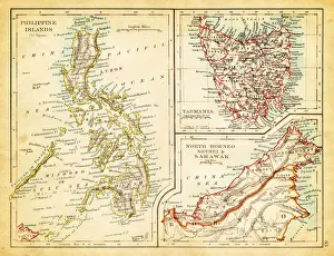
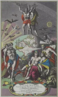
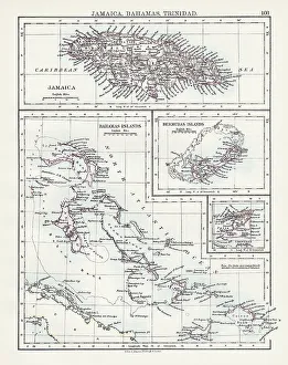
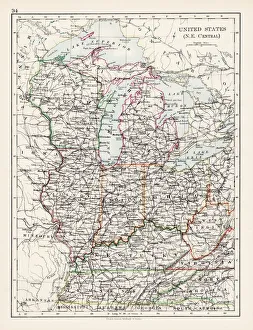
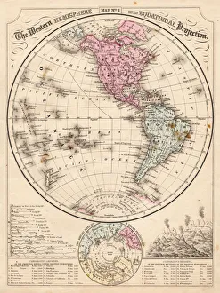
18th century, animal likeness, antique, archival, art, atlas, atlas novus terrarium orbis imperia, book, cover, deities, depicting, design, engraving, figures, geography, globe, god, goddesses

Background imageAtlas Collection: Antique illustration of VERY old world map (around year 600)

Antique illustration of VERY old world map (around year 600)

Background imageAtlas Collection: Canada map 1883

Canada map 1883
The World-Wide Atlas of Modern Geography, Political and Physical W. & A.K. Johnston - London 1897

Background imageAtlas Collection: British North America map 1897

British North America map 1897
The World-Wide Atlas of Modern Geography, Political and Physical W. & A.K. Johnston - London 1897

Background imageAtlas Collection: Colombia Ecuador Galapagos map 1897

Colombia Ecuador Galapagos map 1897
The World-Wide Atlas of Modern Geography, Political and Physical W. & A.K. Johnston - London 1897

Background imageAtlas Collection: South America map 1897

South America map 1897
The World-Wide Atlas of Modern Geography, Political and Physical W. & A.K. Johnston - London 1897

Background imageAtlas Collection: United States North West map 1897

United States North West map 1897
The World-Wide Atlas of Modern Geography, Political and Physical W. & A.K. Johnston - London 1897

Background imageAtlas Collection: Manitoba map 1897

Manitoba map 1897
The World-Wide Atlas of Modern Geography, Political and Physical W. & A.K. Johnston - London 1897

Background imageAtlas Collection: British Columbia map 1897

British Columbia map 1897
The World-Wide Atlas of Modern Geography, Political and Physical W. & A.K. Johnston - London 1897

Background imageAtlas Collection: United States South East map 1897

United States South East map 1897
The World-Wide Atlas of Modern Geography, Political and Physical W. & A.K. Johnston - London 1897

Background imageAtlas Collection: Chile map 1897

Chile map 1897
The World-Wide Atlas of Modern Geography, Political and Physical W. & A.K. Johnston - London 1897

Background imageAtlas Collection: Jamaica Bahamas Trinidad map 1897

Jamaica Bahamas Trinidad map 1897
The World-Wide Atlas of Modern Geography, Political and Physical W. & A.K. Johnston - London 1897

Background imageAtlas Collection: South Argentina map 1897

South Argentina map 1897
The World-Wide Atlas of Modern Geography, Political and Physical W. & A.K. Johnston - London 1897

Background imageAtlas Collection: United States South West map 1897

United States South West map 1897
The World-Wide Atlas of Modern Geography, Political and Physical W. & A.K. Johnston - London 1897

Background imageAtlas Collection: United States North East map 1897

United States North East map 1897
The World-Wide Atlas of Modern Geography, Political and Physical W. & A.K. Johnston - London 1897

Background imageAtlas Collection: United States North East Central map 1897

United States North East Central map 1897
The World-Wide Atlas of Modern Geography, Political and Physical W. & A.K. Johnston - London 1897

Background imageAtlas Collection: Western Hemisphere map 1867

Western Hemisphere map 1867
Mitchells Modern Atlas - Published by E.H. Buttler & Co - Philadelphia 1867

Background imageAtlas Collection: Antique illustration of Greenland and Iceland bathymetry map

Antique illustration of Greenland and Iceland bathymetry map

Background imageAtlas Collection: Map of deep Atlantic ocean 1895

Map of deep Atlantic ocean 1895
Different deep zones of the Atlantic ocean Chromolithograph

Background imageAtlas Collection: Map of the world 1897

Map of the world 1897
Map of the world in Mercator projection

Background imageAtlas Collection: Map of Europe 1897

Map of Europe 1897
Map of Europe

Background imageAtlas Collection: Antique engraving depicting birds eye view of country around Herat showing positions occupied by

Antique engraving depicting birds eye view of country around Herat showing positions occupied by Russia

Background imageAtlas Collection: Rain map of Europe

Rain map of Europe
Antique illustration of a rain map of Europe

Background imageAtlas Collection: Population tightness map of Europe

Population tightness map of Europe

Background imageAtlas Collection: Sweden and Norway

Sweden and Norway
Antique map of Sweden and Norway

Background imageAtlas Collection: Montreal map

Montreal map
Antique illustration of Montreal map

Background imageAtlas Collection: Siberia outline map

Siberia outline map
Antique illustration of Siberia outline map

Background imageAtlas Collection: Lake Lucerne

Lake Lucerne
Antique map of LAKE LUCERNE

Background imageAtlas Collection: Algiers map

Algiers map
Antique illustration of a Algiers map

Background imageAtlas Collection: Vintage map of Tokyo

Vintage map of Tokyo

Background imageAtlas Collection: Bosporus map

Bosporus map
Antique illustration map of Bosporus

Background imageAtlas Collection: Siberia - lake of Baikal map

Siberia - lake of Baikal map
Antique illustration map of Siberia - lake of Baikal

Background imageAtlas Collection: Open atlas, showing road map across double page

Open atlas, showing road map across double page

Background imageAtlas Collection: Entrance porch with bay window and atlases, renaissance, 1886-87, Altstadter Kirchenplatz

Entrance porch with bay window and atlases, renaissance, 1886-87, Altstadter Kirchenplatz, Erlangen, Middle Franconia, Bavaria, Germany

Background imageAtlas Collection: Atlas, neo-renaissance, 1886-87, Altstadter Kirchenplatz, Erlangen, Middle Franconia, Bavaria

Atlas, neo-renaissance, 1886-87, Altstadter Kirchenplatz, Erlangen, Middle Franconia, Bavaria, Germany

Background imageAtlas Collection: New York City, Statue of Atlas, Rockefeller

New York City, Statue of Atlas, Rockefeller
UNITED STATES - CIRCA 1950s: New York City, Statue of Atlas, Rockefeller Center. (Photo by George Marks/Retrofile/Getty Images)


All Professionally Made to Order for Quick Shipping