mail_outline sales@mediastorehouse.com
Map of Kiel, capital of Schleswig-Holstein, Germany, lithograph, published 1887Map of Kiel and surroundings, capital and most populous city in the northern German state of Schleswig-Holstein. Lithograph, published in 1887
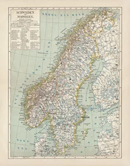
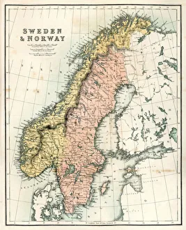
Sweden and Norway, lithograph, published in 1878Ancient map of Sweden and Norway. Lithograph, published in 1878
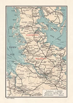
Map of Schleswig-Holstein, northernmost state of Germany, lithograph, published 1887Map of Schleswig-Holstein, northernmost state of Germany. Lithograph, published in 1887
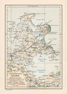
Map of RAOEgen, Baltic Sea, largest island of Germany, lithographMap of RAOEgen - Germanys largest island in the Baltic Sea. Lithograph, published in 1884
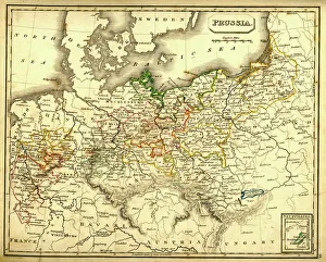
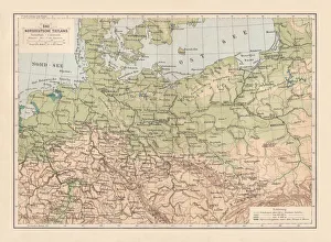
Antquie Map of PrussiaVintage map of Prussia from 1837
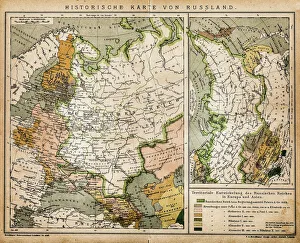
Historic map of RussiaIllustration of a historic map of Russia
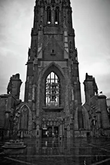
St Nicholas Church in HamburgFormerly one of the five Lutheran Hauptkirchen (main churches) in the city of Hamburg. The church lies now in ruins, with only its tower remaining
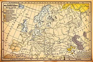
Religion map of Europe, 19th centuryIllustration of a Religion map of Europe, , 19th century
Austria, Balearic Islands, Balkans, Baltic Sea, Belarus, Benelux, Bosnia, BritishAustria, Balearic Islands, Balkans, Baltic Sea, Belarus, Benelux, Bosn, Science Photo Library, 85757880
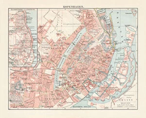
City map of Copenhagen, capital of Denmark, lithograph, published 1897City map of Copenhagen, capital city of Denmark. Lithograph, published in 1897
Young boy on the beach, Kuehlungsborn, Mecklenburg-Western Pomerania, Germany, Europe
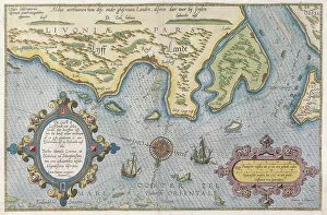
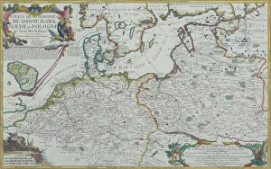
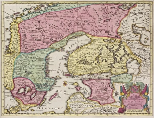
Dutch Trade Map of the Baltic SeaDutch Trade map of the Baltic Sea (hand-coloured engraving) During the last decades of the 16th century and throughout the 17th century Dutch merchants
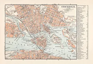
Historical city map Stockholm, capital of Sweden, lithograph, published 1897Historical city map Stockholm, capital of Sweden. Lithograph, published in 1897
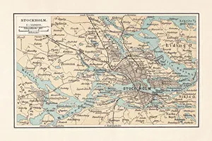
Historical city map of Stockholm and surroundings, Sweden, lithograph, 1897Historical city map of Stockholm and surroundings, Sweden. Lithograph, published in 1897
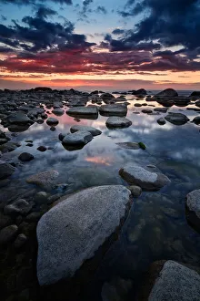
Stone beach at sunset near Kap Arkona on German island Rugen
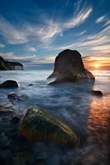
Morning Sun - RAOEgen, SassnitzSummer Morning near the Chalk Cliffs of RAOEgen, a german island in the baltic sea
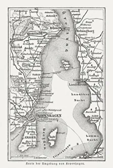
Map of Copenhagen and sourroundings, Denmark, wood engraving, published 1897Map of Copenhagen and sourroundings, Denmark. Wood engraving, published in 1897
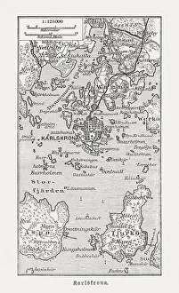
Historic map of Karlskrona and surroundings, wood engraving, published 1897Historic map of Karlskrona and surroundings. Wood engraving, published in 1897
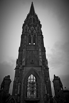
The Gothic Revival Church of St. NicholasThe current condition of the Church of St. Nicholas is the result of the bombing of Hamburg in World War II, resultant demolition in 1951 and restoration work in the 1990s and 2012
North German lowland map, 19th century view, lithograph, published 1884Old Topographic map of the North German lowland in German language. Lithograph, published in 1884
Teutonic Order state (1525), the country of origin of PrussiaTeutonic Order state in 1525 - the country of origin of Prussia. Lithograph, published in 1884
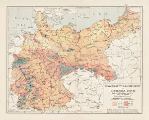
Map of religious affiliation in Germany, lithograph, published in 1897Map of the religious affiliation in Germany at the end of the 19th century. Lithograph, published in 1897
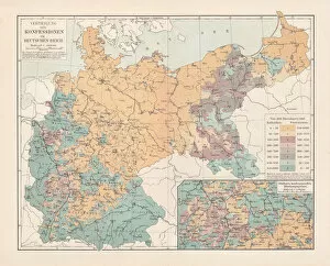
Population density of Germany in 1890, lithograph, published in 1897Map of the population density of Germany in 1890. Lithograph, published in 1897
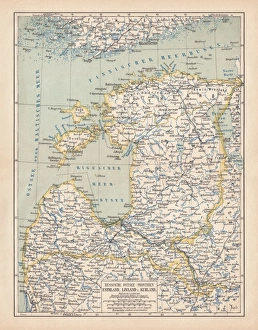
Map of Baltic states, lithograph, published in 1877Historic map of Baltic states: Lithuania, Estonia, Latvia. Lithograph, published in 1877
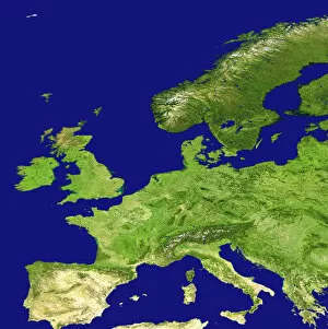
Map of Baltic Sea and Europe
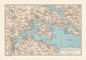
Flensburg Firth (Flensburger FAorde), Baltic Sea, lithograph, published in 1887Map of Flensburg Firth (Flensburger FAorde), Baltic Sea. Lithograph, published in 1887
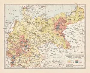
Distribution of the Jews in Germany, lithograph, published in 1897Map of the distribution of the Jews in Germany at the end of the 19th century. Lithograph, published in 1897
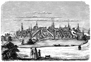
LubeckIllustration of a Lubeck
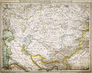
Russia - Central Asia and TurkeyAntique illustration of Russia - Central Asia and Turkey
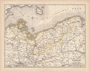
Pomerania, lithograph, lithograph, published in 1878Pomerania, former territory of the German Empire. Lithograph, published in 1878
Ancient map of Mecklenburg, lithograph, published in 1877Ancient map of Mecklenburg, Germany. Lithograph, published in 1877
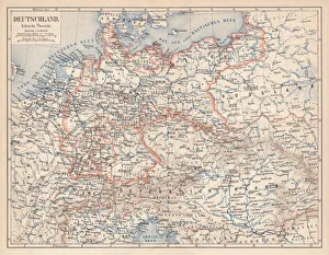
German Empire of 1871-1918, lithograph, published in 1875German Empire within the borders of 1871 - 1918. Lithograph, published in 1875
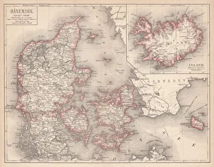
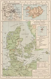
Map of Denmark and Iceland, lithograph, published in 1875Map of Denmark and Iceland. Lithograph, published in 1875
Antique Map of Sweden and NorwayAntique map of Sweden and Norway from 1867
Antique map of Sweden and adjacent countries
Antique map of Scandinavian region
Map of Denmark and Iceland, lithograph, published in 1881Topographic map of Denmark and Iceland. Facsimile, published in 1881
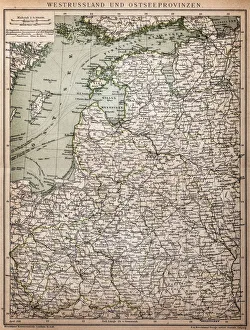
West Russia and Baltic provinces
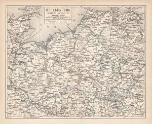
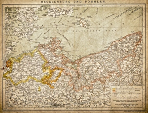
Mecklenburg and PomeraniaAncient map of Mecklenburg and Pomerania
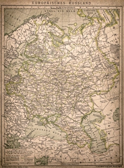
European RussiaAntique illustration of a European Russia
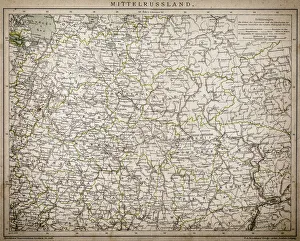
Central Russia
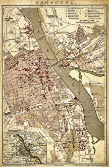
WarsawAntique illustration of a Warsaw from 1898
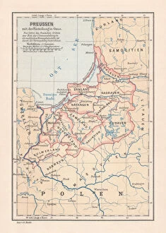
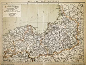
PrussiaAntique illustration of a East-West West Prussia
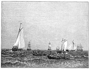
Ships at the port of CopenhagenIllustration of a Ships at the port of Copenhagen, Christoffer Wilhelm Eckersberg
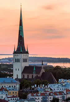
Midnight SunEvening summer light over St Olafs Church in Tallinn, Estonia. St. Olafs Church is believed to have been built in the 12th century
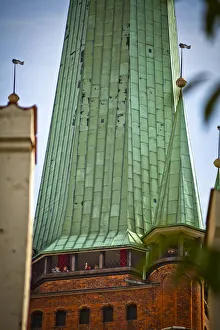
LAOEbeck, GermanyLAOEbeck is a city in northern Germany. Its renowned for its Brick Gothic architecture, dating to its time as the medieval capital of the powerful Hanseatic League trading confederation
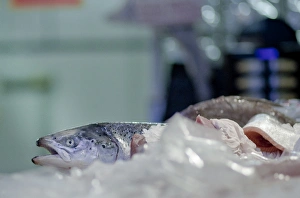
Port of HamburgFish on ice at the fishmarket in the port of Hamburg, Germany, named Germanys Gateway to the World and is the largest port in Germany
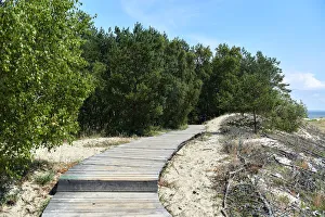
Curonian spitWooden board leading across the sandy dunes. Curonian spit, Kaliningrad region. Russia